 Route Editor

| Guide | ♦ | 5 Triplogs | 0 Topics |
details | drive | no permit | forecast | route |
stats |
photos | triplogs | topics | location |
| 14 | 5 | 0 |
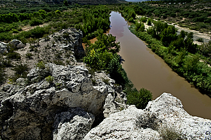
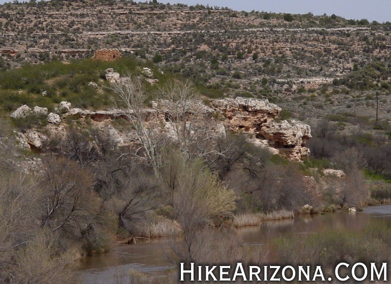
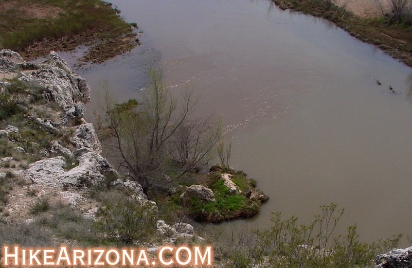
Meeting Grounds by joebartels  Let's not get too excited. This is a neat little Arizona feature. It's not something to plan your day around. If you happen to be driving through Cottonwood, check it out. Let's not get too excited. This is a neat little Arizona feature. It's not something to plan your day around. If you happen to be driving through Cottonwood, check it out.Just a few miles southeast of downtown Cottonwood is the confluence of Oak Creek and the Verde River. Paved roads take you within a mile of the scene. The final mile is easily doable in a car as long as it isn't raining or muddy.
What's cool about this confluence is the mixing of the waters. Oak Creek is a deep red coming down from the red rocks of Sedona. The Verde, on the other hand, means green in Spanish. It really is green when viewed from above. These colors are very dark shades, so you need to look closely. I caught it without question at first glance, wearing my sunglasses. When I took them off, it wasn't nearly as noticeable, so take a pair along. So what does this have to do with hiking!? Well, there isn't a trail to hike, but you can follow the waterways and play around. You drive up to the edge of a small cliff that overlooks the confluence. It's best viewed right there from the edge. A short path takes you down to Oak Creek, and you can venture on from there if you like. Less than a quarter-mile up Oak Creek are some ruins on the left. Known as the Atkeson Ruins. Once again, don't get too excited. They're on private property. You can get close enough to satisfy your curiosity. In the first photo below you can see that Oak Creek gently pours in the Verde River. It's hard to make out the color differential in the photo. I can only imagine how awesome a site this would be after heavy rain. This is one of those things that it's almost cooler knowing that you've seen it than actually seeing it.
Check out the Official Route and Triplogs. Leave No Trace and +Add a Triplog after your hike to support this local community. | ||||||||||||||||||||||||||||||||||||||||||||||||||||||||||||||||||||||||||||||||||||||||||||


