Route Editor

| Guide | ♦ | 1 Triplog | 0 Topics |
details | drive | permit | forecast | route |
stats |
photos | triplog | topics | location |
| 22 | 1 | 0 |
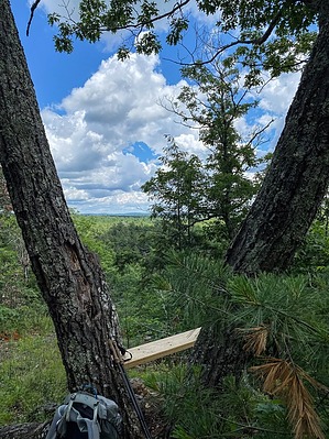
It's nip and tuck between the trail and the beavers by GrangerGuy The Nipmuck Trail starts in the southern part of Mansfield Hollow State Park in Mansfield and meanders north through Ashford and Union, ending at the Massachusetts Border in the Nipmuck State Forest. It passes interesting old grist mill locations and notably, Pixie Falls. It also passes through the Yale-Meyers Forest, used for teaching, UConn East Campus, and lands conserved by Joshua's Trust. History Portions of the trail follow the Old Connecticut Path, which runs from near Hartford through Massachusetts and into New Hampshire. It was used originally by indigenous people and early white settlers.
The south-to-north hike begins at the large parking area in Mansfield Hollow State Park at the end of North Windham Road. After a diagonal walk across a large field, the trail meanders through the woods, with frequent views out to Mansfield Hollow Lake. At about 2.4 miles, it crosses the lake on a road causeway, passes a boat launch, and continues through a large picnic area. Contouring around the west side of the lake, the trail comes out at Southeast Park baseball fields at Warrenville Road. The trail is poorly marked both north and south of Warrenville Road. The official GPX track will be helpful here. North of Warrenville Road, you may see signs indicating the closure of the Iron Bridges North and South across the Fenton River. Do not worry, the trail has been rerouted by the Connecticut Forests and Parks Association onto the former Fenton River Trail. If you follow the blue blazes and the official GPS route, you will be ok. The trail stays west of the Fenton River all the way to the intersection with the Nipmuck Trail - West Fork at about 6.7 miles from the trailhead. Just before the junction, the trail climbs to the top of the 50-foot Rock with great views. From the junction with the West Branch, the trail makes a big easy switchback down the hill, before descending more sharply along a pipeline to Chaffeeville Road, where the trail crosses the Fenton River just below the road. Continuing northward in about 2000' of swampy section between the river and the road, the way then opens up into a beautiful section along the river. At 9 miles, after a short walk along Stonemill Road, you will find the Gurleyville Grist Mill. This historic site operated by Joshua's Trust is only open once a week but is well worth a trip back if it is closed when you go by. Just past the mill is a picturesque little island on a pond, a lovely place for a break but it is on private property, so be respectful. From the mill north 1.7 miles, the route follows the river closely, at one point passing a research station where the trees are plugged in like patients in a hospital. Then the trail suddenly leaves the river, as the beavers are winning the contest there, and follows a high road up to Old Turnpike Road, just short of US-44, where there is parking and the site of the Gurley-Mason Mill. The route goes a short distance east on Old Turnpike Rd, then a short distance west on US-44, before turning north on the trail. A little further north continues an epic contest between the beavers and the trail builders. There is a possibility of getting wet here. In spring, the area along the river will bloom with mountain laurel. The trail soon leaves the Fenton River behind, heading more or less northeast to CT-74 and the Knowlton Brook campsite a short distance beyond, at about 17 miles. Continuing northeast another 5 miles, there is a stone ruin near Iron Mine Lane at the border of Natchaug State Forest that is of uncertain origin. A really interesting section follows through the State Forest, which includes a section of the Old Connecticut Trail, Pixie Falls, Ladies Room Rock, and the Nipmuck Campsite at 22.6 miles from the start, with the intersection of the Natchaug Trail at about 25 miles. Parking on Barlow Mill Road is at 28.5 miles near the remains of the Barlow Sawmill near Bigelow Brook. The trail continues through the Yale-Meyers Forest, passing an outdoor lecture area at about 33 miles, and shortly crossing CT-171, skirting the entrance to Bigelow Hollow State Park, and continuing north through Nipmuck State Forest along the very pretty Breakneck Pond, and ending at the state line at 36.4 miles. Camping There are several campsites along the trail, Knowlton Brook near CT-74 and Nipmuck Camp near Pixie Falls. Also, there are shelters and campsites along Breakneck Pond. All camping on this route requires reservations through the CT-DEEP, which they request 2 weeks in advance, although shorter times may be achieved if you call. Water Sources Water can be found at many places along the trail. Carry a filter. Note At times, the southernmost section in Mansfield Hollow State Park is reserved for hunting dog field trials. At those times, the trail is closed. The schedule may be found here Check out the Official Route and Triplog. Leave No Trace and +Add a Triplog after your backpacking trip to support this local community. | ||||||||||||||||||||||||||||||||||||||||||||||||||||||||||||||||||||||||||||||||||||||||||||