username
X
password
register
for free!
help
  This is likely a great time to hike this trail!  Check out "Preferred" months below, keep in mind this is an estimate. 
  

Tumacacori Peak, AZ

Guide 13 Triplogs  0 Topics
  3 of 5  
Fav
Wish
0
AZ > Tucson > Ruby
details
drive
permit
forecast
map
stats
photos
triplogs
topics
location
141 13 0
Statistics
tap row or icons for details
Distance Round Trip 0 miles
Trailhead Elevation 5,170 feet
 Interest Off-Trail Hiking & Peak
unreported if dogs are allowed
editedit > ops > dogs to adjust
feature photo
Photos Viewed All MineFollowing
36  2022-03-10 HikerWill
9  2021-10-08
Tumacacori Chiltepins
rwstorm
12  2021-01-18 rwstorm
14  2021-01-01 HikerWill
5  2015-01-03 Pivo
43  2014-10-04 Pivo
5  2006-01-29 desertlavender
17  2002-02-27 rwstorm
Author
author avatar Guides 16,832
Routes 17,471
Photos 24
Trips 1 map ( 6 miles )
Age Male Gender
Location HAZ, TrailDEX
Associated Areas
list map done
Tucson Region
Historical Weather
Trailhead Forecast
Expand Map
Preferred Apr, Oct, Mar, Nov
Seasons   Early Winter to Early Spring
Sun  6:31am - 5:47pm
2 Routes
 
0 Alternative


remove free decal offer

  Likely In-Season! 
Expand Map

Happy

Trails!


    Check out the Triplogs.
    Leave No Trace and +Add a Triplog after your hike to support this local community.
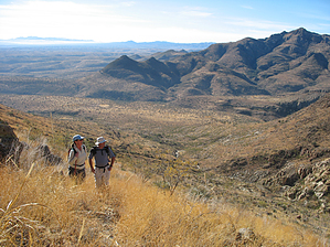
    WARNING! Hiking and outdoor related sports can be dangerous. Be responsible and prepare for the trip. Study the area you are entering and plan accordingly. Dress for the current and unexpected weather changes. Take plenty of water. Never go alone. Make an itinerary with your plan(s), route(s), destination(s) and expected return time. Give your itinerary to trusted family and/or friends.

     Permit $$
    None

    Coronado Forest
    MVUMs are rarely necessary to review unless mentioned in the description or directions
    Coronado Motor Vehicle Use Maps (MVUMs)


     Directions
    or
     Road
    Strictly 4x4

    To hike
    helpcorrectionissue

    end of page marker