 Route Editor

| Guide | ♦ | 17 Triplogs | 2 Topics |
details | drive | permit | forecast | 🔥 route |
stats |
photos | triplogs | topics | location |
| 120 | 17 | 2 |
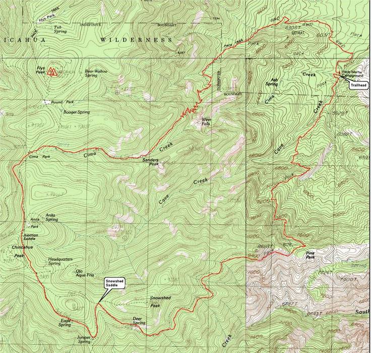
High mountain adventure by gpsjoe  The Snowshed and Greenhouse trails are on the east side of the Chiricahua Mountains, very near the border of Arizona and New Mexico. The trailhead is in the Herb Martyr campground, some 7 miles past Portal, Arizona. The Snowshed and Greenhouse trails are on the east side of the Chiricahua Mountains, very near the border of Arizona and New Mexico. The trailhead is in the Herb Martyr campground, some 7 miles past Portal, Arizona.This hike is not for everybody. It's a relatively grueling 15-mile loop with a total of 4,300 feet of cumulative elevation. For 1.5 of the 15 miles, the trail is almost non-existent or buried under fallen trees and debris from fires several years ago. This 1.5-mile section is on the Snowshed trail as it approaches Snowshed Saddle. Navigating to the saddle requires maps and GPS or both with adequate preparation in advance.
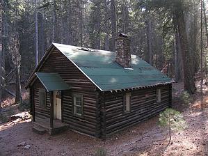
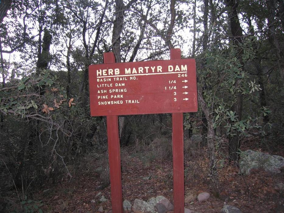
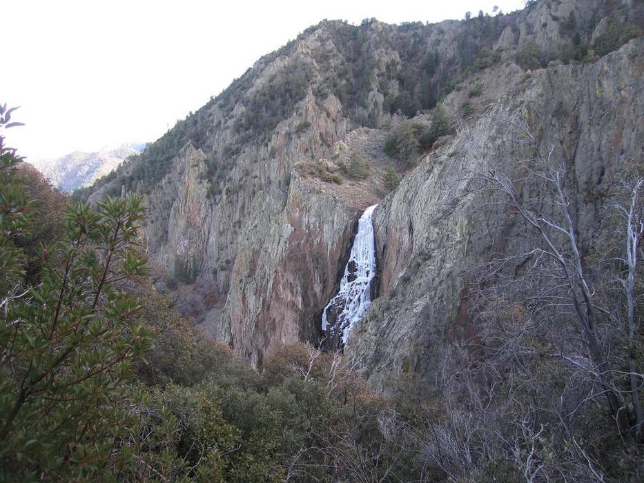
The hike starts at the trailhead in the beautiful Herb Martyr campground about 3 miles past Portal on Cave Creek Road (FS 42a). We start by going south on the Basin trail which is signed as trail 146. This is also the trail number for the Snowshed trail, and they both can't have the same number. On the Coronado National Forest website, this trail is listed as the Herb Martyr trail 247. But the sign on the trail says Basin trail 246, so go figure. We followed this heavily treed trail for 3 miles while climbing 2,000 feet to its end and intersection with the Snowshed trail. Along the way, we caught some great views of the Chiricahua Mountains ahead. We turned right and hiked up another 1,500 feet in 3.1 miles to the Snowshed saddle. The first half of this trail was easy to follow. Then we arrived at the burned-out part, the last 1.5 miles to the saddle. The downed trees and debris from past fires combined with several rainstorms in between have almost wiped out this trail. We would rediscover something that looked like a trail, take a few steps, and lose it again. All the time, we hiked over, under, or around many fallen trees. One of Sun_Hiker's able hiking friends tried this trail several years ago and turned back before reaching the saddle. We pushed through to the saddle, but it took about 2 1/2 hours to do the 1.5 miles. We had planned on going up to Snowshed peak, only 0.6 miles from the saddle, but we decided not to risk coming out in the dark. So on we went. We continued on Snowshed trail 0.4 miles to its intersection with the Crest trail turning right and following it passing the Chiricahua peak and Anita Park and onto Cima Park and the intersection with the Greenhouse Trail for a total of 2.7 miles of hiking on a good trail from Snowshed saddle. From the Crest Trail, there are many panoramic views of the surrounding mountains and valleys below. We then followed the Greenhouse trail east for 4.1 miles to its intersection with a 4WD dirt road. Greenhouse is an awe-inspiring trail with no fire damage. It follows Cima creek that has water with some good flow in spots, although you may need an ice pick to get at it at this time. We crossed Cima creek several times and had to dance on the ice on 3 of those crossings. We passed a couple of cabins on Cima creek, including one cluster of 3 buildings in excellent shape reserved for use by Forest Service personnel. Cima creek feeds Winn Falls, a 365-foot high spectacular waterfall. There is one signed viewpoint for Winn Falls on the Greenhouse trail. At this time, the view was frozen over. We then followed the 4WD dirt road to its intersection with Cave Creek Road, which we followed back to the car. Having stayed in the area the night before, we started hiking at 7:40 AM and finished at 5:45 PM. We arrived back in the Phoenix area at 11:30 PM. Check out the Official Route and Triplogs. Note This is a difficult hike. It would be insane to attempt this entire hike without prior experience hiking. Leave No Trace and +Add a Triplog after your hike to support this local community. | |||||||||||||||||||||||||||||||||||||||||||||||||||||||||||||||||||||||||||||||||||||||||||||||||||||||||||||||||||||||||||||||||||||||||||||||||||||||||||||||||||||||||||||||||||||||||||||||||||


