Route Editor

| Guide | ♦ | 77 Triplogs | 1 Topic |
details | drive | permit | forecast | route |
stats |
photos | triplogs | topic | location |
| 31 | 77 | 1 |
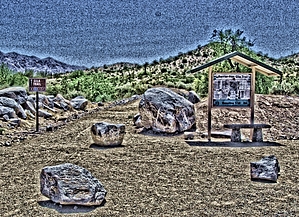
Exciting! A hundred years ago... by joebartels  Overview OverviewBaseline Spur, Gila Loop Trail, Saddle Trail, Toothaker Trail, plus tiny joiners from Rainbow Trail and Horseshoe Trail are access options. This guide reads the original and only option in 2006, the Gila Loop Trail. The two combined offer a 2.3-mile figure-eight loop hike presented here. The hike is relatively low key in elevation change with just enough to keep you looking ahead.
From the trailhead, head out on the Gila Trail, which is barrier-free. This is like the first part of the popular Waterfall Trail in the White Tanks. Meaning it's wheelchair/stroller friendly, designed to comply with ADA guidelines. It's also interpretive, with a few benches along the way, including a shaded bench at the Baseline junction. Once on the Baseline Trail, you circle one of the lowest-lying peaks in the Estrella foothills. The figure-eight loop is separate from the main group of trails in the park. This appears to be an area previously crisscrossed with numerous trails. The park seemingly wanted to keep foot traffic in line by creating this loop. With that in mind, there is no access to the primary trail system from this loop. The tread is pretty easy for the most part. One short-lived steep section through a ravine will get your attention. Which is followed with a few minor gravely sections. The views along the hike are fair at best. A clockwise trek will present a backside view of the Phoenix International Raceway grandstand, followed by a distant view of Rock Knob. Then you bring it home overlooking a golf course followed by views of what the park calls the "Turf Area". An early morning sunrise or a late afternoon sunset would undoubtedly spice things up. Creosote bush and staghorn cholla seem to be the predominant vegetation with some nice ironwoods and Palo Verdes along the way. Baseline is derived from the Gila and Salt River Base Line. Which, yes, is in line with Baseline Road and would plow right smack through this loop hike. Of more interest, to me at least, is the confluence of the Agua Fria and Gila rivers. It's only 0.6 miles NE of the trailhead. Of course, the bastards dammed the Gila near South Butte. Wild mustangs likely inhabited the area long ago in what was once a thriving riparian oasis. Synopsis This is a good loop for those in search of a shorter hike in the park. Just don't come here expecting much and leave feeling robbed due to the access fee. This isn't the Sierra Estrella mountain range the valley views from afar. These are the upper low lying foothills. The majority of the main range is on the Gila River Indian Reservation, which is off-limits. The one sliver of access is the Quartz Ridge Trail. It's out in the middle of nowhere, but it's free and awesome!
Check out the Official Route and Triplogs. Leave No Trace and +Add a Triplog after your hike to support this local community. | ||||||||||||||||||||||||||||||||||||||||||||||||||||||||||||||||||||||||||||||||||||||||||||||||||||||||||||||||||||||||||||||||||||||||||||||||||||||||||||||||||||||||||||||||||||