 Route Editor

| Guide | ♦ | 40 Triplogs | 2 Topics |
details | drive | no permit | forecast | 🔥 route |
stats |
photos | triplogs | topics | location |
| 550 | 40 | 2 |
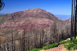
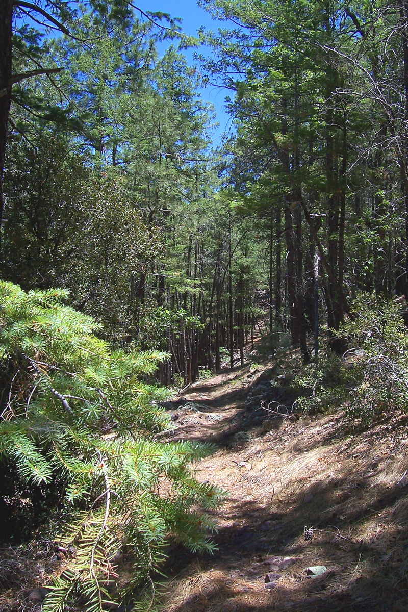
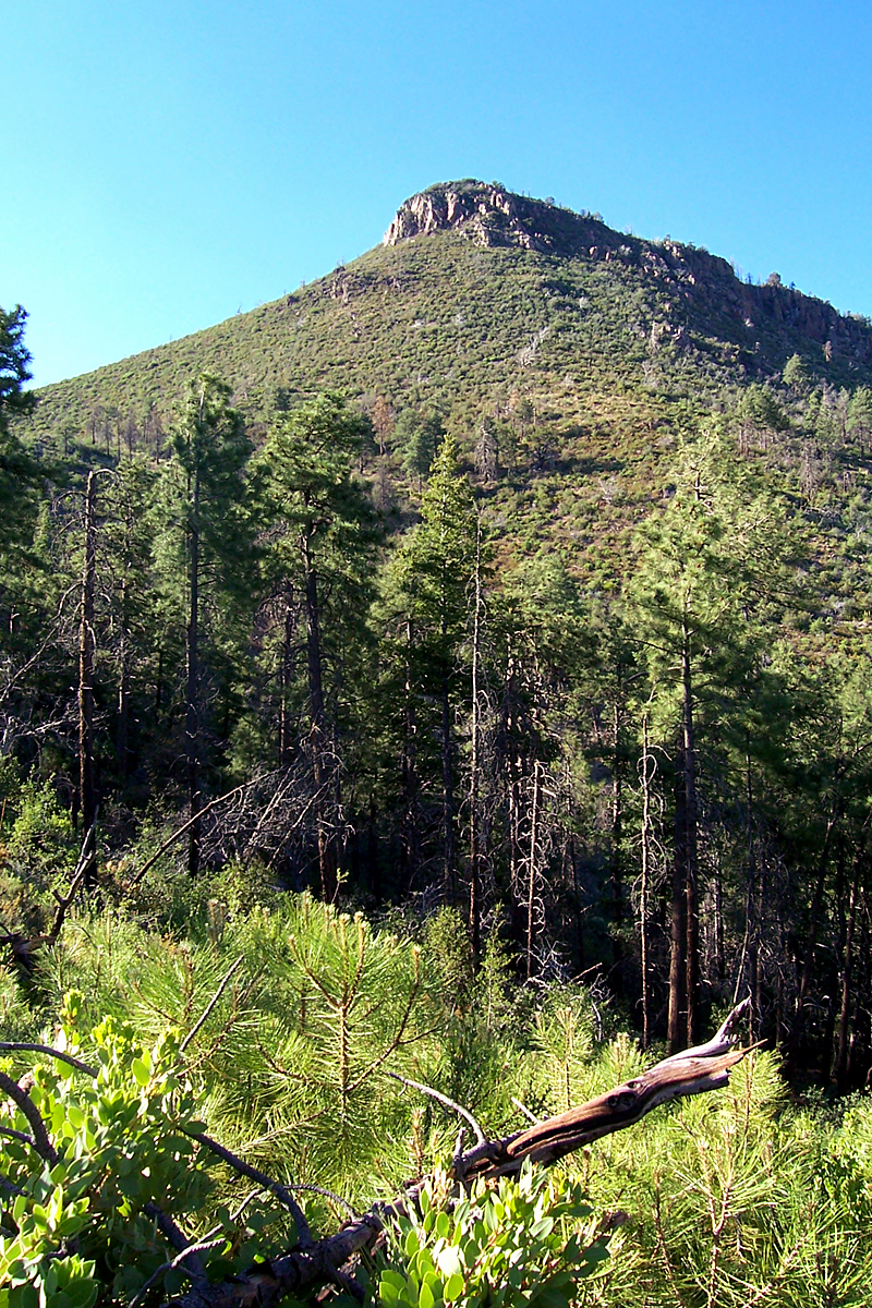
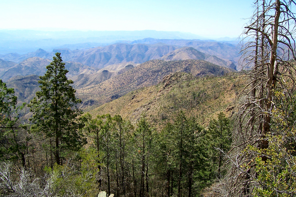
Backbone of the mighty Mazatzals by PrestonSands   The Mazatzal Divide Trail follows the high ridges of the northern Mazatzal Mountains beginning at Mt. Peeley and ending at the East Verde River some 30 miles later. Hiking the entire 30 miles as a day hike would be almost impossible (unless you are a complete animal), so I recommend doing it as a multi-day backpack or hiking it in sections. The Shake Tree, Barnhardt, Rock Creek, and North Peak trails are all access routes to the Mazatzal Divide Trail, should you decide to hike it in sections. This hike describes the southern third of the Mazatzal Divide Trail, from Mt. Peeley trailhead to Y-Bar Basin, connecting with the Shake Tree (Y-Bar) Trail. This section has small campsites in many of the saddles that the trail passes by. Check with the Payson ranger station for water conditions before you go. The Mazatzal Divide Trail follows the high ridges of the northern Mazatzal Mountains beginning at Mt. Peeley and ending at the East Verde River some 30 miles later. Hiking the entire 30 miles as a day hike would be almost impossible (unless you are a complete animal), so I recommend doing it as a multi-day backpack or hiking it in sections. The Shake Tree, Barnhardt, Rock Creek, and North Peak trails are all access routes to the Mazatzal Divide Trail, should you decide to hike it in sections. This hike describes the southern third of the Mazatzal Divide Trail, from Mt. Peeley trailhead to Y-Bar Basin, connecting with the Shake Tree (Y-Bar) Trail. This section has small campsites in many of the saddles that the trail passes by. Check with the Payson ranger station for water conditions before you go.Starting at the Mt. Peeley trailhead, head down the Cornucopia Trail #86 for a half-mile until it reaches the junction with the Mazatzal Divide Trail (trail 23). Turn right onto the Mazatzal Divide Trail as it begins a 500-foot climb up the east side of Mt. Peeley. As I was hiking up the switchbacks through the manzanita trench on this hot June morning, I had to stop in the shade of a juniper to cool down, wondering if attempting this long of a hike in 90-degree weather was a good idea. After the last switchback, the trail rounded the corner of Mt. Peeley, and the shade from the pines brought relief.
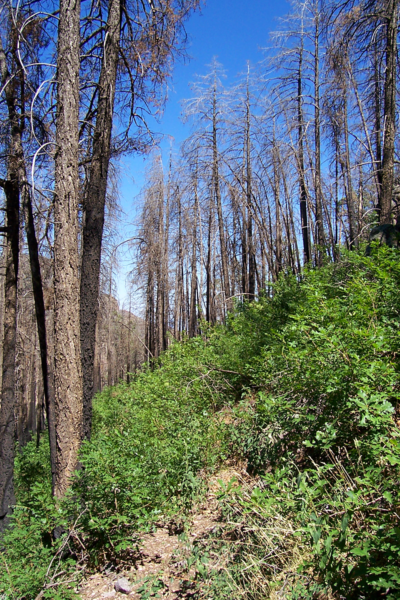
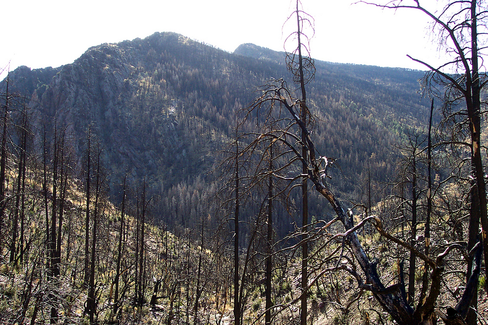
As the trail begins climbing the slopes of the 7358' peak, it reenters the Willow Fire burn. Occasional patches of living forest are encountered as the trail climbs the upper reaches of the rugged Deer Creek gorge. On the northern slope of the 7358' peak, gambel oak saplings were everywhere, nearly obscuring the trail; all ready to replace the blackened douglas fir skeletons above them. Once the 6960' saddle has been reached, there are views of the western side of the Mazatzals and the Verde Valley. From here, it is less than a mile to the highest point on the Mazatzal Divide Trail, at 7150 feet. Here, where the trail turns east, you are greeted with a 360-degree view of the Mazatzals and a giant mountain of layered rock: Mazatzal Peak. With sweat stinging my eyes and the sun cooking me red, I finally got to see the western face of Mazatzal Peak for the first time in eight years. Even with all the greenery burned off, it was still an impressive mountain. After enjoying the views, begin your descent to the saddle near Bear Spring, where a pocket of forest still survives. Continue north past the Bear Spring area as the trail passes under a rocky cliff and through a pass, entering Y-Bar Basin. This once incredible, forest-filled bowl at the base of Mazatzal Peak was reduced to a graveyard of trees by the Willow Fire. The trail then contours along the upper end of Y-Bar Basin until it meets with the Shake Tree Trail #144 near Windsor Spring. From this point, you can continue on the Mazatzal Divide Trail to Barnhardt or beyond, return the way you came (as I did), or take the Shake Tree Trail down to Barnhardt Trailhead if you have left a shuttle vehicle there. Check out the Official Route and Triplogs. Leave No Trace and +Add a Triplog after your hike to support this local community. One-Way Notice This hike is listed as One-Way. When hiking several trails on a single "hike", log it with a generic name that describes the hike. Then link the trails traveled, check out the example. | ||||||||||||||||||||||||||||||||||||||||||||||||||||||||||||||||||||||||||||||||||||||||||||||||||||||||||||||||||||||||||||||||||||||||||||||||||||||||||||||||||||||||||||||||||||||||||||||||||||||||||||


