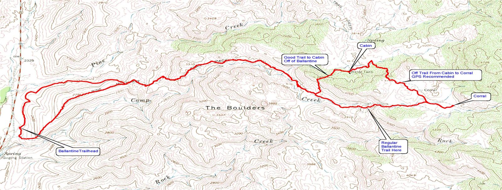
This hike incorporates the Ballantine Trail and the Pine Creek Loop that has been ably described including many triplogs and photos. This hike takes you off of the Ballantine Trail for a trip to an old ranch cabin and corral and then continues to another corral located on the Ballantine. From there we return to the trailhead on the usual Ballantine Trail completing the second half of the Pine Creek Loop in the process.
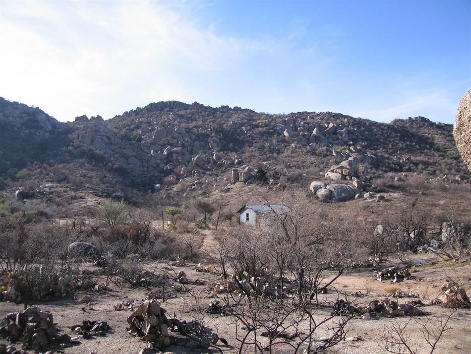
The Ballantine trailhead is located about 1/2 mile past the 210-mile marker on the Beeline Highway, route 87. From the trailhead, turn left or right and go 1.5 miles on Pine Creek Loop to the start of the Ballantine Trail. At the 3.6 mile point, there is a trail that goes off to the left that goes directly to the old ranch and cabin. This trail is reasonably easy to follow. The cabin will come in view after about 1/2 mile as you descend to the valley below. See the 24K topo for the entire hike.
After the grand tour of the area, you can decide to return the way you came in or continue as Sun_Hiker and I did cross country heading for the corral on the Ballantine Trail. There is no trail here. The first half mile is a climb out of the valley with some bushwhacking and rock climbing. After that, you cross over an opening in the barbed wire fence and the remaining mile or so to the corral is a walk in the park. No problem at all. The corral is the final destination and the return trip is the Ballantine Trail.
I have posted a GPS route for this hike and would highly recommend that the off-trail part of the hike be only done if you are using a GPS and have some experience hiking off-trail.
The Ballantine Trail is recovering nicely from fire damage and is in pretty good condition now. A lot of new green is showing through. The low desert recovers much faster than a treed forest I believe.
WARNING! Hiking and outdoor related sports can be dangerous. Be responsible and prepare for the trip. Study the area you are entering and plan accordingly. Dress for the current and unexpected weather changes. Take plenty of water. Never go alone. Make an itinerary with your plan(s), route(s), destination(s) and expected return time. Give your itinerary to trusted family and/or friends.
Permit $$
None
Directions
Road
Paved - Car Okay
To Ballantine Trailhead From Scottsdale follow Shea Blvd East to its terminus at SR87. Turn Left (North) onto SR87. Follow SR87(this is the Beeline) about 9.5 miles past the Four Peaks turnoff. The Ballantine turnoff is easy to find just past Mile Post 210. The trailhead is easy to spot from the parking loop.
From PHX (I-10 & AZ-51) 48.1 mi - about 55 mins From TUC (Jct 1-10 & Grant) 146 mi - about 2 hours 15 mins From FLG (Jct I-17 & I-40) 153 mi - about 2 hours 46 mins
 Route Editor

 This hike incorporates the Ballantine Trail and the Pine Creek Loop that has been ably described including many triplogs and photos. This hike takes you off of the Ballantine Trail for a trip to an old ranch cabin and corral and then continues to another corral located on the Ballantine. From there we return to the trailhead on the usual Ballantine Trail completing the second half of the Pine Creek Loop in the process.
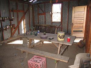


