Route Editor

| Guide | ♦ | 16 Triplogs | 0 Topics |
details | drive | permit | forecast | route |
stats |
photos | triplogs | topics | location |
| 96 | 16 | 0 |
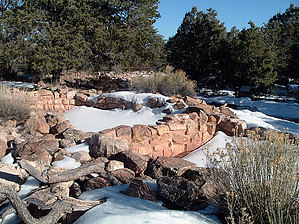
Easy Grand Canyon Ruins by PaleoRob   Tusayan Ruins are the only developed ruins along the South Rim of the Grand Canyon. While the hike is short, it does provide some insight into the lives of the ancient inhabitants of the rim country of the Grand Canyon. It was, in its time, a cultural crossroads, where the Anasazi met with their neighbors to the west and south, the Patayan and the Sinagua. The ruin was partially excavated in the 1930s and now stands with two main trails through it. Neither trail is very long. Tusayan Ruins are the only developed ruins along the South Rim of the Grand Canyon. While the hike is short, it does provide some insight into the lives of the ancient inhabitants of the rim country of the Grand Canyon. It was, in its time, a cultural crossroads, where the Anasazi met with their neighbors to the west and south, the Patayan and the Sinagua. The ruin was partially excavated in the 1930s and now stands with two main trails through it. Neither trail is very long.The first trail runs in a loop from the small but informative museum, around the outside of the ruin on its western wall. Here you can peer into the remains of living rooms. There are a few signs that give some brief information about the rooms that you are looking into, including a neat sign just outside of the museum, at the trailhead, that gives an artist's reconstruction of the pueblo during the late 1200s.
At the northeast point of the pueblo, the trail cuts between the end of the U and a large detached kiva. The kiva is interesting for several reasons - it's aboveground (most Anasazi kivas were below ground level), it has some original wood support pilasters still in place, and it has a partial banquet or bench that in most Anasazi kivas circled the entire kiva, high up. This banquet is more like a bench and is only present in the western half of the kiva. Similar seating benches are present in some Mogollon kivas. It's very interesting to note even in this small ruin the influence of the different cultural groups around the area in the structures. The trail then follows the inside wall of the pueblo. There are a few places where you can walk up and peer into the rooms, but entering them here is off-limits. Crossing the plaza, there is a small sign describing the prehistoric function of the plaza. In the southwest corner of the pueblo, the transition between living areas and storage rooms is marked by the presence of a small kiva, that apparently burned down while the pueblo was occupied, and was never rebuilt. The trail then makes its way back out of the pueblo. Just before returning to the trailhead, there's a sign and a great view of the San Francisco Peaks towards the southeast. One can only imagine precisely what the Peaks meant to the Anasazi, but doubtless, they had some prominence. Trail guides are available at the trailhead just outside of the museum. If you took one, put it back in the box, or pay a quarter to keep it - there's a map of the ruin and trails in it, along with some information about the ruin in addition to what the signs say. This hike is a nice hike to do with kids. It's short, shaded (mostly), and has restrooms, a museum, and picnic tables. A perfect lunch stop on your Grand Canyon rim trip. Check out the Official Route and Triplogs. Leave No Trace and +Add a Triplog after your walk/tour to support this local community. | ||||||||||||||||||||||||||||||||||||||||||||||||||||||||||||||||||||||||||||||||||||||||||||||||