 Route Editor

| Guide | ♦ | 40 Triplogs | 6 Topics |
details | drive | no permit | forecast | 🔥 route |
stats |
photos | triplogs | topics | location |
| 663 | 40 | 6 |
Canyons are inherently risky. Flash floods occur without notice on sunny days. Technical skills & surrounding topography knowledge required yet does not eliminate risk.
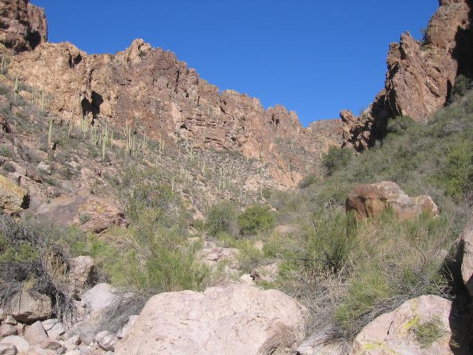
Trapped in the Superstitions by nonot  Warning: hazardous, if not outright dangerous climbing, scrambling obstacles to be encountered, read that disclaimer at the bottom of the page. Do this at your own risk. Warning: hazardous, if not outright dangerous climbing, scrambling obstacles to be encountered, read that disclaimer at the bottom of the page. Do this at your own risk.On a Saturday morning in March, our group of 6 adventurers set off for an area that has seldom been visited in the Superstitions. We planned to complete the first half of the Whiskey Springs-Red Tanks loop before arriving at our primary destination, Trap Canyon, where we would spend the night, and complete the loop the following morning.
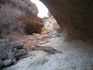
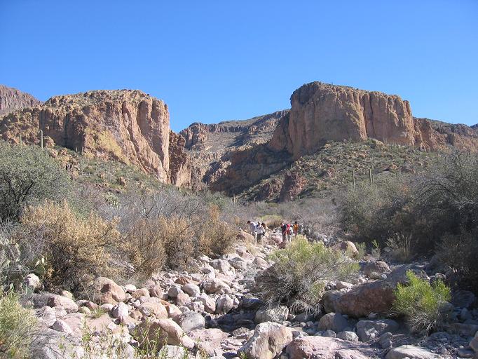
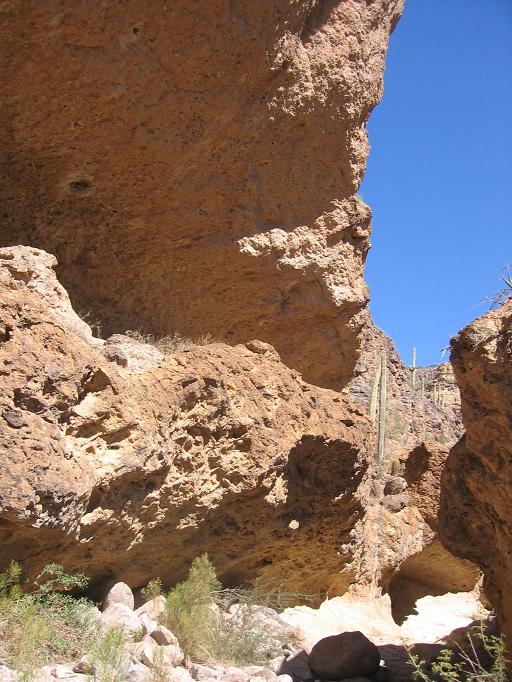
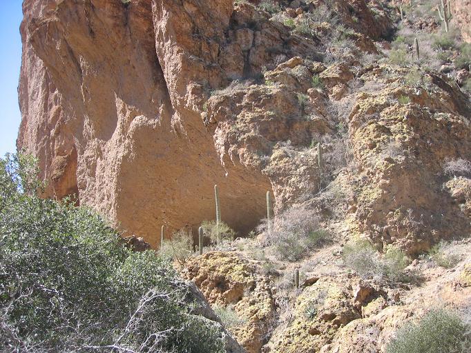
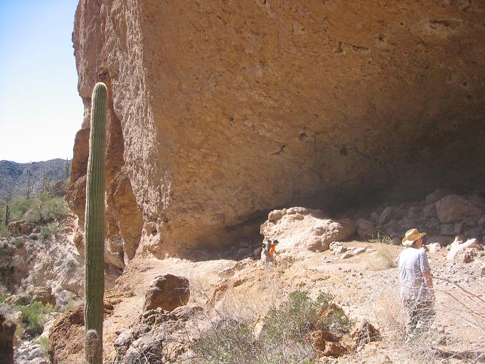
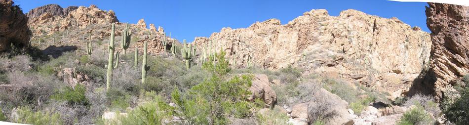
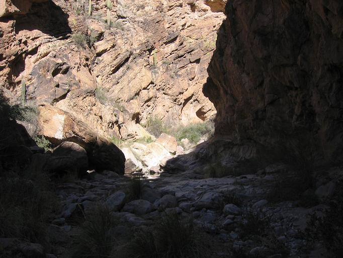
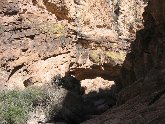
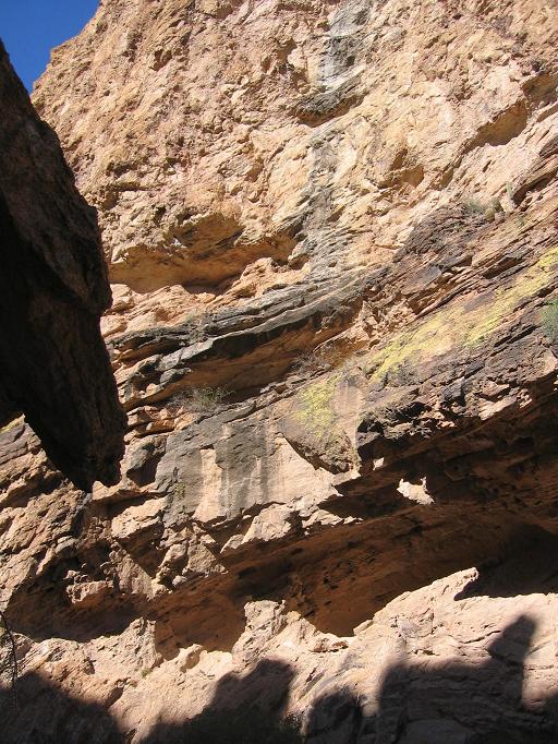
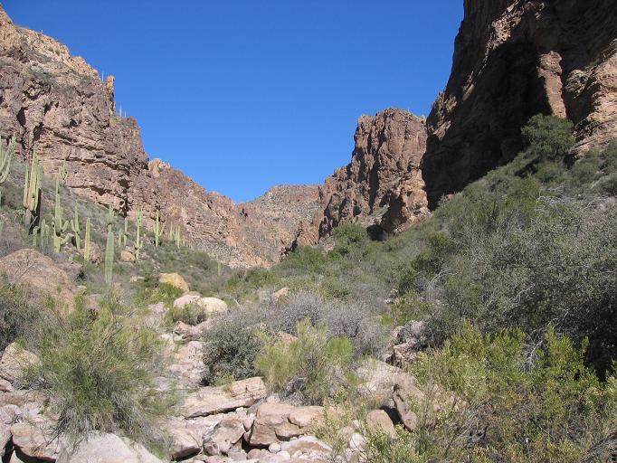
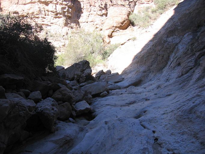
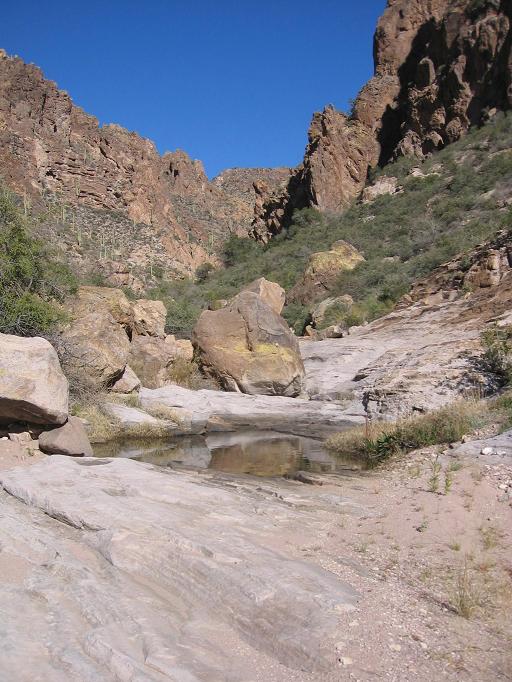
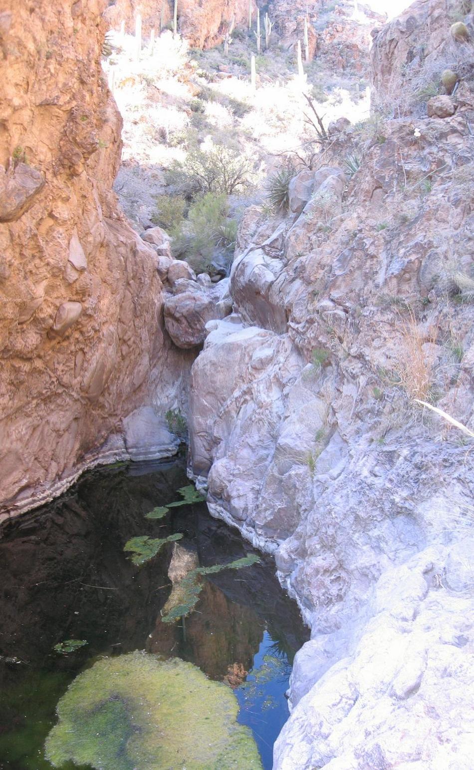
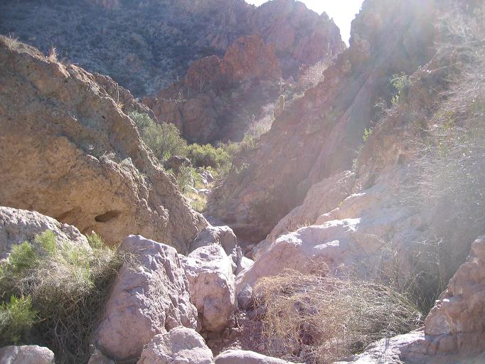
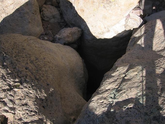
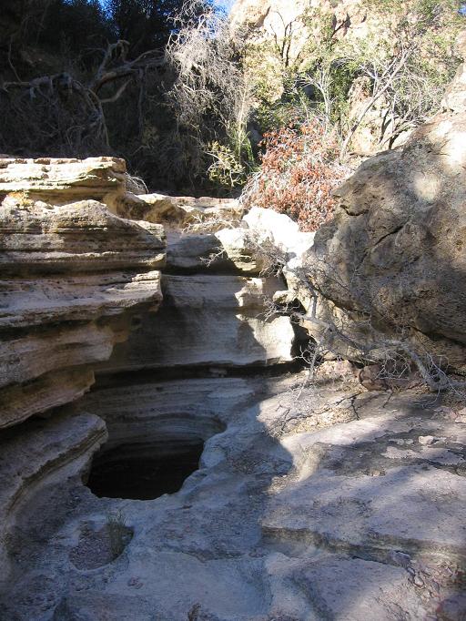
Making good time, we ascended Miner's Summit, slid down Whisky Springs Trail, and marched down LaBarge creek on Red Tanks trail, arriving at the canyon before noon. There, we were surprised to come upon two cowboys exiting the canyon. One of them gave us a tip that there's more to find in Trap Canyon than one would expect to see (or see be described in a trip report ;) The large band shell that can be seen from the distance was our first target. Unfortunately, getting into Trap Canyon is rather difficult as the area is seldom traveled. Following the creek, we were able to locate what we believed was "Trap Spring", which upon our inspection, was a rather poor spring that had the color of syrup. Once past this, we face a choice between a high route to the east and a low route to the west. Neither is particularly pleasant and we quickly become familiar with catclaw on several occasions. Past this comes a smooth rock area that is tightly confined by the walls of the canyon. If you haven't been counting your steps, you'd be surprised to find that the band shell is actually over your head at this point ! A short distance later you can climb up to a ledge and backtrack into the alcove on the west side . We set up camp in the band shell and found filterable, but poor tasting, water a few minutes further up the canyon. 4 of the 6 of us decided to attempt to navigate though the canyon and discover the mystery of the trap for which the canyon is named. The other 2 possessed more common sense and stayed behind. Within 5 minutes of setting out, we come to a wall-to-wall pool with vertical walls boxing in the pool on both sides. A scramble up the canyon on either the north or the south side is possible, but not recommended. Be warned, this type of scrambling sets the tone for most of your trip. Continuing, it is best to get out of the brush and into the rocky streambed that will be your trail for the rest of the trip. Initially, the going is not too difficult, and there are pools and smooth rock sections alternating with your typical Supes canyon rock hopping. You will soon come to a junction. A dry creek bed to the north apparently comes from Sheep Mountain Spring, which looked to be a rather formidable ascent. We proceeded east (right) on the more level ground, continuing our trip up Trap Canyon. There are several shallow caves along the next section . Carved out by wind and water , they are interesting, including one that looks as if it contains a structure assembled from rectangular blocks. I climbed up and was surprised to discover the blocks are natural and a steeply sloping floor appears to render that cave unfit for habitation. Eventually as you continue along, you will come to an area that opens up as the canyon walls become less vertical. However, your way appears to be blocked on all sides as you approach. Undeterred, we proceeded along the creek as far as we could. It is then we noticed that a rather formidable barrier obstructs you from continuing. This is the area Trap Canyon takes a sharp turn from southeasterly to north on your topo map. For the casual adventurer, I would recommend you turn around here. However, we had still not located the trap and decided to continue our search. The only way to bypass this wall-to-wall obstacle is to cling to a rather precarious set of handholds on the eastern side. Be cautious, a slip here could be life-threatening in a place this remote. Past this pool, the difficult ratchets up a couple of notches (yeah, believe it or not, you're only done with the EASY part at this point). The boulders get larger, the canyon tighter, the creek is steeper, and the thorns get thicker. We hopped, climbed, and crawled our way up boulders, through cracks, and up walls. Just when you want to throw in the towel you will encounter a nearly impenetrable barrier. About 4-5 house-sized boulders have collected in a steep section of the canyon. They have lodged together in such a way to completely span the canyon wall to wall. On the southeast side, there is a 10-foot wall one of our members rated as 5 point something. Not being familiar with climb ratings, I'll describe it as pretty much vertical with extremely poor handholds. Another member attempted to summit the boulders on the northwest side and shimmy over onto an adjoining boulder. Neither is a particularly good route, so choose to the best of your abilities, or know your limits and turn around now. When we got to the top, we recognize this as the actual trap! (Note 1) The steep sides of the canyon restrict your options. From above the only route down looks to be to jump through a dim, dark hole to a faintly visible flat spot about 50+ feet down. The boulders appear impassible from above on this side of the canyon. Deciding to test the trap, we threw one of the members of our group into the hole and hoped for the best. (Note 2) Past the trap, we continue our steep scrambling up to a point where the canyon forks to the north and east. The north route was a steep climb that heads up Music Mountain. The east is steep and a bushwhack to get through. As far as we could tell, the Hoolie Bacon trail lay on the other side of the steep climb to the east. However, realizing that it was getting late, we agreed to turn around now rather than face a trek in the dark back to camp. We booked it back down the canyon to beat the setting sun. On the way down I discovered why exploring seldom-visited canyons is dangerous. Climbing down one of the steep sections, I stepped on a rock that broke loose and rolled forward, and I did a rather ungraceful impression of a wounded duck as I slammed backward into the ground. Luckily, I didn't break my arm, but one of my trekking poles was now sporting a cool 30-degree bend on the bottom section. We quickly reached the pool at the recommended turnaround point. As I was skirting along on the handholds, I set my hand on a cactus and instinctively jumped backward. Unfortunately, this is not a particularly good idea when you are on the steep ledge of a cliff. However, I utilized my cat-like reflexes to grab new handholds about 4-6 feet into the fall, and then another member, upon seeing that the canyon had not actually claimed a sacrifice yet, decided to donate his water bottle filled with purple power-aid. (Note 3) Unfortunately, it fell in an inaccessible location, so if you visit and it moves to a position you can grab it, please pack it out. An hour and 15 minutes after turning around, our group strolled confidently into camp, proud we had conquered Trap Canyon (Note 4). The next morning, we finished off our loop on an unseasonably warm day and arrived at Peralta trailhead with sore muscles, but in good spirits. It was a pleasure to hike with this welcoming group of HAZ members that until this weekend I had only read about on this website. Notes:
Check out the Official Route and Triplogs. Leave No Trace and +Add a Triplog after your canyon trip to support this local community. | |||||||||||||||||||||||||||||||||||||||||||||||||||||||||||||||||||||||||||||||||||||||||||||||||||||||||||||||||||||||||||||||||||||||||||||||||||||||||||||||||||||||||||||||||||||||||||||||||||||||||||||||||||||||


