 Route Editor

| Guide | ♦ | 562 Triplogs | 7 Topics |
details | drive | permit | forecast | 🔥 route |
stats |
photos | triplogs | topics | location |
| 3.4k | 562 | 7 |
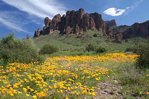
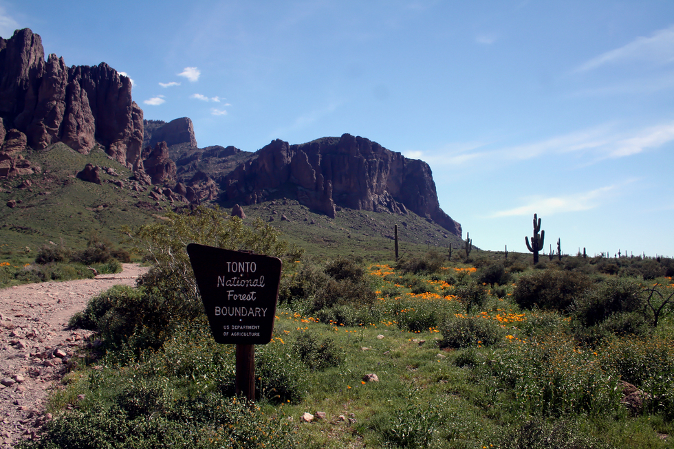
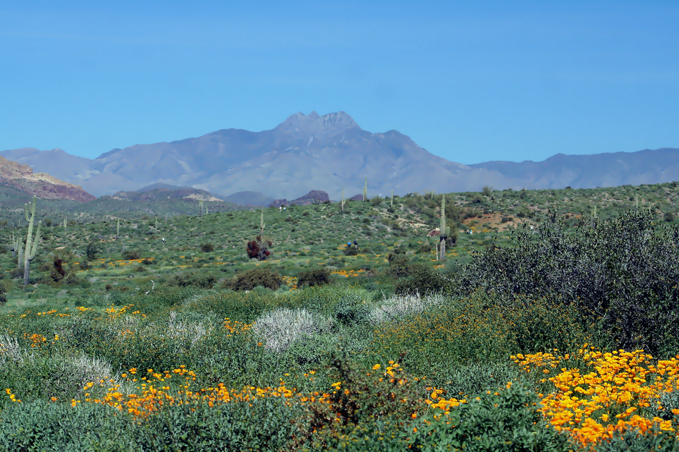
Number One Superstition Draw by Randal_Schulhauser   Note NotePlease post hikes past the polished slick rock basin to the Flatiron page. Overview Head out on the Discovery Trail for 0.5 mi close to the old Siphon Draw TH. Take a left on Siphon Draw Trail #53 and follow 1.4 mi to its end at the polished slick-rock waterfall. Return by the same route.
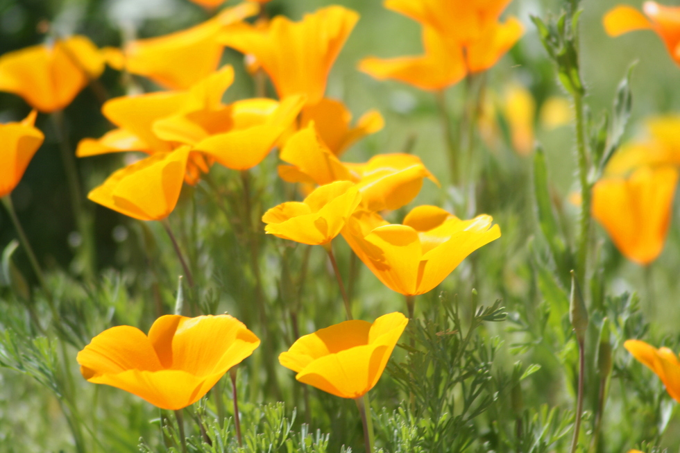
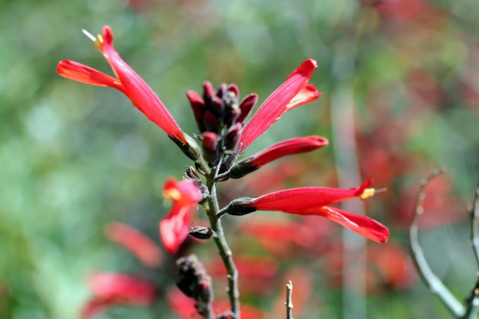
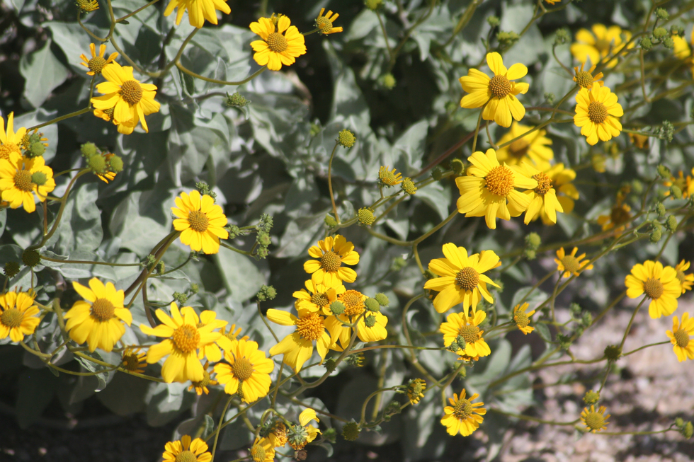
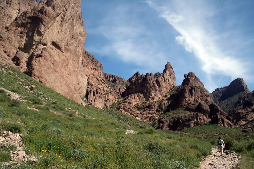
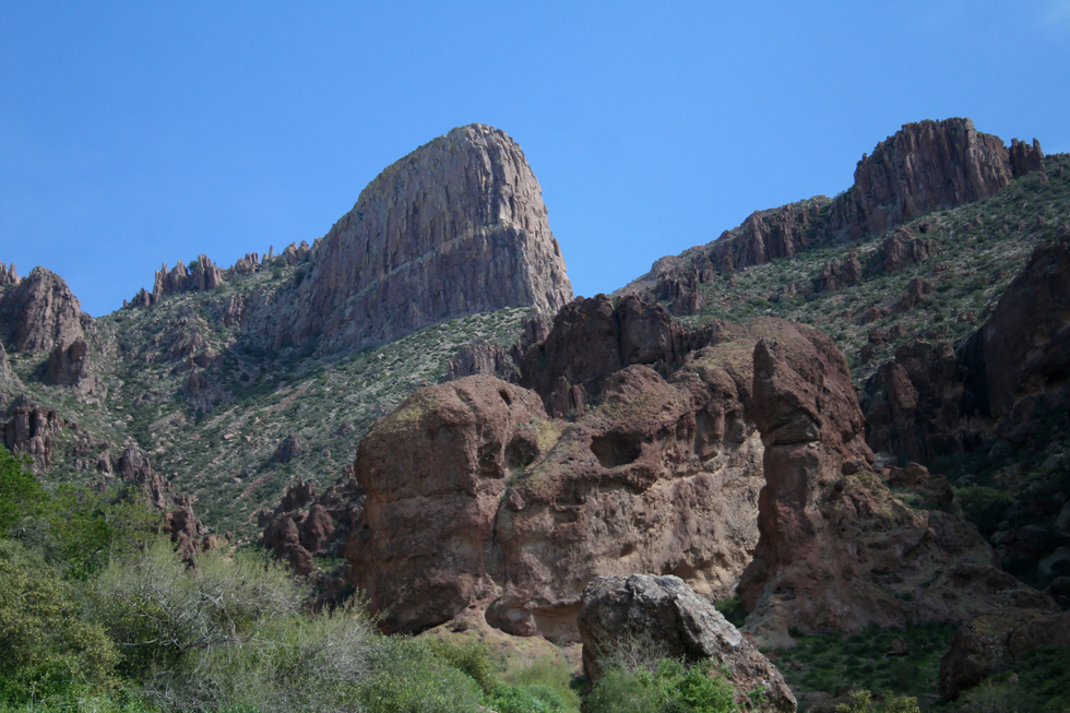
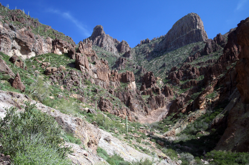
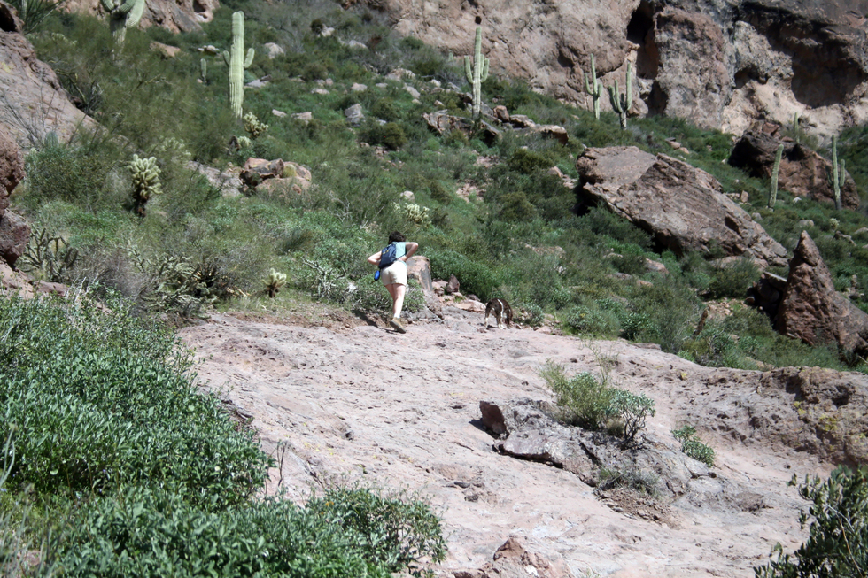
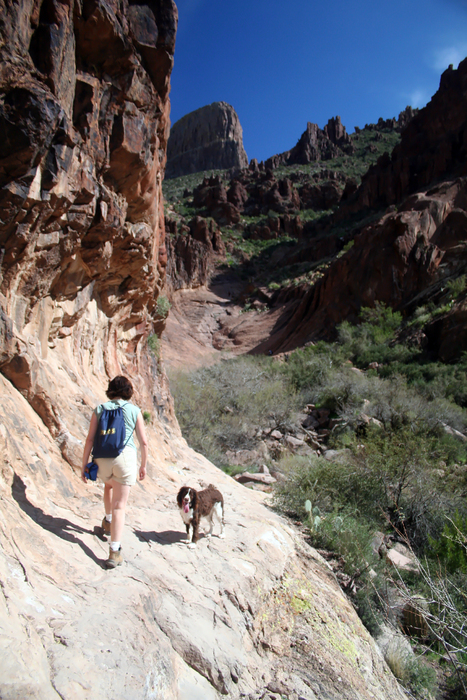
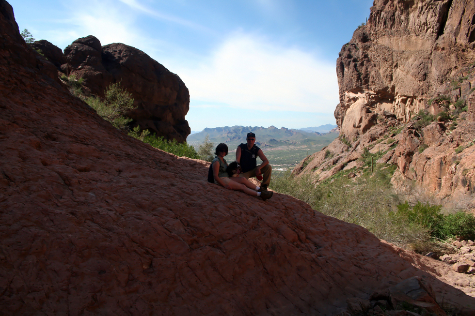
Siphon Draw is aptly named for its ability to "drain off" (i.e., siphon) water from a large area on Superstition Mountain. A light amount of precipitation will result in water being siphoned into the canyon draw and flow over the slick rock. I haven't witnessed the water flow from a torrential storm, but I'm sure it's nothing less than a flash flood! The slick-polished rock offers clues to the violent blasts of water rocketing through the chute. Probably not the place to be in a storm... History This hike is somewhat unique in that in less than 2 miles. It traverses a State Park (Lost Dutchman), a National Forest (Tonto), and a Wilderness Area (Superstition) while urban views of the Greater Phoenix Area are always at hand. This stands as incredible foresight by advocates and legislators to set aside these lands for public use and act as a buffer from unchecked urban sprawl. So who possessed this remarkable foresight? A timeline can provide clues for some of the names; 1903 • Construction begins on Roosevelt Dam Road (aka Apache Trail) 1905 • Tonto National Forest established to protect Salt River and Verde River watersheds 1911 • Completion of Roosevelt Dam 1912 • Arizona becomes 48th State in the Union 1939 • Superstition Primitive Area set aside as a precursor to the Superstition Wilderness Area 1964 • US Congress legislation designates Superstition Wilderness Area 1977 • Lost Dutchman State Park lands acquired from Barkley Cattle Company and others 1984 • Wilderness closed to new mining claims For mining history "nuggets" checkout Lost Dutchman State Park Loop and the Palmer Mine Loop. Hike Pay the day-use fee at the Visitor Center and proceed to the Siphon Draw Trailhead parking area located at the terminus of the day-use area road. If parking is overflowing, check out either the Cholla or Saguaro day-use parking areas. There are plenty of picnic tables under ramadas, so remember to pack the cooler for beverages and eats after the hike! The Discovery Trail heads south from the day-use area towards the campgrounds and Siphon Draw Trail #53. There are interpretive signs along this trail providing information about flora and fauna native to the area. There are strategically placed bird feeders and water ponds to attract wildlife. This trail undulates into a couple of washes and passes the campground amphitheater just before connecting with the old Siphon Draw TH at 0.5 mi. Siphon Draw Trail #53 offers a classic view of Superstition Mountain and the distinctive Flatiron. Now heading in a southwest direction you are following the old Palmer Mine access road. You will soon reach the east boundary of Lost Dutchman State Park at 0.67 mi. Pass through the gates and enter Tonto National Forest. About 1.0 mi from the trailhead, you will come to the intersection with Jacob's Crosscut Trail #58. Continue heading southwest along the old Palmer Mine access road. As you hike along Siphon Draw Trail #53, look back to the north to view Four Peaks. During wildflower season, the trail is lined with Lupine, Mexican Poppies, Chuparosa, and the ever present Brittlebush . Every now and then, a steam whistle can be heard emanating from the tourist train at Goldfield. As you continue trekking towards the wilderness boundary, look towards the east for the old Palmer Mine tailings visible in the sloped talus below the massif cliffs. Just before you reach the intersecting side trail to Palmer Mine at about 1.25 mi, you will see foundation ruins on both sides of the trail. These are remains of the old Palmer mining operations and later Barkley Cattle Company line operations. At 1.33 mi you come to the Superstition Wilderness Boundary denoted by a much-photographed wooden sign. You now walk "Into the Wild" as you enter the Superstition Wilderness Area, and the grade begins to get noticeably steeper... As you enter into Siphon Draw canyon near 1.6 mi, your view is dominated by the obvious Flatiron massif and the subtle "Crying Dinosaur" formation (right spire in photo). As you continue up the draw, the slick rock area known as "The Basin" comes into view. Switchbacks are none existent, just a steady grade uphill towards "The Basin". A couple of sections have minor exposure. At 1.9 mi you reach the slick rock basin. This is a drainage confluence of sorts with a shear wall waterfall to the left and a steep grade to the right. Our dog took advantage of a pool of water below the shear wall waterfall to cool down. Take advantage of the ample shade in "The Basin", enjoy the views, and contemplate whether to push on another 1700 feet up to the Flatiron or turnaround back to the TH... Summary This hike can serve as a good introduction to the Sonoran Desert and the mysterious Superstition Mountains. I've brought many first time visitors to Arizona to this park and will continue to do so. Just remember that the elevation gain can be brutal on less-than-fit or non-hikers. Enjoy! Gate Policy: If a gate is closed upon arrival, leave it closed after you go through. If it is open, leave it open. Leaving a closed gate open may put cattle in danger. Closing an open gate may cut them off from water. Please be respectful, leave gates as found. The exception is signage on the gate directing you otherwise.
Check out the Official Route and Triplogs. Leave No Trace and +Add a Triplog after your hike to support this local community. | ||||||||||||||||||||||||||||||||||||||||||||||||||||||||||||||||||||||||||||||||||||||||||||||||||||||||||||||||||||||||||||||||||||||||||||||||||||||||||||||||||||||||||||||||||||||||||||||||||||||||||||||||||||||||||||||||||


