$0 GC Camping

Car Camping / Trailhead Camping

Moderator: HAZ - Moderators

 Linked Guides none
 Linked Area, etc none
Post Reply
User avatar
montezumawell
Guides: 6 | Official Routes: 0
Triplogs Last: 7,478 d | RS: 0
Water Reports 1Y: 0 | Last: never
Joined: Feb 03 2002 6:32 pm
City, State: Montezumawell, AZ

$0 GC Camping

Post by montezumawell »

Yes, you can camp for FREE 15 minutes from the South Rim of the Grand Canyon.

There are scores of great car-camp sites along Forest Road 302 in the Kaibab Nat'l Forest east of Tusayan. FR 302 heads east immediately south of the Grand Hotel. Camping becomes legal a mere half mile away.
Since FR 302 once lead to the old landfill (closed in July 2001), it is in great shape and suitable for all vehicles.

Campsites are spread out in tall ponderosa trees with a sagebrush groundcover. The area was last logged in the 60's so it looks and feels real nice.

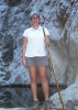
We camped 5 nights there between April 8-13, 2002 and saw only 6 other campers total. Open fires are legal but we used our camp stove anyway.
We timed our travel to and from the Rim each day and it averages 15 minutes either to Mather or to the Camper Services area near the Market Plaza. It can be slower depending on your wait to get through the Entrance Station and/or whether you are following someone driving 15 mph. However, we saw deer on virtually every drive and once we saw elk grazing on new green grass beside the highway. It's a very pleasant drive and there's no need to reserve a spot out there.

The USFS does occasionally send out a law enforcement officer to make sure no one is exceeding the 14 stay limit. You can also camp alongside FR 688 which is the big road just south of the Ten-X Campground.

Water is no problem. There's a really nice public water hose at the GC's Camper Services area. You can also take 5 minute showers for $1 and get a bag of ice or do a load of wash for $1.25. Why, you can even check your email for a mere buck for four minutes, too! :roll:

By using the Kaibab Forest for our camping, we were able to spend six days and five nights at the Canyon for less than $100, including $45 for gas and $12 for film. Be advised that restuarant meals are REALLY pricey on the South Rim. A breakfast burrito at the Maswik Lodge is $4.75 and domestic beers are $3.35 each. Prices at the General Store are about par with your typical convenience store high prices. Fortunately, the Post Office can't mark up post card stamps so they still cost 21 cents each. :wink:

Also be advised that if you camp at Mather CG you can often expect long lines to check in or snag an unreserved campsite. While hanging out at Camper Services, we often saw lines in which people waited upwards of 30 minutes. We also saw rather 'steamed' campers who already had a campsite but couldn't get their vehicles through the RV traffic congestion at the check-in kiosk. Mather is $15 a night unless you are on foot or bike (with NO vehicle), then it's $4 a night. The one time we drove around Mather gawking at the other campers, it took us nearly 10 minutes to drive back out of the campground due to congestion, foot traffic, and the low speed limit. So we figure, timewise to a TH or a rim viewpoint, camping in the Kaibab is roughly equal to camping in Mather anyway.

One last tip we learned this week. The topography of the area east of Tusayan is gently rolling limestone hills and swales. Pick a campsite on top of one of those gentle ridges. They are perfectly flat. Even if you are only 100 feet off of one of those small ridges, your bedroll will be uncomfortably slanted. In other words, a lot of the campsites look level but they aren't. Also, get off of FR 302 as far as possible because the late comers always seem to camp right by the road. You won't get double camped if you are at least a quarter mile off of FR 302.

Hope this info helps you 'bargain basement' day hikers looking to enjoy the South Rim without spending a bundle.

J&S in RR
contribute to this member driven resource
ie: RS > Save/Share after hikes Route Scout GPS Topo Mapper on the App Store Route Scout GPS Topo Mapper on Google Play
User avatar
joebartels
Guides: 264 | Official Routes: 226
Triplogs Last: 5 d | RS: 1960
Water Reports 1Y: 14 | Last: 8 d
Joined: Nov 20 1996 12:00 pm

Re: $0 GC Camping

Post by joebartels »

[quote='montezumawell']Why, you can even check your email for a mere buck for four minutes, too! :roll:[/quote]

That's all you need to say!

:idea: Seriously though, good info
- joe
contribute to this member driven resource
ie: RS > Save/Share after hikes Route Scout GPS Topo Mapper on the App Store Route Scout GPS Topo Mapper on Google Play
User avatar
Pellegrino
Triplogs Last: 8,345 d | RS: 0
Water Reports 1Y: 0 | Last: never
Joined: Feb 04 2002 3:58 am
City, State: Gilbert, AZ

Post by Pellegrino »

Very good info indeed. Hey, how about a site around our Humphries trip, any thoughts there?
Kelly :)

Climb every mountain, ford every stream
Follow every rainbow, till you find your dream
contribute to this member driven resource
ie: RS > Save/Share after hikes Route Scout GPS Topo Mapper on the App Store Route Scout GPS Topo Mapper on Google Play
User avatar
Nighthiker
Triplogs Last: 1,415 d | RS: 0
Water Reports 1Y: 0 | Last: never
Joined: Feb 03 2002 6:59 am
City, State: Payson

Post by Nighthiker »

Great info, since the shuttle service I have been reluctant to visit the South Rim. I camped in the Kaibab Forest south of the GCNP several times and on one ocassion was advised by a law enforcement officer for theGCNP that camping was not allowed wihout permit in the GCNP. Took awhile to convince him that I was on the Kaibab.
contribute to this member driven resource
ie: RS > Save/Share after hikes Route Scout GPS Topo Mapper on the App Store Route Scout GPS Topo Mapper on Google Play
User avatar
evenstarx3
Guides: 1 | Official Routes: 0
Triplogs Last: 8,329 d | RS: 0
Water Reports 1Y: 0 | Last: never
Joined: Feb 03 2002 8:44 am
City, State: Sun City West, AZ from CA

Post by evenstarx3 »

Admittedly I've only been to the GC twice for a total stay of nine days, but I found the shuttle very convenient. Both times I kept the motor home at Trailer Village where I had no trouble checking in and had shuttle service to take me wherever I wanted to go.....and it always did. Never had to wait longer than 15 minutes or so. Try that with any of our sophisticated Urban transportations systems.
Both times I hiked below the rim...Indian Garden the first and Plateau Point the second....I got to and from the BA Trail Head by shuttle. Seems to me it beats fighting a traffic jam of cars that would be on the roads without the shuttle.
Hooli, aka Trihairopelli

"They say the dog is man's best friend.
I don't believe that. How many of your friends have you neutered?"
--Larry Reeb
contribute to this member driven resource
ie: RS > Save/Share after hikes Route Scout GPS Topo Mapper on the App Store Route Scout GPS Topo Mapper on Google Play
User avatar
Donald
Triplogs Last: none | RS: 0
Water Reports 1Y: 0 | Last: never
Joined: Feb 08 2002 7:42 am
City, State: Miami, FL USA

Post by Donald »

J&S,
Thanks for the good tip. Not being near there, I may not be able to use it, at least for a while, but I like this kind of information.
8)

I was last at the Grand Canyon in 1976, in a whirlwind trip across country, after graduating from college.
contribute to this member driven resource
ie: RS > Save/Share after hikes Route Scout GPS Topo Mapper on the App Store Route Scout GPS Topo Mapper on Google Play
User avatar
Randy
Guides: 1 | Official Routes: 0
Triplogs Last: 8,579 d | RS: 0
Water Reports 1Y: 0 | Last: never
Joined: Feb 13 2002 5:13 pm
City, State: Scottsdale, AZ

shuttles

Post by Randy »

Hoolie makes an excellent point about the shuttles. I worked with the GCNP on their transportation plan in the late 90s. The Park service wrestled quite a bit with the transportation issues in developing their new General Management Plan, a long range plan for the Park. They concluded that the Park could accomodate the anticipated increase (to 5 million a year by 2005) in visitors, but not the automobiles.

In addition to the crush of vehicles, congestion on roadways, and parking shortages near viewpoints, the congestion added to air quality problems over the Canyon. The vast majority of visitors stay less than a day; and I recall the average was about three hours; just long enough for photos at three viewpoints, a quick run through the visitor center, a post card for Aunt Em, and a rubber tomahawk for Junior from the souvenir stand. It is the 'day-trippers' who cause the traffic problems, not the hikers and campers.

Those with campground or hotel reservations, or backcountry permits will still be able to bring in their cars except for sections of the rim drive and the village which will be closed to private vehicles. Appropriately, one of the criteria used to evaluate future transit technology was a lack of sensational appeal. The Park Service did not want a 'high-tech' transportation system (Like an overhead monorail like DisneyWorld) to detract from the main show-the Canyon. Vehicles will use non-polluting alternative fuels.

The alternative to limiting autos was to impose visitor level quotas, and close the gates when the place got full. Ed Abbey said something about not being able to drive into the Sistene Chapel to view the ceiling; and that we should be forced to approach the rim on foot and grasp it from a human perspective. This is a step in that direction.

BTW, We may have to think about similar approaches in other areas we are 'loving to death'. Population projections for the Valley are 4.95 million for 2025 and 6.3 million by 2040. This will mean a lot more cars parking at Peralta.....-Randy
contribute to this member driven resource
ie: RS > Save/Share after hikes Route Scout GPS Topo Mapper on the App Store Route Scout GPS Topo Mapper on Google Play
Post Reply

Return to “Camping”