 Route Editor

Does anyone know how to get on top of the Mcdowell mountains, straight north of mesa az, just west of fountain hills. there is a mcdowell regional park, but that does not offer a trail to the mountain, its miles away from the actual mountain. I would assume there is someway to get to it from scottsdale. I see many ways to it, but most ways are blocked by salt river indain communitie's barbed wires and "no tresspassing" signs. Any info would be greatly appreciated.
Next question,
whats is the wilderness area just east of usery mountain??
Mcdowell mountains...
Moderators: HAZ Group Coordinators, HAZ - Moderators
Linked Guides none
-
 finalphaseGuides: 0 | Official Routes: 0Triplogs Last: none | RS: 0Water Reports 1Y: 0 | Last: never
 - Joined: Jan 17 2004 12:46 am
- City, State: Mesa, AZ
contribute to this member driven resource
ie: RS > Save/Share after hikes 

-
 fairweather8588Guides: 1 | Official Routes: 0Triplogs Last: 186 d | RS: 0Water Reports 1Y: 1 | Last: 186 d
 - Joined: Jul 22 2003 6:35 pm
- City, State: Scottsdale
- Contact:
the shortest way to get to the top of McDowell & Thompson Peak is to park up in McDowell Mountain Ranch (just off the 101 on bell road) and head along the big wash, spliting off in either direction depending on which peak you want to go to. there are not many trails and its about 5 miles round trip to either peak.
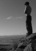
No man should go through life without once experiencing healthy, even bored solitude in the wilderness, finding himself depending solely on himself and thereby learning his true and hidden strength
Kerouac
Kerouac
contribute to this member driven resource
ie: RS > Save/Share after hikes
-
 joebartelsGuides: 264 | Official Routes: 224Triplogs Last: 2 d | RS: 2067Water Reports 1Y: 29 | Last: 2 d
 - Joined: Nov 20 1996 12:00 pm
east of Usery is
Superstition Wilderness
http://hikearizona.com/WilderDEX-Hikes.php?WID=57
general map at the bottom of that page
&
Four Peaks Wilderness
http://hikearizona.com/WilderDEX-Hikes.php?WID=13
the Forest in general is Tonto
http://hikearizona.com/ForestDEX-Hikes.php?FID=6
Superstition Wilderness
http://hikearizona.com/WilderDEX-Hikes.php?WID=57
general map at the bottom of that page
&
Four Peaks Wilderness
http://hikearizona.com/WilderDEX-Hikes.php?WID=13
the Forest in general is Tonto
http://hikearizona.com/ForestDEX-Hikes.php?FID=6
- joe
contribute to this member driven resource
ie: RS > Save/Share after hikes
-
 AZOutdoorsmanGuides: 4 | Official Routes: 0Triplogs Last: 1,802 d | RS: 0Water Reports 1Y: 0 | Last: never
 - Joined: Jan 16 2004 10:31 am
- City, State: Chandler, AZ
McDowells
See Thompson Peak hike on this site. I did this hike last summer, it is one of the better workouts in town - enjoy 
Darrell
Darrell
contribute to this member driven resource
ie: RS > Save/Share after hikes