 Route Editor

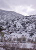
My wife and I are considering an overnight backpacking trip at West Clear Creek. We will head up trail #17. I understand that it is about 5 miles to the place where trail #17 begins heading up to the rim. Instead of heading up to the rim, we were thinking about heading upstream to find a quiet place to camp. However, I have found very little information on that section of the canyon. I understand from what I have found that travel is very slow, so perhaps we will only go upstream another mile or so. Do you know if there are any good camping sites shortly after the area where the #17 trail begins to head up to the rim?
I have heard that there are some deep pools.Our trip will be in late April. Are the pools too cold then to swim? Is it necessary to have a wetsuit or drysuit? Will it be necessary to have a trail boat to float teh pack in to cross the pools in this area? Is the scenery in the section I am asking about worth the extra effort, or do you recommend camping along the #17 trail. Any information you can share would be greatly appreciated.
Thank you.
West Clear Creek- trip planning- help
Moderator: HAZ - Moderators
Linked Area, etc none
-
 austinbostonGuides: 0 | Official Routes: 0Triplogs Last: none | RS: 0Water Reports 1Y: 0 | Last: never
 - Joined: May 04 2002 6:48 pm
- City, State: Leesburg, Virginia
contribute to this member driven resource
ie: RS > Save/Share after hikes 

-
 joebartelsGuides: 264 | Official Routes: 224Triplogs Last: 3 d | RS: 2064Water Reports 1Y: 28 | Last: 13 d
 - Joined: Nov 20 1996 12:00 pm
Re: West Clear Creek- trip planning- help
I would think you could get by with a wetsuit, but I wouldn't go with anything less.austinboston wrote:Our trip will be in late April. Are the pools too cold then to swim? Is it necessary to have a wetsuit or drysuit?
- joe
contribute to this member driven resource
ie: RS > Save/Share after hikes
-
 MaryPhylGuides: 0 | Official Routes: 0Triplogs Last: 9,341 d | RS: 0Water Reports 1Y: 0 | Last: never
 - Joined: Apr 29 2002 7:58 am
- City, State: Flagstaff, AZ
I was out to lunch when I wrote this!
Last edited by MaryPhyl on May 16 2002 6:08 am, edited 1 time in total.
contribute to this member driven resource
ie: RS > Save/Share after hikes
-
joebartelsGuides: 264 | Official Routes: 224Triplogs Last: 3 d | RS: 2064Water Reports 1Y: 28 | Last: 13 d
- Joined: Nov 20 1996 12:00 pm
Okay, I don't know what I was thinking! Somehow I was thinking below the rim & WCC is obviously WELL above the rim... duh
Yes it would be way too cold for swimming in April. Probably near 38-43 degrees.
Canyoneering Arizona has 14 pages on WCC
my copy has been overused, it's really not a "book" anymore
Yes it would be way too cold for swimming in April. Probably near 38-43 degrees.
Canyoneering Arizona has 14 pages on WCC
my copy has been overused, it's really not a "book" anymore
- joe
contribute to this member driven resource
ie: RS > Save/Share after hikes
-
 jeremy77777Guides: 0 | Official Routes: 0Triplogs Last: 8,435 d | RS: 0Water Reports 1Y: 0 | Last: never
 - Joined: Mar 28 2002 3:11 pm
- City, State: Queen Creek, AZ
From beginning to end West Clear Creek is one of my favorite week long hikes in the state. Most of the time you go you will not run into anyone. I haven't the past four times. The stretch you are asking about is breath-taking. You could swim in the deep pools there. Just remember you won't last too long. They are cold and numb your body. Stay in them a while, you might get used to the cold 

Oh Be Wise, Need I Say More?
- Jeremy
- Jeremy
contribute to this member driven resource
ie: RS > Save/Share after hikes
-
 zapmanGuides: 0 | Official Routes: 0Triplogs Last: none | RS: 0Water Reports 1Y: 0 | Last: never
 - Joined: Mar 18 2006 8:09 pm
- City, State: Payson
contribute to this member driven resource
ie: RS > Save/Share after hikes
-
 Al_HikesAZGuides: 11 | Official Routes: 14Triplogs Last: 1,265 d | RS: 0Water Reports 1Y: 0 | Last: 3,405 d
 - Joined: May 16 2005 1:01 pm
- City, State: Scottsdale, AZ
- Contact:
I'm not sure of the current status, but I think that Tonto Rim Search & Rescue has taken a clue from Superstition Search & Rescue and is posting topos on their web site. Keep watching http://www.trsar.org/topo_quads/topo_quads.htmzapman wrote:How would I get topos of the area? Especially around gisela maybe up to hegler's creek.
If you like the quads, your local SAR will appreciate any contribution(s).
contribute to this member driven resource
ie: RS > Save/Share after hikes