 Route Editor

Book "Explore Arizona" by Rick Harris?
Moderator: HAZ - Moderators
Linked Guides none
Linked Area, etc none
-
 GeorgAZGuides: 0 | Official Routes: 0Triplogs Last: none | RS: 0Water Reports 1Y: 0 | Last: never
 - Joined: Apr 30 2002 7:31 pm
- City, State: Scottsdale, AZ
Book "Explore Arizona" by Rick Harris?
A few years ago,I got the Explore Arizona book by Rick Harris+ was actually trying to find some of the ruins/sites+ his directions were so vague,that I was unable to find any of it, The Nipper Ruins,Wingfield 1+2,Cornville Ruins,Haufer Wash Ruins, Mt.St. Claire Ruins. Has anyone read his books+been able to find any of this stuff?? Or is this just a man/woman/Mars/Venus personal orienteering difficulty?? Duh! 
contribute to this member driven resource
ie: RS > Save/Share after hikes 

-
 desert dwellerGuides: 0 | Official Routes: 0Triplogs Last: none | RS: 0Water Reports 1Y: 0 | Last: never
 - Joined: Mar 23 2002 12:19 pm
- City, State: Tucson, AZ
I rememer when I bought Explore Arizona! in 1995 how neat it was. This guy knew about a lot of places.
I planned a couple of road trips to check out these areas. Both trips were unsuccessful. It seems that either the roads were not marked, impossible to find or passed through private land, State Trust land or areas owned by mining companies.
I consider myself pretty good at navigation and route finding. But, Harris's maps and written directions were not useful for me. So don't think of your lack of success as having something to do with your abilities. I really think it is the book.
Nowadays, I just use the Arizona Atlas and Gazetteer by Delorme, pick a place that seems remote and interesting and head out. Sometimes I will do an Internet search for the placenames in the chosen area.
Today I am thinking of making the drive to Canyon de Chelly. Even if the campsites are booked-up the drive will still be nice.
P.S.
Oh yea. I did find and explore the Ice Cave just west of Flagstaff. It was worth the effort to find it. Harris calls it the Lava River Cave.
contribute to this member driven resource
ie: RS > Save/Share after hikes
-
 NighthikerGuides: 0 | Official Routes: 0Triplogs Last: 1,643 d | RS: 0Water Reports 1Y: 0 | Last: never
 - Joined: Feb 03 2002 6:59 am
- City, State: Payson
contribute to this member driven resource
ie: RS > Save/Share after hikes
-
 jeremy77777Guides: 0 | Official Routes: 0Triplogs Last: 8,434 d | RS: 0Water Reports 1Y: 0 | Last: never
 - Joined: Mar 28 2002 3:11 pm
- City, State: Queen Creek, AZ
contribute to this member driven resource
ie: RS > Save/Share after hikes
-
 DarylGuides: 0 | Official Routes: 0Triplogs Last: 8,208 d | RS: 0Water Reports 1Y: 0 | Last: never
 - Joined: Mar 07 2002 11:18 am
- City, State: Lake Stevens, WA
The way the guy writes in the book, I don't think he wants people to find things he writes about, he just wants to sell books.
I found a few things in there, but it took a few lessons learned. You need to sit down with a good map and figure out which roads he is talking about before you hit the road.
I found a few things in there, but it took a few lessons learned. You need to sit down with a good map and figure out which roads he is talking about before you hit the road.
contribute to this member driven resource
ie: RS > Save/Share after hikes
-
 RandyGuides: 1 | Official Routes: 0Triplogs Last: 8,807 d | RS: 0Water Reports 1Y: 0 | Last: never
 - Joined: Feb 13 2002 5:13 pm
- City, State: Scottsdale, AZ
books
I've never seen that one. My favorite guide book is an old Sierra Club "pocket book" called "Hiking the Southwest" by Dave Ganci. Dave is a local, and is a tad loco--he thinks there is horizontal walking, and vertical walking, which most people call climbing. He doesn't get too worked up about it, but then he was on the first climb of Zoroaster Temple in the Grand Canyon, and spent time in the Andes.
What I like about his book is that he just gives you the simply basics on a very great number of areas from the Nevada border to Big Bend, and lets you do the mile by mile discovery.
Hmmmm, an epiphany....HEY JOE, how 'bout a section on favorite hiking related books. it could be divided into subsections on trail and area descriptions, flora, fauna and geology descriptions, history and fiction. Since it's too dry to go hiking, this'll give ya something to pass the time. -Randy
contribute to this member driven resource
ie: RS > Save/Share after hikes
-
 MikeGuides: 5 | Official Routes: 0Triplogs Last: 8,709 d | RS: 0Water Reports 1Y: 0 | Last: never
 - Joined: Feb 03 2002 11:45 am
- City, State: Scottsdale, AZ
Re: books
Joe, pausing for a moment from his thumb twigglin', says, "Sure, Randy, great idea!!!"Randy wrote:Hmmmm, an epiphany....HEY JOE, how 'bout a section on favorite hiking related books. it could be divided into subsections on trail and area descriptions, flora, fauna and geology descriptions, history and fiction. Since it's too dry to go hiking, this'll give ya something to pass the time.
I've found a couple of places in Harris' books, but I agree, the directions are remarkably vague. I think maybe his motive might be to get you in the general vicinity, and let you have the fun of exploring the place to find the attraction. That strategy may deter a lot of the "riff-raff" (kudos to DesertBoots
 ), who might be prone to destroying the sites, stealing artifacts, etc. I think he'd probably sell more books if they were more descriptive, so I don't really believe his motive is money.[/u]
contribute to this member driven resource
ie: RS > Save/Share after hikes
-
desert dwellerGuides: 0 | Official Routes: 0Triplogs Last: none | RS: 0Water Reports 1Y: 0 | Last: never
- Joined: Mar 23 2002 12:19 pm
- City, State: Tucson, AZ
Sometimes happenstance rules your life. Over Memorial Day weekend I headed north from Tucson. I sought to camp someplace along the way but, of course, the Forests were closed with barriers on the Forest Roads. Near Stoneman Lake I stopped a couple of Rangers and asked for an exception to the rules because I am experienced, only use a campstove and will sleep in the back of my truck. They actually gave it some thought but, backdowned and recommended going back south to Forest Road 618, just north of Camp Verde, because camping is allowed anywhere along the road.
I got set up right around dark. Looking at the map closer, I saw that I parked right next to Sacred Mountain at Beaver Creek. This is one of the sites in the Harris book. I got up early the next morning and hiked to the peak. The entire top was ruins.
On the second night, after spending the afternoon driving around the open Forest Roads just south of Grand Canyon Park, I wanted to try and find the Cliff Dweller Ruins on the Verde. I found the Forest Road (500) and four-wheeled it toward the River. Less than a mile from the River, the road was closed for "Wildlife Breeding" and "Fire Hazards". I could have walked on to the dwellings, but I am a believer in following most guidlines. So I just set up camp on a flat spot and spent the night with cattle and cow crap.
Like others have said here, Harris' book must have been written purposefully vague. However, so far the places I have managed to find or stumble across have been worth effort.
dd
contribute to this member driven resource
ie: RS > Save/Share after hikes
-
 MtnGeekGuides: 9 | Official Routes: 0Triplogs Last: 2,124 d | RS: 0Water Reports 1Y: 0 | Last: never
 - Joined: May 01 2002 11:09 am
- City, State: Denver, CO
I hate it when authors are vague. I bought a book called Arizona's Mountains writen by Bob Martin. I decided to check out Sitgreaves Mtn near Flagstaff. The instructions were right on until we came to a road driving straight toward the mountain. We took 3 different roads searching for the right one. The one he mentioned was a road we had to start hiking from, he put the wrong number on the wrong road. It took us an hour to find out what he was talking about.
Desart Dweller, you mentioned Lava River Cave. I have been there 2 times. I really like that area. I plan on posting it as soon as I can aquire some info on it. I saw it on the internet and passed it up (stupid me). I was hoping to do it on June 8, but the stupid forests closed down.
Desart Dweller, you mentioned Lava River Cave. I have been there 2 times. I really like that area. I plan on posting it as soon as I can aquire some info on it. I saw it on the internet and passed it up (stupid me). I was hoping to do it on June 8, but the stupid forests closed down.
contribute to this member driven resource
ie: RS > Save/Share after hikes
-
 joebartelsGuides: 264 | Official Routes: 224Triplogs Last: 8 d | RS: 2063Water Reports 1Y: 28 | Last: 11 d
 - Joined: Nov 20 1996 12:00 pm
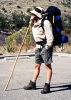
I think I hit Sacred Mountain on the most beautiful day ever
http://hikearizona.com/decoder.php?ZTN=109
I wish I had a better camera then.
I don't mind the vague-ness. Just adds to challenge, that's a big part of why I go out. Also keeps the masses out. However, I can understand if you buy a book on such and such you'd expect a little value for your buck.
http://hikearizona.com/decoder.php?ZTN=109
I wish I had a better camera then.
I don't mind the vague-ness. Just adds to challenge, that's a big part of why I go out. Also keeps the masses out. However, I can understand if you buy a book on such and such you'd expect a little value for your buck.
- joe
contribute to this member driven resource
ie: RS > Save/Share after hikes