 Route Editor

It looks like there are 3 or 4 choices. Snakemarks and I have discussed the possiblity of getting up there other than via Siphon Draw. She's been to the Flat Iron, I haven't. So I think she'd like to do a different route; IF I can persuade her to be my partner in crime; ;) providing it's even doable or I'm just dreaming I could do it, ha! However, if the Siphon Draw is the best, I'll defer to the experts. (I've been to the top of the Draw 3 times just before you go down and back up again).
Superstition Ridgeline's Easiest Route
Moderator: HAZ - Moderators
Linked Area, etc none
-
 tibberGuides: 21 | Official Routes: 51Triplogs Last: 9 d | RS: 547Water Reports 1Y: 0 | Last: 1,008 d
 - Joined: Feb 26 2004 1:27 pm
- City, State: Phoenix, AZ
Superstition Ridgeline's Easiest Route
Say an almost real hiker wanted to get up on some portion of that spectacular ridgeline of the Supes... I've read about the various routes available but what would you say is the easiest route? I understand there reallly isn't an EASY route  but one that would be the least challenging for a weekend hiker.
It looks like there are 3 or 4 choices. Snakemarks and I have discussed the possiblity of getting up there other than via Siphon Draw. She's been to the Flat Iron, I haven't. So I think she'd like to do a different route; IF I can persuade her to be my partner in crime; ;) providing it's even doable or I'm just dreaming I could do it, ha! However, if the Siphon Draw is the best, I'll defer to the experts. (I've been to the top of the Draw 3 times just before you go down and back up again).
It looks like there are 3 or 4 choices. Snakemarks and I have discussed the possiblity of getting up there other than via Siphon Draw. She's been to the Flat Iron, I haven't. So I think she'd like to do a different route; IF I can persuade her to be my partner in crime; ;) providing it's even doable or I'm just dreaming I could do it, ha! However, if the Siphon Draw is the best, I'll defer to the experts. (I've been to the top of the Draw 3 times just before you go down and back up again).
For me, sometimes it's just as much about the journey as the destination.
Oh, and once in awhile, don't forget to look back at the trail you've traveled.
Oh, and once in awhile, don't forget to look back at the trail you've traveled.
contribute to this member driven resource
ie: RS > Save/Share after hikes 

-
 azdesertfatherGuides: 16 | Official Routes: 21Triplogs Last: 5 d | RS: 18Water Reports 1Y: 2 | Last: 327 d
 - Joined: Apr 30 2008 9:57 am
- City, State: Tucson, AZ
- Contact:
Re: Superstition Ridgeline's Easiest Route
My two cents, I don't think there is a route that's noticeably easier. The real bear (I think) isn't the initial ascent up to the ridgeline, but the constant up and downs along the ridgeline...a few hours of that and you're saying to yourself, "OH, $^($!#)^($^($!!!  Not another down and up!"
"I went to the woods because I wished to live deliberately, to front only the essential facts of life, and see if I could not learn what it had to teach, and not, when I came to die, discover that I had not lived." — Henry David Thoreau
contribute to this member driven resource
ie: RS > Save/Share after hikes
-
 nonotGuides: 107 | Official Routes: 108Triplogs Last: 110 d | RS: 0Water Reports 1Y: 9 | Last: 109 d
 - Joined: Nov 18 2005 11:52 pm
- City, State: Phoenix, AZ
Re: Superstition Ridgeline's Easiest Route
I've never done it via Hiero going up. Carney going down isn't too bad IMO.
http://hikearizona.com/garmin_maps.php
Hike Arizona it is full of sharp, pointy, ankle-twisting, HAZmaster crushing ROCKS!!
Hike Arizona it is full of sharp, pointy, shin-stabbing, skin-shredding plants!
Hike Arizona it is full of striking, biting, stabbing, venomous wildlife!
Hike Arizona it is full of sharp, pointy, ankle-twisting, HAZmaster crushing ROCKS!!
Hike Arizona it is full of sharp, pointy, shin-stabbing, skin-shredding plants!
Hike Arizona it is full of striking, biting, stabbing, venomous wildlife!
contribute to this member driven resource
ie: RS > Save/Share after hikes
-
 wallyfrackGuides: 0 | Official Routes: 6Triplogs Last: 5 d | RS: 0Water Reports 1Y: 2 | Last: 180 d
 - Joined: Mar 11 2003 7:33 pm
- City, State: AZ
Re: Superstition Ridgeline's Easiest Route
I would say Siphon Draw is the quickest way up, on Hiero it can be easy to lose the trail and there is some loose scree up top and Carney is fairly easy to follow but there is one section with a few stray cairns and while it goes up in stages it seems to take a long time.
contribute to this member driven resource
ie: RS > Save/Share after hikes
-
 HoffmasterGuides: 0 | Official Routes: 0Triplogs Last: 6,321 d | RS: 0Water Reports 1Y: 0 | Last: never
 - Joined: Oct 04 2002 11:13 pm
- City, State: Canton, OH
- Contact:
Re: Superstition Ridgeline's Easiest Route
It's been a few years since I've been up there, but I don't remember it being like that. I thought it was a rather flat, easy and pleasant stroll across the top. Obviously there's a few ups and downs, but not constantly.dshillis wrote:The real bear (I think) isn't the initial ascent up to the ridgeline, but the constant up and downs along the ridgeline...a few hours of that and you're saying to yourself, "OH, $^($!#)^($^($!!! Not another down and up!"
Tibber, it's just a big hill, like Camelback or the McDowells. Go up from Carney Springs. Take it slow and you'll be on top in no time. Have fun and take some great pics!
"I'm not a vegetarian because I love animals; I'm a vegetarian because I hate plants." A. Whitney Brown
contribute to this member driven resource
ie: RS > Save/Share after hikes
-
 joebartelsGuides: 264 | Official Routes: 224Triplogs Last: 3 d | RS: 2064Water Reports 1Y: 28 | Last: 12 d
 - Joined: Nov 20 1996 12:00 pm
Re: Superstition Ridgeline's Easiest Route
I agree 100%, of course I've been preaching it forever. If you're a moderate strong hiker neither way is really of concern. However it's truly never ending via Carney for the less experienced. It's false hopes after false hopes, then you have to deal with rounding the sw peak. By the time you're actually on "the" ridge you just want to get off. Via Flatiron has more immediate rewards and lures you in.wallyfarak wrote:I would say Siphon Draw is the quickest way up, on Hiero it can be easy to lose the trail and there is some loose scree up top and Carney is fairly easy to follow but there is one section with a few stray cairns and while it goes up in stages it seems to take a long time.
The question is very "opinionated", this thread could blow out religion, politics, guns and hiking naked topics in one fell swoop... just go
Whatever you do go quick before the temps rise. 80 degrees up there and you'll feel pain in a whole new dimension
- joe
contribute to this member driven resource
ie: RS > Save/Share after hikes
-
 snakemarksGuides: 0 | Official Routes: 0Triplogs Last: 3,036 d | RS: 0Water Reports 1Y: 0 | Last: 3,700 d
 - Joined: Oct 31 2007 12:55 pm
- City, State: Middle-of-Nowhere, AZ
Re: Superstition Ridgeline's Easiest Route
Wow. I really stepped in it this time. Looks like I got tibber all fired up with my big mouth. 
So, Flatiron to Carney sounds like the ticket. You guys don't seem to have any trouble doing this in one day.
That's amazing, I think, and not possible for us. We're just girls, you know!
Seriously, some of you might try to imagine your moms up there for a little perspective on it! (I can't believe I said that.)
Has anyone done this as a two day backpack? Where's a good camp spot? When I was on the Flatiron, it was very windy, even though it wasn't in the valley. Is it always like that up there? Is a tent a ridiculous idea? (Don't answer that, te-wa!) ;)
I'm at home in the wilderness... it's civilization I have problems with! ](./images/smilies/eusa_wall.gif "Brick wall")
contribute to this member driven resource
ie: RS > Save/Share after hikes
-
HoffmasterGuides: 0 | Official Routes: 0Triplogs Last: 6,321 d | RS: 0Water Reports 1Y: 0 | Last: never
- Joined: Oct 04 2002 11:13 pm
- City, State: Canton, OH
- Contact:
Re: Superstition Ridgeline's Easiest Route
The more I think about it, the more I agree with Wally and Joe. My last is post is idiotic. Carney Springs is a great route to the top, but you won't be there "in no time." I don't know what I was thinking.joe bartels wrote:If you're a moderate strong hiker neither way is really of concern. However it's truly never ending via Carney for the less experienced. It's false hopes after false hopes, then you have to deal with rounding the sw peak. By the time you're actually on "the" ridge you just want to get off. Via Flatiron has more immediate rewards and lures you in.
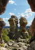
I've always wanted to do that, but other more tempting hikes and backpacks kept pushing it aside. It's another world up there and spending a whole weekend would be awesome. I'm sure you can find a place to camp that is more comfortable than the Flatiron. I bet there are some gems hidden in the hoodoos.snakemarks wrote:Has anyone done this as a two day backpack?
"I'm not a vegetarian because I love animals; I'm a vegetarian because I hate plants." A. Whitney Brown
contribute to this member driven resource
ie: RS > Save/Share after hikes
-
 MoodretsGuides: 0 | Official Routes: 0Triplogs Last: none | RS: 0Water Reports 1Y: 0 | Last: never
 - Joined: Feb 22 2009 7:58 pm
- City, State: Phoenix, AZ
Re: Superstition Ridgeline's Easiest Route
Hmmm, well, neither route is particularly bad, so physically you should be fine for both of them.
However, given that it is winter and that we are N of the equator, the sun will (keep in mind, this is a rather simplistic representation) rise in the south east and set in the south west. If you travel from siphon draw to Carney, the entirety of your hike will be in the southeast direction. Therefore, if you intend to do this hike in the morning (rather than the afternoon), you'll always have the sun in your face.
Forgetting not that the ridgeline itself has virtually no shade whatsoever, you really will be facing the sun for 75% of your trip if you start early at siphon draw.
If that's fine by you, siphon draw in the morning would be my recommendation also. However, if that bothers you (and it usually bothers me), then it might be advisable to go the other way or begin your hike in the afternoon. Remember to account for temperature differences when making your decision, though! It's starting to warm up, don't forget to bring enough water...
I don't know of anyone who's done an overnight yoyo of it, but I did it both ways as a dayhike with a friend of mine back in January, and I know of a guy who did a dayhike yoyo of it a few years back with a somewhat larger group.
contribute to this member driven resource
ie: RS > Save/Share after hikes
-
 rushthezeppelinGuides: 0 | Official Routes: 0Triplogs Last: 6,212 d | RS: 0Water Reports 1Y: 0 | Last: 6,388 d
 - Joined: Oct 25 2008 2:42 am
- City, State: Tempe, AZ
Re: Superstition Ridgeline's Easiest Route
I've only done it one way, but I really enjoyed doing it from Carney Spring to Siphon Draw. I think it's a bit faster this way as long as you have good knees. Going up Siphon Draw does slow me down and wear me out a bit. Coming down it however is a totally different story for me. When I did it, I made it from from Flatiron to the slickrock basin in about 45 minutes. Granted if you do Siphon Draw first it's more downhill from that point than coming from Carney. I guess they probably would be about equal as long as you took your lunch break after getting up to Flatiron so you can recoup a bit.
contribute to this member driven resource
ie: RS > Save/Share after hikes
-
 azhiker96Guides: 0 | Official Routes: 0Triplogs Last: 1,175 d | RS: 2Water Reports 1Y: 0 | Last: never
 - Joined: Feb 03 2002 10:17 am
- City, State: Gilbert, AZ
Re: Superstition Ridgeline's Easiest Route
One thing to remember is there are no water sources on the ridgeline unless it's actively raining. Take plenty of water. I'm sure you can find some nice places to camp along the route, I've never spent the night up there although the views should be outstanding.
"Sometimes I wonder whether the world is being run by smart people who are putting us on or by imbeciles who really mean it."
~ Mark Twain
~ Mark Twain
contribute to this member driven resource
ie: RS > Save/Share after hikes
-
tibberGuides: 21 | Official Routes: 51Triplogs Last: 9 d | RS: 547Water Reports 1Y: 0 | Last: 1,008 d
- Joined: Feb 26 2004 1:27 pm
- City, State: Phoenix, AZ
Re: Superstition Ridgeline's Easiest Route
Thanks for all of your input. We're still pondering our plan of attack on this but we won't be doing anything until early in the Fall when the temps break. It could be just all talk for us but who knows if our actual ability can overtake our desire.
For me, sometimes it's just as much about the journey as the destination.
Oh, and once in awhile, don't forget to look back at the trail you've traveled.
Oh, and once in awhile, don't forget to look back at the trail you've traveled.
contribute to this member driven resource
ie: RS > Save/Share after hikes