 Route Editor

A Four Day Trek through the Algonquin, Ontario’s primitive Jewel.
This is true back country wilderness with extremely thick, heavy forest where spots of sunlight seldom touch the ground, yet the undergrowth is thick and tenacious.
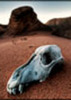
A moose and her calf walked within 10 yards of our campsite. They were in the shallow water at the edge of the lake, making a lot of noise as they sloshed by. They came past in the dark but we got a good view of them on the other side of the cove at dawn. Otter and Loons were out there too.
There is a lot of old growth here and we heard three trees fall over, one just across the lake where it sounded as if we should have seen it but the thick forest obscured it. The cracking, crunching sound was alarming. About a dozen trees had uprooted or cracked in half on or close to the trail. The root spread on one small tree was 10 to 12 feet across.
The trails were relentlessly up and down, at times becoming extremely steep, with rocks and roots as added obstacles.
It rained at times and we learned how to setup a quick tarp shelter to stay dry and cook under. Trekking poles and trees worked very well for this. It was a 5x8’ siltarp and it worked very well as did our sil-nylon ponchos. Most of the hiking time was dry and pleasantly cool.
Evening Falls Softly
You only get in here on foot or by canoe. This is wild, primitive country where the summer days are long and truly magical.
Wild and Loose up on the Canadian Shield
Moderator: HAZ - Moderators
Linked Guides none
Linked Area, etc none
-
 BoyNhisDogGuides: 0 | Official Routes: 0Triplogs Last: none | RS: 0Water Reports 1Y: 0 | Last: never
 - Joined: Feb 03 2002 2:09 pm
- City, State: Tucson, AZ
Wild and Loose up on the Canadian Shield
Last edited by BoyNhisDog on Aug 21 2002 11:09 am, edited 1 time in total.
Glen
contribute to this member driven resource
ie: RS > Save/Share after hikes 


contribute to this member driven resource
ie: RS > Save/Share after hikes
-
 MaryPhylGuides: 0 | Official Routes: 0Triplogs Last: 9,340 d | RS: 0Water Reports 1Y: 0 | Last: never
 - Joined: Apr 29 2002 7:58 am
- City, State: Flagstaff, AZ
contribute to this member driven resource
ie: RS > Save/Share after hikes
-
 GTG_AZHGuides: 1 | Official Routes: 0Triplogs Last: 8,474 d | RS: 0Water Reports 1Y: 0 | Last: never
 - Joined: Feb 03 2002 11:45 am
- City, State: Peoria, AZ - Originally from Rocket City USA
the best of
Glen, you always have the best pictures and the best commentary to accompany them. You are lucky to be able to encounter these places you share with us. You are lucky to be able to describe them as well as you do and we are lucky to have you share them with us.
Thanks for the mental trips,
GTG
Thanks for the mental trips,
GTG
'Alright now look over here and smile! and pretend like you're having a good time!'
contribute to this member driven resource
ie: RS > Save/Share after hikes