 Route Editor

Worst Case Senario
Moderator: HAZ - Moderators
Linked Guides none
Linked Area, etc none
-
 DarylGuides: 0 | Official Routes: 0Triplogs Last: 8,214 d | RS: 0Water Reports 1Y: 0 | Last: never
 - Joined: Mar 07 2002 11:18 am
- City, State: Lake Stevens, WA
Worst Case Senario
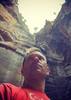
Anyone see worst case senario last night? They had two guys racing through a canyon in the supes. There were waterfalls and pretty swift moving water. I'm guessing it wasn't taped recently. Anyone know where that was? They called it Apache canyon on the show.
“Life is tough, but it’s tougher if you’re stupid”
John Wayne as Sergeant John M. Stryker, USMC in “The Sands of Iwo Jima”
John Wayne as Sergeant John M. Stryker, USMC in “The Sands of Iwo Jima”
contribute to this member driven resource
ie: RS > Save/Share after hikes 

-
 pixelfrogGuides: 0 | Official Routes: 0Triplogs Last: 2,201 d | RS: 0Water Reports 1Y: 0 | Last: never
 - Joined: Apr 11 2002 10:00 am
- City, State: Chandler, AZ
- Contact:
contribute to this member driven resource
ie: RS > Save/Share after hikes
-
 MikeGuides: 5 | Official Routes: 0Triplogs Last: 8,715 d | RS: 0Water Reports 1Y: 0 | Last: never
 - Joined: Feb 03 2002 11:45 am
- City, State: Scottsdale, AZ
contribute to this member driven resource
ie: RS > Save/Share after hikes
-
 joebartelsGuides: 264 | Official Routes: 224Triplogs Last: 5 d | RS: 2066Water Reports 1Y: 28 | Last: 18 d
 - Joined: Nov 20 1996 12:00 pm
That was a great episode!
Wish I would have known it was on last night
That was filmed up by Horrel Ranch in the winter. Reavis School is Upper Horrel for reference. The creek/canyon drops into Pinto Creek. When you go to Reavis Gap/Campaign you drive up a lower section of Pinto Creek. However this area is easier accessed from the south. To reach Upper Horrel check out one of eastern Superstion Hikes. It's like going to the Miles Trailhead(Kennedy Ranch), you pass Haunted Canyon but veer right to Horrel instead of left to Miles TH. It's 4x4 depending on how far you go. Apache Canyon shoots up NW of Horrel. Good to horrid 4x4 trails scatter the area. It's a fun area to explore like, Mill Site Canyon, White Canyon, Walnut Canyon, Devils Canyon and countless others from Globe to Queen Valley.
As for the show, it said "near" Apache Canyon
I believe it was filmed in Little Campaign Creek
2013 edit: http://en.wikipedia.org/wiki/Worst_Case_Scenarios_(TV_series)
- joe
contribute to this member driven resource
ie: RS > Save/Share after hikes