PCT & Spoiled by HikeArizona.com

Day Hiking & general trail related

Moderator: HAZ - Moderators

 Linked Guides none
 Linked Area, etc none
Post Reply
User avatar
Pellegrino
Triplogs Last: 8,345 d | RS: 0
Water Reports 1Y: 0 | Last: never
Joined: Feb 04 2002 3:58 am
City, State: Gilbert, AZ

PCT & Spoiled by HikeArizona.com

Post by Pellegrino »

Just a note ---

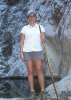
Purchased a book regarding the Pacific Coast Trail which is more like a journal of the folks who wrote it than an informational. So I went on-line to find out more about it. Start and stop points, etc. but didn't have much luck. So I thought I'd check out some hiking around the Mammoth, CA area which I'll probably be visiting this summer and while I came up with plenty of hiking websites nothing like this one where I can post and ask questions, etc. Most were just about the dangers of hiking in the Sierras, i.e. elevation, cold, etc. not very upbeat or encouraging. Which got me thinking about how much I enjoy and learn from this website.

So if anyone knows of a similar type website for Cali. let me know. AND, I know a few of you have done parts of the Pacific Coast Trail and I would love to hear of your adventures i.e. where you started/stopped, how long it took, how crowded or not it was, how it compares to AZ hiking, etc.

I lived in Bishop CA until I was 11 yrs old in the 70's. I remember many times my parents letting hippie hikers pitch their tent in our backyard to rest and re-coup before going on their way. One time while driving in Mammoth we rounded a bend in the road and two hikers and their dog were in the middle of the road. We came screeching to a stop and they were out of water and food. Well, of course, my Dad said 'get in' and while I had it safe in the front seat with my parents, my brothers had to sit in the back seat with those stinky hikers and their dog. Ha, its a funny memory.

Thanks, Kelly :)
Kelly :)

Climb every mountain, ford every stream
Follow every rainbow, till you find your dream
contribute to this member driven resource
ie: RS > Save/Share after hikes Route Scout GPS Topo Mapper on the App Store Route Scout GPS Topo Mapper on Google Play
User avatar
joebartels
Guides: 264 | Official Routes: 226
Triplogs Last: 5 d | RS: 1960
Water Reports 1Y: 14 | Last: 8 d
Joined: Nov 20 1996 12:00 pm

Pacific Coast Trail - PCT

Post by joebartels »

http://www.pcta.org has good info and FAQ's

I hiked a small section near Gardner Valley on the flip side of San Jacinto. It's such a nice area.
- joe
contribute to this member driven resource
ie: RS > Save/Share after hikes Route Scout GPS Topo Mapper on the App Store Route Scout GPS Topo Mapper on Google Play
User avatar
Lizard
Guides: 15 | Official Routes: 0
Triplogs Last: 5,271 d | RS: 0
Water Reports 1Y: 0 | Last: never
Joined: Feb 05 2002 6:40 pm
City, State: Phoenix, AZ

Post by Lizard »

I hiked a large part of the PCT, over 1000 miles continuously. It is an excellent experience. Parts of it in Southern Cali are very comparable to Arizona. However, the desert down there is much thicker with chapparal due to moisture laden winds coming off the ocean. It is seriously thick chapparal. Once you get north of Kennedy Meadows and into the High Sierra, the hiking is nothing like AZ (obviously).

Some good websites:
http://www.backcountry.net
This has e-mail lists devoted to the different Nat'l Scenic Trails. Pretty much any question you have can be answered here.

http://www.pcthiker.com
Journals and photos, and web forum.

http://www.hikermaps.com
Some kind soul has uploaded dozens and dozens of topo maps of the PCT for free.

The best guidebook is the one and only Pacific Crest Trail Volumes I and II, by Jeffry Schaffer and others. These are detailed books and include small topos that are all you really need to hike the trail. You can buy it from Amazon but actually I managed to find the books in Wide World of Maps, so you might check there.

If you have any more questions just ask. The PCT is my favorite topic :)

Chris
contribute to this member driven resource
ie: RS > Save/Share after hikes Route Scout GPS Topo Mapper on the App Store Route Scout GPS Topo Mapper on Google Play
User avatar
Pellegrino
Triplogs Last: 8,345 d | RS: 0
Water Reports 1Y: 0 | Last: never
Joined: Feb 04 2002 3:58 am
City, State: Gilbert, AZ

Post by Pellegrino »

[quote='Lizard']http://www.hikermaps.com
Some kind soul has uploaded dozens and dozens of topo maps of the PCT for free.

The best guidebook is the one and only Pacific Crest Trail Volumes I and II, by Jeffry Schaffer and others.

If you have any more questions just ask. The PCT is my favorite topic :)

Chris[/quote]


Thanks Chris.
I really appreciate people that combine their hobbie with computing to share their info with others. I'll check out those websites in detail soon.

Your trip sounds awesome. When did you do that??? I'm sure I'll come up with some questions when I delve into exactly where the trail goes and what type of day hikes (perhaps even a 2 or 3 day hike) are around Bishop.
Kelly :)

Climb every mountain, ford every stream
Follow every rainbow, till you find your dream
contribute to this member driven resource
ie: RS > Save/Share after hikes Route Scout GPS Topo Mapper on the App Store Route Scout GPS Topo Mapper on Google Play
User avatar
Lizard
Guides: 15 | Official Routes: 0
Triplogs Last: 5,271 d | RS: 0
Water Reports 1Y: 0 | Last: never
Joined: Feb 05 2002 6:40 pm
City, State: Phoenix, AZ

Post by Lizard »

I hiked on the PCT from late April to early July 2000. Starting from Warner Springs California and ending at Lake Tahoe. I have pictures online (look in the thread 'my outdoor pics') and am working on typing up my journal to put up a website.

As far as dayhiking on the PCT, it may be very difficult to do from Bishop. If memory serves me correctly, it was something like 18 miles from the PCT to a trailhead, and then a 20 mile hitchhike from there to get into Bishop. Most thruhikers skipped Bishop as a resupply because of this. The easiest access points for the PCT in the Sierra are Tuolumne Meadows in Yosemite; Red's Meadow Resort, Vermillion Valley Resort, and Muir Trail Ranch. The one that leads quickest into spectacular country is probably Red's Meadow Resort, which you can reach by bus from Mammoth Lakes, CA. Its also possible to go south from Bishop to Independence, CA and hike up the Kearsarge Pass trail. It is only eight miles from the TH to the PCT, although this includes a climb over a 11,500 ft. pass. For the most part the PCT in the Sierra is very remote and access is rather difficult if you are not doing a long backpacking trip. However, I've no doubt that there are plenty of scenic and worthwhile trails in the Bishop area, even if not connected to the PCT.

Lizard
contribute to this member driven resource
ie: RS > Save/Share after hikes Route Scout GPS Topo Mapper on the App Store Route Scout GPS Topo Mapper on Google Play
Post Reply

Return to “Trail Chat”