 Route Editor

Class of 2013; let’s start a discussion…
Trail Name:
Estimated Start Date:
Additional information:
Pops C.
01-15.March, (Depending on snow in the mountains)
Additional information:
To quote Ice-axe, “Train, lose body weight, lose pack weight.”
pops c
Class of 2013 North Bound
Moderators: HAZ - Moderators, AZT - Moderators
Linked Guides none
Linked Area, etc none
-
 pops cGuides: 0 | Official Routes: 0Triplogs Last: 4,402 d | RS: 0Water Reports 1Y: 0 | Last: 5,163 d
 - Joined: Jan 27 2012 10:26 am
- City, State: Tucson, AZ
- Contact:
contribute to this member driven resource
ie: RS > Save/Share after hikes 

-
 mark sGuides: 0 | Official Routes: 0Triplogs Last: none | RS: 0Water Reports 1Y: 0 | Last: never
 - Joined: Feb 22 2010 8:24 am
- City, State: southwest, VA
Re: Welcome to the Arizona Trail Forum!
@sirena
Hi Sirena,
Enjoy your postings on 'Sirena's wanderings for several years now. I am planning a backpack from Superior - Mammoth. I have done the GET to that point. Had a partner lined up for this year and he has had to drop out at the last moment. So trip has been pushed back to early April. I am still looking for someone and have run through all of the usual suspects in my email list. Time is short to pull this off. I have a sign up on the board at Summit Hut on Speedway but no response the first week. I am in Virginia so its tough to find someone with desert experience, or the urge to join my trip. If you know anyone in your contacts who might be interested if you could forward this I would appreciate it. I will be following the old AZT for part of the trip so I can enjoy the White Canyon Wilderness. Ive done lots of camping out there, 3 times in the Sups, 3 trips to the western part of Pinacate, 3 to Organ Pipe (back when they'd let you). Day hikes Dragoons, Chiricahuas (multiple trips to both), Saguaro e and w, Grand Canyon and more. So I have the experience, don't burn up the trail either. About 8 miles the first day or two, then pick it up a bit. I am happy taking 7 days on this 70 miles on the GET. Any suggestions appreciated.
Thanks,
Mark
contribute to this member driven resource
ie: RS > Save/Share after hikes
-
 sirenaGuides: 2 | Official Routes: 2Triplogs Last: 3,675 d | RS: 0Water Reports 1Y: 0 | Last: 3,755 d
 - Joined: Feb 12 2008 8:04 pm
- City, State: Tucson, AZ
- Contact:
Re: Welcome to the Arizona Trail Forum!
Hi Mark!
I would copy your request for a partner and post it as an event on HAZ viewforum.php?f=4 with dates. I bet you'll be able to find someone to who wants to hike the GET for a week. Also, have you posted about it on the GET Yahoo group?
I would copy your request for a partner and post it as an event on HAZ viewforum.php?f=4 with dates. I bet you'll be able to find someone to who wants to hike the GET for a week. Also, have you posted about it on the GET Yahoo group?
contribute to this member driven resource
ie: RS > Save/Share after hikes
-
mark sGuides: 0 | Official Routes: 0Triplogs Last: none | RS: 0Water Reports 1Y: 0 | Last: never
- Joined: Feb 22 2010 8:24 am
- City, State: southwest, VA
Re: Welcome to the Arizona Trail Forum!
Thanks, will try to post tomorrow on HAZ. I did post on GET group. There are some thru-hikers heading out but my schedule didn't overlap their dates. I am going to post again and see if we get a nibble. I guess if I was in the 15 mile/day club it would be easier.
Mark
Mark
contribute to this member driven resource
ie: RS > Save/Share after hikes
-
pops cGuides: 0 | Official Routes: 0Triplogs Last: 4,402 d | RS: 0Water Reports 1Y: 0 | Last: 5,163 d
- Joined: Jan 27 2012 10:26 am
- City, State: Tucson, AZ
- Contact:
No longer a Dreamer
Made "Patsygonia" ;) Looking for that 50 mile merit badge I never got as a kid
AZT a National and International treasure
5 Thru-hikers hit town yesterday all w/ a story to tell. Great town for a 0 day!
Not Thru yet but gettin there
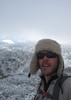
Pops c on the AZT
AZT a National and International treasure
5 Thru-hikers hit town yesterday all w/ a story to tell. Great town for a 0 day!
Not Thru yet but gettin there
Pops c on the AZT
- Attachments
-
contribute to this member driven resource
ie: RS > Save/Share after hikes
-
 blisterfreeGuides: 24 | Official Routes: 31Triplogs Last: none | RS: 0Water Reports 1Y: 0 | Last: never
 - Joined: Jan 29 2012 11:47 pm
- City, State: lithosphere
Re: Class of 2013 North Bound
Good job! How's the snow and water situation, in a few words, maybe?
contribute to this member driven resource
ie: RS > Save/Share after hikes
-
 SredfieldGuides: 4 | Official Routes: 4Triplogs Last: 103 d | RS: 0Water Reports 1Y: 0 | Last: 731 d
 - Joined: Sep 08 2002 1:07 pm
- City, State: Ahwatukee, AZ
Re: Class of 2013 North Bound
I was on the West Fork of Sabino Canyon today, water just about everywhere.
Shawn
The bear went over the mountain to see what he could see.
The bear went over the mountain to see what he could see.
contribute to this member driven resource
ie: RS > Save/Share after hikes
-
blisterfreeGuides: 24 | Official Routes: 31Triplogs Last: none | RS: 0Water Reports 1Y: 0 | Last: never
- Joined: Jan 29 2012 11:47 pm
- City, State: lithosphere
Re: Class of 2013 North Bound
I posted a new topic to share a missing hiker alert but it appears the topic, itself, has also gone missing. One wonders why. In any event, please see the AZ Trail room at trailforums dot com for more details on potentially-missing AZ Trail thru-hiker William.
contribute to this member driven resource
ie: RS > Save/Share after hikes
-
 joebartelsGuides: 264 | Official Routes: 224Triplogs Last: 3 d | RS: 2064Water Reports 1Y: 28 | Last: 12 d
 - Joined: Nov 20 1996 12:00 pm
Re: Class of 2013 North Bound
there was already a topic so it moved to viewtopic.php?f=66&t=7552&p=89793#p89793
- joe
contribute to this member driven resource
ie: RS > Save/Share after hikes
-
pops cGuides: 0 | Official Routes: 0Triplogs Last: 4,402 d | RS: 0Water Reports 1Y: 0 | Last: 5,163 d
- Joined: Jan 27 2012 10:26 am
- City, State: Tucson, AZ
- Contact:
Re: Class of 2013 North Bound
Just dropped off the trail for a couple of days @ La Posta Quemada Ranch MP 120, (RR, resupply, house chores, enjoy a Feast)blisterfree wrote:How's the snow and water situation, in a few words, maybe?
2-3” snow/ice in the Miller Pk area on 14.Mar, was a little dicey @ 0700 hrs with the narrow out-sloped “trail”. This may have melted by now.
Had GREAT water till Twin Tanks @ MP 101. Did not have to clean the filter once till Twin Tanks, (Turning Cow Sh*t soup into potable water required 3 cleanings of the filter per liter, used 3 drops bleach per L vs the usual 2)
Middle Cyn MP 32 had water, this was a biggie, (Used my Canelo Pass cache for a bath)
I would say most all the w1-2 sources were good (this may not last long!)
Cienega Cr MP 115 Lots of water @ Trail crossing.
Other important info: Needed to use Map around Cott Tank MP 41-42 to stay on Trail.
Patagonia: 3 egg omelette @ Gathering Ground, Tucson Barrio Brewery Ale on tap @ The Wagon Wheel.
Totally blown away by the QUALITY trail in the North Santa Rita’s on into La Posta Quemada Ranch (and Volunteer built for the most part I would think?) A great hike!
Pops c on the AZT
Turning my lips into leather and my soul into steel…
http://trackleaders.com/azt
contribute to this member driven resource
ie: RS > Save/Share after hikes
-
 azbackpackrGuides: 34 | Official Routes: 30Triplogs Last: 36 d | RS: 0Water Reports 1Y: 8 | Last: 45 d
 - Joined: Jan 21 2006 6:46 am
- City, State: Eagar AZ
Re: Class of 2013 North Bound
Glad you are on your way. We'll be awaiting your next installment and cheering you on!
There is a point of no return unremarked at the time in most lives. Graham Greene The Comedians
A clean house is a sign of a misspent life.
A clean house is a sign of a misspent life.
contribute to this member driven resource
ie: RS > Save/Share after hikes
-
SredfieldGuides: 4 | Official Routes: 4Triplogs Last: 103 d | RS: 0Water Reports 1Y: 0 | Last: 731 d
- Joined: Sep 08 2002 1:07 pm
- City, State: Ahwatukee, AZ
Re: Class of 2013 North Bound
Look for trail crews around Romero Pass, and then on 4 Peaks.
Shawn
The bear went over the mountain to see what he could see.
The bear went over the mountain to see what he could see.
contribute to this member driven resource
ie: RS > Save/Share after hikes
-
pops cGuides: 0 | Official Routes: 0Triplogs Last: 4,402 d | RS: 0Water Reports 1Y: 0 | Last: 5,163 d
- Joined: Jan 27 2012 10:26 am
- City, State: Tucson, AZ
- Contact:
Surpassing my expectations in everyway
Made unplanned return to Tucson from Oracle (American Flag Ranch Tr Hd ~ mile 200) as 10 yr old water filter gave up the ghost, and a mouse ate off trekking pole strap.
Various Trail info:
#1 Thanks to Fred and Those who report water source info!!! http://www.fredgaudetphotography.com/az ... urrent.pdf
Passage #8: Surprised at how few Saguaros there are until you reach Hope Camp, (Someone once told me, “Quilter Tr was the most beautiful passage of all the AZT outside of the Grand Canyon” (I may be a little prejudice; had better withhold judgment till I see all the AZT). I sure felt at Home in that FOREST of saguaros!
#9: Needed Map on Mica Mt; numerous fire “loop” Tr’s, AZT was not well signed (I plan to be talking /working w/ the Park to have this fixed for the Class of 2014.)
#10: Tr N. of Redington Rd – high on grass covered ridges, laying like a string on the contour. I had no idea how beautiful this section is. Must hike late July (w/ snake guards/high boots when it’s green).
#11: Caution! Large beehive in hollow tree next to popular campsite @ Sycamore Cr crossing (They had lots of honey flow w/ riparian forest in bloom, but may be aggressive after the mesquite bloom finishes especially in the fall. All wild bees should be considered Africanized.).
Dropping into the East Fork of Sabino at sunrise – brought tears to my eyes…a mini Grand Canyon.
Should have taken a dip in Hutches pool
Romero Pass is a climb not a hike; plan accordingly.
#12 Kiss a tree:
Summerhaven: what a good vibe, enjoyed pints of Fat Tire and a great lunch (The FRESHNESS of the house salad after eating trail food for 5 days!) at the Sawmill, (What a superb staff of employees to serve you). Met Thru-hiker S.O.L. @ the General Store. Thanks for sharing your maildrop; the food variety was a welcome treat!
Oracle Ridge: Have never seen cattle grazing on such steep slopes (it was freakish) I asked myself are there elk up here? No, this is cow dung. The trail was trashed from the cows’ use of and traversing of. What a brutal existence in an environment more suited to goats.
How much of this trail is rideable by MTB? Maybe the cattle are being used to prep the fuels for a Rx fire?
Anyone know how to keep small animals from eating off your trekking pole straps during the night? (I like them by my side when cowboying, in this case they were supporting the tent).
Oracle Inn: $2.50 pints of 4 Peaks Kilt Lifter, that will knock your socks off!
Seeing the sun coming up over the Rockies
hardened my resolve, “I’m going all the way”.
pops c on the AZT
Epic: a long series of events characterized by adventures or struggle
Various Trail info:
#1 Thanks to Fred and Those who report water source info!!! http://www.fredgaudetphotography.com/az ... urrent.pdf
Passage #8: Surprised at how few Saguaros there are until you reach Hope Camp, (Someone once told me, “Quilter Tr was the most beautiful passage of all the AZT outside of the Grand Canyon” (I may be a little prejudice; had better withhold judgment till I see all the AZT). I sure felt at Home in that FOREST of saguaros!
#9: Needed Map on Mica Mt; numerous fire “loop” Tr’s, AZT was not well signed (I plan to be talking /working w/ the Park to have this fixed for the Class of 2014.)
#10: Tr N. of Redington Rd – high on grass covered ridges, laying like a string on the contour. I had no idea how beautiful this section is. Must hike late July (w/ snake guards/high boots when it’s green).
#11: Caution! Large beehive in hollow tree next to popular campsite @ Sycamore Cr crossing (They had lots of honey flow w/ riparian forest in bloom, but may be aggressive after the mesquite bloom finishes especially in the fall. All wild bees should be considered Africanized.).
Dropping into the East Fork of Sabino at sunrise – brought tears to my eyes…a mini Grand Canyon.
Should have taken a dip in Hutches pool
Romero Pass is a climb not a hike; plan accordingly.
#12 Kiss a tree:
Oracle Ridge: Have never seen cattle grazing on such steep slopes (it was freakish) I asked myself are there elk up here? No, this is cow dung. The trail was trashed from the cows’ use of and traversing of. What a brutal existence in an environment more suited to goats.
How much of this trail is rideable by MTB? Maybe the cattle are being used to prep the fuels for a Rx fire?
Anyone know how to keep small animals from eating off your trekking pole straps during the night? (I like them by my side when cowboying, in this case they were supporting the tent).
Oracle Inn: $2.50 pints of 4 Peaks Kilt Lifter, that will knock your socks off!
Seeing the sun coming up over the Rockies
hardened my resolve, “I’m going all the way”.
pops c on the AZT
Epic: a long series of events characterized by adventures or struggle
contribute to this member driven resource
ie: RS > Save/Share after hikes
-
blisterfreeGuides: 24 | Official Routes: 31Triplogs Last: none | RS: 0Water Reports 1Y: 0 | Last: never
- Joined: Jan 29 2012 11:47 pm
- City, State: lithosphere
surpassing Pops' expectations
Thanks for the trail musings, Pops. Keep up the good work.
You might try nightly dipping your trekking poles upside-down in the creek or nearest facsimile thereof. Rodents, like hikers, like salt. That, and avoid the popular campsites, which becomes easier the more the night sky trends toward darkness and away from two, maybe three, distinct sources of light pollution. As with life in general, you want these on the distant horizon as much as possible.
That would be great if Saguaro National Park were amenable to the idea of AZT-specific signage. I imagine one of the obstacles is the relative permanence of the etched metal trail signs used throughout the park, and how ugly they'd look with stickers added to them. Maybe carsonite posts could be added though. The mapset tries to be of help here, but in actual fact it is difficult to convey so many trail junctions at such frequent intervals without dumbing down reality a bit.
Cows. Eat no beef or have no beef, as they say. They did the same thing in Chiricahuas immediately after the 2011 fires, which was similarly freakish to behold, but probably the closest thing to sound science for an agency relegated to the department of agriculture. The hooves turn the soil and disperse seeds, while the dung works wonders of its own. Unlike deer, cows will linger in a given area until the ground is visibly impacted. Pre-fire, they will tend to flatten dried grasses, reducing the rate of fire spread should a fire happen. As a bonus, if you like the idea of stealth camping where no human has camped in ages, all you need do is find a trailside juniper and kick away last year's dried patties. The more patties, the flatter the ground and the better the shade, too.
Keep on trekking!
contribute to this member driven resource
ie: RS > Save/Share after hikes
-
 AndrewAZGuides: 1 | Official Routes: 1Triplogs Last: 845 d | RS: 0Water Reports 1Y: 0 | Last: 2,720 d
 - Joined: Feb 27 2012 10:37 am
- City, State: Cochise County
Re: Class of 2013 North Bound
Matt Brown and I started on March 17 and finished on May 3. From reading registers and talking to people, it looks like Summitbagger and Crazylegs started 2 days before us and finished 2 weeks ahead of us, and SOL, Lint, and Dirtmonger finished the day after us (not sure when they started). Passed Hardcore outside Patagonia and Tessa passed us in Superior, and we hiked for a few days with Oliver from Prescott Valley. Stopped seeing Tessa's footprints between Flagstaff and the Grand Canyon, so not sure if she finished, and saw random references to a few other hikers but don't have any information.
Seems to have been (and continues to be) many hikers on the trail this year, although I can't imagine doing the Oracle-Superior stretch any later than we did it in late March/early April.
Seems to have been (and continues to be) many hikers on the trail this year, although I can't imagine doing the Oracle-Superior stretch any later than we did it in late March/early April.
contribute to this member driven resource
ie: RS > Save/Share after hikes
-
 tibberGuides: 21 | Official Routes: 51Triplogs Last: 9 d | RS: 547Water Reports 1Y: 0 | Last: 1,008 d
 - Joined: Feb 26 2004 1:27 pm
- City, State: Phoenix, AZ
Re: Class of 2013 North Bound
writelots (Wendy) and I talked with Lint (I think - he's the one with the PCT tats and such on his legs) on AZT 23 for a bit. I thot Wendy said he started Apr 5th which means he was cruising. I don't know how you all do it as those are some tough miles in places. Anyway, kudos and Congrats :worthy:AndrewAZ wrote:Matt Brown and I started on March 17 and finished on May 3. From reading registers and talking to people, it looks like Summitbagger and Crazylegs started 2 days before us and finished 2 weeks ahead of us, and SOL, Lint, and Dirtmonger finished the day after us (not sure when they started). Passed Hardcore outside Patagonia and Tessa passed us in Superior, and we hiked for a few days with Oliver from Prescott Valley. Stopped seeing Tessa's footprints between Flagstaff and the Grand Canyon, so not sure if she finished, and saw random references to a few other hikers but don't have any information.
Seems to have been (and continues to be) many hikers on the trail this year, although I can't imagine doing the Oracle-Superior stretch any later than we did it in late March/early April.
For me, sometimes it's just as much about the journey as the destination.
Oh, and once in awhile, don't forget to look back at the trail you've traveled.
Oh, and once in awhile, don't forget to look back at the trail you've traveled.
contribute to this member driven resource
ie: RS > Save/Share after hikes
-
SredfieldGuides: 4 | Official Routes: 4Triplogs Last: 103 d | RS: 0Water Reports 1Y: 0 | Last: 731 d
- Joined: Sep 08 2002 1:07 pm
- City, State: Ahwatukee, AZ
Re: Class of 2013 North Bound
Congratulations! 
Shawn
The bear went over the mountain to see what he could see.
The bear went over the mountain to see what he could see.
contribute to this member driven resource
ie: RS > Save/Share after hikes
-
 cactuscatGuides: 0 | Official Routes: 3Triplogs Last: 158 d | RS: 26Water Reports 1Y: 2 | Last: 329 d
 - Joined: Oct 15 2002 12:08 pm
- City, State: Rimrock, Arizona
Re: Class of 2013 North Bound
Met several NoBo's in the past couple of weeks at my store ... very cool talking with them.
contribute to this member driven resource
ie: RS > Save/Share after hikes
-
 jimbo4537Guides: 0 | Official Routes: 0Triplogs Last: none | RS: 0Water Reports 1Y: 0 | Last: never
 - Joined: Feb 03 2013 9:58 pm
- City, State: Indianapolis
Re: Class of 2013 North Bound
Loup and I finished on May 7th (started March 18th). Met SOL, Lint and Dirtmonger before the Grand Canyon. Had an amazing hike! Good luck to everyone else on the trail and watch out for the dead owl water.
contribute to this member driven resource
ie: RS > Save/Share after hikes
-
blisterfreeGuides: 24 | Official Routes: 31Triplogs Last: none | RS: 0Water Reports 1Y: 0 | Last: never
- Joined: Jan 29 2012 11:47 pm
- City, State: lithosphere
Re: Class of 2013 North Bound
Congratulations guys. Say, where is the dead owl water, anyway? Anyone have any links to journals or photos (from your thru-hike, not just of the dead owl)? Also, where's Pops?
contribute to this member driven resource
ie: RS > Save/Share after hikes
-
sirenaGuides: 2 | Official Routes: 2Triplogs Last: 3,675 d | RS: 0Water Reports 1Y: 0 | Last: 3,755 d
- Joined: Feb 12 2008 8:04 pm
- City, State: Tucson, AZ
- Contact:
Re: Class of 2013 North Bound
Congrats to you all!
Pops is still at it, looks like he's south of Mormon Lake- http://www.trackleaders.com/azt
And here is an article that came out in the Payson Roundup about Backpack Guy and other AZT hikers: http://www.paysonroundup.com/news/2013/ ... back-yard/
Pops is still at it, looks like he's south of Mormon Lake- http://www.trackleaders.com/azt
And here is an article that came out in the Payson Roundup about Backpack Guy and other AZT hikers: http://www.paysonroundup.com/news/2013/ ... back-yard/
contribute to this member driven resource
ie: RS > Save/Share after hikes