 Route Editor

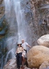
Hells Gate Trail, Temps at the bottom.
Moderators: Backpack Specialist, HAZ - Moderators
Linked Area, etc none
-
 Xiled1Guides: 0 | Official Routes: 0Triplogs Last: 2,162 d | RS: 0Water Reports 1Y: 0 | Last: 5,512 d
 - Joined: Feb 26 2009 10:59 am
- City, State: Mesa, AZ
Hells Gate Trail, Temps at the bottom.
Any idea on the overnight temps this time of year at the bottom of Hells Gate Trail? Looks to be around 5000 ft elevation, but its by water which can cool it down drastically. I've frozen my butt off at Reavis Ranch and a couple of other wet canyons before.
contribute to this member driven resource
ie: RS > Save/Share after hikes 

-
 joebartelsGuides: 264 | Official Routes: 224Triplogs Last: 3 d | RS: 2064Water Reports 1Y: 28 | Last: 13 d
 - Joined: Nov 20 1996 12:00 pm
Re: Hells Gate Trail, Temps at the bottom.
looks nippy at the 3,960ft crossing
http://hikearizona.com/forecast.php?e=T ... 14TWc9PQ==
you can get NWS forecast for any spot on MapDEX
- position the map to your desire, the red crosshair in the middle is your target spot
- right click over the map & click "Forecast"
http://hikearizona.com/forecast.php?e=T ... 14TWc9PQ==
you can get NWS forecast for any spot on MapDEX
- position the map to your desire, the red crosshair in the middle is your target spot
- right click over the map & click "Forecast"
- joe
contribute to this member driven resource
ie: RS > Save/Share after hikes
-
 DschurGuides: 13 | Official Routes: 0Triplogs Last: 3,428 d | RS: 0Water Reports 1Y: 0 | Last: never
 - Joined: Oct 25 2002 4:29 pm
- City, State: Payson, AZ
- Contact:
Re: Hells Gate Trail, Temps at the bottom.
Was 29 this morning in Payson at 5000 ft..
Dawn
--On the loose to climb a mountain, on the loose where I am free. On the loose to live my life the way I think my life should be...For we only have a moment and a whole world yet to see...I'll be looking for tomorrow on the loose. ---unknown--
--On the loose to climb a mountain, on the loose where I am free. On the loose to live my life the way I think my life should be...For we only have a moment and a whole world yet to see...I'll be looking for tomorrow on the loose. ---unknown--
contribute to this member driven resource
ie: RS > Save/Share after hikes
-
Xiled1Guides: 0 | Official Routes: 0Triplogs Last: 2,162 d | RS: 0Water Reports 1Y: 0 | Last: 5,512 d
- Joined: Feb 26 2009 10:59 am
- City, State: Mesa, AZ
Re: Hells Gate Trail, Temps at the bottom.
Thanks for the info on Mapdex. I'll use that in the future.
Looks like its chilly. Thanks for the update.
Looks like its chilly. Thanks for the update.
contribute to this member driven resource
ie: RS > Save/Share after hikes
-
Xiled1Guides: 0 | Official Routes: 0Triplogs Last: 2,162 d | RS: 0Water Reports 1Y: 0 | Last: 5,512 d
- Joined: Feb 26 2009 10:59 am
- City, State: Mesa, AZ
Re: Hells Gate Trail, Temps at the bottom.
It was cold, but not too bad. No frost or frozen condensation.
contribute to this member driven resource
ie: RS > Save/Share after hikes