 Route Editor

http://www.kutv.com/news/top-stories/st ... 6355.shtml- safety video revamp
- safety kiosk at trailhead
- translate the safety video and brochures into foreign languages
- revamp BLM website, greater emphasis on the dangers and difficulty
Safety Changes For 'The Wave'
Moderator: HAZ - Moderators
Linked Area, etc none
-
 joebartelsGuides: 264 | Official Routes: 224Triplogs Last: 3 d | RS: 2067Water Reports 1Y: 29 | Last: 2 d
 - Joined: Nov 20 1996 12:00 pm
Safety Changes For 'The Wave'
HAZ Wave news correspondent Kurt Sedler must be on a hike assignment so I'll fill in...
- joe
contribute to this member driven resource
ie: RS > Save/Share after hikes 

-
 big_loadGuides: 0 | Official Routes: 1Triplogs Last: 516 d | RS: 3Water Reports 1Y: 0 | Last: 2,718 d
 - Joined: Oct 28 2003 11:20 am
- City, State: Andover, NJ
Re: Safety Changes For 'The Wave'
@joe bartels
It's good that they're thinking about safety, but I don't know how effective this approach will be. Too bad they can't hand out common sense pills.
It's good that they're thinking about safety, but I don't know how effective this approach will be. Too bad they can't hand out common sense pills.
contribute to this member driven resource
ie: RS > Save/Share after hikes
-
 Alston_NealGuides: 1 | Official Routes: 0Triplogs Last: 164 d | RS: 0Water Reports 1Y: 0 | Last: never
 - Joined: Apr 19 2008 5:53 pm
- City, State: Phoenix, AZ
Re: Safety Changes For 'The Wave'
There's not a pill factory big enough to supply the human race.big_load wrote:Too bad they can't hand out common sense pills.
contribute to this member driven resource
ie: RS > Save/Share after hikes
-
 chumleyGuides: 94 | Official Routes: 239Triplogs Last: 12 d | RS: 73Water Reports 1Y: 92 | Last: 10 d
 - Joined: Sep 18 2002 8:59 am
- City, State: Tempe, AZ
Re: Safety Changes For 'The Wave'
I wonder if Ladd has a sister named Lass? 
I'm not sure what my spirit animal is, but I'm confident it has rabies.
contribute to this member driven resource
ie: RS > Save/Share after hikes
-
 PLC92084Guides: 2 | Official Routes: 3Triplogs Last: 4,368 d | RS: 0Water Reports 1Y: 0 | Last: 5,512 d
 - Joined: Dec 22 2009 8:46 am
- City, State: Vista, CA
Re: Safety Changes For 'The Wave'
Maybe they should hire the Google Street View crew to record the route... The "virtual" Wave would be much safer.
contribute to this member driven resource
ie: RS > Save/Share after hikes
-
 tibberGuides: 21 | Official Routes: 51Triplogs Last: 16 d | RS: 547Water Reports 1Y: 0 | Last: 1,015 d
 - Joined: Feb 26 2004 1:27 pm
- City, State: Phoenix, AZ
Re: Safety Changes For 'The Wave'
already done if you want to watch my videos:PLC92084 wrote:Maybe they should hire the Google Street View crew to record the route... The "virtual" Wave would be much safer.
To THE Wave - https://www.youtube.com/watch?v=EHHUpmSao4U
THE Wave, Dinosaur tracks and pursuit of Wave2 - https://www.youtube.com/watch?v=kY_PkCOn5O8
Final pursuit of Wave2, back thru the wash, the main trail, Stateside TH walk and the bad moon rising, well for us the good moon rising - https://www.youtube.com/watch?v=kY_PkCOn5O8
For me, sometimes it's just as much about the journey as the destination.
Oh, and once in awhile, don't forget to look back at the trail you've traveled.
Oh, and once in awhile, don't forget to look back at the trail you've traveled.
contribute to this member driven resource
ie: RS > Save/Share after hikes
-
 toddakGuides: 13 | Official Routes: 7Triplogs Last: 5 d | RS: 0Water Reports 1Y: 0 | Last: 1,726 d
 - Joined: Nov 15 2005 8:46 pm
- City, State: Jackson, CA
Re: Safety Changes For 'The Wave'
No matter how strongly they warn people about the dangers, anyone winning a permit is probably going to disregard the warnings and go anyway. The Wave has become such a mystical, iconic and over-hyped place that its appeal is almost irresistible, particularly to people with limited wilderness experience, and the difficulty of obtaining a permit only increases the likelihood that the winners will ignore the conditions and go. Unfortunate, but that's the reality.
So IMHO the BLM should just accept it and 1) scrap the permit system and the limits on numbers of visitors, 2) build a quality restroom at the trail head to help minimize waste along the hike, 3) allow/encourage cairn-building along the route to help prevent people getting lost, 4) close the trail on days of extreme heat, with a ranger at the trail head for enforcement. Yes this would likely increase overall visitation, but hopefully prevent more deaths. Certainly there's no perfect solution, but the current system doesn't seem to be working all that well.
So IMHO the BLM should just accept it and 1) scrap the permit system and the limits on numbers of visitors, 2) build a quality restroom at the trail head to help minimize waste along the hike, 3) allow/encourage cairn-building along the route to help prevent people getting lost, 4) close the trail on days of extreme heat, with a ranger at the trail head for enforcement. Yes this would likely increase overall visitation, but hopefully prevent more deaths. Certainly there's no perfect solution, but the current system doesn't seem to be working all that well.
contribute to this member driven resource
ie: RS > Save/Share after hikes
-
 azbackpackrGuides: 34 | Official Routes: 30Triplogs Last: 43 d | RS: 0Water Reports 1Y: 8 | Last: 52 d
 - Joined: Jan 21 2006 6:46 am
- City, State: Eagar AZ
Re: Safety Changes For 'The Wave'
Nothing yet has created in me a desire to go there. Is there a t-shirt? ;)
There is a point of no return unremarked at the time in most lives. Graham Greene The Comedians
A clean house is a sign of a misspent life.
A clean house is a sign of a misspent life.
contribute to this member driven resource
ie: RS > Save/Share after hikes
-
 beterarcherGuides: 0 | Official Routes: 0Triplogs Last: 4,394 d | RS: 0Water Reports 1Y: 0 | Last: 4,186 d
 - Joined: Jul 23 2012 7:17 pm
- City, State: phoenix, az
Re: Safety Changes For 'The Wave'
@azbackpackr
" I thought of going to the Wave, but all I decided to do is get this crappy t-shirt"
You can get one at Zazzle
" I thought of going to the Wave, but all I decided to do is get this crappy t-shirt"
You can get one at Zazzle
Understand, when you eat meat, that something did die. You have an obligation to value it - not just the sirloin but also all those wonderful tough little bits.
Anthony Bourdain
Anthony Bourdain
contribute to this member driven resource
ie: RS > Save/Share after hikes
-
azbackpackrGuides: 34 | Official Routes: 30Triplogs Last: 43 d | RS: 0Water Reports 1Y: 8 | Last: 52 d
- Joined: Jan 21 2006 6:46 am
- City, State: Eagar AZ
Re: Safety Changes For 'The Wave'
What does it say? Wave goodbye to solitude?
There is a point of no return unremarked at the time in most lives. Graham Greene The Comedians
A clean house is a sign of a misspent life.
A clean house is a sign of a misspent life.
contribute to this member driven resource
ie: RS > Save/Share after hikes
-
 RedRoxx44Guides: 5 | Official Routes: 0Triplogs Last: 4 d | RS: 0Water Reports 1Y: 0 | Last: 6,527 d
 - Joined: Feb 15 2003 8:07 am
- City, State: outside, anywhere
Re: Safety Changes For 'The Wave'
My first trip to the Wave was over 20 years ago. Saw nobody the whole day. There was no trail then for sure and you just aimed for "Top Rock" which you can see from a lot of areas around there.
There was no permit system either. I have been there 4 times and yep, no permit. But then it's not that hard to get there from many directions, just depends on how much fun you want to have. The surrounding area is incredible as well. I think it's worth the permit hassle; not in the summer though when it's an oven with all the reflective rock. The second time I went there was a cairned route, the third time I was offtrailing it from the south and the fourth time I climbed out mid Wire Pass, stayed low, actually went past then cut back because I wanted to get to an area of Teepee rocks in the distance. One of my trips did I see other hikers, a young couple from Germany.
IMO White Pockets offers just as amazing an experience, and from what I know, no permit is needed, just a good 4wd for all that sand.
contribute to this member driven resource
ie: RS > Save/Share after hikes
-
 SAMBAGuides: 0 | Official Routes: 2Triplogs Last: 2,580 d | RS: 0Water Reports 1Y: 0 | Last: never
 - Joined: Oct 02 2009 12:59 pm
- City, State: Tucson, AZ
Re: Safety Changes For 'The Wave'
@azbackpackr
I went Waving in early Spring, and save for one other small party of hikers/tourists, my two fellow adventurers and I had the place to ourselves. The adventure came from trying to find our ways to and from The Wave on an un-cairned trail (?) across a wide expanse of slickrock.
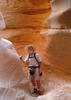
Per usual, you are spot on. As this picture shows, http://photos1.meetupstatic.com/photos/ ... 57548.jpeg , my illegal, so-called adventure to The Wave was a total waste of time. NOT!azbackpackr wrote:Nothing yet has created in me a desire to go there
I went Waving in early Spring, and save for one other small party of hikers/tourists, my two fellow adventurers and I had the place to ourselves. The adventure came from trying to find our ways to and from The Wave on an un-cairned trail (?) across a wide expanse of slickrock.
contribute to this member driven resource
ie: RS > Save/Share after hikes
-
 FOTGGuides: 37 | Official Routes: 103Triplogs Last: 12 d | RS: 204Water Reports 1Y: 70 | Last: 3 d
 - Joined: Jan 21 2013 10:47 am
- City, State: AZ
- Contact:
Re: Safety Changes For 'The Wave'
@toddak
4) close the trail on days of extreme heat, with a ranger at the trail head for enforcement
Great ideas if you are running a theme park, but what happens when you plan all year to go, and you get there...and a ranger tells you that it is unsafe to hike because it is 101 degrees...and the park service deems that unsafe?? I cant remember ever cancelling a hike, because I thought it was going to be too hot..carry more water, be in shape, hike early, proper gear, keep one's wits, etc...extreme heat alone will not kill if proper preparations are made..better to carry too much water a hundred times, than not enough water once.. all deaths were tragic and they hit home for any hiker, but I think in each instance, they were ultimately the results of human errors in judgement and poor preparation...
contribute to this member driven resource
ie: RS > Save/Share after hikes
-
toddakGuides: 13 | Official Routes: 7Triplogs Last: 5 d | RS: 0Water Reports 1Y: 0 | Last: 1,726 d
- Joined: Nov 15 2005 8:46 pm
- City, State: Jackson, CA
Re: Safety Changes For 'The Wave'
@friendofThundergod
And one more thing - as RedRoxx44 says above, any experienced hiker with a good sense of direction and a low profile can visit this area by any number of alternate routes. Not that I'm suggesting anyone circumvent any BLM rules of course.
That's exactly my point, that unprepared and unqualified people are hiking in dangerous conditions, and that the current permit system makes it almost inevitable that this will continue to happen.they (deaths) were ultimately the results of human errors in judgement and poor preparation...
That would be a bummer, no doubt, but the intent of a closure would be to keep the noobs from killing themselves. But if the current permit system were scrapped (my #1 suggestion), that would make planning for and visiting The Wave much easier for everyone anyway. Instead of being locked into a single day months in advance by the permit lottery, you could go whenever you wanted to, and you would know ahead of time by looking at the weather forecast which particular days are going to have a good chance of a closure (and which would be miserable for hiking anyway).what happens when you plan all year to go, and you get there...and a ranger tells you that it is unsafe to hike because it is 101 degrees...and the park service deems that unsafe??
And one more thing - as RedRoxx44 says above, any experienced hiker with a good sense of direction and a low profile can visit this area by any number of alternate routes. Not that I'm suggesting anyone circumvent any BLM rules of course.
contribute to this member driven resource
ie: RS > Save/Share after hikes
-
 nonotGuides: 107 | Official Routes: 108Triplogs Last: 117 d | RS: 0Water Reports 1Y: 9 | Last: 116 d
 - Joined: Nov 18 2005 11:52 pm
- City, State: Phoenix, AZ
Re: Safety Changes For 'The Wave'
What makes someone unqualified? I can certainly agree that unprepared people are a danger, which the park seeks to address by publishing more information to inform people. But I don't think anyone would be unqualified.
Unpreparedness probably is a result of inexperience combined with lack of information.
Whether the people listen to the warnings (don't go hiking in extreme heat with minimal water) is up to every individual. The people that risk this and pay the ultimate price are the ones that didn't listen to the warnings, that are the reasons for the warnings. I imagine there are people that hike this in summer that don't die.
It isn't the government's job to prevent people from harming themselves. However, with the current mindset of most Americans, sadly this will become the standard for our children.
You are not allowed to drive because of the possibility you will get killed.
You are not allowed to forego healthcare because of the possibility you will get sick and die without being able to pay for treatment.
etc.
I agree that by limiting visitation with permits, its makes people more likely to ignore the warning and hike this in the summer. I agree that allowing more visitors during the winter would make this less likely. However more visitors will decrease the pristine nature of the site. There is no good solution. Todd's suggestion is the most likely since this is the approach taken by most natural parks, in which swarms of humans look at a very heavily visited place. Perhaps if they constructed a wooden/metal walkway over the fragile sandstone.
http://hikearizona.com/garmin_maps.php
Hike Arizona it is full of sharp, pointy, ankle-twisting, HAZmaster crushing ROCKS!!
Hike Arizona it is full of sharp, pointy, shin-stabbing, skin-shredding plants!
Hike Arizona it is full of striking, biting, stabbing, venomous wildlife!
Hike Arizona it is full of sharp, pointy, ankle-twisting, HAZmaster crushing ROCKS!!
Hike Arizona it is full of sharp, pointy, shin-stabbing, skin-shredding plants!
Hike Arizona it is full of striking, biting, stabbing, venomous wildlife!
contribute to this member driven resource
ie: RS > Save/Share after hikes
-
 DschurGuides: 13 | Official Routes: 0Triplogs Last: 3,435 d | RS: 0Water Reports 1Y: 0 | Last: never
 - Joined: Oct 25 2002 4:29 pm
- City, State: Payson, AZ
- Contact:
Re: Safety Changes For 'The Wave'
They don't close the Grand Canyon trails when it is 110+ in the bottom of the canyon....and no permits for hiking in the day..
Dawn
--On the loose to climb a mountain, on the loose where I am free. On the loose to live my life the way I think my life should be...For we only have a moment and a whole world yet to see...I'll be looking for tomorrow on the loose. ---unknown--
--On the loose to climb a mountain, on the loose where I am free. On the loose to live my life the way I think my life should be...For we only have a moment and a whole world yet to see...I'll be looking for tomorrow on the loose. ---unknown--
contribute to this member driven resource
ie: RS > Save/Share after hikes
-
big_loadGuides: 0 | Official Routes: 1Triplogs Last: 516 d | RS: 3Water Reports 1Y: 0 | Last: 2,718 d
- Joined: Oct 28 2003 11:20 am
- City, State: Andover, NJ
Re: Safety Changes For 'The Wave'
At least the GC corridor trails have enough traffic and the terrain funnels them well enough that someone in trouble will usually get noticed before it's too late (though not always). I don't know enough about the number of permits or local topography near the Wave to form an opinion. There was obviously a cluster of incidents at the Wave this year, but how do the long-term per-hiker incident rates compare?Dschur wrote:They don't close the Grand Canyon trails when it is 110+ in the bottom of the canyon....and no permits for hiking in the day..
contribute to this member driven resource
ie: RS > Save/Share after hikes
-
 JimGuides: 76 | Official Routes: 39Triplogs Last: 6 d | RS: 94Water Reports 1Y: 7 | Last: 5 d
 - Joined: Sep 08 2006 8:14 pm
Re: Safety Changes For 'The Wave'
Well, a few who didn't have sense or ability suffered the most extreme punishment for their actions, so we all now must pay, and be protected from ourselves? Instead of simply forcing people to sign waivers explaining they are on their own, or that death may occur, or going to an extreme of placing them into a sauna for 30 minutes (or until medical care is necessary and having them pay for the process by increased fees) with conditions of temperature and humidity that would mimic the conditions at the heat of the day, we should simply exert ultimate control by closing things down. After all, we live in a world of lowest common denominators, where people are expected to be incapable, and simultaneously unable to accept responsibility for their actions or poor decisions.
contribute to this member driven resource
ie: RS > Save/Share after hikes
-
nonotGuides: 107 | Official Routes: 108Triplogs Last: 117 d | RS: 0Water Reports 1Y: 9 | Last: 116 d
- Joined: Nov 18 2005 11:52 pm
- City, State: Phoenix, AZ
Re: Safety Changes For 'The Wave'
There is a motion to enact day hiking permits in the corridor. Last I heard, it was likely to pass. Something about too many rude trail runners.Dschur wrote:They don't close the Grand Canyon trails when it is 110+ in the bottom of the canyon....and no permits for hiking in the day..
http://hikearizona.com/garmin_maps.php
Hike Arizona it is full of sharp, pointy, ankle-twisting, HAZmaster crushing ROCKS!!
Hike Arizona it is full of sharp, pointy, shin-stabbing, skin-shredding plants!
Hike Arizona it is full of striking, biting, stabbing, venomous wildlife!
Hike Arizona it is full of sharp, pointy, ankle-twisting, HAZmaster crushing ROCKS!!
Hike Arizona it is full of sharp, pointy, shin-stabbing, skin-shredding plants!
Hike Arizona it is full of striking, biting, stabbing, venomous wildlife!
contribute to this member driven resource
ie: RS > Save/Share after hikes
-
 SredfieldGuides: 4 | Official Routes: 4Triplogs Last: 3 d | RS: 0Water Reports 1Y: 0 | Last: 738 d
 - Joined: Sep 08 2002 1:07 pm
- City, State: Ahwatukee, AZ
Re: Safety Changes For 'The Wave'
I have heard the numbers in the canyon are off the charts. Typical is an employee association for a large corporation will charter a bus, sending 50-100 runners and wannabee runners there for a weekend. You can imagine what 50 at a time will do for the "experience" for anyone encountering that hoard. And the emergency responses required will tax the system. I'm sure no one wants a permit system, but what else is there other than limiting the numbers to a level the land and those charged with managing it can handle?
Shawn
The bear went over the mountain to see what he could see.
The bear went over the mountain to see what he could see.
contribute to this member driven resource
ie: RS > Save/Share after hikes