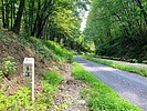
| Railroad Right-of-Way |
| Railroad Right-of-Way | 126 locations | Pioneer |
|
|||||||||||||||
Description: The railroad opened the west, expanding eastern cultural influences and connecting San Francisco to the midwest and eastern industrial centers. The western cattle, crop, and mineral wealth are able to be explored and exploited. The earliest documented railroad in Arizona was the 1880 Atlantic and Pacific Railroad, which ran as a subsidiary of the Atchison, Topeka, and Santa Fe Railroad between Albuquerque, NM and Needles, CA along the modern BNSF mainline that runs through Kingman, Flagstaff, Winslow, Holbrook, and east into New Mexico. New rail lines are still being constructed in Arizona, including the Phoenix Metro Light Rail and the expansion of the Union Pacific (formerly Southern Pacific) tracks between Phoenix and Tucson. This label should be used not only for current rail line and track, but also for any abandoned railroad right-of-ways. Many of these have been reclaimed into roads, hiking, and biking trails across not only Arizona but the entire country. Images of train cars or locomotives should be associated under the appropriate label. This is for tracks and right-of-way only. |
|||||||||||||||
| .: kingsnake :. | |
 |
|
Johnson Canyon Railway Tunnel Trail | |
| .: kingsnake :. | |
 |
|
Johnson Canyon Railway Tunnel Trail | |
| .: kingsnake :. | |
 |
|
Johnson Canyon Railway Tunnel Trail | |
| .: kingsnake :. | |
 |
|
Johnson Canyon Railway Tunnel Trail | |
| .: kingsnake :. | |
 |
|
GAP Trail MP 0.0-15.5 | |
| .: kingsnake :. | |
 |
|
GAP Trail MP 0.0-15.5 | |
| .: kingsnake :. | |
 |
|
GAP Trail MP 0.0-15.5 | |
| .: kingsnake :. | |
 |
|
GAP Trail MP 0.0-15.5 | |
| .: kingsnake :. | |
 |
|
GAP Trail MP 0.0-15.5 | |
| .: kingsnake :. | |
 |
|
GAP Trail MP 0.0-15.5 | |
| .: Jim :. | |
 |
|
Tuckerton Road | |
| .: kingsnake :. | |
 |
|
CO Canal MP 150.0-156.0 | |
| .: kingsnake :. | |
 |
|
Maricopa Trail - East Valley | |
| .: kingsnake :. | |
 |
|
C&O Canal Path | |
| .: kingsnake :. | |
 |
|
C&O Canal Path | |
| .: kingsnake :. | |
 |
|
C&O Canal Path | |
| .: kingsnake :. | |
 |
|
C&O Canal Path | |
| .: DixieFlyer :. | |
 |
|
Devin - Railroad - Fred Haught | |
| page 1, 2, 3, 4, 5 ... 14 |
|
|
|
|

| Information on this page has been gathered from member submissions. Effort has been made to avoid any infringement of copyright. Additionally, any use is anticipated to be within the "fair use" doctrine. If any copyright has been infringed, please notify the webmaster. The disputed information will be removed and your issue will be resolved. If you are a submitting member, please inform and discuss with HAZ if you think you are submitting any copyright issue. Please help us stay with the law. |