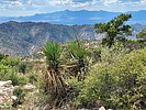
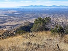
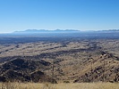
| Ramsey Peak |
| Ramsey Peak, Arizona - Cochise County | Summit |
|
|||||||||||||||||||||||||||||
|
|||||||||||||||||||||||||||||
| .: DixieFlyer :. | |
 |
|
Juniper Flats Mountain | |
| .: rwstorm :. | |
 |
|
Reef Townsite - Interpretive Loop & Campground | |
| .: DixieFlyer :. | |
 |
|
Sala Benchmark - Dragoon Mountains | |
| .: DixieFlyer :. | |
 |
|
Little Dragoons Meander | |
| .: writelots :. | |
 |
|
Bear Canyon Trail #125 | |
| .: rwstorm :. | |
 |
|
Ramsey Vista CG | |
| .: rwstorm :. | |
 |
|
Ramsey Canyon Autumn | |
| .: Merianne :. | |
 |
|
Carr Peak - Comfort Springs Loop | |
| .: joebartels :. | |
 |
|
Carr - Miller - Pat Scott Loop | |
| .: chumley :. | |
 |
|
Reef Townsite - Interpretive Loop & Campground | |
| .: chumley :. | |
 |
|
Carr Miller Comfort | |
| .: chumley :. | |
 |
|
Ramsey Peak | |
| .: chumley :. | |
 |
|
Ramsey Peak | |
| .: chumley :. | |
 |
|
Ramsey Peak | |
| .: chumley :. | |
 |
|
Carr Crest Pat Comfort Loop | |
| .: chumley :. | |
 |
|
Carr Crest Pat Comfort Loop | |
| .: rwstorm :. | |
 |
|
Carr Camping | |
| .: rwstorm :. | |
 |
|
Carr Peak | |
| page 1, 2, 3 |
|
|
|
|

| Information on this page has been gathered from member submissions. Effort has been made to avoid any infringement of copyright. Additionally, any use is anticipated to be within the "fair use" doctrine. If any copyright has been infringed, please notify the webmaster. The disputed information will be removed and your issue will be resolved. If you are a submitting member, please inform and discuss with HAZ if you think you are submitting any copyright issue. Please help us stay with the law. |