

|
Another interesting and beautiful piece of geology. Hard to fathom this was all part of the northern arm of the Pedregosa Sea https://benefactorsrrsp.org/sedona-geology.html and then a Lake. And did you know Interstate 17 takes advantage of the ramp built upon valley-descending lava flows? and that Oak Creek Canyon's half-mile deep gorge is less than six million years old?
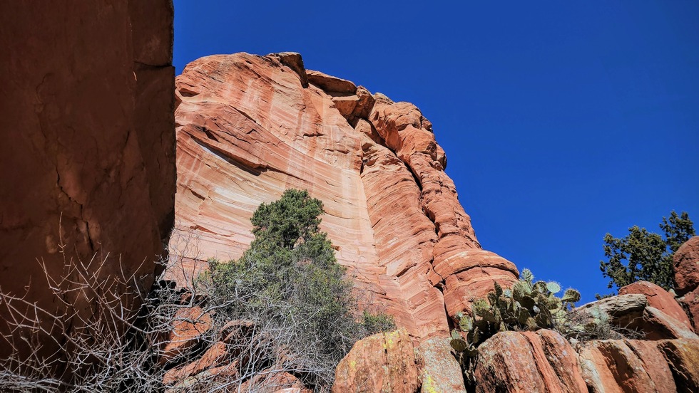
When all of Earth’s continents were beginning to assemble into a supercontinent called Pangaea around 280 million years ago, western North America and the future Sedona area lay on the arid, western edge of this giant landmass (modern coordinates used throughout). Rivers from the eroding Appalachian Mountains brought sandy sediment down to broad floodplains that were present in modern day Montana and Wyoming. Here the river water was evaporated or seeped into the sandy ground and it was from these dry riverbeds that northern winds carried sand grains to the south toward northern Arizona. Low-slung coastal dunes developed here and stretched for miles in all directions. It was in this setting that many of Sedona’s red rocks were deposited, and today are called the Schnebly Hill Formation. In the last 40 years, more details regarding this setting have been uncovered.
When all of Earth’s continents were beginning to assemble into a supercontinent called Pangaea around 280 million years ago, western North America and the future Sedona area lay on the arid, western edge of this giant landmass (modern coordinates used throughout). Rivers from the eroding Appalachian Mountains brought sandy sediment down to broad floodplains that were present in modern day Montana and Wyoming. Here the river water was evaporated or seeped into the sandy ground and it was from these dry riverbeds that northern winds carried sand grains to the south toward northern Arizona. Low-slung coastal dunes developed here and stretched for miles in all directions. It was in this setting that many of Sedona’s red rocks were deposited, and today are called the Schnebly Hill Formation. In the last 40 years, more details regarding this setting have been uncovered.