username
X
password
register
for free!
help
ArticlesGuidesRoutes
 
Photosets
 
 Comments
triplogs   photosets   labels comments more
Arches National Park Trails - 5 members in 10 triplogs have rated this an average 4.4 ( 1 to 5 best )
10 triplogs
login for filter options
Apr 07 2017
avatar

 Guides 171
 Routes 253
 Photos 6,100
 Triplogs 1,135

44 male
 Joined Apr 03 2006
 Pocatello, ID
Arches National Park TrailsSoutheast, UT
Southeast, UT
Hiking avatar Apr 07 2017
PaleoRobTriplogs 1,135
Hiking2.00 Miles 300 AEG
Hiking2.00 Miles   6 Hrs      2.00 mph
300 ft AEG   5 Hrs    Break
 no routes
Linked   none no linked trail guides
Partners none no partners
Took a tour from MWC out to Arches to showcase the geology of the park. Long day with folks in and out of the vans, but hiking and talking about geology is never a bad day. Main hikes were the Windows loop and Balanced Rock. Mileage is approximate.
wildflower observationwildflower observationwildflower observationwildflower observationwildflower observation
Wildflowers Observation Isolated
_____________________
"The only thing we did was wrong was staying in the wilderness to long...the only thing we did was right was the day we started to fight..."
-Old Spiritual
My book, The Marauders on Lulu and Amazon
 
Mar 03 2017
avatar

 Guides 6
 Routes 183
 Photos 5,612
 Triplogs 1,647

male
 Joined Mar 12 2004
 Scottsdale, AZ
Arches National Park TrailsSoutheast, UT
Southeast, UT
Hiking avatar Mar 03 2017
John9LTriplogs 1,647
Hiking2.50 Miles 300 AEG
Hiking2.50 Miles
300 ft AEG
 no routesno photosets
1st trip
Partners partners
clairebear
We started wtih Delicate Arch & the Devil's Garden Primitive Loop & then drove around hitting a variety of other areas. The stops were fairly quick and we did some short hiking. It was a good way to end our day in Arches. Our plan is the Islands District in Canyonlands the next day.
_____________________
  2 archives
Apr 24 2016
avatar

 Guides 171
 Routes 253
 Photos 6,100
 Triplogs 1,135

44 male
 Joined Apr 03 2006
 Pocatello, ID
Arches National Park TrailsSoutheast, UT
Southeast, UT
Hiking avatar Apr 24 2016
PaleoRobTriplogs 1,135
Hiking1.50 Miles 125 AEG
Hiking1.50 Miles
125 ft AEG
 no routes
Linked   none no linked trail guides
Partners none no partners
Spent the day, after driving up from Bluff, poking around Arches with Jen. She had never been before so we had to make it so. Misjudged the timing as well, since it had been a few years for me too, and ended up not seeing the northern end of the park before we had to book it back to GJ for the Game of Thrones premier. Overall a good time and I enjoyed visiting some old friends and showing them to her!
wildflower observationwildflower observationwildflower observationwildflower observationwildflower observation
Wildflowers Observation Moderate
Globemallows everywhere north of Moab! Several different things blooming in the park right now, including claret cup, globemallow, wood betoney, penstemon, Indian paintbrush, and single-leaf ash.
_____________________
"The only thing we did was wrong was staying in the wilderness to long...the only thing we did was right was the day we started to fight..."
-Old Spiritual
My book, The Marauders on Lulu and Amazon
 
Apr 20 2016
avatar

 Guides 10
 Routes 673
 Photos 7,281
 Triplogs 4,660

67 female
 Joined Nov 17 2008
 phoenix, az
Arches National Park TrailsSoutheast, UT
Southeast, UT
Hiking avatar Apr 20 2016
trekkin_geckoTriplogs 4,660
Hiking12.25 Miles 2,300 AEG
Hiking12.25 Miles
2,300 ft AEG
 
1st trip
have wanted to visit arches national park for years, since sue and i made a road trip to the north rim, zion and bryce back in 2009
couldn't figure out how to fit all five parks in one trip back then
picked arches and canyonlands for this one
a little crowded but the beauty outweighs that, especially for a one day visit
we benefited by the free entry week celebrating 100 years of national parks
hiked several trails and saw a lot of arches ;)
started with devil's garden, taking in every possible side trip out to dark angel
chose not to return on the primitive loop, as we had more to hike and sue is still recovering from a fall at work that broke her radius in two places and required surgery to install some hardware
made scrambling a little difficult for her
hiking on and over the rock fins was fun, and we were able to get in or under almost every arch
most people stop after landscape arch, so it really wasn't crowded
stopped near sand dune arch for a picnic and walked through the sand to see it
also saw broken arch and skyline arch nearby
drove over to delicate arch and joined the conga line heading up the trail
fun hike, but saw several people who maybe shouldn't have been up there mid-afternoon
we ended up giving out water away to some who needed it more - i don't normally do that, but maybe a once-in-a-lifetime experience to the unprepared?
delicate arch was pretty cool to see, and i even got a photo without anyone else in it
a bus load of schoolkids viewing the arch, but well behaved and one took a photo for us
stopped by the glyphs and cabin on the way down
drove over to the windows section next, and hiked up to the four main arches there
stopped by courthouse butte overlook on the way out of the park for some fantastic views
felt we got a good representation of hikes for one day, and still a few things to see if i ever make it back
had dinner at miguel's, then did some shopping at gearhead's
another visit to moab coffee roasters, staying in moab again
 Named place
 Named place [ checklist ]
[ checklist ]  Delicate Arch
_____________________
hazhole
  1 archive
Apr 02 2015
avatar

 Routes 144
 Photos 1,145
 Triplogs 1,238

77 male
 Joined Sep 09 2004
 Scottsdale, AZ
Arches National Park TrailsSoutheast, UT
Southeast, UT
Hiking avatar Apr 02 2015
Sun_RayTriplogs 1,238
Hiking4.70 Miles 840 AEG
Hiking4.70 Miles
840 ft AEG
 no routes
1st trip
Linked   none no linked trail guides
Partners none no partners
Took the scenic drive stopping at points along the way. My sister and husband were with us.
Landscape Arch-1 mile
Delicate Arch viewpoint-.5 Had been to this arch on a prior trip so just walked to the view point on the backside.
Windows Arches-1.6 miles
Park Ave-1.6 miles
_____________________
Brian
Monday, Tuesday, Wednesday, Thursday, Friday, Saturday......there is no SOMEDAY!
  1 archive
Jul 05 2014
avatar

 Routes 26
 Photos 1,288
 Triplogs 124

66 male
 Joined Oct 28 2003
 Andover, NJ
Arches National Park TrailsSoutheast, UT
Southeast, UT
Hiking avatar Jul 05 2014
big_loadTriplogs 124
Hiking6.00 Miles 200 AEG
Hiking6.00 Miles   4 Hrs      1.50 mph
200 ft AEG
 no routes
1st trip
Linked   none no linked trail guides
Partners none no partners
After the family reunion in Flagstaff, Mrs. big_load looked forward to some adventures on our own, and I wanted to show her some new places. After the last stragglers left (hey, that was us), we drove up through the rez, past Tsegi Canyon (I so badly wanted to park the car and hike in), and on through Monument Valley with short stops there and at Mexican Hat. We would spend the next few nights in Bluff, exploring SE UT.

Our first day was supposed to be relaxing. We drove up to Moab, ate lunch, and spent the afternoon Arches NP. It was pretty warm, and surprisingly humid, but definitely worth the braving the crowds. She ran out of gas and didn't want to hike all the way to Delicate Arch at the end of the day, but revived a bit when we took a slickrock excursion from the upper observation point.

Most of these pictures are hers (except for Double Arch).
_____________________
 
Nov 09 2012
avatar

 Photos 22
 Triplogs 4

32 female
 Joined Oct 05 2012
 Tempe, AZ
Arches National Park TrailsSoutheast, UT
Southeast, UT
Hiking avatar Nov 09 2012
Orchdork13093Triplogs 4
Hiking10.00 Miles
Hiking10.00 Miles
 no routes
1st trip
Linked   none no linked trail guides
Partners none no partners
I went with a group of about 20 from my college. We had a blast camping in the snow storm and waking up to the beautiful views on Sunday. The hiking trails on Sunday and Monday were amazing to say the least. I would definitely visit the beautiful park again.
_____________________
 
Apr 16 2012
avatar

 Triplogs 25

44 female
 Joined Apr 10 2013
 Yuma, AZ
Arches National Park TrailsSoutheast, UT
Southeast, UT
Hiking avatar Apr 16 2012
VixenTriplogs 25
Hiking
Hiking
 no routesno photosets
1st trip
Linked   none no linked trail guides
Partners none no partners
Arches!
_____________________
 
Nov 08 2010
avatar

 Guides 25
 Routes 36
 Photos 2,890
 Triplogs 658

39 male
 Joined May 30 2008
 Peoria, AZ
Windows - Arches NPSoutheast, UT
Southeast, UT
Hiking avatar Nov 08 2010
hippiepunkpirateTriplogs 658
Hiking3.50 Miles 250 AEG
Hiking3.50 Miles
250 ft AEG
 no routes
1st trip
Partners none no partners
Arches - Canyonlands Trip November 2010
Day 3 - Windows / Needles District

Day 1 - Delicate Arch
Day 2 - Corona Arch / Island in the Sky

The final day of this long weekend trip involved an early pre-dawn start to catch sunrise. We left the motel somewhere in the vicinity of 6AM, heading north. We were contemplating catching the sunrise somewhere along the Colorado east of Moab, but at the last minute we decided to shoot back up into Arches and catch it at the Windows. I really wanted to shoot the famous shot of Turret Arch through the North Window. As we were driving up into the park, we could already see a few hints of red in the eastern sky. We knew it was the beginning of a magic morning.

We reached the Windows trail head and a nice band of pink was highlighted in the clouds over the Windows fin. I quickly set up the tripod and did an exposure of a North Window silhouette before booking it up to the North Window itself. I walked through the North Window and spotted the outcrop I needed to be on to get my shot. Upon climbing a few feet down from the window, an NPS sign on the ground said, "This is not a trail, blah blah blah." The brochure I got from the gate had a picture of the specific composition I was going for, so I ignored the sign at went on my way. To get out on the right section of outcrop, it requires a small, easy but mildly exposed move. Holding a fully extended tripod with a dSLR attached makes it more treacherous. I made the move and set up my composition at Turret Arch. By now the sky over the La Sals (partially obscured by a group of fins and spires) was turning a golden yellow. I fired off a few bracketed exposures and then sat back to enjoy the magnificent morning and wait for my light. A young European couple soon appeared in the North Window, but kindly moved when the alpenglow hit. The alpenglow was absolutely stunning, similar to what I witnessed to days before at the Delicate Arch sunset. I got my shots before the glow went away. I am so thankful for that beautiful alpenglow because once the sun crested the horizon, the clouds in the east were too dense to let it pierce through.

I got down from the outcrop and headed down a faint social trail to catch the Windows Primitive Loop downhill to the east. From the trail shot a the obligatory shot of the North and South Windows before heading up the north section of the loop. Nearing the trail head, light started to spray out of the clouds and onto the landscape to the southwest. I went back up the trail a hundred yards or so to take some more shots. I spotted my dad up on an outcrop near Turret Arch, he spotted me too and started heading down. When he got within earshot, I shouted, "I'm gonna head over to Double Arch." He gave the thumbs-up and I booked it that way.

Let me tell you, Double Arch is even better in the early morning light! I found a nice composition in the sandy wash below the trail, moments later a nice glow pierced through the clouds onto Double Arch, I fired off a few exposures then headed back toward the trailhead. It was darn close to 8AM, and with plans to stop by the Canyonlands Needles District on the way home, I was itching to get going.

We stopped at the La Sal Mountains overlook once more to get one last glimpse at Arches National Park, then made the trek back through Moab and south on US 191. I dozed for a while then woke up in time for the turnoff to the Needles. A front was moving in from the Pacific, and an overcast day at the Needles District was imminent. The drive into the Needles is long, but stunningly beautiful with massive cliffs of Wingate Sandstone underscored by a hefty slug of the Chinle Formation. Evidently the climbers appreciate the Wingate Cliffs, as this is an extensive climbing (take notes, Janelle).

At the Needles visitor center, some couple was going crazy about some red stain on the rocks along the Slickrock Foot Trail, asking the rangers what it was. The man kept saying, "The only thing I can think of is Cinnabar," and muttering about his knowledge of geology. The rangers said, "Maybe it's paint." The couple would reply, "It had to have been painted by ancient people!" We showed our parks pass and quickly got away from there.

The Slickrock Foot Trail happened to be our destination as well. We saw the rocks in question, and they definitely had paint on them, and definitely were not from the immediate vicinity. We could not figure out what the fuss was about. It was definitely overcast on the slickrock, and the wind made it cold. It's a nice enough hike, but I could not help by find it rather gloomy. Maybe it's the location too. This place is way out in the middle of an expansive valley, you feel like your in the middle of nowhere. It's too beautiful to be "God forsaken", it feels more like a forgotten sea of slickrock severely isolated from the neighboring cliffs, canyons and landmarks of slightly more astounding beauty. Maybe if the sun was shining I wouldn't have been in such a gothic mood.

Leaving Canyonlands, it was time to head back to Flagstaff. It remained overcast as well passed through the comparatively boring land surrounding Monticello, Blanding and Bluff. We got excited as we approached Comb Ridge and were able to the name flurry of contorted rock layers as we quickly drove down section. We crested the Lime Ridge Anticline and stopped to look for the small syncline separating the Lime Ridge and Raplee Anticlines, and were successful in doing so. Far off in the distance, the monoliths of Monument Valley were visible with brilliant sun rays illuminating the flats in front of them. The drive into Mexican Hat was nice as always, we admired Cedar Mesa, Mexican Hat Rock and the meanders of the San Juan River as it leaves the upwarped strata of the Honaker Trail Formation on Raplee Ridge. We looked with nostalgia at the restaurant at the San Juan Inn in Mexican Hat, right on the small cliff above the San Juan River itself. We made the obligatory stop at the Redlands Overlook just northeast of Monument Valley, and a hole in the storm clouds provided a portal for the bright afternoon sun to turn Brigham's Throne and the Stagecoach into dark silhouettes under an overwhelming cloudscape.

As we neared the turnoff for Monument Valley proper, I had an suspicion that the portal the clouds to the southwest would allow for a spectacular light show on the Mittens. I forked over $10 so we could enter Monument Valley. It had been about a year and a half since my Dad and I had been to the Mittens overlook and Ansel Adams rock, and we barely recognized the scene. Well, the Mittens haven't changed, but where a dirt lot once ran up to Ansel's Rock, the tribe has now paved a parking lot! Taken aback, we quickly parked a walked the 20 yards on the pavement to the overlook. My suspicion was correct, and an amazing light show ensued over the Mittens and Merrick Butte. The wind was gusting like crazy, sand was blowing in our teeth, but we remained there awestruck by the light show unfolding over such a grand scene, snapping off picture after picture after picture. Once sure that the sun was fully eclipsed by the dark clouds in the western sky, we left satisfied. $10 for 20 minutes was never so worthwhile.

We drove through Kayenta and headed through the long valley between Black Mesa and the Organ Rock Monocline. As we approached the turnoff for the Peabody Coal Mine, the sun was piercing through the clouds once more. My dad couldn't see the road too well because of the sun so we made the quick two minute drive up to the top of Black Mesa. A tall rainbow was in view to the northeast, then it faded as the western sky filled with yellow sunbeams and a misty glow was cast over the shrubs in front of us. It was a perfect way to end a perfect Colorado Plateau adventure!

I was exhausted for the rest of the drive, and fell asleep in a wholly uncomfortable position that left a crick in my neck for a couple days after. The pain in my neck was worth it however. Of the marvelous adventures I have had this year, this may have been the best. I came home with a whole bunch of great photos, saw a ton of new and wonderful places, and just had an awesome time doing it.
 Geology
 Geology [ checklist ]
[ checklist ]  Natural Arch
 Named place
 Named place [ checklist ]
[ checklist ]  North Window  Turret Arch
foliage observationfoliage observationfoliage observationfoliage observationfoliage observation
Autumn Foliage Observation Isolated
_____________________
My blog: Mountain Tripper
My book: Arizona: A Photographic Journey
 
Nov 06 2010
avatar

 Guides 25
 Routes 36
 Photos 2,890
 Triplogs 658

39 male
 Joined May 30 2008
 Peoria, AZ
Delicate ArchSoutheast, UT
Southeast, UT
Hiking avatar Nov 06 2010
hippiepunkpirateTriplogs 658
Hiking3.50 Miles 520 AEG
Hiking3.50 Miles
520 ft AEG
 no routes
1st trip
Linked   linked  
Partners none no partners
Arches - Canyonlands Trip November 2010
Day 1 - Delicate Arch

Day 2 - Corona Arch / Island in the Sky
Day 3 - Windows / Needles District

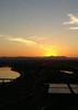
Left Flag at 6:00 AM with my Dad with hopes to make it to Moab in time to eat, see some sights and squeeze a Delicate Arch hike at sunset. Going down the hill toward Cameron, a magnificent sunrise was underway. I had an itch to shoot it but the power lines just west of the highway were a deterrent. My dad spotted a dirt road and went for it. Within two minutes we passed under the lines and we hopped out. Gray Mountain's upturned rock layers took on a beautiful pink-purple glow to match the clouds above it. Looking the other direction, snow-capped Humphrey's was catching some early morning rays. It was a good sign for the start of a great trip. Snapped off some shots and then continued on the trek northward.

Didn't stop again until the turn-off for the Peabody Coalmine, which we took up to the top of Black Mesa to enjoy the view. Met a timid stray dog up there, poor guy was scrounging in the trash. Stared off into the expansive Plateau country and then sped off again, passing through Kayenta and then pulling off roadside to admire Agathla Peak. I just can't get over the wonder of these volcanic necks. The drive through Monument Valley was boring :sl: as always. Took an obligatory stop at the Redlands Overlook, then enjoyed the drop down the hill into Mexican Hat. Pulled out Baar's "Traveler's Guide to the Colorado Plateau" and started the geologic contemplation of the Raplee and Lime Ridge Anticlines. Took a brief stop on top of Lime Ridge to try to see the small syncline, were unsuccessful but would be redeemed on the drive home. Stopped again a couple minutes later to admire the Comb Ridge Monocline and it's mess of upturned strata. Once we hit Bluff, we put the pedal to the metal. The rocks get boring up around Blanding and Monticello, and we were ready to be in Moab, so roadside stops were eliminated. Dropping out of Monticello, the rocks get good again, but we chose to admire the buff sandstone beauty at 70 miles per hour.

Upon reaching Moab, we drove up and down main street to scout the local restaurant scene before checking into the Red Stone Inn. After eating snacks all day, a feast was had at Fiesta Mexicana in preparation for the late afternoon scurry into Arches. Stopped briefly at the Arches visitor's center buy some souvenirs and then head up the hill into the park.

Let me say that while Arches National Park is not huge in area or in grand scale compared to the Grand Canyon or Death Valley, it definitely packs a punch. Upon cresting the hill, the cliffs and fins of Park Avenue are mind blowing, and are just a taste of what is to come. We stopped at the La Sal Mountains Viewpoint, which in the late afternoon is spectacular. The La Sal Mountains tower in the south eastern sky, but then you have the Entrada Sandstone cliffs and monuments the other direction, with the Three Gossips being the center piece. To the east north east, the fins of the Windows area can be seen in the distance, just crying to be explored.

The drive in continues its majesty with the cliffs of the Great Wall on left going on forever. The road drops through Courthouse Wash, and the Cottonwoods were showing their stunning yellow fall color. Balanced Rock pops up on the right, bending the mind with its massive head supported by a thin pedestal. We decided to check out Double Arch before making the trek out to Delicate. The scenery is gorgeous, but being so easily accessible, the park was busy on this saturday afternoon. The Windows trail head was packed full, but fortunately the Double Arch trail head a hundred yards further had only a couple cars.

You can see Double Arch from the parking lot, but it's still worthwhile to walk up to it. Heck, its only two tenths of a mile, and it's hard to put into words how it feels to stand beneath it. It's overwhelming. The spans on the thing are in the neighborhood of a hundred feet wide and a hundred feet tall, so it's a towering spectacle. Contemplating the odds of these two huge arches forming in such a manner is mind-boggling. But of course, Delicate Arch was in the back of our minds. We spent a couple of minutes admiring Double Arch and trying to take pictures that didn't include Korean tourists, then headed out to the Delicate trail head.

Being my first Delicate Arch hike, I wasn't exactly sure what to expect. When we arrived, the parking lot looked near full. My dad said it looked less busy to him compared to the last time he was there, and two volunteer rangers were helping people park. We snagged a parking spot and headed out. The stagnant smell of the creek is obvious as you cross the bridge. Not sure if I would have built a ranch here, myself. The trail is typical of what you would expect for such a famous place: wide and smooth. Looks like a Grand Canyon corridor trail. And it's packed like a Grand Canyon corridor trail too. And people don't really look like hikers. Few have packs or hiking boots. Almost nobody carries water. Fortunately the weather was perfect so there wasn't anybody putting themselves at too much risk Evidently, NPS is doing some maintenance, putting in new culverts and whatnot. The slickrock section was fun. Saw some kids adding rocks to the top of the cairns. There were a couple of guys playing catch with a football. Yes, not a typical hike. The catwalk blasted out of a fin is a blast, then you turn the corner and there it is.

There must have been 50 people gathered around Delicate Arch. I'll go out on a limb and say that pictures don't quite do the thing justice. It's just so perfect. The arch is a free-standing beauty, obviously a wonder of the world. But the setting it's in is perfection. This slickrock bowl creates a marvelous amphitheater for the viewing the most stunning beautiful arch in the world. There are even large slabs of rock for people to sit on, and nature put them there. Then there is the broad view behind the arch with the skyline of the La Sal Mountains. If there was anything that could persuade me that there is a god, this would be it. The setting is just unreal. It's a testament to the magic of nature.

It was so beautiful, and there was ton of people to share it with. And there were lots of photographers with pro-grade dSLRs. The sun was getting low in the sky and a magnificent yellow light was cast across the arch and the bowl. Evidently the sunset scene at Delicate is much different from mid-day. The were no massive groups of people under the arch, most everyone hung back out of the respect for the photography. A couple times people would run down and get their pictures taken, but otherwise there were eons of time to shoot the arch without the human presence. My dad likened the vibe to "worshipers at a shrine." While there was no solitude that defines a typical "wilderness experience", there seemed to be a collective sense of respect from all that were there. People were willing to leave their selfish aside and let the arch be for the full enjoyment of all. Who really needs their picture taken at Delicate Arch, shouldn't the memory of the place be enough anyway?

Eventually the sun went below the horizon and the light on the arch turned drab. In the western and northern corners of sky opposite the arch, shades of pink started to creep their way in. Everyone held their ground, waiting, knowing there was the potential for something special to happen. About fifteen minutes after the official sunset, the sun was still at work somewhere, and the western sky blew up bright pink, casting a most brilliant alpenglow over the arch. My heart was instantly warmed. Shutters fired on fifty different cameras. Some guy just had to run down there and pose for a picture, and the thought in heads of everyone else echoed silently, "Move! MOVE! Get outta there!" A couple moments later he made his way back up and the shutters flurried once more. It was an unforgettable light show, and definitely lived up to the expectations of what all were hoping for.

The light soon dissipated, and darkness was quickly on its way. Headlamps were donned for the dark trek down. We let a large mass of the people get going before we left. A steady stream of headlamps could be seen going down the slickrock. When we reached the slickrock, headlights and taillights of cars could be seen going up the road. "Everyone's driving home from church," joked my dad. Climbing back up the hill between the slickrock and the trail head, we could see another small stream of headlamps descending. We weren't last ones out. We stopped for a minute to enjoy the night, and two guys passed by heading in to the arch, hiking in without headlamps of flashlights. We were soon back to the truck and headed back to our motel in Moab, where I quickly uploaded the days pictures onto the laptop and started processing.

My experience at Delicate Arch was deeply satisfying. It is a wonder of nature that must be seen in person to truly appreciate. It's not a wilderness experience, but a pilgrimage to a mecca of the American southwest. I cannot wait to go back and see it again.
foliage observationfoliage observationfoliage observationfoliage observationfoliage observation
Autumn Foliage Observation Light
_____________________
My blog: Mountain Tripper
My book: Arizona: A Photographic Journey
 
average hiking speed 1.75 mph

WARNING! Hiking and outdoor related sports can be dangerous. Be responsible and prepare for the trip. Study the area you are entering and plan accordingly. Dress for the current and unexpected weather changes. Take plenty of water. Never go alone. Make an itinerary with your plan(s), route(s), destination(s) and expected return time. Give your itinerary to trusted family and/or friends.

helpcommentissue

end of page marker