username
X
password
register
for free!
help
ArticlesGuidesRoutes
 
Photosets
 
 Comments
triplogs   photosets   labels comments more
Shiva Temple - 3 members in 8 triplogs have rated this an average 4.7 ( 1 to 5 best )
8 triplogs
login for filter options
Oct 04 2024
avatar

 Guides 1
 Routes 1
 Photos 44
 Triplogs 38

35 male
 Joined Feb 01 2013
 Tucson, AZ
Osiris TempleNorthwest, AZ
Northwest, AZ
Hike & Climb avatar Oct 04 2024
jajohnson11Triplogs 38
Hike & Climb42.00 Miles 13,500 AEG
Hike & Climb42.00 Miles4 Days         
13,500 ft AEG
 no routes
1st trip
Linked   linked  
Partners none no partners
After every successful canyon summit one’s mind immediately thinks: What next! After success with Vishnu and Angel’s Gate with my buddy Kyle Hoyt, it was Osiris Temple, with just one entry on Peakbagger and 1000 feet of prominence that piqued my interest. I began by looking at possibilities for approaches and ideas on Caltopo. I have zero rafting experience, and do everything in my power to avoid if possible. It did look to me however, that there was perennial water below Dragon Spring, and in Crystal Creek. That would mean that a camp below the redwall west of the Ra/Osiris saddle could be a nice setup if that redwall indeed goes. This idea had an added bonus, in that we could bag Shiva Temple as well, which is a summit neither of us had and another 1k prominence GC summit.

Day 1: Tiyo Point trailhead to Shiva Temple summit, camp at saddle. 12 mi +2500
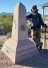
After a last minute detour to buy a bmx bicycle helmet in Page (I forgot my climbing helmet in Tucson!) I was off to meet Kyle at the North Rim. I picked him up near Jacob Lake and we drove the 4x4 road to Tiyo Point. Not a bad drive and the Ranger easily handled some of the rougher areas. We followed the Tiyo point trail and blew right past the Shiva Junction. Not a good start… We did some cross country through the forest to reconnect without having to backtrack but it did cause some unnecessary ups and downs which felt all too heavy with our 4 day packs loaded with 2 30m ropes, a small rack of gear and food/water/bivy. We made it to the saddle around 4pm and quickly dropped our packs and headed for Shiva. We had zero beta on Shiva- we had honestly completely overlooked it since all of our focus was on Osiris and Ra, and we figured that Shiva got enough traffic to easily route find our way to the summit. This cost us a bit of time, as we hit the initial cliffs and side skirted all the way around to the right and didn’t see any path or cairns. We headed left and found the correct route but again, tried to ascend too quickly and couldn’t find any good paths up (the correct route contours back almost the whole way to the ridge) We navigated through the coco scrambling easily enough, and once the true summit came into view we realized we were definitely going to be coming down in the dark. We logged in (last entry Lee Chandler 2022), walked to the true highpoint, and turned on headlamps for our descent. It was a little confusing coming down, and we did have some route finding issues but all went well and we were cowboy camped and in bed by 9pm and ready for a nice easy second day.

Day 2 – Descend Shiva NR saddle, camp at junction with Redwall route past the Dragon/Crystal confluence. 6mi, -3200 ft.
There was surprisingly a decently cairned route to get down into Dragon creek. This didn’t take much time and we enjoyed the morning shade. It quickly began heating up however, and the last few miles to Dragon Spring were brutal with the October heat wave. Made even more brutal was getting cliffed out and realized we missed a work around. We enjoyed a nice break at Dragon Spring which is quite the oasis. Didn’t bother treating any of the pristine water and rehydrated. It had been a water rationed two days and it felt amazing to drink up to our hearts content. After that, we made our way to the junction with the redwall route and set up camp there, but not before enjoying some of the small pools near the dragon/crystal confluence. We got to bed early, since we knew we had a long day in store.

Day 3: Camp at Junction -> Osiris -> Tower of Ra -> Back to camp. 10.3mi +5300, -5300. Well, here we go. Alpine start towards the redwall. Saw a huge scorpion, plenty of frogs and a black widow on the approach. The beta we had for the redwall was a paragraph from an out of print book and a picture of the 1890 Kane route by Butchart that’s floating around online. What could go wrong? The redwall is series of confusing layers of scree and choss. There are no cairns, some class 4 in rotten rock, and extremely steep terrain where one slip could be disastrous. For me, navigating the redwall was definitely the crux of the day both mentally and physically. Towards the top of the redwall, we cheated towards the base of Osiris and stashed gear here. The only beta we had for Osiris was that it went at class 3, and that the Supai break required a contour. We contoured ¾ of the way around the mountain, looking up at cliff bands just a little too steep to scramble. Eventually, it does indeed ease. The contouring did get very thin at times right on exposed cliffs (classic grand canyon catwalk). The upper supai breaks by their easiest lines were all class 4. If a C3 line does exist we didn’t find it. Once above the Supai it is just a short hike to this seldom visited peak. By our count we were the 16th party to summit the peak. Supposedly Kane reached the summit of this peak on his 1890 trek, but the first ascent after him in 1960 mentioned seeing no trace of humans, or any cairn or object left to signify an ascent which was interesting.
Tower of Ra: After Osiris, we began our trek towards Ra. I was rapidly depleting my 5 liters of water that I brought because of this nice heat wave. We grabbed our 2 30m ropes and light rack that we stashed at the saddle and headed for Ra. From the saddle, we aimed to traverse the base of the supai cliffs. We found a nice 5.6 crack to climb and I quickly led a pitch and brought Kyle up behind. The lower bands might be traversable but they looked to get thin in spots which is why we decided to go up first. We worked around to the opposite side and found the only line that looked doable. I was exhausted and out of water and there was a small bit of shade in the chimney near the base of the climb that I used to drop my pack for a minute. Kyle on the other hand, was chomping at the bit to summit and started right on up. We had enough rope to Rap these pitches and gear as well to protect (which was the original plan) but Kyle made it up in no time and shouted down something unintelligible to me to which I responded “YO!” as in Yo what the hell did you just say? That was the last I heard of him, so I figured it was time for me to head on up. I later on found out he said “hey you coming up?” and he thought I said “NO!”… :lol: Make no mistake about it, this is an intense scramble. It is about 80 feet of vertical on great rock. It is solid class 5 scrambling so come prepared with your mental game. That being said it is my favorite GC scramble to date and one of my favorite all time, right up there were with Babo, 14er traverses, and wham ridge. The summit is a massive football field. There were very few signatures in the registry. I think I counted 8 names that predated myself and Kyle. As was the theme of the day, we enjoyed the summit for about 5 seconds, and than began our descent. We downclimbed the Ra scramble. In the redwall I rappelled a few of the choss scrambles. Kyle downclimbed everything. We made it back to the upper pourover at the base of the redwall just as it was getting dark enough for headlamps. I had a liter of water that I stashed here, and we sat, finally able to breath for a second- and enjoy what we just did. We hiked the last few miles back to the junction with Crystal creek and then enjoyed a nice dinner and a short night of rest.

Day 4: Hike out. 13.5 mi. +5400. Brutal hike out in the heat wave. Return to vehicle by 5:30pm. Bagged NK Plateau highpoint on our drive out and got a nice meal at Cliff Dwellers which Kyle was kind enough to treat me to. All in all, another successful, memorable trip into some rarely visited places of the canyon, and fortunate enough to successfully summit these rarely climbed peaks!

Now to figure out… What’s Next!

water 1 out of 5water 2 out of 5water 3 out of 5water 4 out of 5 Crystal Creek Heavy flow Heavy flow
Aunt flow

water 1 out of 5water 2 out of 5water 3 out of 5water 4 out of 5 Dragon Creek Heavy flow Heavy flow
She's a beaut!
_____________________
  8 archives
Sep 10 2021
avatar

 Guides 37
 Routes 556
 Photos 10,872
 Triplogs 1,052

43 male
 Joined Jan 21 2013
 AZ
Claude Birdseye PointNorthwest, AZ
Northwest, AZ
Hike & Climb avatar Sep 10 2021
FOTGTriplogs 1,052
Hike & Climb24.66 Miles 7,027 AEG
Hike & Climb24.66 Miles2 Days         
7,027 ft AEG
Solo  • Trad • 5.3 Unknown Unknown • 40 Feet 1 Pitch
 no routes
1st trip
Linked   linked  
Partners partners
seanpeters
Pro: A few medium size cams
Very rarely in the Canyon does a backup plan work this nicely. The original plan, which was admittedly ambitious in nature involved Shiva and Osiris in a one day push from the Shiva-North Rim Saddle. We had permits for three days and began our journey Friday afternoon at 4:00 p.m.

We stepped off Friday with packs loaded down by water and although our pace was generally good to the rim, the weight was felt on our shoulders and backs. I carried in 14 liters of liquids for a frame of reference. The descent went generally smooth despite us doing nearly half of it with head lamps. We camped at the saddle where we prepacked our day packs, ate and wondered aloud about the day ahead of us. We fell a sleep to a crystal clear night with the massive outline of Shiva looming over.

We left camp at 4:00 a.m. on the dot with head lamps on. There would be no warm up to this day, as our work began immediately when we left camp and began the steep, loose climb to Shiva's headwall and distinct crumbling arete. The scramble up Shiva was surreal. The scrambling felt more airy and the route finding was more engaging. The sight of headlamps going down South Kaibab in the distance further enhanced the ambiance of our headlamp ascent. We topped out at the jugs at 5:42 a.m and after a quick signing of the register were on our way.

We dropped off the southwest side of Shiva and used a distinct drainage to descend and gain the coconino bands of Shiva. Osiris came into view for our first time from here, it looked amazing and the lure of the summit was strong. With a little trial and error, we picked our way through the cliff bands until reaching the main wall that would be our guide for the somewhat tedious traverse. As we traversed, Osiris revealed itself more and the approach to its saddle and "possibly" up it came into sight. Unfortunately, the more we saw of Osiris the more clear it became that bailing was the prudent decision. We had a tremendous descent still ahead of us to reach the saddle of Osiris which sits atop the redwall. Then we would have to commit to an unproven guess that we could pick our way through the Supai bands guarding its north side to the summit, or commit to a tedious traverse to the Ra-Osiris Saddle and the known route up. Neither one of us had the stoke for those options and neither one of us believed it would be a good idea to still shoot for the summit with those options and the heat. We were making good time at the point we bailed, but that did not deter from our belief that we made the right decision. Luckily, I was able to convince Sean he was due for a second ascent of the elusive Claude Birdseye Point; a summit he climbed in 2019 after four years in the making.

The approach to CBPT was per usual for the canyon, but along the way we did encounter some of the more unstable and unpredictable coconino plates I have walked on. Use caution, if in the area. We both soloed the easy, but awkward and airy climb to CBPT's summit. The 40 foot climb is listed at 5.3, but one can bring a few cams to protect, or have a competent leader solo it and bring the second up on belay. We spent a considerable time on the summit and then began our tedious journey back to our camp at the saddle. The descent of Shiva was painstaking and long. Needless to say, we were very happy when we finally made it back to our camp at the saddle.

After taking an extended break at camp, we packed up and started the strenuous climb back to the north rim. We did not break any speed records on the way out and finished just before and a little after seven.

Not bad for an off the couch Canyon adventure. CBT is an excellent summit that offered some superb perspectives of that area of the Canyon. Osiris is still on the todo list, but a revised itinerary and approach may be necessary, also 20 degrees cooler temperatures couldn't hurt.
 Culture
 Culture [ checklist ]
[ checklist ]  Agave Roasting Pit
_____________________
 
Oct 03 2020
avatar

 Guides 1
 Routes 269
 Photos 613
 Triplogs 1,360

50 male
 Joined Dec 22 2003
 Tucson, AZ
Shiva TempleNorthwest, AZ
Northwest, AZ
Backpack avatar Oct 03 2020
RedwallNHopsTriplogs 1,360
Backpack18.00 Miles 4,375 AEG
Backpack18.00 Miles   11 Hrs   37 Mns   1.76 mph
4,375 ft AEG
 no routes
1st trip
Linked   linked  
Partners none no partners
Part 3 of my Grand Canyon trip - we did Shiva as an overnight - hauled water down to the saddle. Found a nice spot and trudged up the slope to Shiva. By this time the week had caught up to me and I was dragging. Caught a bit of a second wind during the fun Coconino climbs. At the top - hiked over to the east side and soaked up the views. Great to have this view of Isis. Super fun summit.
_____________________
 
Aug 13 2016
avatar

 Guides 37
 Routes 556
 Photos 10,872
 Triplogs 1,052

43 male
 Joined Jan 21 2013
 AZ
Shiva TempleNorthwest, AZ
Northwest, AZ
Hiking avatar Aug 13 2016
FOTGTriplogs 1,052
Hiking19.51 Miles 4,375 AEG
Hiking19.51 Miles   11 Hrs   37 Mns   1.91 mph
4,375 ft AEG   1 Hour   25 Mns Break
 
1st trip
Linked   linked  
Partners none no partners
Spending over a half hour staring across the Grand Canyon from Shoshone Point last weekend really had me pining for something in the Canyon all last week. I had my heart set on a summit, but with the warmer temps, my options were limited. I thought about the long, hard to pronounce H word one from South Bass, I thought about a Coronado repeat, or maybe even a sinking ship, however, nothing really piqued my interests. Then after reading a couple triplogs from the North Rim, the idea of Shiva popped into my head. The summit to Shiva had already been blazed by the usual suspects, so I sent out a PM to @Dave1 and @sbkelley to gather some beta. I decided it was the summit for me and made the short drive up Friday night, for what would be my first trip to the North Rim by vehicle.

The morning went pretty smooth, as the few miles I hiked of Tiyo were pleasant and other than the fact that apparently I am incapable of walking a straight line, I was at what I would call the jumping off point (actually jumping off from here not recommended) for Shiva, after only a couple hours of hiking. The first part was a little slow going, as I made the traverse along the ridgeline via a series of brushy cattle trails to the point where you make the steep descent to Shiva's Saddle. I never thought I would be writing about cattle trails and a G.C. summit in the same breath!

From the saddle, I identified and then made the steep, loose climb up Shiva's predominant northwest ridge to the first traverse and class four climb. I could not find the climb at first and probably spent 15 minutes walking back and forth wondering how I could have missed it and where it was. Turns out, I simply did not backtrack far enough and am embarrassed to say I just simply missed the pretty well-cairned route. After finding the climb, I was back in my element and shot right up it, with only a few instance of losing the route and a couple of backtracks. After the climb and a little ridgeline hiking, it was on to the steep traverse and the final steep ascent up through a series of shelves in the kaibab. This is a nasty little traverse by the way and its compounded by deadfall, loose rock, loose soil and a steep slope. However, it does mark the final obstacle and after only a short time, I was finally staring at Shiva's jugs. I signed the register and then made a beeline to the south to check out some of the views, as suggested by @sbkelley. Great views to the south, great views to the north and overall a cool little area up there, as Shiva's summit has the feel of a forested island in the middle of the desert.

From the summit, it was the same route back. There were a few instances where I had to double check the G.P.S to locate some of the down-climbs, but overall it went pretty smooth and I was naturally a little more efficient in my route selection. Once I hit the rim, I really took my time and just enjoyed the pleasant stroll through the pines back to the TH.

Final Notes

Although not the hardest summit in the canyon, this one was no gimmie. The route is rugged and it's the most "bushwhacking" I have done in my short canyon career. Likewise, the route really beat me up, as I came away dirty, scratched, thirsty and a little bruised. Speaking of thirsty, I consumed 5.5 liters of water, 28 ounces of Gatorade and a 12 oz Kickstart energy drink on this hike/climb! If doing this hike in the warmer months, caching water along the way is a must. I cached my water on Shiva's saddle, in order to insure I had something for the final climb up to the north rim. In regards to the North Rim, it was a great first trip for me. I loved the scenery, lack of people and smaller ranger presence. Probably not in terms of trails, but in terms of everything else, the North Rim may be the best the canyon has to offer in my opinion. I found the drive almost equally as impressive and stopped several times to take pictures along the section to Lee's Ferry. Another amazing summit in the canyon and a big thanks to @Dave1 and @sbkelley for helping make it happen.
_____________________
  4 archives
Jun 07 2014
avatar

 Routes 596
 Photos 9,604
 Triplogs 2,400

58 male
 Joined Jan 30 2011
 Chandler, AZ
Shiva TempleNorthwest, AZ
Northwest, AZ
Hiking avatar Jun 07 2014
JuanJaimeiiiTriplogs 2,400
Hiking18.75 Miles 3,997 AEG
Hiking18.75 Miles   11 Hrs   12 Mns   2.15 mph
3,997 ft AEG   2 Hrs   28 Mns Break
 
1st trip
Linked   none no linked trail guides
Partners partners
neurolizer
sbkelley
The plan was to drive to Death Valley and do Shorty's Well to Telescope Peak this weekend. A warm front rolled in and we aborted plan A and went with plan B. Shiva Temple it would be. After all how hot could it be on the north rim?

We arrived late Friday night/Early Saturday Morning and crashed out in freezing temps. Scott woke up with ice on his sleeping bag. I was thankful to be sleeping in the Jeep but it was still cold in there. Around 7am we hit the trail and started making our way through the woods. An hour later we were shedding layers.

Once at the Tiyo/Shiva Point junction we turned and headed towards Shiva Point. It is a beautiful walk through the trees where there once was an old road. From Shiva Point the route is well carined and fairly easy to follow. At Shiva the route works it's way around the base and then scrambles up to the top.

Up top we immediately found the notorious milk jugs and signed the register. Last entry was 7/8/13 by John Domaska and a guy named Thomas. The day prior to that Dave1 was there. Plenty of other recognizable names in the register including Glenn Rink which is Richards Uncle.

Naturally we wanted to go across the top and look down at Isis and all across the canyon. I must say the views from Shiva are spectacular. In the distance you can see Red Butte and the San Francisco Peaks. We soaked it all in for quite some time and then headed back the way we came.

On our drive out we made a quick pit stop at the north rim lodge and then headed for Jacob Lake. On the way out of the park we saw a large heard of Bison. I had a little fun with them while taking their picture.

Tasty burgers at Jacob Lake and then off to Marble Canyon Lodge where we had a hot shower and a room waiting for us.

This was a great trip and I really enjoyed the company of both Scott and Richard. Thanks for suggesting this one Scott and thanks for coming along Richard! Good Times!
_____________________
 
Jun 07 2014
avatar

 Guides 6
 Routes 13
 Photos 1,377
 Triplogs 184

41 male
 Joined Mar 29 2007
 Reno, NV
Shiva TempleNorthwest, AZ
Northwest, AZ
Hiking avatar Jun 07 2014
sbkelleyTriplogs 184
Hiking18.75 Miles 3,999 AEG
Hiking18.75 Miles   11 Hrs   15 Mns   1.67 mph
3,999 ft AEG
 no routes
1st trip
Linked   none no linked trail guides
Partners partners
JuanJaimeiii
neurolizer
We were looking for a higher, cooler adventure this weekend. This seemed to be the ticket, but we hit this on a hot day. That seems to be a recent theme in Shiva's summit log.

The walk through the North Rim forest is long, but easy. Navigation with a GPS is quite helpful from the Tiyo Point road junction to Shiva Point. From there, the route down to Shiva Saddle is relatively straight-forward, as there are bits of trails and routes here and there. We stayed on or near the main ridgeline from the point down to the saddle, for the most part. The lower part through the Coconino is steeper, looser, and less shaded, but is over quickly.

After crossing Shiva Saddle, staying on the ridgeline towards Shiva was the ticket to the base of the Coconino. A very Isis-esque Hermit Shale gully traverse appears, and the climbing starts after that. It was pretty straight-forward and fun scrambling. After topping out in the Coconino, we made our way to the final Kaibab barrier. An annoying, exhausting sidehill came next, but at least we were in the shade under cool pines! Steep, loose final climb to the top brought us to the famous jugs! A stroll (and a brew) on the south edge was the reward.

Hot day - even up this high. Highs were well into the 90s down at Shiva Saddle. Went through over 5L of fluids and would have drank more if it were available. Back on the rim by mid afternoon and enjoyed the pines and aspens on the relaxing walk out.
_____________________
 
Jul 07 2013
avatar

 Routes 29
 Photos 1,548
 Triplogs 1,802

49 male
 Joined Jan 25 2009
 Phoenix, AZ
Shiva TempleNorthwest, AZ
Northwest, AZ
Hiking avatar Jul 07 2013
Dave1Triplogs 1,802
Hiking18.70 Miles 4,865 AEG
Hiking18.70 Miles   9 Hrs   55 Mns   2.22 mph
4,865 ft AEG   1 Hour   30 Mns Break14 LBS Pack
 
1st trip
Linked   linked  
Partners none no partners
I've had my eye on this one for a while. Made 2 sort-of attempts prior but didn't make it far. Once from Phantom Creek and another from Widforss Trail. On both I ran out of time and energy to make any serious progress. Ready for a third go at it although July is probably not the best time to do it but I was starting to get itchy.

From HW67 on the North Rim, I turned off onto Point Sublime Road (also the road to get to Widforss Trailhead) and followed that about 4 miles to Tiyo Point Road. As I discovered, Tiyo Road is now Tiyo Trail and is closed to vehicles so I backed up and found a spot to park about 1 mile away. I walked Tiyo Point Trail about 3 miles from the gate to the turn off for Shiva Point Trail. The intersection is marked with 2 metal tags nailed to a tree. Tiyo is an old road so it is easy to follow (except it is quickly being reclaimed by the forest with lots of new trees and downfall) but Shiva Road exists only for a couple hundred yards and then completely disappears. From here a compass or GPS is necessary, IMO, to continue as you're just walking through the trees with no view of the rim until you're almost there, 2 1/2 miles later.

From Shiva Point, the trail down to the saddle is well marked with cairns. This is also an exit for one of George Steck's routes so I think it gets lots of use. There's also many cattle or bison trails leading down.

On the saddle I was surprised to find a large rock holding a pocket of water on such a hot day! This probably explains the cow trails. After crossing the saddle I found the route up to the Temple pretty straight forward using the description from Grand Canyon Summits Select. There are a couple of class 4 climbs through the Coconino and then lots of scrambling to the Kaibab break. Most of the route is cairned. This section beat me up good but most of the climbs are pretty easy.

On the mostly flat and tree covered summit I quickly found the two 5-gallon metal milk jugs on the high point. I opened the one containing the register and was greeted by a nice little hornets nest under construction! No way I was leaving without signing in so I reached in and yanked out the register as fast as I could and then sprinted about 100 yards away. The log dates back to 2001 with about 2-3 trips per year, mine being the first for '13. After gently replacing the register I heard the sounds of an approaching thunder storm. Dam! No time to explore the top, had to get down and beat the lightning. I made it down to saddle just as the rain started. Put on my $1.50 emergency poncho and found a low spot to wait out the storm and hide from the lightning. The storm passed after about 20 minutes and the sky was blue again but now it was hot and humid. I returned back to Shiva Point mostly the same way and back across the Kaibab forest to my truck without any more issues. Didn't see any people all day.

On the way home I stopped at the BCO and picked up 2 permits. North Bass in September and South Canyon in October :y: .
_____________________
 
Sep 15 2001
avatar

 Guides 59
 Routes 1,100
 Photos 1,191
 Triplogs 1,290

male
 Joined Jan 01 2023
 Arizona
Shiva TempleNorthwest, AZ
Northwest, AZ
Hiking avatar Sep 15 2001
pseudalpineTriplogs 1,290
Hiking11.29 Miles 3,728 AEG
Hiking11.29 Miles
3,728 ft AEG
 no routesno photosets
1st trip
Linked   linked  
Partners none no partners
  1 archive
average hiking speed 1.94 mph

WARNING! Hiking and outdoor related sports can be dangerous. Be responsible and prepare for the trip. Study the area you are entering and plan accordingly. Dress for the current and unexpected weather changes. Take plenty of water. Never go alone. Make an itinerary with your plan(s), route(s), destination(s) and expected return time. Give your itinerary to trusted family and/or friends.

helpcommentissue

end of page marker