|
| | | |
| |
|
| Hiking | 19.02 Miles |
3,340 AEG |
| | Hiking | 19.02 Miles | 8 Hrs 34 Mns | | 2.33 mph |
| 3,340 ft AEG | 25 Mns Break | | | |
|
|
| |
| Partners |
|
none
[ show ]
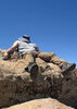
| no partners | | This hike had its ups and downs (no pun intended). I got to utilize my special skill of easily getting lost off-trail multiple times. Although the temperatures were a cool 65ish degrees, the loop going up and around the canyon has zero shade, so make sure you bring proper sun protection. I could have very much prepared better for this hike in terms of navigation because I didn't even download the maps for the area surrounding the planned route. This made navigation while I had no cellular service in the canyon much less convenient.
The drive to the trailhead is accessible to basically all vehicles. I drove a sedan to the trailhead the night before and only encountered 2 spots where I had to maneuver around rocks/pot holes to not scrape the underside of my car. I car camped at the trailhead, and there were actually some people with tents set up around the area where the trailhead was. We had a nice chat in the morning before I set off for my hike around 8 am.
Starting at the trailhead, you will be hiking about 1/2 a mile before looking for the Blodgett Basin trail. I actually hiked an additional 1/2 mile past where I THINK the trail splits off to the north before turning back around, because for whatever reason it was impossible for me to find. I gave up and ended up actually hiking off-trail up the hill where I thought the trail would be until I eventually found it. The trail seems to have become VERY overgrown with cacti and other sorts of vegetation near the bottom of the canyon, but it became easier to follow as I got closer to the top.
After exiting the gate marking the end of the trail, you will have to hike along FR214 (Cedar Flats) for 1.2 miles until taking a right and then following FR214A for another ~1.4 miles to Trail 17 trailhead. FR214A is only accessible with high clearance vehicles for those ever considering driving to this spot. There were three trucks at the trailhead but I didn't encounter anyone in this area. The trail down the canyon quickly becomes steep and the terrain is very easy to slip on in some areas. I managed to do the entire descent without using my trekking poles however I highly recommend using a set if able.
Once I got down to the creek, I purposely went off-trail and walked through/alongside the creek for 1/2 a mile. At first, it was nice, but after that 1/2 mile it quickly became more trouble than it was worth. In some sections, I had to cling onto the side of some very sketchy terrain like a mountain goat to avoid getting in any water above my waist. After reviewing my GPS route now, it was clear that the maintained trail was far up the hill away from the creek. Without a reliable way to locate the maintained trail while I was there, I kind of followed the creek for 1.5 miles before I was able to locate the trail again. I was able to trek along this until I reached one of the mandatory water crossings, where I once again got lost and walked alongside the creek for 2 miles. Once I decided to focus on locating the trail instead of walking along the creek in hopes of finding it, I was able to finish the last 3 or so miles without having to scratch myself up pushing through bushes.
I finished the hike around 5 pm, giving me about an hour until sunset. The hike definitely went a little too long for my comfort, but thankfully, I packed enough food/water despite the extra ~1.5 hrs from my off-trail adventures. I bought a cheap pair of slip-on water shoes beforehand which was definitely a lifesaver from all the water crossings I ended up doing. |
| | |
|
|
|
 Route Editor