|
| | | |
| |
|
| Run/Jog | 100.50 Miles |
14,500 AEG |
| | Run/Jog | 100.50 Miles | 27 Hrs 41 Mns | | 3.63 mph |
| 14,500 ft AEG | | | | |
|
|
| |
| Partners |
|
none
[ show ]
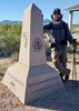
| no partners | | Back in 2015, this was my first 100 mile run, and to this day, still my fastest. Decided to go back and give it another go to mark 5 years, but it was postponed twice due to Covid. I guess 7 is just as well... The course changed a little bit in 2016, so it's slightly harder now.
Things started out well enough on Friday morning, went at what I felt was a comfortable pace, and the climbs up and over Middle Peak and Stonewall Peak were uneventful. Then a trip around a big meadow along the California Riding and Hiking Trail, and then to Sunrise Trailhead for a stretch on the PCT. By this time it started to warm up a little, but there were occasional clouds, which helped.
Fatigue didn't really start setting in until after Pioneer Mail (mile 28), on the drop down to Noble Canyon. This section really started warming up. Got passed by a lady who for some reason thought it would be a good idea to keep pushing hard as it warmed up; the results would later indicate she didn't finish. Huh. Anyways, it was warm down there, but it could've been worse, as there was a decent breeze in Noble Canyon, and a good amount of shade after a couple miles. Still, by the time I got up to Penny Pines (mile 44), I felt pretty beat, and the idea of doing 56 more miles seemed daunting. But I've done this enough to know that such thoughts are temporary.
The next section, mostly on Big Laguna and Sunset trails, was pleasant, and probably the prettiest part of the course. This is in the Laguna Mountains, in pretty meadows surrounded by pine trees. You wouldn't guess you're right between San Diego and the Imperial Desert. A couple miles after Red Tailed Roost, I hit the PCT again, and started the decent down to Cibbets Flat (mile 63), along with the night portion of the run.
Took a caffeine pill before heading back up, which provided a good boost. From here it would be 28 miles on the PCT, and then a mostly flat 9 miles to the finish. Felt pretty good all the way up to Todd's Cabin (mile 75) where I learned only 40 runners had passed through. A bit shocking to find out I was doing better than 80% of the field considering how slow I thought I had been going, but I'll take it... After this, things started getting a lot rougher. I was still moving kinda OK, but the wind got pretty ridiculous, it was probably gusting at about 50mph. At least it wasn't cold.
Got to Pioneer Mail right at Sunrise. 16 miles to go; in 2015 I finished right around this time. By this time I was hiking all but the smooth downhills, and those stretches of "running" weren't much faster than hiking. After I left Sunrise, it occurred to me to just power hike the rest of the way; it turned out to be just as fast, and less effort, than what I had been doing. Got passed by a few runners the last few miles, but I still managed a 40th place finish, which I felt was pretty solid considering the quality of my run.
This is a great event. Maybe I'll even come back again in 2025. |
| _____________________
| | |
|
|
|
 Route Editor


 The tall shrubs did not impede the views, since the trail ran mainly along gentle side-slopes. At this point, the views were mainly of the surrounding hills.
 Dropping over the other side of the ridge, we picked up a dirt road that took us back to the main road, which we scurried across between traffic.


