|
| | | |
| |
|
| Backpack | 11.50 Miles |
3,192 AEG |
| | Backpack | 11.50 Miles | 2 Days 17 Hrs 26 Mns | | |
| 3,192 ft AEG | | 50 LBS Pack | | |
|
|
| |
| Linked |
|
none
[ show ]
| no linked trail guides |
| Partners |
|
none
[ show ]
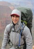
| no partners | | My girlfriend and I decided to do this trail as a three day backpacking trip. Absolutely beautiful trail, but definitely would have done things a little different if we had spoken to someone else that had done it first. Our plan was to drive in from Phoenix in the morning, arrive at the trail around lunch time, hike down and get to the falls around sunset (6p-7p). We had heard that we could setup a tent on a flat rock near the top of the falls, so we planned to make camp there. Spend the next day (Wednesday) at the falls enjoying the water, sleep there a second night, then hike out on Thursday.
Now for what actually happened and what we would have done differently. Like any experienced hiker or backpacker will tell you, get the earliest start you can manage. We started hiking at 11:30am, which obviously is already half way through the day and puts you in direct exposure to the sun while you are hiking down the canyon to the creek. We knew that going into it and it was okay. Getting to the trailhead went okay, fortunately we had a raised jeep that got us straight to the actual trailhead. Like you've probably read, a normal sedan can't make it that last mile, it is way to rocky and jagged. Personally, I would say you need an off-road capable car for the whole dirt road, driving in a Prius for that distance on that bumpy road could not be good for it. And it's a long gravel bumpy road.
For the entire dirt road and arriving at the trailhead we were the only ones there. There is a log at the head of the trail that we signed in to; according to the log no one had been there in a few days. Going down the canyon went okay, except for some difficulty finding the trail once you get toward the bottom where the canyon meets the creek. We were trying to be extra careful because we knew that there is a second trail that turns right down the creek instead of left toward the falls. Note, my navigation was using a handheld Garmin GPSMAP 64s. It helps, but it's precision is like within 30ft of where you are actually standing and when the inside of the canyon is 50ft wide it doesn't help with trail finding too much. Once we were at creek level and started upstream toward the falls it was pretty rough going. We decided to keep our boots on instead of switching to water shoes, which worked okay. The only problem with that is it's harder to do the many creek crossings that are necessary to progress up the creek; what you will find is that typically one side of the creek has boulders, rocks, and shrubbery with no discernible trail, and the other side will be sheer rock that meets the creek. The side with the sheer rock and the side that you can hike on switches fairly often and will require that you cross the stream fairly often. This is a challenge if you decide to keep your boots on because the stream crossings are not straightforward. You might be hiking and end up at sheer rock in front of you where you need to cross, then you will need to backtrack to suitable rocks that will allow you to hop across. This takes time and effort, plus we had heavy packs on. Hiking poles definitely helped here and prevented us from falling several times.
At around 6pm we had been hiking along the creek for some time, and looking out for the well known swimming section with the fallen log. Looking down at the GPS we saw we had less than a half a mile to the falls and were in decent spirits. 30 minutes later we arrived at the swimming section, right as the sun was starting to set.
(We knew that to get to the falls with backpacking packs we'd need a fairly large pool floatie with a bottom to it - no hole in the middle. A few days before the trip we went out to purchase one- we went to two Walmarts, a Target, and called several other places and they were all sold out. Literally their pool floatie aisles were empty. We ended up purchasing one off Amazon that arrived the day before our trip - https://www.amazon.com/gp/product/B01KG ... ikearizona . We later learned that some pool stores might have had one in stock, in case you find yourself in a similar situation. As you can imagine a large pool floatie weighs a lot - something like 5 pounds, and also requires a ton of air to fill up. Our sleeping pad uses a "Schnozzel Pumpbag" to be inflated - https://www.rei.com/product/829645/expe ... lsrc=aw.ds . The night before the trip I designed a piece and 3d printed it that would act as an adapter between our pump bag and the floatie.)
So using the adapter and the pump bag it took us about 20 minutes to fill up the floatie. Our packs weren't waterproof, so we knew we needed to be really careful transporting the packs across the water. We did have three 5L waterproof bags that we placed more of the water sensitive items into, like the GoPros, DSLR, iPhones, personal locator beacon, extra batteries, first aid, etc - so we knew that if the bags did fall into the water the critical stuff would be safe. We changed into our bathing suits and water shoes and carefully packed the bags onto the floatie. Note, their were a couple of trashed floaties laying around that people were too lazy to carry back up with them; in a pinch you probably could bring a patch kit and inflate them. Having or floaties inflated and bags packed on top, we made it across with the bags dry  . This is where things started to get pretty rough. It was starting to get really dark, we were wet, and the going had been really rough hiking up the creek. Add in a thunderstorm had rolled in so the sky is cracking and lighting up every few seconds, and a light rain had started to come down. Plus, with the darkness now the insects really started coming out. Not like mosquitoes particularly, but flys and gnats, large spiders (didn't see any tarantulas like others had reported), and a scorpion. Keep in mind we're now in open toed Chacos and bathing suits - the exact opposite of what you want to be in when there are tons of things that could bite or sting you. Plus I'm carrying this huge pool floatie up and down huge slippery rocks. In any case we take maybe 30 steps forward and we get to the next pool of water that you must swim through. We grab our headlamps out of the packs, it's nearly pitch black now. The only things I can see are what the headlamp is illuminating. I take the floatie and plunge into the water looking for where we can swim across and safely unload our packs. I look up and the side of the creek where there are good rocks for us to climb out -- and of course there are huge spiders on all of the rocks, with their eyes shining from the light of the headlamp. This was pretty rough and my girlfriend certainly was not happy be in the pitch black, in water, with spiders all around us. In any case we were able to make our way through and the bags again, luckily, came out dry. At this point it was nearly 8pm and the GPS said we were less than .18 miles from the falls. The situation was starting to seem a little uneasy though, because were were barely making any progress, we didn't know how many more full swims might be up ahead, we hadn't seen anywhere to camp in a while and we couldn't really turn back to find ones we had passed because we weren't about to do those swims again. Instead of attempt to camp at the falls we decided to find the next suitable camping site. We found a nice flat-ish rock a little above the creek maybe 20 steps away. We setup camp and ate dinner - not enjoyable with thousands of insects being attracted to the headlamp. Using the red light on the headlamp seemed to help, in case you find yourself in a similar situation. We also had bug spray, which kept us from getting bitten in case the gnats or mosquitoes that may have been present were tempted. While outside the tent the temperature was okay, inside the tent it was humid and hot (it was raining so we had to keep the rainfly on the tent). Falling asleep was kind of rough, but we were happy to be safe and dry in the tent. . This is where things started to get pretty rough. It was starting to get really dark, we were wet, and the going had been really rough hiking up the creek. Add in a thunderstorm had rolled in so the sky is cracking and lighting up every few seconds, and a light rain had started to come down. Plus, with the darkness now the insects really started coming out. Not like mosquitoes particularly, but flys and gnats, large spiders (didn't see any tarantulas like others had reported), and a scorpion. Keep in mind we're now in open toed Chacos and bathing suits - the exact opposite of what you want to be in when there are tons of things that could bite or sting you. Plus I'm carrying this huge pool floatie up and down huge slippery rocks. In any case we take maybe 30 steps forward and we get to the next pool of water that you must swim through. We grab our headlamps out of the packs, it's nearly pitch black now. The only things I can see are what the headlamp is illuminating. I take the floatie and plunge into the water looking for where we can swim across and safely unload our packs. I look up and the side of the creek where there are good rocks for us to climb out -- and of course there are huge spiders on all of the rocks, with their eyes shining from the light of the headlamp. This was pretty rough and my girlfriend certainly was not happy be in the pitch black, in water, with spiders all around us. In any case we were able to make our way through and the bags again, luckily, came out dry. At this point it was nearly 8pm and the GPS said we were less than .18 miles from the falls. The situation was starting to seem a little uneasy though, because were were barely making any progress, we didn't know how many more full swims might be up ahead, we hadn't seen anywhere to camp in a while and we couldn't really turn back to find ones we had passed because we weren't about to do those swims again. Instead of attempt to camp at the falls we decided to find the next suitable camping site. We found a nice flat-ish rock a little above the creek maybe 20 steps away. We setup camp and ate dinner - not enjoyable with thousands of insects being attracted to the headlamp. Using the red light on the headlamp seemed to help, in case you find yourself in a similar situation. We also had bug spray, which kept us from getting bitten in case the gnats or mosquitoes that may have been present were tempted. While outside the tent the temperature was okay, inside the tent it was humid and hot (it was raining so we had to keep the rainfly on the tent). Falling asleep was kind of rough, but we were happy to be safe and dry in the tent.
I woke up feeling nauseous and wasn't sure if I'd be able to hike to the falls. I ate a pop tart and took a tums, and the nausea worsened. Knowing that we were so close to the falls and that to be safe we might need to turn back was a pretty crappy feeling. Luckily, I figured out that I might have been dehydrated - I hadn't had much water since dinner and I think I had been mouth breathing the majority of the night. After drinking a liter of water I started to feel much better. After filtering more water we decided to day hike to the falls, come back and grab our camping stuff (we packed it up before leaving for the falls), then hike downstream as far as we could - with hopes of getting to a campsite near the part of the creek right before you take the trail to exit the canyon. With a plan in place, we packed day packs with the cameras and phones, and started hiking to the falls. Lucky we camped where we did because twenty feet upstream from our campsite was another section that you had to swim, which if we had come to the night before would have been pretty demoralizing. Having a light pack now, the swim was easy. Back on land we went another ten feet, then found ourselves at another section that we had to swim with the floatie. As we swam that last bit you turn a corner and the falls come into view. A great site to see after putting in so much effort to get there! We hung out at the falls for a while, got some pictures floating around and jumping off the side of the falls. Ate lunch. Relaxed. It was nice and we had the falls all to ourselves. Heading back we arrived at our packs and got moving downstream toward the campsite. Since it was daylight we stopped to take more pictures at the famous swimming section with the broken log suspended in between the canyon. We then packed the bags onto the floatie and proceeded down that section. This time were weren't so lucky with the packs though - halfway through the 100 yard swim my girlfriend's pack, which was on top of mine, dislodged itself and fell into the creek. Our feet couldn't touch the bottom so we just sort of let it float near us until we got the end where I could stand up and lift it back onto the floatie. Then, of course, right before we get out, I slip and hit he floatie and both of our bags go into the water. I was able to rescue mine fairly fast but it still soaked a little bit. What can you do though, ya know. Again, our critical stuff was in dry bags, so we just had to hope that they did their job. We emerged from the swimming sections and hiked until we got to the campsite we had read about and had heard was a solid place to camp - and fortunately we got there right at 6p before the sun started to set. It was a sandy site, so it was nice to be able to take off the water shoes and walk barefoot for a little bit. For anyone who's interested, these are the GPS coordinates of that camp: N34° 33.536' W111° 36.793' . That site could also support probably 4 or more tents if you're trying to go with a group. The rest of the trip was fairly uneventful. I was using a Platypus gravity water filter and the clean bag sprung a leak, which was a minor inconvenience. Hopefully they'll warranty that out for me. Hearing that people were running out of water on the way up, we were more cautious and filled up both of our 3.5L hydration bladders + 1.5L SmartWater bottles. That camp was less than a half a mile from the exit point where the trail goes up the canyon. The next morning we put our boots back on for the first time since Tuesday (it felt great to have shoes on again!) and began hiking out around 9am. It was a little hot once we were moving up the side of the canyon; it's really exposed. We attached our sumbrellas back to our packs once we were out of the brush and that makes it more bearable - we were essentially using these type umbrellas for those who haven't heard of them https://www.amazon.com/UV-Blocker-Prote ... ikearizona with some Velcro ties to keep them on our packs.
We arrived back at the trailhead around 12p, our Jeep (thankfully tires not flat) was still the only car there. We ended up finishing with both SmartBottles full, and our camelbacks 3/4 empty. As we left and drove a few hundred feet down the road a pickup truck was arriving so we pulled off to let them pass. It's almost like we had appointments and it was their turn 
Overall great trip, more adventure than we would have hoped for but it was still very memorable!
Now, onto what we would have done differently. We probably still would have started hiking at the same time, but instead of camping at the falls we would have planned on camping at the campsite we stayed the second night or found one a little further upstream closer to the falls (but before the big swims). That would have greatly reduced the effort we had to exert because the packs are really heavy and there is no trail. You're just bushwhacking for what feels like forever. Since we wouldn't have needed to swim with our packs, we would have been able to bring a smaller floatie that didn't weigh 5 pounds and take a ton of air to inflate. We also would have been able to move much faster and safer. From that campsite we would have day hiked to the falls and spent more of the day there, knowing that we have a nice camp that is already setup waiting for us downstream. Or if we really wanted to camp at the falls we would have woken up at like 3am on Tuesday and gotten to the trailhead by like 6am, setting us up to be able to do everything in the daylight; we also would have purchased full dry bags for the backpacking packs. |
| _____________________
| | |
|
|
|
 Route Editor