|
| | | |
| |
|
| Hiking | 6.65 Miles |
2,874 AEG |
| | Hiking | 6.65 Miles | 5 Hrs 25 Mns | | 1.23 mph |
| 2,874 ft AEG | | | | |
|
|
| |
| Linked |
|
none
[ show ]
| no linked trail guides |
| Partners |
|
none
[ show ]
| no partners | | Brian and I had talked this hike for many years and finally did it today. I've seen past trip reports on various sites that have described this hike as a rough bushwhack with a lot of thorny brush that will "make you bleed". It was nothing like that in our experience and we believe it was because of one or more wildfires that must have occurred after 2016.
This description assumes that you parked within about 100 feet of the water tank, as described in my driving directions. Start off hiking West on FSR 4378. The road will eventually switch back and dead end near an old mine shaft after hiking a total of 0.8 miles. You can walk into the mine shaft. The tunnel only goes in 25 or 30 feet and there's a dead end. There was really nothing of any interest inside. If you continue past where the road ends you will see a trail that continues for about 100 feet. Then, there's a use trail going UP. Your goal is to get on the ridgeline. This is one of the steepest parts of the entire hike. Continue until you have reached the ridgeline and keep in mind that there are multiple ways to go.
By the time you reach the ridgeline you will have hiked roughly 1.08 miles. Once you are on the ridgeline, you should see a use trail going up the ridge. You can follow this trail all the way to the summit. Along the way, there will be a few downhill sections where you are basically going around some hills along the ridgeline. At a certain point, there is a rock formation blocking the trail. I climbed this rock formation and looked down and saw about a 10 foot drop going down. I felt like I probably could down climb this but it was not trivial and it could potentially be dangerous, so I found a much safer way around the left side of the rock formation. On the upper sections of the trail you will hike through some "dead forests" where the fire obviously burned through. The good news is there are many green trees on the North part of the ridgeline but the trail didn't go there.
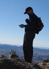
When you get to the top of the mountain, you will see a rock pile with some kind of antenna, and this is where the benchmark exists. You will also see a US survey marker here. If you look Northwest about 400 feet away, there's another high point. My GPS device measured 7506 feet elevation as the highest reading at the benchmark and 7504 at the "West peak". Never-the-less, we found the registry at the "West peak". Whether it's really higher or not, it's good to visit both places because there are slightly different views from each place.
On the way down, we followed the same route, but instead of hiking down the side of the lower ridge to the 4x4 road, we hiked further down the ridge and around to our parking area. Take a look at my route for more details.
Stats:
---------
Distance (round-trip) = 6.65 miles
AEG = 2,874 feet
Strava moving time = 4 hrs 12 mins
Strava elapsed time = 6 hrs 53 mins
Driving Directions: Take I-10 E out of Tucson. About 13 miles East of Benson, take exit 318 for Dragoon Road.
Turn right onto E Dragoon Rd
continue 10.8 mi
Turn right onto N Cochise Stronghold Rd
continue 6.0 mi
Turn right onto W Ironwood Rd
continue 2.0 mi
Turn right onto FSR 795, also known as N Cam Biblia
continue 1.4 mi
Turn left onto FSR 4378, also known as High Lonesome Trail
continue 0.25 mi and look for parking area on the right side
*If you have a good high clearance vehicle you can continue for 0.45 mi and park off the road. You should see a water tank in the final 100 feet of the drive. This is where my route and description starts from. |
|
Wildflowers Observation Isolated
white mariposa lily, white stem evening primrose, saltmarsh false foxglove?, wavy leaf paintbrush, larkspur (delphinium), yellow evening primrose, moss phlox? |
|
| _____________________
Michael Williams
IT Professional
Rocky Point Vacation Rentals
Ocean Front Condo in Rocky Point, Sonora, Mexico
www.beachfrontmexico.us
 |
| | |
|
|
|
 Route Editor