username
X
password
register
for free!
help
ArticlesGuidesRoutes
 
Photosets
 
 Comments
triplogs   photosets   labels comments more
Zion Narrows - 17 members in 34 triplogs have rated this an average 4.2 ( 1 to 5 best )
1, 2  Next
34 triplogs
login for filter options
Jun 05 2025
avatar

 Guides 41
 Routes 1,626
 Photos 14,983
 Triplogs 2,760

69 male
 Joined Jan 20 2009
 Far NE Phoenix,
Zion Day 2, UT 
Zion Day 2, UT
 
Hiking avatar Jun 05 2025
The_EagleTriplogs 2,760
Hiking10.80 Miles 1,908 AEG
Hiking10.80 Miles   5 Hrs   39 Mns   2.04 mph
1,908 ft AEG      21 Mns Break12 LBS Pack
 
1st trip
Partners partners
Ladyeagle
Route Scout Route Recorded  on Route Scout | Pop | Map | Popup | MapDEX
Riverside Walk 2 Miles - 75' AEG
This is actually a very scenic walk on a paved trail that leads to The Narrows. Don’t expect solitude—unless you’re on the first bus to Stop 9. Accessible to all ages and experience levels. Worth checking out when in the park, even if you don’t plan on doing The Narrows.

Zion Narrows 1 Mile 20' AEG
We brought our own water shoes and changed into them at the end of the Riverside Walk. Most people rented water socks, shoes, and wooden hiking sticks. Bring trekking poles if you have them. The water was typically calf-deep, but you couldn’t see what was below the murky surface. We only went in about half a mile, until we saw people going “nips deep” in the water—that was enough of a sample for us. Very pretty, albeit slow going. As with most of the park, don’t expect solitude.

Emerald Pools – Zion 3.48 Miles - 418' AEG
My favorite of the day. We hit the Lower, Middle, and Upper Emerald Pools. We had planned to hike from Stop 6, past the pools, to Stop 5 at the Zion Lodge, but the bridge across the river wasn’t scheduled to open for another week, so we did an out-and-back instead. In retrospect, a good hike would have been from Stop 6 to Stop 4
Upper Emerald Pool ==> [ youtube video ]

Sand Bench Trail – Zion 4.26 Miles 801 AEG
I did this as a filler hike on the way back. The namesake sand gets annoying after a while, and since the trail is also used for horseback rentals, the sand is chewed up and littered with horse apples and runoff. Go counter-clockwise if you're doing the loop, or clockwise if you're just planning an out-and-back.
wildflower observationwildflower observationwildflower observationwildflower observationwildflower observation
Wildflowers Observation Isolated

water 1 out of 5water 2 out of 5water less than maxwater less than max Behunin Canyon Light flow Light flow

water 1 out of 5water 2 out of 5water less than maxwater less than max Emerald Pools 26-50% full 26-50% full
Lower and middle pools were not impressive. Upper pool was much larger.
_____________________
There is a very fine line between "hobby" and "mental illness."
Dave Barry 🦅
 
Apr 01 2024
avatar

 Guides 33
 Routes 286
 Photos 445
 Triplogs 251

35 male
 Joined Oct 23 2017
 Tempe
Zion NarrowsSouthwest, UT
Southwest, UT
Canyoneering avatar Apr 01 2024
KingLeonidasTriplogs 251
Canyoneering6.66 Miles 7,090 AEG
Canyoneering6.66 Miles   4 Hrs   46 Mns   1.79 mph
7,090 ft AEG   1 Hour   3 Mns Break6 LBS Pack
Canyon Hiking - Non-technical; no rope; easy scrambling; occasional hand use
B - Up to light current; wading/swimming; possible wet/dry suit
II - Normally requires a half day
 
no photosets
1st trip
Linked   none no linked trail guides
Partners none no partners
Route Scout Route Recorded  on Route Scout | Pop | Map | Popup | MapDEX
Hiked the Narrows with Victoria on the last day of our Zion trip.

We lucked out on this one. With the weather (a winter storm rolled in on our 2nd day in the park) the Virgin river went from a clear 70 cfs to a muddy 150 cfs and the park service closed the narrows for safety reasons. However on our last day the weather cleared up, the flow had returned to a more manageable 80-85 cfs, and although the water was still murky the narrows was opened again for hikers.

We found this out on our morning hike and headed back out to the park entrance afterwards to rent wetsuit boots, drysuit overalls, and broom handles (to serve as probes/trekking poles).

It seems everyone else who was avoiding the park due to the bad weather decided to show up and we ended up waiting for the shuttle at the visitors center for an hour (the line was out to the parking lot).

After finally arriving at the Temple of Sinawava we hustled the mile of riverside walk to the start of the narrows as we were getting a much later start than we would have liked. I set my phone timer to alarm when we were halfway from our start time to 6 pm (the logic being the last bus is at 7:15 pm and if there were another hour wait we wouldn't get stuck in the park). This turned out to be a sound decision as we made it out with some time to spare. The guides were recommending slightly less return time than the time going out as the current is helping you at that point. While this is true it turns out to only improve your time if you entire party is comfortable in water/good at canyoneering (which was not the case for us).

At the very beginning, there was a large crowd of tourists congregating at the beginning of the narrows hike taking photos and in some cases trying to start the route (unsuccessfully of course, the water was far too cold to attempt without proper equipment).

The conditions for the canyoneering route were pretty good all things considered. There was a deep section at the 2nd crossing that was over waist deep (I had to hike my bag way up to avoid getting it wet) but aside from that the remainder of the crossings were knee to thigh deep ad the highest). The current was reasonably strong (at least strong enough that the broom handles came in handy) but not unmanageable. The water was fairly cloudy, as we would later find the sediment was mostly coming from the Orderville junction.

It was immediately apparent (both from our group and others we saw) that there are two types of Narrows hikers: those that "get it" and after a short period are able to make the crossings efficiently without having to slow down much and those that don't and have to turn each crossing into a painstaking process where each step is carefully considered and tested before moving forward. I fell into the former category and unfortunately Victoria fell into the latter. The categories tend to be self-reinforcing as well if you take longer making the crossings you will be in the cold water longer and are going to get chilled, fatigued, and tired sooner than someone who is able to cross efficiently. This was our challenge on the return; even though the current was helping Victoria was cold and tired enough that she ended up making the same time on the return even with the current helping.

Some notes on the Narrows Canyoneering technique (for my own future reference on potential return trips):

The broomhandle should be used more as a probe than an trekking pole during the crossings. In deep water especially it works best to hold it with both hands and probe the ground ahead looking for deep holes (which should be avoided unless you want to flood your waders). Hold it more or less rigidly one step ahead of the foot you are currently setting forward with, this will check the next forward step for that foot, and in deep water is efficient as the probe motion will match the pivot you are making at the waist. For the next step direct the probe to land a step ahead of your other foot as you move it forward, rinse, lather, and repeat until you are across.

Choosing the right place to cross can save you a lot of trouble do not just blindly follow the people in front of you, they may be doing it wrong (or at least inefficiently). Look for a wider stretch of the river if possible as this will be shallower than a narrower area (the flow is constant and water is incompressible after all). Another good indicator of shallower areas is rapids or surface disturbances around rocks; if you can see the surface flowing over or around rocks that area is likely to be more shallow than a still area (which can often hide a deep pool)

We made it to the Orderville Canyon Junction and the narrow area called "Wall Street" which is a proper slot canyon and very beautiful. The flow from Orderville was the color of chocolate milk (very full of sediment) and there was a pretty significant flow from it. This was mixing with the relatively clear flow from the Virgin river and making it turbid. We ventured upstream into the Orderville Canyon some distance tanking pictures and a bit into Wall Street before turning back as we were out of time.

I am confident that, given an entire day, I could have easily made the Big Spring and back. Victoria not so much (in fact she said she said she didn't want to do it again and once was enough lol). I will have to return some time to do the whole distance this was a unique and beautiful hike, a real adventure and gem of the park. Our trip to Zion would have been incomplete without hiking The Narrows.
_____________________
 
May 21 2018
avatar

 Guides 3
 Routes 25
 Photos 2,216
 Triplogs 237

63 male
 Joined Apr 22 2012
 Fountain Hills,
Zion NarrowsSouthwest, UT
Southwest, UT
Canyoneering avatar May 21 2018
KBKBTriplogs 237
Canyoneering5.00 Miles 246 AEG
Canyoneering5.00 Miles   5 Hrs   23 Mns   1.14 mph
246 ft AEG   1 Hour    Break20 LBS Pack
Canyon Hiking - Non-technical; no rope; easy scrambling; occasional hand use
B - Up to light current; wading/swimming; possible wet/dry suit
 no routes
1st trip
Linked   none no linked trail guides
Partners none no partners
My wife, my daughter, and I hiked from the Temple of Sinawava to the narrows and then entered the narrows until we reached Orderville Canyon. We went about half a mile into Orderville and then returned to the narrows. We continued another half mile up-canyon in the narrows before returning.

We made it one waterfall further up Orderville this year. This didn't add a tremendous amount of distance, but we felt like we had accomplished something nonetheless. We stopped at a waterfall which would have required ascending a right leaning log and then perhaps stepping onto a floating log to gain the ledge above. My daughter started to go to the log, but I told her to return when I saw the water go to neck level.

Also, we hadn't been up the Narrows beyond Orderville in the past - it was nice to see that part of the Narrows past the intersection with Orderville.

It seemed easier this year - I think that the water level was lower. Most of our hiking through water ended up being no higher than crotch level. It got somewhat higher in a few spots last year.

It was a busy canyon on the day we did it, but a lot of fun regardless.
_____________________
 
Sep 07 2017
avatar

 Guides 6
 Routes 183
 Photos 5,612
 Triplogs 1,647

male
 Joined Mar 12 2004
 Scottsdale, AZ
Zion NarrowsSouthwest, UT
Southwest, UT
Canyoneering avatar Sep 07 2017
John9LTriplogs 1,647
Canyoneering3.76 Miles 150 AEG
Canyoneering3.76 Miles   1 Hour   23 Mns   2.72 mph
150 ft AEG
 
1st trip
Linked   none no linked trail guides
Partners none no partners
For my last trip I headed into the Narrows. I planned on hiking a couple of miles up canyon and then I would return to Phoenix that evening. I left a very crowded shuttle stop around 5pm and started in. The first mile is paved and easy going. Lot's of people were hiking out as I made my way to the Narrows. After a bit the walls narrowed and it was time to get your feet wet. I grabbed a stick propped against the wall and started in. The going is fairly straightforward and the stick helped a lot with balance. I continued in and made a few turns. I was keeping a close eye on the time as I took a variety of pics. The Narrows are just breathtaking and I wanted to see more. I soaked in what I could and then headed out. I jumped on a bus and returned to the visitor center and loaded up and made the drive home. Another trip in the books.
_____________________
  1 archive
Aug 15 2016
avatar

 Guides 73
 Routes 176
 Photos 10,174
 Triplogs 2,324

46 male
 Joined Sep 08 2006
 
Zion NarrowsSouthwest, UT
Southwest, UT
Hiking avatar Aug 15 2016
JimTriplogs 2,324
Hiking3.00 Miles
Hiking3.00 Miles   3 Hrs      1.00 mph
 no routes
1st trip
Linked   none no linked trail guides
Partners none no partners
Braved the very, very, very crowded river walk trail, or whatever it is called, and headed up the cold river in to the canyon. With the crowds up in the river, and the swift current and frigid waters, this is something I would do once and probably never do again. If there was one thing that really hit home, it was that America's National Park are visited by virtually everyone but Americans.
_____________________
🍭
 
May 28 2016
avatar

 Guides 2
 Routes 25
 Photos 1,890
 Triplogs 604

41 male
 Joined Sep 13 2009
 Mesa, AZ
Riverside WalkSouthwest, UT
Southwest, UT
Hiking avatar May 28 2016
jochalTriplogs 604
Hiking3.00 Miles
Hiking3.00 Miles
 no routesno photosets
1st trip
Linked   linked  
Partners none no partners
Followed the Narrows up for an hour before turning around.
_____________________
 
Oct 12 2015
avatar

 Guides 25
 Routes 36
 Photos 2,890
 Triplogs 658

39 male
 Joined May 30 2008
 Peoria, AZ
Zion NarrowsSouthwest, UT
Southwest, UT
Canyoneering avatar Oct 12 2015
hippiepunkpirateTriplogs 658
Canyoneering3.40 Miles 150 AEG
Canyoneering3.40 Miles   1 Hour   45 Mns   1.94 mph
150 ft AEG15 LBS Pack
 no routesno photosets
1st trip
Linked   none no linked trail guides
Partners none no partners
Went to Vegas for a wedding and hit this on the way back to Page. Didn't leave Vegas as early as I hoped so I only had about two hours of hiking available. Made the most of it and nearly ran the first mile of the river-walk to get to the good stuff. Sprinkled in some photography and made it about 2/3 of a mile past the end of the trail before having to turn back. It was super-pretty back in there and I'd love to go back for more. Not sure when that will be as my season at Glen Canyon ends on Oct. 17th and I'll be back in the Valley again.
foliage observationfoliage observationfoliage observationfoliage observationfoliage observation
Autumn Foliage Observation Isolated
A few yellow leaves here and there, but still overwhelmingly green for the most part. Fall is definitely coming to Zion soon, however!
_____________________
My blog: Mountain Tripper
My book: Arizona: A Photographic Journey
 
Aug 01 2015
avatar

 Guides 3
 Routes 632
 Photos 8,235
 Triplogs 604

54 male
 Joined Apr 13 2011
 Gilbert, AZ
Zion NarrowsSouthwest, UT
Southwest, UT
Canyoneering avatar Aug 01 2015
ddgrunningTriplogs 604
Canyoneering4.00 Miles 200 AEG
Canyoneering4.00 Miles   2 Hrs   43 Mns   1.47 mph
200 ft AEG
 no routes
1st trip
Linked   none no linked trail guides
Partners none no partners
Hiked up the bottom of the Narrows from Temple of Sinawava Trail, along with about 6,000 of my closest friends :roll: Mileage is a guess, as my GPS had a pretty difficult time in the narrow canyon. It's a beautiful place, and knowing that this is a very popular hike, I anticipated there wouldn't be much "alone" time on this one. I'm not typically a solitude snob, but honestly the huge crowds detracted a bit from the experience for me.
_____________________
 
Jul 12 2015
avatar

 Photos 792
 Triplogs 48

64 male
 Joined Nov 29 2009
 Gilbert, AZ
Zion NarrowsSouthwest, UT
Southwest, UT
Canyoneering avatar Jul 12 2015
JohnnieTriplogs 48
Canyoneering16.00 Miles 1,865 AEG
Canyoneering16.00 Miles
1,865 ft AEG
 no routes
1st trip
Linked   none no linked trail guides
Partners none no partners
I joined some friends from Prescott for a trip up to Zion National Park (my first) I can't believe I waited all these years to visit that park. Lots of fun was had by all. We went to Angels landing (quite breath taking) although I didnt make it all the way up with the rest of the group. The jewel of the trip was doing "The Narrows" from top to bottom with an overnight in the middle. If this hike isnt at the top of my list of several thousand miles of hikes I've done then its at least in the top 2 or 3. I have included a few photos to share , I hope you enjoy
_____________________
 
Mar 18 2015
avatar

 Triplogs 348

32 male
 Joined Oct 13 2012
 Tucson, AZ
Zion NarrowsSouthwest, UT
Southwest, UT
Canyoneering avatar Mar 18 2015
iborregoTriplogs 348
Canyoneering3.00 Miles 100 AEG
Canyoneering3.00 Miles
100 ft AEG
 no routesno photosets
1st trip
Linked   none no linked trail guides
Partners none no partners
_____________________
 
Mar 15 2015
avatar

 Photos 1,345
 Triplogs 298

67 male
 Joined Jan 15 2010
 Avondale
Zion NarrowsSouthwest, UT
Southwest, UT
Hiking avatar Mar 15 2015
leonesiegelTriplogs 298
Hiking2.00 Miles
Hiking2.00 Miles   2 Hrs   15 Mns   1.14 mph
      30 Mns Break
 no routes
1st trip
Linked   none no linked trail guides
Partners none no partners
We hiked in the river just a short distance as the water temp was 41 degrees!
_____________________
 
Jun 25 2014
avatar

 Guides 8
 Routes 20
 Photos 512
 Triplogs 194

54 male
 Joined Apr 22 2008
 Mesa, AZ
Zion NarrowsSouthwest, UT
Southwest, UT
Canyoneering avatar Jun 25 2014
charlieazTriplogs 194
Canyoneering17.00 Miles 1,865 AEG
Canyoneering17.00 Miles2 Days         
1,865 ft AEG
 no routes
1st trip
Linked   none no linked trail guides
Partners none no partners
This was the highlight of our week-long stay in Zion NP. We secured an online permit to stay overnight in the narrows at campsite #12 which is just around the corner from Big Springs. When we do it again we’ll probably choose a campsite a little further upstream. The 11 mile first day was a bit challenging with our packs, even though they were lighter than usual. We secured passage to the trailhead via one of the local shuttle services (about $35/person). We already had good water shoes and decided to invest in some neoprene socks at Sportsman Warehouse for $20 a pair. Well worth the money!

The Virgin River water level was really low. I expected it to be low since it was late June, but it could hardly be called a river when we did this hike. In fact, just before we reached Deep Creek it was all but dried up. But Deep Creek was a roaring river.

The first day we only saw a couple of people in the canyon. They were on the same shuttle as us driving up to the trailhead. Other than that the canyon was ours. The solitude was great and I guess the silver lining in the low water level was it was fairly easy going.

The advantage of being in campsite #12 is that day two means only 5 miles to go. We were visited by park rangers early in the morning on day two and another couple of hikers after that who apparently didn’t know or care that Big Springs is the stopping point for those coming from the bottom.

The first half of the second day was my favorite part of the hike. There was lots of water, beautiful canyon walls and few people. But as we closed in on the end of the hike the massive number of people coming from the bottom up surprised me . . . and I was expecting a lot of people.

This was a spectacular hike filled with a lot of adventure and fun, beauty and serenity. The night in the canyon was so peaceful listening to the birds and running water while I dozed off in my hammock. There were swimming holes everywhere; one right next to camp. The temperature was perfect. I didn’t even need my sleeping bag most of the night.
 Culture
 Culture [ checklist ]
[ checklist ]  Wooden Dwelling
 Named place
 Named place [ checklist ]
[ checklist ]  The Narrows
_____________________
 
Jun 24 2014
avatar

 Guides 26
 Routes 21
 Photos 562
 Triplogs 1,393

female
 Joined Jan 04 2011
 Las Vegas, NV
Zion NarrowsSouthwest, UT
Southwest, UT
Backpack avatar Jun 24 2014
autumnstarsTriplogs 1,393
Backpack16.00 Miles 90 AEG
Backpack16.00 Miles2 Days         
90 ft AEG
 no routes
1st trip
Linked   none no linked trail guides
Partners none no partners
It was a delight to enjoy this hike over two relaxed days, instead of one long day as I have before. A slower pace provided plenty of time to look around, take pictures, and soak up the surroundings. Two of our group of six had never been backpacking before, and this is a nice introduction in my opinion - amazing scenery, only one night, and no need to carry huge loads of water. Flow in the North Fork was even lower than usual for late June and the water temperature was almost 65 F, so no need for anything fancy. Just water shoes with a decent wool sock.

I didn't remember the bathroom at the trailhead, but after a terror-inducing shuttle ride :scared: (driver was late to pick us up and trying to make up time), we were all happy to use it before getting started. With new backpackers in the group, we used the old road at the beginning of the hike to get them used to hiking with the pack and make any minor strap adjustments. Once we reached the water, it was interesting to see who tried to keep dry feet and who just got straight in.

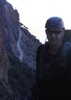
As the walls slowly grew higher and closed in on the river, we spotted a number of American dippers on boulders. No one else had ever seen one, so we spent quite a bit of time enjoying their quirky behavior. Even with 102 degree temps, the shade and water kept things pleasant, and silence fell over the group as we hiked through the first narrows section. The pool below the waterfall looked pretty low, so no one risked jumping, but we all made sure to get nice and wet anyway. :D

As usual, the flow level doubled where Deep Creek joined the main canyon. This is where the hiking starts to get more fun if you enjoy hiking in water - more flow, less visible and certain footing. Most of the campsites are after this confluence, and the two newbies were counting sites as they began to tire. A deer greeted us just before our campsite, and we saw him again the next day near Big Springs. We stayed at Site 9, which was nice. Far enough off the water not to be bothered by other hikers, and right up against a rock wall that echoed the sounds of the flowing water back at you. We relaxed with Yahtzee and a few adult beverages in camp.

We opted for the luxury of sleeping in the next morning. Most of our group had arrived at the campground quite late the night before starting, so we had only gotten something like 5 hours sleep beforehand. A late start was no problem, though, since we had ~6 miles for the day. This last section is the most scenic part of the hike with the longest continuous narrows, and we took our time enjoying it. The deepest unavoidable pool wasn't even waist-deep. Soon, however, we started to encounter the usual hoards of people near the mouth, and knew our trip was almost at an end. Odd to walk the last mile on pavement - I'll never get used to that.


We used a commercial shuttle service, and saving the 4 hours retrieving your vehicle at the end of the hike was worth it to me. However, the road to the trailhead was in the best shape I have ever seen it, and a car (driven slowly) could easily make it without damage.

The winner for Most Inappropriate Footwear easily went to two people hiking up the water in really fancy off-road motorcycle boots. :o But, what a way to ruin your expensive boots!

Funniest thing asked of us by a day hiker, hiking upriver in the narrows section:
"How much further until I see something interesting?" :doh:
 Named place
 Named place [ checklist ]
[ checklist ]  The Narrows
wildflower observationwildflower observationwildflower observationwildflower observationwildflower observation
Wildflowers Observation Isolated
Mimulus and columbine flowering at the springs and seeps provided a welcome bit of color. Also a few penstemon flowering along the road near the trailhead.
_____________________
"Let it ride / Let it roll / Let it go"
 
May 24 2014
avatar

 Routes 29
 Photos 1,548
 Triplogs 1,802

49 male
 Joined Jan 25 2009
 Phoenix, AZ
Zion NarrowsSouthwest, UT
Southwest, UT
Hiking avatar May 24 2014
Dave1Triplogs 1,802
Hiking2.00 Miles 200 AEG
Hiking2.00 Miles
200 ft AEG
 no routesno photosets
1st trip
Linked   none no linked trail guides
Partners none no partners
_____________________
 
Jul 03 2013
avatar

 Routes 34
 Photos 149
 Triplogs 131

40 male
 Joined May 04 2012
 Denver, CO
Zion NarrowsSouthwest, UT
Southwest, UT
Hiking avatar Jul 03 2013
DennyforrealTriplogs 131
Hiking8.00 Miles 750 AEG
Hiking8.00 Miles   4 Hrs      2.00 mph
750 ft AEG8 LBS Pack
 no routesno photosets
1st trip
Linked   none no linked trail guides
Partners none no partners
_____________________
 
Jun 26 2013
avatar

 Routes 1
 Photos 29,225
 Triplogs 1,447

45 female
 Joined Jan 18 2011
 In the Wild
Zion NarrowsSouthwest, UT
Southwest, UT
Canyoneering avatar Jun 26 2013
LucyanTriplogs 1,447
Canyoneering4.00 Miles 1,865 AEG
Canyoneering4.00 Miles   3 Hrs      1.33 mph
1,865 ft AEG
 no routes
1st trip
Linked   none no linked trail guides
Partners none no partners
_____________________
 
Jun 07 2013
avatar

 Guides 13
 Routes 38
 Photos 1,651
 Triplogs 577

60 male
 Joined Nov 15 2005
 Jackson, CA
Zion NarrowsSouthwest, UT
Southwest, UT
Canyoneering avatar Jun 07 2013
toddakTriplogs 577
Canyoneering16.00 Miles 1,865 AEG
Canyoneering16.00 Miles   10 Hrs      1.60 mph
1,865 ft AEG
Canyon Hiking - Non-technical; no rope; easy scrambling; occasional hand use
B - Up to light current; wading/swimming; possible wet/dry suit
III - Normally requires most of a day
 no routes
1st trip
Linked   none no linked trail guides
Partners none no partners
Phenomenal scenery top to bottom, not even the hordes of tourists near the end could diminish the grandeur. Nice water temp, flow was about 40 CFS, low for this time of year but very pleasant, made for easy crossings, only a few waist-deep wades. $30 for the commercial shuttle to the start.
 Named place
 Named place [ checklist ]
[ checklist ]  The Narrows
_____________________
 
Jun 07 2013
avatar

 Photos 377
 Triplogs 579

female
 Joined Jun 19 2009
 AZ
Zion Canyoneering Extravaganza, UT 
Zion Canyoneering Extravaganza, UT
 
Canyoneering avatar Jun 07 2013
oceanwithinTriplogs 579
Canyoneering18.65 Miles
Canyoneering18.65 Miles4 Days         
 no routesno photosets
1st trip
Linked   linked  
Partners none no partners
Six canyons with five companions in four days = one unforgettable adventure.


Day 1: Warming Up

- Hidden Star Canyon - 1.3 miles, 3/4B I. It was hotty mchothot out but the water was nice and cold. Got some practice boosting out of a keeper pothole using a foot-loop and a helping hand from the ledge above. Really cool, interesting little canyon and the geology of it was very worthwhile to see. Perfect way to break up the drive into Zion.

- Keyhole Canyon - .75 miles, 3B I. Another great little canyon with surprisingly sweet narrows and fun rappels. We moved through very fast but had a blast the whole time. Definitely needed the wetsuit on this one as some of the pools were COLD.

Day 2: Pure Enjoyment
- Mystery Canyon, 6 miles, 3B III. Since I won the permits ( :y: 
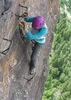
), it was decided that us girls would lead the boys through and do all of the rope work. I loved Mystery so much; it was so enjoyable with all the best parts about canyoneering wrapped into one canyon. The 2nd to last big rappel was unbelieveably beautiful, an enormous stone room with a lush spring at the bottom. The last rappel goes right into the virgin river and there were a TON of people hiking the narrows who stopped to cheer as we all made it down. Good times. :)


Day 3: The More the Merrier
-Spry Canyon - 3 miles, 3B III. Enjoyable day through this classic canyon, starting off with a long scramble up a steep slickrock section. The timing was perfect as we ran into a couple who ended up sticking their only rope and would have been stranded between rappels if we didn't happen to be right ahead of them when it happened. We gained two group members as they used our ropes and finished the canyon with us, then leading us to the sweet swimming hole at pine creek before going our separate ways. Glad it all turned out ok and they were able to make it out of there with us.


Day 4: Icing on the Cake
- Englestead Canyon/Orderville Canyon exit- 7.6 miles, 4B III. Englestead doesn't waste any time getting intense as it immediately starts off with a whopping 300' rappel into a deep, dark, sculpted cavern. The canyon keeps dropping, twisting and turning and then drops again after a long walk through perfectly-formed hallway. The hike out through Orderville was so worthwhile with the incredible narrow walls, water that appears out of nowhere and ever-changing geology. The day went by much too fast and before I knew it we were back on the virgin river, hiking towards the exit with 4 full days of canyoneering behind us.


What a trip. Zion is an immenstely beautiful and humbling place and I have an ever greater love for it after getting to see so many of its hidden gems this weekend. I am so appreciative of the amount of planning & logistics that went into this trip as everything went without a hitch, and I can't imagine doing it all with better people. The next trip there is already in the making... :D
_____________________
 
Oct 13 2012
avatar

 Routes 11
 Photos 260
 Triplogs 423

64 male
 Joined Mar 12 2011
 Cave Creek, AZ
Zion NarrowsSouthwest, UT
Southwest, UT
Canyoneering avatar Oct 13 2012
Hiking_FoolTriplogs 423
Canyoneering3.00 Miles 1,865 AEG
Canyoneering3.00 Miles
1,865 ft AEG
 no routesno photosets
1st trip
Linked   none no linked trail guides
Partners none no partners
I will have to go back and do this hike.
_____________________
 
Sep 01 2012
avatar

 Triplogs 100

40 male
 Joined Jan 03 2011
 chandler, Az
Zion NarrowsSouthwest, UT
Southwest, UT
Canyoneering avatar Sep 01 2012
DBmoonerTriplogs 100
Canyoneering6.00 Miles 400 AEG
Canyoneering6.00 Miles
400 ft AEG
 no routesno photosets
1st trip
Linked   none no linked trail guides
Partners none no partners
i was un able to get a last min. permet to do a top to bottom so i went and did angles landing .after i finish angels landing i decided to go meet up with my freind in the narrows as they finished up eaglestead hollow i went about 3 miles in befor i ran into them.
_____________________
 
average hiking speed 1.65 mph
1, 2  Next

WARNING! Hiking and outdoor related sports can be dangerous. Be responsible and prepare for the trip. Study the area you are entering and plan accordingly. Dress for the current and unexpected weather changes. Take plenty of water. Never go alone. Make an itinerary with your plan(s), route(s), destination(s) and expected return time. Give your itinerary to trusted family and/or friends.

helpcommentissue

end of page marker