username
X
password
register
for free!
help
ArticlesGuidesRoutes
 
Photosets
 
 Comments
triplogs   photosets   labels comments more
Bridal Veil Falls - Telluride - 5 members in 13 triplogs have rated this an average 4.4 ( 1 to 5 best )
13 triplogs
login for filter options
Aug 07 2025
avatar

 Routes 386
 Photos 49
 Triplogs 792

43 female
 Joined Jun 23 2015
 Phoenix, AZ
Bridal Veil Falls - TellurideWest, CO
West, CO
Hiking avatar Aug 07 2025
emilystardustTriplogs 792
Hiking3.32 Miles 839 AEG
Hiking3.32 Miles   1 Hour   36 Mns   2.08 mph
839 ft AEG
 
no photosets
1st trip
Linked   none no linked trail guides
Partners none no partners
Route Scout Route Recorded  on Route Scout | Pop | Map | Popup | MapDEX
_____________________
 
Jun 20 2025
avatar

 Guides 12
 Routes 192
 Photos 863
 Triplogs 356

42 male
 Joined Nov 30 2015
 Phoenix, AZ
Marshall Creek loop, CO 
Marshall Creek loop, CO
 
Run/Jog avatar Jun 20 2025
ShatteredArmTriplogs 356
Run/Jog9.00 Miles 2,464 AEG
Run/Jog9.00 Miles   3 Hrs   14 Mns   36 Secs2.93 mph
2,464 ft AEG      10 Mns Break
 no routesno photosets
1st trip
Partners none no partners
First big activity while in town for the Bluegrass Festival. Started from the hotel and made our way up the river trail to the east end of town, then followed the gravel path and road up to the bottom of Bridal Veil Falls trail. I've run up and down the road a few times to the top of the falls and beyond, but for some reason never did the trail. Lots of people around, and I heard later that they'd had to do multiple rescues over the course of the weekend.

Decided to run down the road, and figured we had the time for a little detour so we headed up Marshall Creek trail. The first half mile or so is pretty well maintained since it's the exit for the Via Ferrata, but after we passed the end of the VF, it turned into very steep Jeep road and then a crossing of Marshall Creek at an old mine site that required getting the feet wet.

The stretch on the north side of the creek is a bit rough; it more or less follows an old road grade, but it's washed out in a couple parts, one of which required hands-and-knees scrambling up scree. At the very top of the switchbacks, things got much easier, with about a half mile of level, shady road to Imogene Pass road.

The run down Imogene Pass road was nice, as the road is closed for the summer due to road damage (we got to pass through the area in question, it would definitely be sketchy getting a vehicle through there). Didn't quite make it back to town in time to catch the start of the Mountain Grass Unit set, but we saw most of it.

Marshall Creek trail was interesting enough, but I don't think I'd do it again, even if it might be the only way to do a loop around town without a substantial amount of road.
_____________________
 
Jul 20 2023
avatar

 Guides 2
 Routes 25
 Photos 1,890
 Triplogs 604

41 male
 Joined Sep 13 2009
 Mesa, AZ
Bridal Veil Falls - TellurideWest, CO
West, CO
Hiking avatar Jul 20 2023
jochalTriplogs 604
Hiking2.00 Miles 840 AEG
Hiking2.00 Miles
840 ft AEG
 no routesno photosets
1st trip
Linked   none no linked trail guides
Partners none no partners
Got to the falls right after the sun first peeked out over the mountains, the light in the mist was something.
_____________________
 
Aug 21 2021
avatar

 Routes 175
 Photos 2,335
 Triplogs 191

44 female
 Joined Jan 21 2019
 Pine, AZ
Bridal Veil Falls - TellurideWest, CO
West, CO
Hiking avatar Aug 21 2021
jillyonanadventureTriplogs 191
Hiking4.11 Miles 907 AEG
Hiking4.11 Miles   2 Hrs   56 Mns   1.45 mph
907 ft AEG      6 Mns Break
 
1st trip
Linked   none no linked trail guides
Partners partners
Bsolaz
klfranz
Route Scout Route Recorded  on Route Scout | Pop | Map | Popup | MapDEX
After a morning of chasing a lesser known waterfall, we headed off to a more well known place for our afternoon destination. Upon arrival at the trailhead for Bridal Veil Falls, it was crowded and it had started raining pretty hard. (Zero rain in the forecast, gotta love the mountains!) We waited it out for a parking space, then for it to clear up a bit before starting.

Right from the start it’s uphill and it does not stop. I was already out of breath given the thin air on the first section of the trail. Kristin in our group started chatting with a soaked hiker coming down, who informed us that you can drive right up to the main falls with a high clearance vehicle. This awesome hiker also let us know that there was a pretty sweet waterfall that was only about a 1/2 mile from our current location. The skies still looked questionable, and I really despise crowds, so I strongly considered bailing to drive to the top. However, the allure of the mystery bonus waterfall kept me hiking up.

There are about 4 “bonus” waterfalls on the way up to the main event. The trail signs are extremely clear as to when you should exit the trail to get to viewpoints of each of the falls. I’m not going to lie, I’m not in the best shape right now so all that steep, rocky, muddy uphill in the high altitude was totally kicking my butt. :sweat: However, with each bonus waterfall we saw, it gave me a little rejuvenation and made me keep going.

The main event waterfall was beautiful of course, but I preferred the bonus falls throughout the hike even more. We hiked the road back down which created a perfect loop and provided additional Mountain View’s. It felt great to accomplish the hike the “hard” way instead of just driving to the top like many others do. I’m glad I saw this one, but I wouldn’t return. I just prefer more solitude on my hikes!
 Named place
 Named place [ checklist ]
[ checklist ]  Bridal Veil Falls  Ingram Falls
_____________________
Restless between adventures...
 
May 17 2021
avatar

 Guides 116
 Routes 337
 Photos 11,399
 Triplogs 894

63 male
 Joined Dec 20 2010
 Sunnyslope, PHX
Bridal Veil Falls - TellurideWest, CO
West, CO
Hiking avatar May 17 2021
kingsnakeTriplogs 894
Hiking5.68 Miles 1,070 AEG
Hiking5.68 Miles   2 Hrs   19 Mns   2.45 mph
1,070 ft AEG
 
1st trip
Linked   none no linked trail guides
Partners none no partners
After driving nearly 500 miles up from Phoenix, my wife and I were spent the week in Mountain Village, the ski resort above the city of Telluride. As with most of our other trips, I wanted to get a hike in while I was there.

When my wife and I arrived at the east end of Telluride, a San Miguel County road crew had the road blocked off for yearly maintenance, so we parked on the road, west of Pandora Mill. At 9:00 a.m., on a off-season Thursday, there were four other vehicles there.

My plan was to hike Bridal Veil Trail at least as far as in the Ingram Creek crossing and, if safe, all the way to Bridal Veil Falls. If Ingram Creek was too dangerous to cross, I would double back to the trailhead, then hike up Black Bear Pass Rd.

The first 100 yds. of Bridal Veil Trail stay close to Black Bear Pass Rd. before turning south towards Ingram Creek. Mind your footing with roots and stepping between rocks. Ingram Creek is in ⅓ of a mile. Crossing it was no problem at all. “Hazardous stream crossing” is way over blown. (Unless there is a flash flood.)

The vegetation is a mixture of fir trees, aspen and small evergreen shrubbery. I saw two species of flowers, but neglected to photograph them. While laying on the ground, a pair of hikers stopped to ask me if I was okay. “Yeah, just taking pictures of these tiny molds.” “Cool!” But it was nice of them to check. 👍

300 yds. past Ingram Creek, there is a 30 ft. waterfall. (Marked as Side Falls #1 on my GPS route.) The temperature drop in the waterfall’s vicinity was noticeable. Speaking of temperature, I had been worried that I was under-dressed with only a hoodie, as it was quite chilly when I started. But other than the waterfalls’ microclimate, it warmed up enough to be a pleasant late morning hike.

300 yds. past the first side waterfall, was a second, slightly taller and less vertical waterfall. Both are on Bridal Veil Creek. Just beyond Side Falls #2, is the signed junction of Ingram Spur Trail. The sign marks the ¾ mile point of Bridal Veil Trail. I stayed right on Bridal Veil Trail. ↗️

… Which I soon lost in a snow bank. Bridal Veil Falls is visible from much of the Bridal Veil Trail, and the way up the drainage was fairly obvious, but I wanted to lay down an accurate track, so instead of bushwhacking, I doubled back to the sign., following Ingram Spur Trail along a contour to Black Bear Pass Rd.

I got a kick out of finding a snowman on Black Bear Pass Rd. ⛄️

At the bottom of Bridal Veil Falls, I found the top of Bridal Veil Trail, so I doubled back to where I lost it — I recognized a crushed bush — then headed back up to the falls, laying down an accurate final ¼ mile of GPS route.

I spent about 20 minutes at the base of Bridal Veil Falls. There’s a lot of mist, so I tried to time the swirls to get a relatively clear shot. By the time I was done, I figured it was enough for the day, so I skipped hiking four more Black Bear Pass Rd. switchbacks to the top of the the falls. (Just under 500 ft. and another mile.)

On the way back down Black Bear Pass Rd., there was a steady trickle of people heading up. There were a ton more cars parked near the Pandora Mill. I imagine it would be a zoo on the weekends!

Hike Video: https://vimeo.com/555442675
wildflower observationwildflower observationwildflower observationwildflower observationwildflower observation
Wildflowers Observation Isolated
Two species I don't remember on Bridal Veil Trail. Fair amount of dandelions on Black Bear Pass Rd.

water 1 out of 5water 2 out of 5water 3 out of 5water 4 out of 5 Bridal Veil Creek Heavy flow Heavy flow
The top of the mountains still had snow, but only spot snow lower down. So, I imagine flow was near peak with spring melt.

water 1 out of 5water 2 out of 5water 3 out of 5water less than max Ingram Creek Medium flow Medium flow
_____________________
http://prestonm.com : Everyone's enjoyment of the outdoors is different and should be equally honored.
 
Jul 21 2018
avatar

 Routes 297
 Photos 6,928
 Triplogs 552

49 male
 Joined Dec 30 2007
 Avondale,Az
Bridal Veil Falls - TellurideWest, CO
West, CO
Hiking avatar Jul 21 2018
StoicTriplogs 552
Hiking2.60 Miles 715 AEG
Hiking2.60 Miles      95 Mns   1.84 mph
715 ft AEG      10 Mns Break
 
1st trip
Linked   none no linked trail guides
Partners none no partners
The weather started to turn, so we didn't make it to the end of the trail. We ended up hiking back down, and I drove back up with the truck.
_____________________
 
Jul 10 2016
avatar

 Photos 418
 Triplogs 169

female
 Joined Jul 22 2016
 Sedona, AZ
Bridal Veil Falls - TellurideWest, CO
West, CO
Hiking avatar Jul 10 2016
xthineTriplogs 169
Hiking2.67 Miles 717 AEG
Hiking2.67 Miles      54 Mns   2.97 mph
717 ft AEG
 no routesno photosets
Linked   none no linked trail guides
Partners none no partners
Decided to visit the falls before driving out of Telluride. Hiked up only to the base this time.
_____________________
 
Jul 02 2016
avatar

 Photos 418
 Triplogs 169

female
 Joined Jul 22 2016
 Sedona, AZ
Bridal Veil Falls - TellurideWest, CO
West, CO
Hiking avatar Jul 02 2016
xthineTriplogs 169
Hiking5.53 Miles 1,917 AEG
Hiking5.53 Miles   2 Hrs   1 Min   2.74 mph
1,917 ft AEG
 no routesno photosets
Linked   none no linked trail guides
Partners none no partners
Hiked all the way to the top of the falls. It was my first time in Colorado and what a trip it was!
There were not other cars at the trailhead, we parked at the bottom (sedan) but jeeps can make it all the way top of the falls (then jeep traffic is one way). It's a climb all the way to the top, switchbacks took the wind out of me. :scared: It was a little bit drizzly in the morning,they called for more rain that day.
Spectacular views of Telluride at the top of the falls, met one other hiker who said that there are more trails beyond that point. I would say this is a must do if you're in Telluride. (also grab some cookies at Baked in Telluride after). :y:
_____________________
 
Jun 01 2014
avatar

 Guides 7
 Routes 72
 Photos 14,456
 Triplogs 627

62 female
 Joined Aug 19 2011
 Scottsdale, AZ
Bridal Veil Falls - TellurideWest, CO
West, CO
Hiking avatar Jun 01 2014
outdoor_loverTriplogs 627
Hiking2.80 Miles 890 AEG
Hiking2.80 Miles
890 ft AEG
 no routes
1st trip
Linked   none no linked trail guides
Partners none no partners
This Hike was on my Agenda from the Beginning...Not just because I love Water and Waterfalls, but also because I heard that there may be Mountain Goats up there.... :D I found it hard to believe that only 3 HAZers have done this Hike...Well, ok, maybe only one of them has actually HIKED it... :sweat:

I got there around 2:30 P.M. after dinking around Camp and in Telluride for awhile. I knew I would like the Afternoon Light better anyway... :) I pretty much decided that I wasn't going to Drive the Road, as 1. It is Posted as a 4x4 so I didn't know what kind of Conditions to expect. 2. It was Late Spring with lots and lots of Water coming off the Mountains. 3. I need the Exercise anyway and even though it's Road Hiking, it's still a nice Jaunt with Stellar Views! My Decision not to try it with the Escape was an excellent Choice for ALL 3 Reasons! :sweat: I parked at the "Official" TH/Overlook Area next to some weird Green Pools that probably had something to do with the Mine. As I headed on up, I was glad right away I didn't drive it. The first 1/4 or so Mile was the Steepest and it was paved with Loose Rock...Even if I had managed to get a Bite with non-Optimal Street Tires, I would have been afraid that I would have thrown a Rock and punctured something underneath...And then you have a Creek running over the Road...It was a little interesting crossing on Foot as the Stepping Stone Rocks were pretty much under Water and the Creek was wider than the Stones were long...I finally just opted to get one Foot Wet and made it across...It was about Ankle Deep at that Point...After that stretch though, the Road was pretty good, and a few people drove up it. I do know of a couple of Guys that would regret that Decision later... :o

Bridal Veil Falls may have been the Main Event, but there were Waterfalls coming off the Cliffs everywhere and the Creeks/Rivers were literally raging down the Slopes...It was supposed to be in the 70's for a few days and you could tell the Snow Melt was ON! The Camera worked Overtime on this one, but I know none of you will be surprised. :sweat:

I had considered going farther than just to the Top of the Falls...there was another Set of Falls further up the Road, and I also considered going up the Trail further, to possibly Silver or Blue Lakes, but the Environment became a Factor...I ran into a Fisherman who was on his way down and he stated that he couldn't even make it to Silver Lake before he was Postholing through the Snow...So that was out...I got to the Switchback where the Gate was located by the Top of the Falls and the House, and realized that I wouldn't be going up any further on the Road either...Not without Crampons, an Ice Axe, Poles and Gators! I sat down and took a break and when I did, two Hikers WITH Crampons, Ice Axes, Poles and Gators showed up on the Road above me...It was interesting watching them come down that last, large Drift to where I was... :sweat: Apparently, they had started very very early and had Summited Ajax Peak which towered in the Distance over us...There was still a lot of Snow up there... :sweat: Even one of them stated that although they made the Peak, "it wasn't quite ready yet, and it was a long day" :sweat:

After my Break, I went through the Gate and checked out the House and the Top of the Falls...I decided not to continue any further as I had to Hike through some Slush just in the short Distance from the Gate to the House and I knew it would only get worse further up...So I turned around at that Point. As I Hiked down, I made a little Side Trip to check out a Mine that was up there and upon returning to the Road, there was a Truck Parked there with some Climbers getting ready to go...It's about 5:00 now and I've noticed that the Water Levels in the Creeks coming off the Mountains was rising some and more Waterfalls were magically appearing...The Climbers were getting ready to do The Telluride Via Ferrata...You're not Climbing Up...You're Clipped to a Cable and you're Traversing a Ledge that at times is no wider than one of your Feet... :sweat: I asked them how they Traversed through the Waterfalls that were presently pouring off up there, and they stated that "you just find a way"... :o I will tag their Route for you on one of my Photos...It's pretty Interesting... :sweat:

I continued on down, and when I got to the Creek Crossing again, the Water was now up to over the Knees. Double glad that I didn't drive my Vehicle, did I say that already??? And I would be triple glad before I was done...:sweat: In the time that I was up there, someone had brought a Plank and rigged the Crossing so you could walk across a tad bit upstream... Apparently, that was not all that was done since I had gone up... :o I get a little further down and start finding Rocks in the Road that weren't there when I went up and then a giant Excavated Hole with a Water Line at the bottom that looked to be newly Repaired. They had actually constructed a little Trail through the Trench, so you had to go in the Trench and out the other side to continue. And then, not only were there Rocks on the Road, there were Boulders...and to top it off, there was also a small River running down the Road...None of this was here when I went up...Mother Nature had been very busy in the last few hours... :sweat: I felt bad for the Climbers...They were not going to get their Truck back down on this Day, the Road was now impassable by Vehicle... ;)

Got back down to my Vehicle and headed on out. Although I had hoped for some Mountain Goats up there, there were none to be found, but I enjoyed another Photoshoot with some Elk again as I left Town...Probably the same Herd as the day before, just in a different Meadow... :)

Great little Hike! I could do this one every time I'm there! The Scenery is just gorgeous and there are some pretty cool Destinations beyond the Falls that I would really like to see as well...I would definitely recommend this one if you haven't done it!

Just a Post Note...before you hit the Base of the Falls, there looked to be a Platform with Steps that you could go up, but it was Barricaded Off with a No Entry Sign...Not sure if this is something Seasonal or if that probable Viewing Platform is Closed Permanently....
 Fauna
 Fauna [ checklist ]
[ checklist ]  Elk
 Geology
 Geology [ checklist ]
[ checklist ]  Mud
 Named place
 Named place [ checklist ]
[ checklist ]  Bridal Veil Falls
wildflower observationwildflower observationwildflower observationwildflower observationwildflower observation
Wildflowers Observation Isolated

water 1 out of 5water 2 out of 5water 3 out of 5water 4 out of 5 Bridal Veil Creek Heavy flow Heavy flow

water 1 out of 5water 2 out of 5water 3 out of 5water 4 out of 5 Bridal Veil Falls Heavy flow Heavy flow

water 1 out of 5water 2 out of 5water 3 out of 5water 4 out of 5 Ingram Creek Heavy flow Heavy flow

water 1 out of 5water 2 out of 5water 3 out of 5water 4 out of 5 Ingram Falls Heavy flow Heavy flow
_____________________
Life is not a journey to the grave with the intention of arriving safely in a pretty & well preserved body, but rather to skid in broadside, totally worn out & proclaiming, "Wow What a Ride!"
 
Sep 29 2012
avatar

 Guides 71
 Routes 98
 Photos 9,967
 Triplogs 1,009

65 male
 Joined May 14 2003
 Ahwatukee, AZ
Colorado Fall Colours 2012, CO 
Colorado Fall Colours 2012, CO
 
Backpack avatar Sep 29 2012
Randal_SchulhauserTriplogs 1,009
Backpack15.00 Miles 1,500 AEG
Backpack15.00 Miles5 Days         
1,500 ft AEG
 no routes
Colorado Fall Colours 2012

I'm in the habit of booking a quarterly "wilderness adventure" months in advance so I can work my schedule around the dates. After having my first Colorado Adventure into the San Juan Mountains this past summer (check out :next: [ photoset ] ), I snapped up the offer from one of my Phoenix Coyotes' season ticket partners to use his Colorado Cottage during the height of fall colours. With a 5-day weekend booked the end of September/beginning of October, I began researching primo fall colour photo ops weeks in advance (check out :next: [ Colorado Fall Colours 2012 (San Juan Mountains) ] ) narrowing down to 5 selected shots from various pro's and trying to figure out the exact location they captured their image.

Image #1 "Highway and Farm near Telluride" by Shane McDermott. Thanks to a tip from the photographer, I was able to confirm the location on Airport Road (aka Last Dollar Road) near Telluride and enter GPS coordinates into Google Maps (N 37.952726, W -107.877846). My "interpretation" certainly doesn't do Shane McDermott's wonderful image any justice, but I had fun doing the detective work trying to figure out the location (thanks also to Jake for the Google Maps tip!).

Image #2 "Hay Rolls near Sneffels Range" by Derek von Briesen (check out :next: https://www.pbase.com/sedonamemories/image/139539899 ). Thanks to a tip from HippyPunkPirate (aka Jake) and others, it turns out that this is an iconic view taken from the Double R L Ranch along Highway 62 near Ridgway. It took a Colorado resident to clue me in that Double R L Ranch, as in Ralph R. Lauren's ranch, is known to everyone in the Ridgeway/Telluride area. Take County Road 9 off of Highway 62 and spot the field near GPS coordinates I entered into Google Maps (N 38.118892, W -107.829008). My "interpretation" certainly doesn't do Derek von Brieson's stellar image any justice, but once again I had fun doing the detective work trying to figure out the location (thanks Jake for the Google tip - Google RRL Ranch images and see what you get...).

Image #3 "Aspen Stand and Fence near Sneffels Range" by Jason Hatfield. Hats off to Jason and his most informative eBook "A Photographer's Guide to Colorado's Fall Colors - the Best Locations & How to Photograph Them", 14 locations are in the San Juan Mountains! Take County Road 7 off of Highway 62 and spot the open field near GPS coordinates I entered into Google Maps (N 38deg 2' 58.42", W 107deg 48' 31.01"). My "interpretation" certainly doesn't do Jason Hatfield's awesome image any justice, but once again I had fun doing the detective work trying to figure out the location (thanks Jason for sharing your inside information - highly recommend if you are heading into the San Juan's to pick up Jason's bargain priced eBook.

Image #4 "Dallas Divide in the Sneffels Range" by Darren Kilgore. I found the "Dallas Divide" on the map and noted a Scenic View turnout along Highway 62 between Telluride and Ridgway. Taking a leap of faith, I entered GPS coordinates into Google Maps (N 37.952726, W -107.877846) and hoped for the best. Although my "interpretation" certainly doesn't do Darren Kilgore's splendid image any justice, I had fun exchanging thoughts with about 20 other photographers jamming the turnout along Highway 62 trying to capture an image in the waning afternoon light.

Image #5 "Wilson Mesa Property for Sale - $12,995,000" by unknown realtor (advertisement had photo of San Miguel Mountains reflecting off lake surrounded by flaming yellow aspens - unfortunately no internet link). Armed only with a real estate ad from a Telluride Homes magazine I picked up at a Telluride gas station during my July 2012 visit, I looked for various clues in the photo and the map and could only conclude that this had to be Woods Lake on Wilson Mesa. Taking another leap of faith, I entered GPS coordinates into Google Maps (N 37.952726, W -107.877846) and marked a route along Fall Creek Road that seemed to connect to Woods Lake. Although my "interpretation" doesn't justify the real estate asking price, I had fun meeting a photographer from Maryland (sorry, forgot your name!) also trying to capture the perfect reflection off the lake.

DAY #1 - Saturday 9/29 After a Friday airplane commute to and from our Diabetes division in Northridge CA, I headed on the road early Saturday to start a 5-day weekend with Lynn and the dogs at the Danzl Cottage along the Dolores River between Dolores CO and Telluride CO. Lynn packed everything we needed except some choice Colorado brews. Stopping at the Dolores Liquor Store, I picked up a 6-pack of Dark Lager by Durango Brewing Company (Durango CO) and 90 Shilling Ale by O'Dell Brewing Company (Fort Collins CO). I thought it was strange that none of the Dolores Brewery or Telluride Brewery beers were available here. Arriving at the Danzl Cottage with about an hour of daylight, I got the well pump primed and the hot water tank filled (while evacuating all the airlocks) and the electric heats plugged in and fired-up (low of 29degF forecast for tonight). With the cottage up and running, time to focus on tonight's BBQ dinner - burgs and dogs...
DAY #2 - Sunday 9/30 After rustling up breakfast of maple sausages and eggs on the BBQ, we loaded up the F-150 and headed along Hwy 145 and the Dolores River Valley towards Telluride. There were multiple stops along the way taking in the riot of colour. Hard to judge if we missed the peak, some trees were bare, some were still green, others where ablaze in yellows and golds. Arriving in Telluride, we headed up Airport Road to find "Image #1" location to re-create Shane McDermott's "Highway and Farm near Telluride". As we rounded the first bend to the north, it was found! Near the Telluride Airport, the road becomes Last Dollar Road (IMO - a fall colour "must" route). We found a roadside clearing onto a bench outcrop that made for a perfect lunch location - mountain views, fall colours, perfect temperatures! After a Tibber-mode flurry of photo stops, we popped out onto Hwy 62 and headed east towards County Road #9 and the Double RL Ranch. Hay rolling was in progress, but not in the field captured by Derek von Briesen in "Image #2". I did find another field with the hay rolls in situ to create my own composition. Next on the list was County Road #7 to recreate "Image #3" by Jason Hatfield. CO#7 has a number of choice locations noted in Jason Hatfield's eBook and I think I found them all. With the sun beginning to set, we left CO#7 and headed back to Telluride (also discovering the Dallas Divide scenic viewpoint on Hwy 62 and recreating "Image #4"). With an alpenglow on the peaks, had enough light to show Lynn Bridal Veil Falls and downtown Telluride. It must have been 10pm when we got back to the Danzl Cottage and fired up the BBQ for our evening meal in the glow of the full moon. There was a strange banshee screaming at the moon - a bobcat in heat?
Hike of the Day :next: Dolores River Trail (actually an abandoned bridge and section of old Hwy 145 near Rico CO) ~5 miles.
DAY #3 - Monday 10/1 Perfect weather in the forecast again as we headed to Durango and up the Million Dollar Highway to Silverton. Animas Forks Ghost Town was the objective of the day - thwarted by a misplaced boulder hitting my skid plate and damaging an airflow/sound barrier plate. Unable to do a field repair, we heading back to Silverton to the lone garage mechanic for miles around. We removed the off-road customized airflow/sound barrier plate and were on our way. Adjusting our plans, we headed north on Hwy 555 towards Mineral Creek and Kendal Camp Ground for lunch. Next up, the Red Mountain Mining Area followed by Ouray, Ridgeway, and another stop at the Dallas Divide (another "Image #4" recreation attempt). Our adjusted plans allowed us to tour Fall Creek Road and the Wilson Mesa area in search of Woods Lake. To my great surprise, there was ample signage to Woods Lake where I made numerous attempts at recreating "Image #5". With all 5 of my "pre-work" images now in the bag (or on the FLASH card), it was time to drive back to Danzl Cottage and a choice steak waiting to be BBQ'd...
Hike of the Day :next: Woods Lake Campground Trail ~5 miles.
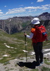
DAY #4 - Tuesday 10/2 Today's agenda includes CR38/Township Route 535 (aka Dunton Road - IMO another Fall colour "must" route) and the Lizard Head Wilderness area. With multiple photo ops along the route, we decided to take a lunch break on top of Stoner Mesa via CR-M/FR875 (aka Stoner Mesa Road). I found a meadow/camp area on the top of Stoner Mesa surrounded by aspen stands on every side where we broke out the tailgating chairs and had lunch. IMO - Stoner Mesa Road had the BEST Fall colours of any route we had been on during our 5-day weekend. We had time to hike a few miles towards Navajo Lake from the Kilpacker TH and The Meadows. Great views of the San Miguel Mountains and the Lizard Head Wilderness area!
Hike of the Day :next: Kilpacker Trail ~5 miles (intersects with Navajo Lake Trail [ Navajo Lake Trail #635 ] ). Check out :next: https://4cornershikestell.blogspot.com/ ... trail.html
DAY #5 - Wednesday 10/3 Getaway Day - back home to the Valley heat in Ahwatukee. Quite the contrast being treated to 5 days of 72degF Hi and 29degF Lo in the Colorado San Juan Mountains...
MUCHO GRACIAS to the Danzl Family for the use of their Colorado Cottage on the Dolores River
Many elk, deer, mountain goats, beaver, and bald eagles
No TV, internet, or cell phone reception
1 tank of gas from Phoenix to Colorado
5-days in the San Juan Mountains
420 images on 2 cameras
Spectacular fall colours
Perfect weather
Priceless!
 Fauna
 Fauna [ checklist ]
[ checklist ]  Beaver  Elk
foliage observationfoliage observationfoliage observationfoliage observationfoliage observation
Autumn Foliage Observation Extreme
_____________________
 
Aug 15 2012
avatar

 Guides 44
 Routes 162
 Photos 24,766
 Triplogs 2,411

75 male
 Joined May 04 2004
 Mesa, AZ
Bridal Veil Falls - TellurideWest, CO
West, CO
4x4 Trip avatar Aug 15 2012
CannondaleKidTriplogs 2,411
4x4 Trip9.10 Miles 940 AEG
4x4 Trip9.10 Miles      50 Mns   13.65 mph
940 ft AEG
 no routes
1st trip
Linked   none no linked trail guides
Partners partners
trixiec
Due to the slow going through Telluride we decided to skip the hike and just drive up to Bridal Veil Falls for some photos. Afterward we high-tailed it back to our rented cabin outside of Ridgway for a relaxing evening.

Only 9 photos so I posted all on HAZ as well as my web site here:
http://changephoenix.com/jpserver/web/public/album.php?id=200
 Named place
 Named place [ checklist ]
[ checklist ]  Bridal Veil Falls
_____________________
CannondaleKid
 
Jul 26 2012
avatar

 Guides 71
 Routes 98
 Photos 9,967
 Triplogs 1,009

65 male
 Joined May 14 2003
 Ahwatukee, AZ
Colorado Tales 2012, CO 
Colorado Tales 2012, CO
 
Backpack avatar Jul 26 2012
Randal_SchulhauserTriplogs 1,009
Backpack25.00 Miles 2,000 AEG
Backpack25.00 Miles5 Days         
2,000 ft AEG
 no routes
1st trip
Colorado Tales 2012

5 days
1296 miles
65 gallons of gasoline
379 digital images
1 relatively trouble-free drive
Clean, crisp mountain air
Vintage railways
Ghost towns
Choice eats and beverages (Colorado microbreweries!)
No work distractions
Priceless!

The Plan => Thursday 7/26 rendezvous at the Danzl residence in Sedona AZ, truck pool, and hit the road to the Danzl Colorado Cottage along the Dolores River between Dolores CO and Stoner CO in the San Juan Mountains.

My 2012 quarterly wilderness adventures have been limited to "Anza Borrego California Tales 2012" (check out => [ photoset ] ) and "Oregon Tales 2012" (check out => [ photoset ] ), so with X consecutive days of 100degF Valley weather, a trek to the high country seemed in order. The Colorado Rockies would certainly satisfy that requirement, so my Coyotes' season ticket co-holder, Ralph Danzl suggested his Colorado Cottage as a base camp to escape the heat. With no definitive plans, other than our base camp, we hit the road and ended up at the following destinations;

A. Ahwatukee AZ - ground zero, home
B. Sedona AZ - rendezvous at Danzl's Bell Rock Blvd. residence
C. Kayenta AZ - stop at the local Burger King
D. Monument Valley AZ/UT - first visit for the Danzl's (check out => [ Monument Valley ] and https://www.americansouthwest.net/utah/ ... e-map.html )
E. Bluff UT - stop for gas
F. Hovenweep Ruins UT - also "Canyon of the Ancients" including Painted Hand and Lowry Pueblo (check out => [ Hovenweep Hikes ] )
G. Dolores CO - base camp at Danzl Colorado Cottage off Hwy 145 on Road 37 (CR36 on map)
H. Ophir Pass CO - off-roading with side treks to Crystal Lake and Lookout Peak (check out => https://www.narrowgauge.org/4x4/html/ophir.html )
I. Silverton CO - Silverton Brewery for eats (check out => https://www.silvertonbrewing.com )
J. Animas Forks CO - off-roading to ghost town (check out => https://www.coloradopast.com/index.php? ... as%20Forks and https://www.narrowgauge.org/4x4/html/sil_af.html )
K. Durango CO - a drive on the "Million Dollar Highway" (check out => https://www.rmpbs.org/byways/sjs_map.html )
L. Dolores CO - Dolores River Brewery for eats (check out => https://www.doloresriverbrewery.com/ ) and base camp at Danzl Colorado Cottage
M. Dunton CO - along FR535 and West Dolores River valley trekking to Lizard Head Wilderness (check out => https://www.visittelluride.com/things-t ... wilderness )
N. Telluride CO - Smuggler Joe's MicroBrew for eats (check out => https://www.smugglerjoestelluride.com/o ... mmary.aspx and https://coloradobeer.org/brewers )
O. Rico CO - ghost town (check out => https://www.ghosttowns.com/states/co/rico.html )
P. Taylor Mesa CO - wildlife spotting along FR545
Q. Dolores CO - supplies and Galloping Goose Museum (check out => https://www.gallopinggoose5.com/ ) plus base camp at Danzl Colorado Cottage
R. Mesa Verde CO - for future reference (check out => [ Mesa Verde National Park Trails ] )
S. Tuba City AZ - pit stop on the road home
T. Sedona AZ - collect my wheels at the Danzl residence
U. Ahwatukee AZ - home again...

DAY 1 - Thursday 7/26
Ahwatukee AZ to Sedona AZ
129 miles
2 hrs 19 min 1-way per Google Maps

Rendezvous at the Danzl residence off Bell Rock Blvd and hit the road early morning for the Colorado mountains....

DAY 2 - Friday 7/27
Sedona AZ to Dolores CO via Monument Valley and Hovenweep Ruins
341 miles
7 hrs 17 min per Google Maps

On the road to Danzl's Colorado Cottage along the Dolores River between Dolores CO and Stoner CO with stops at Monument Valley and Hovenweep Ruins. Exited Monument Valley just as a deluge hit. With a side trip into uncharted territory (that would be Hovenweep UT, check out => https://www.nps.gov/hove/index.htm ), we discover "Canyon of the Ancients" and signage for some vaguely familiar ruins (Cutthroat Castle, Painted Hand Pueblo, Lowry Pueblo, etc). I'm filing this for a future trek (check out => https://www.nps.gov/hove/planyourvisit/ ... rMap-2.pdf and https://www.blm.gov/co/st/en/nm/canm.html ). Our plans to pick up supplies in Dolores CO are thwarted by the time zone change as we arrive into town at 8pm local time only to discover all the grocery stores closed! Good thing we have some ground beef in the cooler and we're able to pick-up some buns at the local gas station. We arrive at the Danzl Cottage in a light rain. Ralph gets the water turned on while Brian and I get the old-school BBQ fired up with briquettes and mesquite chips. Burgs and beverages to put a bookend on the day...

DAY 3 - Saturday 7/28
Dolores CO to Ophir Pass to Animas Forks and Durango CO return
188 miles
5 hrs 21 min per Google Maps

Into the really high country with side treks to Crystal Lake and Lookout Peak near the crest of Ophir Pass. On to Silverton where we caught the narrow gauge railroad (check out => https://www.durangotrain.com/ ) waiting to take on passengers. 4WD trekking up to Animas Forks checking out all the mining relics and ghost towns along the way. I regret not climbing up to higher vantage to snap an image of the entire Animas Forks ghost town complex - next time! Refreshments at the Silverton Brewery and off along the Million Dollar Highway to Durango CO. In Durango, we pick up steaks, fresh picked corn-on-the-cob, mushrooms, onions, etc. for an evening feast back at Danzl Cottage. Interesting light show back at the cottage as a summer monsoon rumbles through the Dolores Valley...

DAY 4 - Sunday 7/29
Dolores CO to Lizard Head Wilderness to Telluride CO to Taylor Mesa return
153 miles
4 hrs 53 min per Google Maps

More high country trekking checking out beaver dams along FR535 and the West Dolores River plus a leg stretcher into the Lizard Head Wilderness. Refreshments at Telluride Brewing Company and Smuggler Joes' Brew Pub in Telluride. Up to the Bridal Falls overlook and on the road towards Rico ghost town and primo wildlife spotting on Taylor Mesa. Plenty of elk and deer spotted. No bears - disappointment since Ralph indicated he's seen bear here every time he's visited. Back at Danzl Cottage for another summer monsoon light show and time to fire up the BBQ for some choice tube steaks...

DAY 5 - Monday 7/30
Dolores CO to Mesa Verde CO to Tuba City AZ to Sedona AZ to Ahwatukee AZ
461 miles
8 hrs, 21 min per Google Maps

A chance to check out the Galloping Goose and Dolores River Brewing Company before hitting road for home. Conversation along the road included setting a time for a return visit with fall colours being the choice excuse. Maybe a last week in September, first week in October future trek (check out => https://www.narrowgauge.org/4x4/html/autumn.html ) may be in the cards...

And that's my Colorado Tale 2012!
 Culture
 Culture [ checklist ]
[ checklist ]  Steam Locomotive
wildflower observationwildflower observationwildflower observationwildflower observationwildflower observation
Wildflowers Observation Moderate
_____________________
 
Aug 15 2011
avatar

 Routes 69
 Photos 3,135
 Triplogs 1,853

72 male
 Joined Jul 24 2009
 Mesa, AZ
Bridal Veil Falls - TellurideWest, CO
West, CO
Hiking avatar Aug 15 2011
trailzrusTriplogs 1,853
Hiking2.80 Miles
Hiking2.80 Miles
 
1st trip
Linked   none no linked trail guides
Partners none no partners
Great hike to beautiful falls. There is parking at the trailhead. Start of trail is located at the east end of Hwy 145 where the asphalt ends. Hikers continue to walk up the dirt road that is very rocky about 1.4 miles to the bottom of the falls. Bridal Veil Falls drops 365 feet and is the tallest free-falling waterfall in Colorado.
 Named place
 Named place [ checklist ]
[ checklist ]  Bridal Veil Falls
_____________________
 
average hiking speed 2.35 mph

WARNING! Hiking and outdoor related sports can be dangerous. Be responsible and prepare for the trip. Study the area you are entering and plan accordingly. Dress for the current and unexpected weather changes. Take plenty of water. Never go alone. Make an itinerary with your plan(s), route(s), destination(s) and expected return time. Give your itinerary to trusted family and/or friends.

helpcommentissue

end of page marker