username
X
password
register
for free!
help
ArticlesGuidesRoutes
 
Photosets
 
 Comments
triplogs   photosets   labels comments more
South Loop Charleston Peak Trail - 7 members in 22 triplogs have rated this an average 4.1 ( 1 to 5 best )
1, 2  Next
22 triplogs
login for filter options
Aug 17 2025
avatar

 Guides 26
 Routes 21
 Photos 562
 Triplogs 1,393

female
 Joined Jan 04 2011
 Las Vegas, NV
South Loop Charleston Peak TrailVegas, NV
Vegas, NV
Hiking avatar Aug 17 2025
autumnstarsTriplogs 1,393
Hiking9.31 Miles 3,672 AEG
Hiking9.31 Miles
3,672 ft AEG
 no routesno photosets
Linked   none no linked trail guides
Partners none no partners
It had been a long time since I'd been on this trail, several years, in fact. The trailhead access has changed with a whole new parking lot configuration opened for this trail and Cathedral Rock trail. Even flushing restrooms - wow! But plan to get there early if you want to park, as the lot fills up fast on weekends. Start out on Cathedral Rock trail and continue straight/left at the fork after less than 0.25 mi toward South Loop (going right takes you to Cathedral Rock, also a worthy hike).

The initial switch-backs are not the easiest, but also not the steepest you might encounter. In contrast to previous hikes here, the rock steps were more washed out. I quickly remembered why I typically opt for North Loop, as much of the initial climbing on this side occurs out in the sun with little in the way of shade. But, this day's weather was very pleasant, with a cool breeze, so easy to enjoy.

Today, I turned around at the ridge where you select between turning left for Griffith Peak or right for Charleston Peak. Having a small windbreaker would have been the deciding factor to continue as it was quite windy up along the ridge. Either way you go from there continues either along or just off the ridge line.

More people than expected on trail this day, but most weren't going all the way to the peak based on the amount of water they were carrying. The one hiker coming down from Charleston wearing a coat confirmed my decision to turn back.
wildflower observationwildflower observationwildflower observationwildflower observationwildflower observation
Wildflowers Observation Isolated
It's down to the last few scattered flowers out there.
_____________________
"Let it ride / Let it roll / Let it go"
 
Jul 20 2023
avatar

 Routes 18
 Photos 580
 Triplogs 1,081

42 male
 Joined Nov 16 2010
 Kingman, AZ
South Loop Charleston Peak TrailVegas, NV
Vegas, NV
Hiking avatar Jul 20 2023
nikorock28Triplogs 1,081
Hiking10.20 Miles 3,530 AEG
Hiking10.20 Miles
3,530 ft AEG
 no routes
Linked   none no linked trail guides
Partners none no partners
Awesome two peak day in the beautiful Spring Mountains, NW of Las Vegas.

Hike 1: Mummy Mountain (11,533') via Trail Canyon, North Loop, scree slope. 9:21AM to 1:56PM. 8.2 mi/3,799' elevation gain.
Hike 2: Griffith Peak (11,064') via South Loop. 3:13PM to 8:08PM. 10.2 miles/3,523'
_____________________
  4 archives
Sep 26 2022
avatar

 Routes 18
 Photos 580
 Triplogs 1,081

42 male
 Joined Nov 16 2010
 Kingman, AZ
South Loop Charleston Peak TrailVegas, NV
Vegas, NV
Hiking avatar Sep 26 2022
nikorock28Triplogs 1,081
Hiking8.70 Miles 3,100 AEG
Hiking8.70 Miles
3,100 ft AEG
 no routes
Linked   none no linked trail guides
Partners none no partners
I felt pretty decent the day after hiking Trail Canyon-North Loop and started up the South Loop at 2:33PM. I had a hard stop, break, eat, hydrate and turn around time at 2 hrs, which put me right at the Charleston-Griffith saddle. I really enjoy the first two miles of this trail, up to the Echo Overlook. Another day of ideal conditions in the Spring Mountains.
_____________________
  2 archives
Jun 11 2022
avatar

 Routes 1
 Photos 29,225
 Triplogs 1,447

45 female
 Joined Jan 18 2011
 In the Wild
South Loop Charleston Peak TrailVegas, NV
Vegas, NV
Hiking avatar Jun 11 2022
LucyanTriplogs 1,447
Hiking12.00 Miles 4,278 AEG
Hiking12.00 Miles
4,278 ft AEG
 no routes
1st trip
Linked   none no linked trail guides
Partners none no partners
_____________________
  2 archives
Aug 04 2021
avatar

 Routes 18
 Photos 580
 Triplogs 1,081

42 male
 Joined Nov 16 2010
 Kingman, AZ
South Loop Charleston Peak TrailVegas, NV
Vegas, NV
Hiking avatar Aug 04 2021
nikorock28Triplogs 1,081
Hiking17.00 Miles 4,800 AEG
Hiking17.00 Miles   7 Hrs   17 Mns   2.33 mph
4,800 ft AEG
 no routes
Linked   none no linked trail guides
Partners none no partners
The high was forecasted to be 86 for the day at Mt. Charleston with 0% chance of precipitation and I got going at 7:24AM and 66 degrees. The first two miles or so to the Echo Overlook were quite nice, including some steeper stretches of trail. From there, it was mind numbing forest switchbacks up to the Griffith Peak junction. Fairly moderate stretch of trail until it gets steep right before the junction. From there, there was some up and down along the ridge, though most of the trail does not follow the ridge. With a mile or so to go, there is a junction with some rocks and you can choose to go up to the ridge or down on the official trail. I went down, though if I hike it again, I will choose to go up. The views will be much better from the ridge.

The final half mile is fairly steep and I had the summit to myself, as there weren't many folks on the trail this day. 3:39 ascent time. A bit of clouds were trying to form overhead, so I was up there for about 10 minutes, then headed back down. Uneventful hike back down to the parking lot, with the last portion being a touch warm. My arms got burned pretty good as I wore short sleeves for the duration of the hike. Lesson learned to wear some sunscreen if I am going to be hiking in the sun for several hours at altitude. Nice hike, but next time I will do the Trail Canyon/North Loop up and down, as I found miles 2 to 4.5 of that route far superior (haven't been on the upper reaches of North Loop).
_____________________
 
Jun 12 2021
avatar

 Guides 99
 Routes 1,484
 Photos 16,072
 Triplogs 1,374

male
 Joined Jan 07 2017
 Fountain Hills,
Charleston Peak Loop, NV 
Charleston Peak Loop, NV
 
Hiking avatar Jun 12 2021
DixieFlyerTriplogs 1,374
Hiking18.60 Miles 5,114 AEG
Hiking18.60 Miles   9 Hrs   33 Mns   2.42 mph
5,114 ft AEG   1 Hour   52 Mns Break
 
1st trip
I did this hike last year and enjoyed it so much that I decided to do it again.

We did a CW loop starting from the Trail Canyon TH. We hiked down the road for a short distance and then picked up a connector trail that took us to the South Loop Trail. From there we went to the Charleston Peak summit and then took the north loop down to the trail canyon trail, which we took back to the TH.

I like going up the south loop in the morning -- it is partially shaded and has lots of switchbacks. Once to Griffith Saddle, the trail is fairly flat for a bit, and then steepens as you get closer to the summit.

The air was clear which made for some really nice summit views. On the descent we dropped about 800 feet in short order, but from there there were lots of ups-and-downs, and it seemed like we would never descend. The "ups" got really old.

It seemed like there were more trail runners than hikers on the south loop. On the north loop, we met a few people going up in the first half mile or so from the summit; thereafter we hardly saw anyone.

There was no snow whatsoever on the trails. It wouldn't have surprised me to see a patch or two of snow on the north loop.

This one is a really nice hike -- it is a good workout on good trails with some great views!
 Named place
 Named place [ checklist ]
[ checklist ]  Charleston Peak
wildflower observationwildflower observationwildflower observationwildflower observationwildflower observation
Wildflowers Observation Moderate
There were some decent wildflowers in various places on the south loop.
_____________________
Civilization is a nice place to visit but I wouldn't want to live there
 
Oct 19 2020
avatar

 Guides 110
 Routes 2,246
 Photos 8,982
 Triplogs 2,600

45 female
 Joined Dec 24 2007
 Ahwatukee, AZ
Griffith-Charleston loop, NV 
Griffith-Charleston loop, NV
 
Hiking avatar Oct 19 2020
LindaAnnTriplogs 2,600
Hiking18.88 Miles 5,267 AEG
Hiking18.88 Miles   10 Hrs   7 Mns   2.02 mph
5,267 ft AEG      46 Mns Break
 
1st trip
Route Scout Route Recorded  on Route Scout | Pop | Map | Popup | MapDEX
Parked at the Trail Canyon lot and started a few minutes before 0600. Headed back down the road to Echo trailhead and got on the trail over to South Loop. Saw a dead fox(?) alongside the road. A man was bit last week here by a rabid fox, so kind of interesting to see a dead one without any obvious injuries. There were also two horses standing in the road, staring at me.

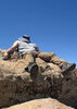
Headed up South Loop, which I always enjoy. The trail is in good shape, and the switchbacks help the climb feel not too terrible. Saw seven bucks on the way up, they looked like they are used to people. Short break at the saddle, then over to Griffith. Short and steep, but in good shape. Once back down, I continued on South Loop over to Charleston. Despite the fire damage, I enjoy South Loop, although today’s views were limited by heavy smoke. Once over the next saddle, I veered off the official trail and stayed along the ridge. Better views, more enjoyable, and it cuts off some distance and elevation. Once at the crash site, I got back on the real trail and headed up to Charleston.

Short break up top, then down North Loop. I like the upper few miles of North Loop, through the cliffs, but after that, I always get bored with it. The trail itself is not in as good of shape as South Loop. At 1435, I chatted with three people who were still heading up to Charleston, and they were still about four miles and a lot of elevation from the summit. It had taken them all day to reach that point, and they looked tired. I suggested they consider turning around since their vehicle was parked way over at the beginning of North Loop, but they were determined to keep going. I asked if they had lamps and enough water. They said they did, but didn’t have much in the way of warm clothing. I wished them luck and kept going downhill.

The hike down Trail Canyon went by quickly, the trail is in good condition, and when I reached the parking lot, there was a police office parked a few cars over. I waved Hi, and he came over and asked if I came down Trail Canyon. After I said yes, he asked if I saw anyone, which I didn’t. I guess there was a lost hiker who was calling for help and was trying to find his way back to Trail Canyon. I gave the officer a quick description of the six hikers I saw on North Loop, but nobody fit the description of who he was looking for. As we were chatting, the lost hiker called him back and said he was on the right trail and heading down. I told the officer about the three hikers who were about to spend a very cold night somewhere on Charleston and let him know where their vehicle was parked. He thanked me for the info and said he’d make sure to let the next shift know to keep an eye on that vehicle in case it was still there tomorrow or if someone called for help.

Good hike, with warm temps for October. I’ve hiked through snow up there in mid October a few times, so today was definitely easy hiking conditions. A very smoky sky was the biggest negative.
 Named place
 Named place [ checklist ]
[ checklist ]  Charleston Peak
foliage observationfoliage observationfoliage observationfoliage observationfoliage observation
Autumn Foliage Observation Isolated
Mostly past peak. Still some yellow aspens.
_____________________
Stop crying and just go do the hike.
  1 archive
Sep 26 2020
avatar

 Guides 6
 Routes 183
 Photos 5,612
 Triplogs 1,647

male
 Joined Mar 12 2004
 Scottsdale, AZ
Charleston Peak from Trail CanyonVegas, NV
Vegas, NV
Hiking avatar Sep 26 2020
John9LTriplogs 1,647
Hiking18.65 Miles 5,522 AEG
Hiking18.65 Miles   8 Hrs   51 Mns   2.36 mph
5,522 ft AEG      57 Mns Break
 no routes
1st trip
Charleston Peak has been on my wish list for a long time. It shot up my list after Chumley and I drove through Vegas on our way to the Ruby Mountains in early July. It was on my mind and I decided to do this earlier in the week. I told Karl about it Thursday night and he was interested in joining me. He booked the hotel and I drove the sporty malibu. We would leave Phoenix on Friday afternoon and we stayed in a hotel in northwest Vegas. We were up early on Saturday and then on trail before 7am.

We started with Trail Canyon on the north end of the village. The trail makes a steady climb as it follows an old road. We were delighted to see the Aspens in prime color. This really added to a great hike. We climbed and climbed and eventually turned for Charleston. It was a long way as the trail wrapped around a ridge and then makes the final climb to the summit. I was gassed when we reached the top and was glad for the extended break. We would enjoy a summit beer and some food while we enjoyed the smoky views. All of southern Nevada is suffering under a cloud of smoke from the fires in California. Luckily it didn't ruin our hike.

After lunch, we continued north as we started the loop portion of the hike. We set a steady pace as the trail drops and then climbs a small way. As we headed north, we came over a ridge and saw total devastation from a fire in 2013. Thousands of trees were completely torched and all that remained was their charred skeletons. It was a bummer. We headed through and were saddened by may bristlecone pines that are gone. This goes on for a while.

With some effort we reached our turn, that leads down to the valley, and we took a break. From here, the trail makes a solid descent as it switches it way down. We were ready to be done and cruised down. We hit the bottom and then worked our way back over to the malibu. The area was very busy on this Saturday afternoon. We would reach the car around 4pm and we agreed to pack up and head back to Phoenix. It was a long day but well worth the effort. This was a great hike!
 Flora
 Flora [ checklist ]
[ checklist ]  Bristlecone Pine
_____________________
  1 archive
Sep 26 2020
avatar

 Guides 4
 Routes 491
 Photos 10,890
 Triplogs 1,257

55 male
 Joined Nov 20 2012
 Phoenix, AZ
Charleston Peak from Trail CanyonVegas, NV
Vegas, NV
Hiking avatar Sep 26 2020
BiFrostTriplogs 1,257
Hiking18.65 Miles 5,522 AEG
Hiking18.65 Miles   8 Hrs   51 Mns   2.36 mph
5,522 ft AEG      57 Mns Break
 no routes
1st trip
Great hike up Charleston Peak and the loop! John suggested the idea so sounded like a good plan. Headed up Friday night so we could get an early Saturday start which was just before 7am. Started from Trail Canyon trail head and began the several thousand foot initial climb which was pleasantly lined with aspens in fall color. Last time I did this hike it was June so I didn't realize just how many aspens are on this hike. Along with the foliage, the great views, and high quality trail this section is hard to beat. The views get even better about 6 or 7 miles up the trail when it reaches the main ridge line and then contours leading to the final switchbacks.

The final switchbacks are equally impressive even though the altitude burns a little more. The last mile is above tree line so nothing to obstruct the view except for the smoke from CA fires but still wasn't too bad. Finally made the summit and we enjoyed a great summit beer :D A handful of other people on the summit but not to crazy being so close to Vegas. We took a good break before continuing down the South Loop Trail.

On South Loop Trail the first part above tree line is nice easy walk but eventually we hit the burn section about 1.5 miles down the trail. The trail is fine through the burn but the damage is nuclear with only tree skeletons left and not much growing back. Most of the trees were Bristlecone pine so they probably don't grow back very fast or maybe not at all. The fire was in July 2013 and took out about 28,000 acres. After about 2 miles or so we reached the junction to head down off the ridge line and hiked out of the burn. From there it was lots of switchbacks that drops over 3,000 feet back down to the canyon. We were treated to some more fall color towards the bottom of the hike. Eventually we reached the South Loop trail head and then followed a few connector trails back over to the Trail Canyon start.

Great hike and still debate whether to do the loop next time or out and back on Trail Canyon. Trail Canyon is without doubt the nicer of the two trails but I dislike out and backs just enough to make the loop an option. Will see next time :-k
_____________________
  2 archives
Sep 11 2020
avatar

 Guides 12
 Routes 192
 Photos 863
 Triplogs 356

42 male
 Joined Nov 30 2015
 Phoenix, AZ
Charleston loop (south north trail canyon), NV 
Charleston loop (south north trail canyon), NV
 
Run/Jog avatar Sep 11 2020
ShatteredArmTriplogs 356
Run/Jog18.27 Miles 4,802 AEG
Run/Jog18.27 Miles   5 Hrs   10 Mns   3.57 mph
4,802 ft AEG      3 Mns Break
 
no photosets
1st trip
I've been wanting to do this one for awhile, and it's on the way back to phx and fits within my recent theme of ultraprominent peaks.

Climb up to the ridge isn't bad, nothing too steep. On top, the miles through the burn scar make one wonder what this place used to look like.

Spent a few minutes at the summit, the headed down north loop. Didn't see anybody until I was almost to Trail Canyon, which is odd, because North Loop was way more fun and scenic.

Flew down Trail Canyon. Smooth trail that's a lot of fun to run down.

Overall, fun day, great scenery, I'd go back.
_____________________
 
Jun 14 2020
avatar

 Guides 99
 Routes 1,484
 Photos 16,072
 Triplogs 1,374

male
 Joined Jan 07 2017
 Fountain Hills,
Charleston Peak - Las Vegas, NV 
Charleston Peak - Las Vegas, NV
 
Hiking avatar Jun 14 2020
DixieFlyerTriplogs 1,374
Hiking19.30 Miles 5,374 AEG
Hiking19.30 Miles   9 Hrs   49 Mns   2.37 mph
5,374 ft AEG   1 Hour   40 Mns Break
 
Charleston Peak has been on my radar screen for a while, and I finally got to hike it yesterday!

We started the hike bright and early at the Trail Canyon TH, which is where we also finished the hike. We began by hiking down the paved road for 1/4 mile or so to the Echo TH. Then we took the Echo Trail to the South Loop Trail at the Cathedral Rock Trailhead.

We then took the South Loop Trail all the way up to the summit of Charleston Peak. The trail was pretty steep until we got to a saddle down below Griffith Peak. There are lots of switchbacks on the trail, so the ascent was not bad. We hung out at the saddle for a bit and I contemplated going up to Griffith, but my compadres did not like the idea, so I'll save Griffith for another time. The saddle was at about 10,800' and the going was relatively flat for a couple of miles or more. Along the way we passed some airplane wreckage that supposedly had some connection to Area 51. There had been a fire on this side of the mountain at some point, so there are sections of the trail that go through burned out trees. Eventually we got to a point where the trail climbed 800-900 feet up to the summit. Most of this is above the treeline, and there are some nice views.

We hung around at the summit for a while and enjoyed the awesome views. It was a near perfect day weatherwise -- sunny with almost no wind -- and I did not even have a jacket on.

We then descended down the North Loop. We dropped about 1,000 feet in the first mile, and then the trail was relatively level for probably 3 miles. Eventually we started going downhill, and a couple of miles from the TH we took the Trail Canyon Trail back to the TH (this was at a well-marked trail junction).

I really enjoyed going down the north side, and that was the highlight of the hike for me. The views were outstanding, and once down below the treeline we went through an ancient bristlecone pine forest, which was cool to hike through.

The north trail was great to hike on, and we were able to pick up the pace on the descent.

There was one patch of snow on the north loop trail that we went through, but it was not in a sketchy part of the trail and it was no problem to get through without traction devices.

This hike is a winner in my book, and I would put it in my list of top ten hikes!
 Fauna
 Fauna [ checklist ]
[ checklist ]  Mule Deer
 Meteorology
 Meteorology [ checklist ]
[ checklist ]  Fire Burn Area & Recovery
_____________________
Civilization is a nice place to visit but I wouldn't want to live there
 
Jun 19 2019
avatar

 Guides 73
 Routes 176
 Photos 10,174
 Triplogs 2,324

46 male
 Joined Sep 08 2006
 
South Loop Charleston Peak TrailVegas, NV
Vegas, NV
Hiking avatar Jun 19 2019
JimTriplogs 2,324
Hiking16.50 Miles 4,500 AEG
Hiking16.50 Miles   12 Hrs      1.38 mph
4,500 ft AEG10 LBS Pack
 
1st trip
Linked   none no linked trail guides
Partners none no partners
Don't attempt this trail until well after July 4th. Excessive snow is present!

My plan was for a loop going up the south and down the north loop. There is excessive snow on the north face of Charleston, and I wasn't about to kill myself going down that, slipping, and going off a cliff. This is despite the nearly clear appearance of the north loop itself. So, I went up and down this.

I really should have seen the snow, and gone up the north loop to as far as I could make it, and then turned back. The best part of the hike is the upper trail and cliffs, anyway.

There is about 4 to 5 feet of dense snow on the upper trail, and being unfamiliar with the route I went directly up a slope that had existing boots tracks. The hike on the ridge is a mix of snow, flowing sheets of water, dry rock, water flowing on the trail, and mud, lots of mud. It's really lousy and not at all worth doing.

Coming down was a nightmare. If you want to do this hike, wait 3 to 4 weeks.
_____________________
🍭
 
Oct 17 2018
avatar

 Guides 110
 Routes 2,246
 Photos 8,982
 Triplogs 2,600

45 female
 Joined Dec 24 2007
 Ahwatukee, AZ
South Loop Charleston Peak TrailVegas, NV
Vegas, NV
Hiking avatar Oct 17 2018
LindaAnnTriplogs 2,600
Hiking17.00 Miles 4,796 AEG
Hiking17.00 Miles   8 Hrs   29 Mns   2.13 mph
4,796 ft AEG      29 Mns Break
 
1st trip
Linked   none no linked trail guides
Partners none no partners
I was originally going to do a loop of Charleston, going up the North Loop from Trail Canyon, then down the South Loop, but I had a little bit of a head cold and didn't know if I wanted to hike that far, so I decided on Griffith Peak as the consolation. Started around 0745 and headed up South Loop. It was about 30 degrees, but did not feel that cold since there was no wind. I made good time up the steep climb, and when I got to the turn to Griffith, I was feeling pretty good, and decided to head over to Charleston instead. Pleasant walk along the ridge; I had not been up there since before the fire a few years ago, and the lack of trees opened up the views a lot. The final half mile to the summit was slow, and I took a short break at the top, then headed back down. It was in the 30's most of the day, but I only wore a long sleeve shirt all day, only getting cold enough for gloves in the shade of the switchbacks on the way back down. Finished up at 1615, earlier than I thought I would.
_____________________
Stop crying and just go do the hike.
 
Jun 22 2018
avatar

 Guides 13
 Routes 38
 Photos 1,651
 Triplogs 577

60 male
 Joined Nov 15 2005
 Jackson, CA
South Loop Charleston Peak TrailVegas, NV
Vegas, NV
Hiking avatar Jun 22 2018
toddakTriplogs 577
Hiking19.50 Miles 5,000 AEG
Hiking19.50 Miles   8 Hrs   30 Mns   2.29 mph
5,000 ft AEG
 no routes
1st trip
Outstanding loop around the rim of the gorgeous basin through amazing bristlecone pines. Went clockwise, road walk back to start. Who knew Vegas could be a hiking destination?!
 Named place
 Named place [ checklist ]
[ checklist ]  Charleston Peak
_____________________
  1 archive
Jun 24 2017
avatar

 Guides 4
 Routes 491
 Photos 10,890
 Triplogs 1,257

55 male
 Joined Nov 20 2012
 Phoenix, AZ
Charleston Peak Loop, NV 
Charleston Peak Loop, NV
 
Hiking avatar Jun 24 2017
BiFrostTriplogs 1,257
Hiking19.77 Miles 6,101 AEG
Hiking19.77 Miles   10 Hrs   12 Mns   2.07 mph
6,101 ft AEG      39 Mns Break
 
1st trip
Partners partners
slowandsteady
We started hiking about 645 from Trail Canyon Trailhead which connects with the North Loop Trail. It’s about 2 miles up Trail Canyon and 1700 feet gain to North Trail junction but high quality trail all the way. Once on North Loop Trail it’s less steep and some traversing towards Charleston Peak.

We ran into first snow at about 10,900 on North Loop Trail. There were a few sections of snow along the traverse but nothing that we couldn’t cross. The traverse also had some cool rocky cliffs on the approach to Charleston Peak. Just below the peak the final switchbacks kick in for the last 900 feet above tree line.

We took an extended break on the summit which we had to ourselves for about 10 minutes until a group of people came up from the South Loop Trail. After lunch break we headed down South Loop Trail which is slightly longer than North Loop. Just like North Loop the South traverses along the ridge line descending gradually for about 5 miles. The South Loop trail had been closed for several years because of fire damage in 2013 but has since reopened. Most of the first damage is in that 5 mile section on the south side of the ridgeline which sparred Kyle Canyon.

South Loop abruptly descends from the ridge line at the Griffith Peak junction. But before dropping down went up Griffith Peak about 1 mile round trip. The fire burned the summit but still nice views with elevation just above 11,000.

Back at the junction we headed down South Loop with impressive switchbacks dropping 2700 feet in about 4 miles. Again very good trail conditions as was most of the North and South Loop trail. Cathedral is the end of South Loop Trail so we used a connector trail over to Echo trail head and then hiked about ½ mile up the road to Trail Canyon trail head and our vehicle. Of course if we had two vehicles it would have been an easy shuttle but not really a big deal with only about a mile between trail heads.

water 1 out of 5water 2 out of 5water 3 out of 5water less than max Cave Spring Gallon per minute Gallon per minute
there is a spring box where the trail crosses with clear water for filtering
_____________________
  1 archive
Jun 24 2017
avatar

 Routes 67
 Photos 966
 Triplogs 694

51 female
 Joined Jan 05 2012
 Phoenix,AZ
Charleston Peak Loop, NV 
Charleston Peak Loop, NV
 
Hiking avatar Jun 24 2017
slowandsteadyTriplogs 694
Hiking19.77 Miles 6,101 AEG
Hiking19.77 Miles   10 Hrs   12 Mns   2.07 mph
6,101 ft AEG      39 Mns Break
 no routesno photosets
1st trip
_____________________
 
Aug 03 2012
avatar

 Routes 1
 Photos 2,050
 Triplogs 425

46 male
 Joined Sep 16 2011
 Phoenix
South Loop Charleston Peak TrailVegas, NV
Vegas, NV
Hiking avatar Aug 03 2012
VolcanoCLMBRTriplogs 425
Hiking8.25 Miles 4,278 AEG
Hiking8.25 Miles   6 Hrs   30 Mns   1.27 mph
4,278 ft AEG
 no routes
1st trip
Linked   none no linked trail guides
Partners none no partners
A friend recommended me this hike while in Vegas this past weekend, i took off from the Cathedral Rock trailhead as there is a construction inside the park area. I wasn't able to make it to the summit as the weather took a turn to the thunder and lightning side. I made it about a.5 miles past the saddle/junction then i decided to turn back around as i was hiking on my own. Overall it was a very challenging climbs that combined some very steep areas along with countless switchbacks. I would love to finish the south loop as a two day backpacking trek. To do 16 miles in one day would be a great physical undertaking but definitely doable under the right weather conditions and a very early morning start. I came across a few deer and lots of chipmunks.
 Fauna
 Fauna [ checklist ]
[ checklist ]  Mule Deer
 Named place
 Named place [ checklist ]
[ checklist ]  Charleston Peak  Mummy Mountain
_____________________
The world is my playground!
 
Jun 16 2012
avatar

 Guides 26
 Routes 21
 Photos 562
 Triplogs 1,393

female
 Joined Jan 04 2011
 Las Vegas, NV
South Loop Charleston Peak TrailVegas, NV
Vegas, NV
Hiking avatar Jun 16 2012
autumnstarsTriplogs 1,393
Hiking16.60 Miles 5,748 AEG
Hiking16.60 Miles
5,748 ft AEG
 no routesno photosets
Linked   none no linked trail guides
Partners none no partners
Hike up to Mt Charleston and back via South Loop Trail. The higher elevation promised cooler temperatures, and did not disappoint - 70 degrees was our high for the day.

In the avalanche shoots, blooming phlox, lupine and paintbrush provided a lovely mess of color. The smell from the phlox blooms was so strong, it was intoxicating. :D Above tree line, the shooting stars and columbine were just beginning to open - should be incredible in a week or two!

We made sure to take a route this time, so this should be a more accurate estimate of the distance and AEG. You still have to begin this hike at the Cathedral Rock trail head, but the Forest Service has put in a little cut-through trail which avoids some of the unnecessary up and down. No signs as of our visit, but on the way up, just stay left at all junctions before the switchbacks start.
wildflower observationwildflower observationwildflower observationwildflower observationwildflower observation
Wildflowers Observation Isolated
_____________________
"Let it ride / Let it roll / Let it go"
 
Sep 04 2011
avatar

 Guides 26
 Routes 21
 Photos 562
 Triplogs 1,393

female
 Joined Jan 04 2011
 Las Vegas, NV
South Loop Charleston Peak TrailVegas, NV
Vegas, NV
Hiking avatar Sep 04 2011
autumnstarsTriplogs 1,393
Hiking16.50 Miles 4,278 AEG
Hiking16.50 Miles
4,278 ft AEG
 no routesno photosets
Linked   none no linked trail guides
Partners none no partners
After last Sunday's hike to Griffith Peak, I decided to hike up to Mt Charleston this weekend. Apparently, a lot of other people had the same idea. Lots of father-son backpacking teams had made a full weekend of it :D

Regardless of all the people, it proved an enjoyable way to spend my Sunday above the valley floor. Weather could not have been more perfect, with swiftly-moving cloud cover and a high of maybe 70. The bristlecone pines were as stoic as always. Once above tree line, the columbines, vetches, and other small plants were flowering away - it seems to have been a rather late summer in many of the higher elevation areas. The air was calm, so this time I did see some Mt Charleston Blue Butterflies in the meadows and open ridges. Pretty late in the year to see them, too. At the peak, I ate some snacks, but didn't stay long due to the wind and terrible visibility (fires, pollution, just a bad air quality day). I did find it disturbing that being on top of the highest peak in southern Nevada, you can still hear the motorcycles in Kyle Canyon. :(

Poked around the old plane wreck on the way down off the top. Once walking along the ridge, a juvenile red tail hawk flew just along side me on the other side of the ridge - almost like a challenge to race. Cool!

The rest of the hike down was uneventful, other than chatting with some of the other hikers. Since I was doing this as a training hike, I also had plenty of extra water (for weight) and dropped that with the crew working on the trail re-routing for Griffith Peak.

Good hike.
wildflower observationwildflower observationwildflower observationwildflower observationwildflower observation
Wildflowers Observation Isolated
_____________________
"Let it ride / Let it roll / Let it go"
 
Sep 03 2011
avatar

 Guides 6
 Routes 6
 Photos 1,634
 Triplogs 186

58 male
 Joined Apr 04 2002
 Flagstaff, AZ
South Loop Charleston Peak TrailVegas, NV
Vegas, NV
Hiking avatar Sep 03 2011
squatpukeTriplogs 186
Hiking17.90 Miles 4,278 AEG
Hiking17.90 Miles   6 Hrs   30 Mns   2.75 mph
4,278 ft AEG
 no routes
1st trip
Linked   none no linked trail guides
Partners none no partners
Every so often craziness enters my thick noggin. I've wanted to climb Charleston for several years now and was returning back home to Flagstaff from my Whitney trip. Charleston was on my agenda and I was hoping NOT to do it solo...

I contacted my cousins that live in Vegas and convinced one, 17 y/o Andrew, how great this would be. (He and I had hiked Turtlehead several months prior.) Two words best describe Andrew: stud athlete. Dude is a hardcore swimmer and has great cardio.

Unfortunately, the time-window for my visit coincided with Andrew having to work (lifeguard) at noon the following day...so if we were going to do Charleston, it would be a night hike.

What the heck I said to myself...let's do it.

We hit the trail-head at 1am!! with a goal of easily returning by noon. We made the saddle around 3:15am extremely sweaty because of the fast pace we were climbing. There, we hit some very hard winds which made us VERY cold..we weren't prepared for those temps. We built a small fire (probably illegally) and ate some Mountain House and granola bars. Since we thought we were way ahead of schedule, we took a nap next to the cozy fire...we ended up sleeping for 2 hours...LOL.

We wanted to make summit by sunrise so we busted off again...The Meadows turned out to be quite a bit longer than we thought and we were just over 1/2 way across them when the sun came up. We thought we saw the summit very near, but it was "false"...we came over the ridge and our hearts sank when we saw another mile expanse before the last switchbacks to the "true" Charleston summit. Andrew wanted to turn back (cause of the time of his work) but I coaxed him onward saying we could jog back to make up time...we quickly banged out the rest of the hike and summited around 7am. We obviously couldn't stay long so off we went after a few photos...we made a very quick stop at the plane crash.

I had the backpack and was NOT able to jog with it (Andrew offered to take, but to be truthful, was a good excuse for me to slow him down ;) )...the miles were creeping up on my 44 y/o bod and feet were aching...I could tell Andrew was being patient and had the energy to easily make it back and we was polite in slowing down a bit for me. Best I could muster was double time...we made back to vehicle just after 10am and I hustled the 60 min drive back to West Vegas...Andrew crashed hard in the car..his only rest.

Once home, Andrew was able to get ready and barely made work in time.

Was a memorable day.

(only entered "moving time" but we really cranked this thing out)
 Flora
 Flora [ checklist ]
[ checklist ]  Bristlecone Pine
 Named place
 Named place [ checklist ]
[ checklist ]  Charleston Peak  Mummy Mountain
_____________________
squatpuke@gmail.com
 
average hiking speed 2.14 mph
1, 2  Next

WARNING! Hiking and outdoor related sports can be dangerous. Be responsible and prepare for the trip. Study the area you are entering and plan accordingly. Dress for the current and unexpected weather changes. Take plenty of water. Never go alone. Make an itinerary with your plan(s), route(s), destination(s) and expected return time. Give your itinerary to trusted family and/or friends.

helpcommentissue

end of page marker