|
| | | |
| |
|
| Hiking | 5.00 Miles |
1,184 AEG |
| | Hiking | 5.00 Miles | 3 Hrs 16 Mns | | 1.57 mph |
| 1,184 ft AEG | 5 Mns Break | 15 LBS Pack | | |
|
|
| |
| Linked |
|
none
[ show ]
| no linked trail guides |
| Partners |
|
[ show ]
| partners | | Thanks to @WildForAZ for posting the trip to Donnelly Slope, it brought to mind that although it had been on my to-do list since I bagged South Butte in mid-June 2012 (@105°) somehow I had never gotten-around-to-it.
Tracey had just lined up an extended length of time off and we had one open day before a 4-day/3-night stay in Pine so she figured with now-reasonable temps why not git-er-done before our sojourn up North.
Having driven almost every road and wash in the Gila River/Cochran area when the Cherokee was my go-anywhere vehicle (2012 to 2017) I had to decide where we wanted to begin the hike and which route to get there.
In the end I got a bit lazy and and just went with the December 2017 route @chumley posted for the starting point and see what the day brings. The drive to the TH was easy enough, just following Florence/Kelvin Highway, Cochran Road and Donnelly Wash.
I initially parked next to a tree filled with bees but soon thought better of it and parked a distance away. I'll blame that event for getting off to a less-than-ideal start.
While we should have stayed in the wash, when we encountered a section of thick-and-thorny vegetation we took a detour on a game-trail which ultimately lead us astray. In retrospect we should have dropped back into the wash as soon as possible, but with the path taking us in the general direction we wished to go, we continued, slowly climbing along the way.
It wasn't long before I realized we really needed to get back down into the wash, but now the challenge was how do we get back down? Between steep drop-offs and thick vegetation it took quite some time and effort, including a number of back-tracks before we finally got back on-track. Wow, I thought it sure is easy to follow the wash now while figuratively kicking myself for the delay.
But no matter, just stick to the plan. Following the drainage was reasonably easy as enough cattle had been through we had a 'trail' to follow... until the pour-off. While the route to bypass it was quite obvious, and a decade ago I would easily have scrambled up it but a few moments, I'm not as spry as I'd like. Noting just enough exposure which could bring a bout of vertigo, it dampened the will to just go-for-it and I settled with safety over risk.
Ok, now what?
During my lazy 'planning' I noted the routes posted congregated near the center of the 'slope' and had drawn out a few 'possibles' in the more open area to the North, part of which could be described as an ATV playground. So, we turned around, but instead of back-tracking along the wash we headed directly East, up and over the ridge (where shooters will be later in the day) and out to Donnelly Wash which we would follow back to the car.
Back at the car, we figured there's no point to gear-down for a short drive only to gear-up again, so we just set off on foot along the Western edge of Donnelly Wash until the turning onto the road heading West into the aforementioned ATV playground. At that point we simply followed the tracks of ATV's as far up as they went before turning toward the South, climbing all the way. Much of this area was open enough that whenever an obstacle presented itself, there was always a relatively easy no exposure detour.
Some distance up in a wide flat area we encountered a desert tortoise and while it appeared quite healthy, it was doing absolutely nothing. After taking a few quick photos of the non-action we continued up, only to encounter another tortoise barely 15 minutes later. Sadly, this tortoise was but a shell of its former self, so we quickly moved on.
Once we reached the upper reaches of the Western ridge/cliff, rather than continuing to the Southern reaches of Donnelly we decided to head back along a route slightly West of our climb route before connecting with the road at the foot of South Butte, following it East out to Donnelly Wash before trudging in the soft sandy rock wash back to the car.
In the end, it was a shorter (time & distance) hike than planned, and it covered nowhere near the amount of ground I would have liked, getting back home to pack up and get the last of the supplies for tomorrow's trip to Pine took priority.
So, will Donnelly Slope end up a case of "we'll be back for more" or will it just go back on the list and if we get back, great, if not, oh well, at least we covered part of it. |
| _____________________
| | |
|
|
|
 Route Editor


 .
.
 ? YEP
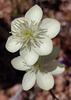
? YEP  the farthest tip of the other point. It got a bit tricky but he managed to get over this one area to the edge of the point. Now it was time to head back up the Slope. We would all eventually meet up and then hiked further west back to the high point where believe it or not, there was a benchmark. We thoroughly enjoyed walking on the very edge of the Slope and looking down and beyond it. We spotted some poppies and I even spotted a squirrel. Believe it or not, though I couldn't quite see the squirrel when it scooted under a rock, my zoom camera photo revealed I got a shot of him.
 . I've sure been loving my lunch spots lately. I can't wait until I get to enjoy lunch spots like these more than once a week.
 . See my Generic Trip Report and Photos.
