|
| | | |
| |
|
| Hiking | 8.34 Miles |
3,605 AEG |
| | Hiking | 8.34 Miles | 8 Hrs 20 Mns | | 1.00 mph |
| 3,605 ft AEG | | | | |
|
|
| |
| Linked |
|
none
[ show ]
| no linked trail guides |
| Partners |
|
[ show ]
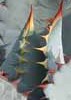
| partners | | The Sand Tank Mountains are worth a visit, and they're closer to PHX than you think. The required BMGR permit and location south of I-8 kept me away from doing this for awhile, but the massif of Javelina Mountain and Maricopa Peak always looked interesting. Ken, Tanya, and I took our turn last Saturday.
We took Ken's jeep to the end of Road 8015, and except for the last mile or so, the road wasn't really rocky or steep at all. Healthy saguaro and cholla stands everywhere. Our initial plan was to head up Bender Wash, which would get us closer to Javelina Peak first. The main wash is actually wide, and had just been scoured by the recent rains, so progress was easy. Signs of passing immigrant parties appeared: water bottles, backpacks, and food tins. Surprised to see that on the mountain's north side. The wash steepened and we rock-hopped our way to the foot of a steep ridge, taking the calf-burning slope to its top. From there, we were about halfway between Javelina and Maricopa Peaks.
The main ridgeline itself is great travel: rolling, smooth, largely free of any obstacles and high on scenery. Travel is almost easiest directly on the ridge, though. We tried traversing the final obstacle before Javelina Peak: not worth it. Terrain to the south of us appeared rugged and remote - you cannot see a single habitation from here, and only the distant sound of I-8 pushes back the quiet. That, and afternoon bombing runs a couple miles away on the Goldwater...
The trek over to Maricopa Peak took awhile, and drops you at a low saddle, before the final push begins. Rock and terrain is generally solid, making for good passage. The last couple hundred feet up Maricopa features some decent optional scrambling...and a makeshift very-recently-used helicopter pad with a mangled palo verde tree nearby. Here's to hoping that was just a Luke AFB training exercise instead of illicit aircraft. Atop Maricopa Peak, there were a number of signatures in the log of people looking for a triangulation benchmark, which seems to be the main draw here, not the fact that it's the Sand Tanks' highpoint. Whatever the draw, the reward of the view is well worth it.
Back as the sun was getting low, and afternoon light is always amazing out there. |
| _____________________
| | |
|
|
|
 Route Editor