|
| | | |
| |
|
| Hiking | 12.31 Miles |
1,534 AEG |
| | Hiking | 12.31 Miles | 4 Hrs 57 Mns | | 2.49 mph |
| 1,534 ft AEG | | | | |
|
|
| |
| Linked |
|
none
[ show ]
| no linked trail guides |
| Partners |
|
none
[ show ]
| no partners | | This is the first, and probably easiest, of several hikes I have planned in the so far mostly HAZ-unexplored Harquahala Mountains. I'd been over the route so many times, in both satellite and topo view, that when I arrived at the TH at the intersection of Eagle Eye Rd and Microwave Relay Rd, and discovered I had forgot to load a route in my GPS, it was no big deal.  I simply aimed for the saddle west of Hill 4489. (Beside, I had a paper copy of the topo route.) You would have to try very hard to get lost on this hike. Despite the direction being obvious, there is a lot to see there, and it is well worth your time. I simply aimed for the saddle west of Hill 4489. (Beside, I had a paper copy of the topo route.) You would have to try very hard to get lost on this hike. Despite the direction being obvious, there is a lot to see there, and it is well worth your time.
I tried following a jeep trail and wash northeast, but after a few steps tired of sandy wash walking. I went about 50 feet up to a spur between two washes, and followed that for several miles instead. The ground was so free of obstacles -- ankle breakers or thigh stabbers -- that it was like walking on a road, except easier and faster. The only vegetation was scattered creosote, white bursage and a few brittlebrush. About 3.5 miles in, I hooked up with the jeep trail I had meant to be on all along. A half mile after that, I descended into Browns Canyon Wash.
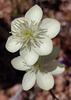
The two miles I travelled of Browns Canyon Wash were the highlight of the hike. Lots of boulders and rocky outcroppings. The wash bottom had sandy areas and many pools. There was more cow flop around the pools than you would think bovinely possible.  Just south of Browns Canyon proper, north of the dam and near the spring, I found a small triangular plateau with an absolutely stunning population of ocotillo. Just south of Browns Canyon proper, north of the dam and near the spring, I found a small triangular plateau with an absolutely stunning population of ocotillo.  Never did find the spring. Found some *very* fresh cow flop, and figuring it could not be more than a few minutes old, gave a moo. I actually got a reply. I found the cows, but they kept walking away from me. I had to give up my pursuit when they laid a minefield in my path. Never did find the spring. Found some *very* fresh cow flop, and figuring it could not be more than a few minutes old, gave a moo. I actually got a reply. I found the cows, but they kept walking away from me. I had to give up my pursuit when they laid a minefield in my path.
Looking up from Browns Canyon, the west slope of Hill 4489 was covered with more saguaro then you ever laid eyes on. There's a lot of washes running off the west slope, so while I knew in general where I was, and where I had to go, I was not sure of the specifics. (Red is my intended route; blue my actual route: http://hikearizona.com/map.php?MY=3170&M=3 ) Turned out I began my ascent towards the saddle about a half mile east of where I intended.
Unlike the first three miles, both the south and north slope of the saddle were choked with palo verde, catsclaw, 2-3 feet diameter rocks for stepping over or around, and every kind of cactus you could imagine: barrel, hedgehog, ocotillo, saguaro and, of course, cholla. It was slow going. And I missed the saddle, going further up the slope than I intended. From the highpoint, a little over 3000 feet, I could easily see the APS substation, where I was headed, and the RV park at Gladden.
From the highpoint, I took the path of least resistance down, eventually hooking up with the jeep trail below the prospects I had been aiming for. From there it was a simple matter of quick-timing the last couple of miles to the APS substation. |
| _____________________
| http://prestonm.com : Everyone's enjoyment of the outdoors is different and should be equally honored. |
| | |
|
|
|
 Route Editor