username
X
password
register
for free!
help
ArticlesGuidesRoutes
 
Photosets
 
 Comments
triplogs   photosets   labels comments more
Keet Seel - 16 members in 39 triplogs have rated this an average 4.4 ( 1 to 5 best )
1, 2  Next
39 triplogs
login for filter options
Sep 29 2023
avatar

 Guides 2
 Routes 25
 Photos 1,890
 Triplogs 604

41 male
 Joined Sep 13 2009
 Mesa, AZ
Keet SeelNortheast, AZ
Northeast, AZ
Backpack avatar Sep 29 2023
jochalTriplogs 604
Backpack17.00 Miles 1,500 AEG
Backpack17.00 Miles
1,500 ft AEG
 no routesno photosets
1st trip
Linked   none no linked trail guides
Partners none no partners
The Navajo National Monument is trying to get the public access to Keet Seel again, so this trip was the 4th of 4 overnight backpacking trips they scheduled for September. This is great news, of course. One major caveat that might be disappointing (depending on your view) is they are not allow access into the ruin. In fact we couldn't even climb the ladder, and our ranger leader kept us a respectful distance away from the base of the ladder. It would have been cool to get into the ruin, but I certainly can appreciate the archaeological and cultural sensitivities. We were still able to view some of the broken pottery near the base, which gives the site its name.

Anyways, it was a great trip. We were led by 2 park staff, who had the help of 2 volunteers. A substantial number of the participants either worked for the park service, forest service, or BLM. This included several archaeologists and interpretive rangers, and it was great to listen to their dialogue. The leaders did a good job of accommodating the different paces of the participants.

In researching the site ahead of the trip, I had been struck by some of the black and white photos of the ruin against the alcove, and seeing this in person was more than worth the journey.

Due to it being a full moon, about half the group went out to the benches in front of the ruin and watched the moonrise.

I wore waterproof Merrill Moab Mids, and these worked well. The stream crossing conditions were never too deep, but you did have to watch your step to avoid quicksand. Some people on the trip had worn trail runners and I don't think were happy with mud and sand getting in.

The first day, I did a poor job of managing my diet (skipped lunch), and really ran out of steam at the end of the hike in. Second day, i learned my lesson and did fine, just a little slow up the hill. I also, like always, overpacked. Mainly by bringing too much food.

We were required to start with 2 gallons, and I ended up using about 6 liters...so I think the 2 gallon mandate is reasonable. We were able to stash water along the way, and that helped. I stashed 2 liters at the base of the climb back up out of the valley.

Great trip, and I hope they can continue to develop a public access program.
_____________________
 
Jun 16 2018
avatar

 Triplogs 5

59 female
 Joined Feb 09 2016
 mesa az
Keet SeelNortheast, AZ
Northeast, AZ
Hiking avatar Jun 16 2018
boogenhagenTriplogs 5
Hiking18.05 Miles 2,000 AEG
Hiking18.05 Miles   9 Hrs   10 Mns   1.97 mph
2,000 ft AEG
 no routesno photosets
1st trip
Linked   none no linked trail guides
Partners none no partners
We did a little meander over to Keet Seel, weather was perfect and overcast with a teeny drizzle to cool off. Met a friendly raven or two as guides along the way. Had a chat with a baby foal and some cows. The little houses were awesome and I had a great laugh as the taller members of our tour had to watch their heads on the doorways and I was a perfect fit. :D

The park ranger was very nice and the pottery was very interesting. Really had a great time, until the last two miles of up when the sand in my shoes felt like a sandpaper exfoliation without the benefit of a Mai Tai to take the edge off. Mr. boogenhagen zipped up to the top like a man with a mission, but I took my time and just enjoyed the perfect day of hiking with great views and a lovely destination.
_____________________
 
Jun 03 2018
avatar

 Routes 28
 Photos 1,661
 Triplogs 20

52 male
 Joined Apr 05 2013
 Peoria, AZ
Keet SeelNortheast, AZ
Northeast, AZ
Hiking avatar Jun 03 2018
MudholeTriplogs 20
Hiking17.46 Miles 1,869 AEG
Hiking17.46 Miles
1,869 ft AEG8 LBS Pack
 
1st trip
Linked   none no linked trail guides
Partners none no partners
What a truly amazing place to visit in Arizona. We did this hike as a same-day 18 miler due to time constraints, but it was worth every minute in the 90 degree heat. Water was continuous along the entire canyon floor all the way to the ruins. Regardless of the online rumors, the water is able to be filtered just fine as long as you're conscious of the sand sediment. My Sawyer Squeeze did just fine. The only dry section is the first and last 2.5 miles where you're descending/ascending the canyon switchbacks, but you get to water very quickly.

The ruins are spectacular. They look so small from a distance until you get up the ladder with the guide and see them in person. The condition of the ruins is much more preserved than I could have expected, and the pottery sherd variety is second to none. I couldn't take enough pictures, and our guide Steve was so friendly and knowledgeable about the history of its past residents.

A real treat to experience.
_____________________
"Keep close to Nature's heart... and break clean away, once in a while, and climb a mountain or spend a week in the woods. Wash your spirit clean." - John Muir
 
Aug 31 2017
avatar

 Guides 16
 Routes 81
 Photos 1,269
 Triplogs 1,144

51 male
 Joined Apr 30 2008
 Tucson, AZ
Keet SeelNortheast, AZ
Northeast, AZ
Hiking avatar Aug 31 2017
azdesertfatherTriplogs 1,144
Hiking18.56 Miles 1,974 AEG
Hiking18.56 Miles   9 Hrs   29 Mns   1.96 mph
1,974 ft AEG35 LBS Pack
 no routesno photosets
1st trip
Linked   none no linked trail guides
Partners partners
ddegroot
MountainguyAZ
_____________________
"I went to the woods because I wished to live deliberately, to front only the essential facts of life, and see if I could not learn what it had to teach, and not, when I came to die, discover that I had not lived." — Henry David Thoreau
  1 archive
May 30 2016
avatar

 Photos 75
 Triplogs 10

54 male
 Joined Mar 17 2014
 Tucson, AZ
Keet SeelNortheast, AZ
Northeast, AZ
Backpack avatar May 30 2016
gunungapiTriplogs 10
Backpack17.00 Miles 2,000 AEG
Backpack17.00 Miles2 Days         
2,000 ft AEG
 no routesno photosets
1st trip
Linked   none no linked trail guides
Partners none no partners
I hiked this trail overnight with my 14-year old son and 11-year old daughter on Memorial Day. We camped in the Canyon View Campground the night before so we could get an early start.

This is an easy trail, with the exception of a short 3/4-mile descent/ascent. The scenery was nice, though not spectacular. We did not run into any quicksand. The ranger at the orientation the day before said that there wasn't enough water for quicksand. I was apprehensive that walking in the creek would be difficult -- the usual slogging through sand alternating with jumping from rock to rock -- but the sand by the creek turned out to be quite firm. Cool creek water felt good on the feet.

The campground at Keet Seel is quite nice. Lots of shade.

Steve and Diane Hayden were the rangers on duty. Steve gave a fantastic, 2-hour tour of the dwellings. It is incredible to walk freely through so much history, surrounded by broken pottery, corn cobs, yucca ropes, etc. I have never been anywhere else where it was possible to see and touch so many things. You can understand that it is all 700 years old, but in a way, it's hard to believe. Maybe because it's not behind glass.

I was amazed at Steve's generosity with his time, and Diane was quite kind, asking the kids several times if they needed a drink or any supplies. When we lamented that we had forgotten to bring playing cards, Diane lent us a deck.

I can't wait to go again. See it while you still can!

PS. I should add that my daughter was amazed at the cleanliness of the pit toilets everywhere in Navajo National Monument. For what it's worth. (That kind of thing is important to her.)
_____________________
 
Jul 18 2015
avatar

 Routes 1
 Photos 2,050
 Triplogs 425

46 male
 Joined Sep 16 2011
 Phoenix
Keet SeelNortheast, AZ
Northeast, AZ
Backpack avatar Jul 18 2015
VolcanoCLMBRTriplogs 425
Backpack17.00 Miles 2,000 AEG
Backpack17.00 Miles2 Days         
2,000 ft AEG
 no routes
1st trip
Linked   none no linked trail guides
Partners partners
Lucyan
Finally made it to the fabulous Keet Seel on our second try! Our first chance bad weather cancelled our permits and moved it to this past weekend. On friday night we made the drive up to the Navajo National Monument. On saturday morning we started our hike down after having got the mandatory orientation presentation by the NPS. The weather was cloudy the entire weekend making the temperatures much more comfortable. That also meant we had the chance of rain showers, which they did on and off on the way in. Great views on the way down the canyon, once we reached the creek we stopped for a 5 minute break and cached water for our way back. We then continued our hike into the canyon wading through water on and off, it took us around 3:20hr/min to reach our campsite. Later in the afternoon we headed over to the Keet Seel cliff dwellings, in which our Navajo guide Max showed us while telling us the history of this place and its ancient people. The site was amazingly well preserved and was well worth the trip. The following morning we made our way out and made it out in 3:30hr/min, under very comfortable overcast skies. Very happy i got this place off my bucket list!
_____________________
The world is my playground!
 
Jul 18 2015
avatar

 Routes 1
 Photos 29,225
 Triplogs 1,447

45 female
 Joined Jan 18 2011
 In the Wild
Keet SeelNortheast, AZ
Northeast, AZ
Backpack avatar Jul 18 2015
LucyanTriplogs 1,447
Backpack17.00 Miles 2,000 AEG
Backpack17.00 Miles
2,000 ft AEG15 LBS Pack
 no routes
Linked   none no linked trail guides
Partners partners
VolcanoCLMBR
Keet Seel is one of the great backpacking trips to experience a beautiful sandstone canyon, a babbling desert creek, and very well preserved cliff dwellings.

We drove up after work on Friday and car camped at Navajo National Monument north of Tuba City.

On Saturday morning, after a ranger orientation, we hiked the moderate 8.5 miles to a camped site across from the ruins. The trail heads up pretty Betatakin Canyon with numerous creek crossings and some minor ups and downs.

After we set up camp, we met the ranger and enjoyed a guided tour of Keet Seel.
The site is pretty amazing and the Navajo ranger answered all of your questions about the ancient Anasazi inhabitants.

On Sunday, we got very early start and hiked the same way out.

We experienced mild warm weather, sun and light rain.
wildflower observationwildflower observationwildflower observationwildflower observationwildflower observation
Wildflowers Observation Moderate
_____________________
  2 archives
Jun 15 2013
avatar

 Routes 1
 Photos 29,225
 Triplogs 1,447

45 female
 Joined Jan 18 2011
 In the Wild
Keet SeelNortheast, AZ
Northeast, AZ
Backpack avatar Jun 15 2013
LucyanTriplogs 1,447
Backpack17.00 Miles 2,000 AEG
Backpack17.00 Miles2 Days         
2,000 ft AEG25 LBS Pack
 no routes
Linked   none no linked trail guides
Partners none no partners
Keet Seel is one of the great backpacking trips to experience a beautiful sandstone canyon, a babbling desert creek, and very well preserved cliff dwellings.

We drove up after work on Friday and car camped at Navajo National Monument north of Tuba City.

On Saturday morning, after a ranger orientation, we hiked the moderate 8.5 miles to a camped site across from the ruins. The trail heads up pretty Betatakin Canyon with numerous creek crossings and some minor ups and downs.

After we set up camp, we met the ranger and enjoyed a guided tour of Keet Seel.
The site is pretty amazing and the Navajo ranger answered all of your questions about the ancient Anastazi inhabitants.

On Sunday, we got VERY early start and hiked the same way out so we could join the 10:30 am Betatakin ruin tour.
 Named place
 Named place [ checklist ]
[ checklist ]  Keet Seel Canyon
_____________________
 
Jun 01 2013
avatar

 Guides 20
 Routes 13
 Photos 3,189
 Triplogs 451

female
 Joined Mar 31 2002
 Chandler, AZ
Keet SeelNortheast, AZ
Northeast, AZ
Backpack avatar Jun 01 2013
desertgirlTriplogs 451
Backpack17.00 Miles 2,000 AEG
Backpack17.00 Miles   8 Hrs   15 Mns   2.72 mph
2,000 ft AEG
 no routes
1st trip
Linked   none no linked trail guides
Partners partners
bigfoot
chihiggs
Finally made the backpack to Keet Seel; years after I had 1st learnt of this amazing location. After much hand-wringing over the permits, transferring the permits, attending the orientation ...we were on the long road that lead to the original TH and down to the ruins! YAY!

We met up at the Keet Seel Parking area at 7:00 am MST (Navajo Nation is on MST - 1 hr ahead of AZ Time) and finally started walking down the road towards the 1st of many " you need a permit to go past this point" barriers! The actual trail down the canyon is 7 miles and a good 1.5 miles of old and not so old road walking thrown in for a good measure. Getting closer to Tsegi Canyon, we are greeted with some sun-kissed views of the sandstone cliffs and the shimmering lazy meanders of the creek. Soon we are at the original TH and we plunge down through the sandstone cliffs on a rocky trail-- may steps hewn into the rocks and in other areas the trail is held together with railroad ties, rods driven into the sandstone and some old pinyon logs shoring up the crumbling trail footbeds. The steps are huge and don't work well with shorter legs -- this is painful - especially with all the extra water we were carrying for the wettest dry camp experience! We were caching some water at the river bottom for our climb out and carrying rest for our camp supplies.

350ft descent through the rocks and then we are at the turn off for Betatakin Ruins ( That will be another hike) and after some easier walking, we plunge down a few sand hills for another 350 ft descent till we reach the "junipers" at the end of the cliff. We take a quick break to cache our water under a trail side tree...snack some and then its down to the canyon floor and our 1st water crossing. I was prepared with my 510 canyoneers so I happily waded in and was on my way ... some attempted to keep their feet dry but that lasted a few more minutes. You quickly accept the fact that you will be walking in the water or in the wet sand near the water( far easier than slogging in the dry sand!) Based on reading trip reports, I expected a stinky & gross creek but was pleasantly surprised at the fact that it was not really odiferous or have but the occasional bovine/horse turd in the water. I was not going to drink for the creek but was OK with the "gross" factor. I think not being super grossed out helped make this hike more enjoyable.

We are confronted with 3 canyons coming together fairly quickly ….follow the white logs and your will find the right canyon. Its not too hard. There is also the much talked abut "big rock" that marks the right canyon - if you attend the orientation you will know ! Lucky for me, everyone in the group but us attended the orientation (thanks ya'll) the prior evening so we knew where to go! Its fairly easy walking in the canyon bottom -- just follow the water & keep track of the white posts.
Just so we know, looking down from the water cache area; Long Canyon is to your immediate left with water flowing in it. Next canyon over is Keet Seel canyon, there is water flowing thru it. About a 1/4 mile up Keet Seel Canyon - you run into Dowozhiebiko Canyon( Dry Canyon) branching right. Stay to the left after you enter Keet Seel canyon. There is a large 8' white post marking Keet Seel canyon. Tsegi heads off in a south eastern direction draining the waters from Keet Seel & Long canyons.
Soon we are at the junction of Keet Seel Canyon & Dowozhebetio Canyons & per our drilling from the orientation we turned left. In some areas there is short cuts that go over the sand banks -- some of these are marked with the white posts. We pass Battleship Rock and then Kachina Mother (Pointed Cluster of Rocks that dominate the horizon). The canyon begins to narrow down and soon we are at the "Big water Falls". You will see ATV tracks up until this point - the rangers bring some of the supplies in on ATVs up to this point. We climb up around on a steep sand hill( on the right side) . There is a tiny sign in the side canyon that points you uphill. I find the sign amusing " Keet Seel --Up Hill! We continue on past a few more water falls….Diane gets really hungry so we break for a quick snack just before the last water fall -- probably less than 1/4 mile from camp. Diane crawls into some shade and we reminisce our crawling and hiding in Copper Canyon ( Grand Canyon - Royal Arch Trip). Soon we pack up and make a quick walk to camp. Mike has hike up before us and scored us a nice campsite ( Thanks Mike) - we don’t get the prize camps at the far end with a view of the ruins but our site is nice - tables, flat ground & lovely view. Even the bathroom is close :) - who would have expected a rather nice ( Ok a bit smelly) composting bathroom with TP & sanitizer after a 8.5 mile backpack! They also provided us with huge metal bins to put our packs in...how awesome is that -- no rats, no ravens and not worries about getting the packs wet! Thanks NPS….

We lounge at camp a bit and then decide to walk down to the ranger station and stake out our spot to get on the ruins tour. I get out of my boots and slip into my Tevas. Diane gets into her flipflops and provides some hilarity as she crosses the stream a few times and the creek wants to eat her flipflops…. We come up to the NPS boundary again and let ourselves in closing the gate behind us ( this is to keep the cattle away from the ruins - there are still a few Navajo families that run cattle in the canyon). We are greeted by Diane -she is the wife of the Volunteer Ranger Steve Hayden who is covering the tours for the 1st 10 days after the park opens ( Park Opens Memorial Day). She banters with us, tells us stories and builds up some excitement. We hang out on the benches under the gambel oak canopy and enjoy the chitchat and get some rest. It will be another hour before our tour starts… Diane & I can't wait to see the ruins so we run off to the ruins overlook and sit there in the hot mid-day sun gawking at the amazing scene before us -- hundreds of rooms - an entire village tucked back in the massive alcove. I had seen many pictures of this place but just being there is something else…. If it even remotely on your list -- go! Soon the hot sun gets our attention & we get back to the shade and wait for Steve to finish the tour. We learn that Steve Hayden's grand father Irwin was the head of CWC project of 1934 that excavated the ruins and stabilized them-- their work is what lends shape to the Keet Seel of today. We also learn Steve's father - Julian - a young 23 yrs old worked on the project as the cataloguer and help dejour. This happens to be one of the many project that was funded by the CWC when the country was gripped in the throes of the "Great Depression" -- this was a time that folks worked hard and made a living wage and government lent a helping hand through the CWC program putting people to work on public projects - the park service stood to benefit from many of these projects, in fact I think they worked on about 12 sites for stabilization of ruins in AZ ( I think I heard this right) . Irwin was a Harward educated archaeologist looking for some work & fortuitously ended up leading this project. For rest of the story we have to wait for Steve…. Meanwhile, Diane ( Steve's wife) is showing me where there a Mouqi steps -- they are all over that area -- quick scary ascents ( I cant fathom how you descend these…) to the rim. She also mentions there is an easy walk up round the bend to the rim...so all the more "why these steps?". Perhaps these are associated with rituals, quests or just fun ?

Soon the other group walks back with Steve and after a short break Steve joins us for our tour. After some background and introduction … Steve takes us up to overlook and continues to share with us the lives of this people -- what was impressive was the images he shared from 1910 ...the front of the ruins is a plain farmable land with just the beginnings of arroyo back cutting …. Markedly different from the deep gullies that cover that area -- just last year ( or 2 yrs ago ?) the 75yr old trail to the ruins. Dramatic changes in landscape in a short time ...more on this later. We hear about CWC, his grandfather Irwin & his dad, their work at the site, what conservation meant in 1934….and finally Steve leaves us hanging with the fact that his grandfather just picked up and walked to Kayenta one day -- no trip report was ever submitted for this work back in 1934. This has remained a mystery for a long while -- until Steve found his grandfathers diaries from that time at their family home in Tucson. ( Web search tells you Steve lectures based on this information from time to time!). He leaves us wondering and we make our way across the brand-new trail -- briefly pausing to look at midden that is eroding out ...Basketmaker period we are told. We are soon at the base of the alcove ….its cool, shady and well protected from the elements, the summer sun never gets to the ruins ( full sun in winter for warmth)- these old time builders knew solar gain & studied the direction of movement of the sun over time.

We stop by to examine examples of pottery sherds and the corn cobs that are scattered every where. I catch sight of corrugated, Kayenta Black on White, Tsegi Orange, KeetSeel Black on White ...and few more that I don’t know, shards of bowls, ladles, pots are scattered everywhere. Steve tells us the stabilization work and specifically on how the retaining wall is built up...we learn that the CWC built up quite a bit of that wall -- using same techniques that were used by the people that originally constructed these walls. You can tell where the walls are original & where the reconstruction starts - this is intentional. We climb up the 70 ft ladder -- easy climb, we see evidence of some steps hewn in sandstone towards the higher end. This puts us on the main street of this thriving village - it is easy to see a bustling community overlooking thriving farms - paradise in a land of plenty with water food and shelter. People began settling in Keet Seel around A.D. 950. In A.D. 1250, a new group of settlers arrived and a steady influx kept the village growing until it contained more than 150 rooms.

Part of the ruins are closed - these are the unrestored ruins - much of it is intact and well preserved. You look down main street and see may homes with windows facing the street line this path. Each house seems to be built at different times, slightly varying in style and details, there are tall poles that line this path - perhaps birds / animals were tethered to these?, were they used for hanging things one wonders… some walls are masonry and others are "wattle and daub" construction. A good majority of the rooms are intact with ceilings. Its very interesting to see these living rooms & storage rooms - a few hearths, loom pole holes, ledges, shelves, some matates and lots of pot sherds and corn cobs. You see evidence of sharpening - axes, blades - some predating the ruins.

We descend to a different level -- the village looks to be laid out along 3 main streets that together run the length of the alcove broken up by small courtyards, kivas and granaries. There are 4 different kivas, each build differently yet serving the common cause of community gathering- some burnt down by the freak fire, evidence of rapid construction as well as very careful detailed work - some of it very beautiful, a few pictographs ( Canada geese, turkeys...and human figures and patterns, one 4 fingered hand print in yellow and black) a petroglyph of snake ( evidence of Snake Clan association with this site ?). The yucca & turkey feather ropes still bind roof beams together -- it all looks so new - testament to the protective dry desert alcove that has preserved so much of the ruins in the Desert Southwest.

We hear more about the restoration work, the attention to detail and the philosophy back in 1934 of conservation, how ruins were viewed, how the white man was the "discoverer" of so many places that clearly show signs of current and prior habitation … Steve walked us to a wall where there was a interesting window - he goes over how the unstable wall was shored up and then for the great reveal about his grandfather leaving the site - Well! Its Steve's story so you will just have to walk up to Keet Seel in the 1st 10 days of the season to find the answer!

Further on we hear about macaws and how the community raised turkeys, of lush fields and granaries so full that rooms in houses were converted to store grain….that they traded far and wide...with the surplus of grain they definitely had the bartering power. We peek into a room with deep marks of axe sharpening - these predate the ruins, we see dark soot deposits on the alcove again predating the ruins, pottery of different time litter the site… timber has been reused on the site - all evidence of a repeated occupation of this location. Steve tells us of native lores of many lands - the Hopis, Zunis talk of Kiet Siel in their migration stories - look like Keet Seel was a stopping point for millennia. I wonder if the "Clovis man" made it here ...perhaps someone will find a Clovis point ( After all they have found one in the White mountains at Casa Malapias). We wrap up our wanderings at the home of someone well-to-do: multiple rooms with fine details on the walls , an open courtyard near the kivas….trappings of a power of bygone eras.

Steve talks about the end times -- there is evidence of hasty reconstruction, walls, towers part built…. Haphazard conversion of rooms into granaries …. The theory is that the sand dam at the mouth of the canyon blew out in a massive water event ( or perhaps just over population leading to tree cutting and erosion and hence the loss of wetlands ?) and that dropped the water table, accentuated erosion and soon the delta was being washed away - the people saw this loss of a land and soon tried to build kivas to hold ceremonies to appease the spirits ...but they knew its was soon time to move …..they had done this before in many places...soon the elders decided it was time to move, they put up a huge log across the threshold to the village - they were closed. Families sealed doors, stored corn in pots in their granaries and sorted out their pots, stashing them for when they would return. They carried with them the essentials to start life in a new place ...there were no horses or mules, what they were carrying will be on their backs…. One last night under their alcove that had been so good to them, they woke to a wondrous morning and took their 1st steps out of the canyon ...Babies in arms, mothers walked, elders lead the way and the young men forged ahead … looking for a new land to live. I sure there were many a backward glance at their village - the rooms where they lived and loved, their farms and granaries, the bubbling springs, ceremonial kivas…. They were walking away in small family groups looking to the future…. their time here was done , just like their forefathers who came here from their other settlements; they now walked forth not knowing where they will end up. Perhaps they ended up on the mesas of Hopiland? Or did they walk further on …

I think of these thoughts as I drift off under the stars ….next morning we too pack up and head down the canyon. We make quick time along the canyon, briefly pausing at the waterfalls, overall the canyon views are pretty: the early light warming the cliffs and throwing golden reflections in the creek. We tick of the miles and soon are at our water cache. We stock up and soon are headed up hill -- sand hill and then the stone steps past the sandstone buttes …. The creeks dropoff behind us, the day warms… soon we break the rim and at the TH and the long walk back to the car park feels like the longest part of the hike. A quick stop at Tsegi overlook and onto Navajo tacos at Cameron Trading post. We toast to fond memories of our hike to Keet Seel and soon we are speeding on towards the urban lights of Phoenix on a ribbon of asphalt… a far far distance from our morning of walking along the glittering creeks re-tracing the pathways of the Anasazi elders and those that came after … in a slower time when one had time to live in sync with nature. What a trip - an opportunity to reach out and touch the past in the company of some wonderful friends, lifetime memories and a pause to appreciate the way it was…. In the wonderful Desert Southwest that is keeper of so many special memories!

Interesting Read on the Wetherill Contoversy: http://wetherillfamily.com/keet_seel.htm
 Fauna
 Fauna [ checklist ]
[ checklist ]  Wild horse
wildflower observationwildflower observationwildflower observationwildflower observationwildflower observation
Wildflowers Observation Light
_____________________
 
Aug 11 2012
avatar

 Guides 1
 Routes 3
 Photos 337
 Triplogs 311

41 male
 Joined May 31 2009
 
Keet SeelNortheast, AZ
Northeast, AZ
Hiking avatar Aug 11 2012
azflyguyTriplogs 311
Hiking17.00 Miles 2,000 AEG
Hiking17.00 Miles
2,000 ft AEG
 no routesno photosets
1st trip
Linked   none no linked trail guides
Partners none no partners
_____________________
Canyoneering gear beta tester and supplier. Visit http://www.shadowcatadventures.com for canyoneering, climbing, hiking and backpacking gear.
 
Aug 11 2012
avatar

 Photos 377
 Triplogs 579

female
 Joined Jun 19 2009
 AZ
Keet SeelNortheast, AZ
Northeast, AZ
Hiking avatar Aug 11 2012
oceanwithinTriplogs 579
Hiking17.00 Miles 2,000 AEG
Hiking17.00 Miles
2,000 ft AEG
 no routesno photosets
1st trip
Linked   none no linked trail guides
Partners none no partners
Keet Seel, what an incredible experience. My roommate organized this trip; Ben and I decided to day-hike it and everybody else did an overnighter. We camped at the top on Friday night and were treated to an incredible meteor shower before heading to bed. The Sunset campground is really nice with bathrooms and running water, considering that it's free to stay there.

We hit the trail at 9am after the mandatory orientation. The view from the top of the canyon is pretty incredible! After making it down the switchbacks and hitting the creek, we encountered the family of wild horses that the ranger warned us about. The mud made the hike a little slower than we wanted but it was still a lot of fun. Saw fresh mountain lion tracks as well as some freaky long skinny worm creatures in the water, of which would probably love to make a new home in your intestines if you are crazy enough to drink the creek water here. We stuck to the stream bed instead of taking the high route, which turned into quite an adventure as at one point I found myself sinking waist-deep into quicksand! I had encountered quicksand before on the Paria but nothing like this. Ben had to help me out as I was just sinking, sinking. Took a little bath in the next waterfall to wash off the mud and continued on our way. :)

We made it to Keet Seel a few hours ahead of the backpackers and met up with the guide, a quietly funny fellow named Bill. He gave us a pretty thorough lesson in the history, inhabitants, geology and edible plants of the area. The alcove is beautiful, the ruins are still so intact and I really enjoyed being there. We were shown the moki steps leading up both sides of the canyon, I am blown away that people used to climb up those. Before long the tour was over and it was time to head back so that we could get out of the canyon before sunset.

We should have cached some water on the way down as it was a pretty hot hike back out. We rationed our water and had just enough between the two of us. We encountered the wild horses again, this time much closer. Monsoon clouds began rolling in and began sprinkling on us for the last mile of the hike. We made it out with plenty of daylight left, just before it began pouring on us. It was such a great day, full of incredible sights and sounds and tidbits of knowledge gained about the area. I absolutely LOVE how even after years of hiking in Arizona, there are still so many gems like Keet Seel left to explore. :y:
_____________________
 
Aug 04 2012
avatar

 Guides 27
 Routes 669
 Photos 12,096
 Triplogs 856

56 male
 Joined Jul 05 2006
 Mesa, AZ
Keet SeelNortheast, AZ
Northeast, AZ
Hiking avatar Aug 04 2012
DarthStillerTriplogs 856
Hiking17.00 Miles 2,000 AEG
Hiking17.00 Miles   9 Hrs      1.89 mph
2,000 ft AEG
 no routes
1st trip
Linked   none no linked trail guides
Partners partners
Al_HikesAZ
Morel
PROLOGUE

After two weeks in Serbia hiking and seeing the national park sites and spending two weeks making weekend road trips to mark off hikes in the Scott Warren "100 Classic Hikes in AZ" book, I decided that my final hurrah hiking weekend before my family returns from Serbia and for my birthday should be Keet Seel. I planned this about 4 months in advance and actually getting to do was a bit of a challenge after I made the reservation for a permit since the monsoons decided to act up the week we were to arrive.

I called on Monday to confirm my reservation to find out that the area had just gotten hammered by a monsoon and it was currently raining very hard. I was also told that the people who had spent the night before had just barely got out due to the flow in the canyon. Yikes. I spent the week optimistic, but also planning a backup plan just in case. I originally figured to call on Thursday, but by Tues. afternoon anxiousness got the better of me and I found out that the trail was already closed. My plan was to take off work all day Friday and a half day Thursday to get ready to leave at 5am Friday. When I called on Thursday for an update, the trail was still closed but rangers were doing a recon. I told the attendant what my travelling and planning situation was and if she has an idea if it would stay closed or it might open. She replied, "It might open". Good enough. I gave my phone # and waited for an afternoon call to see if it would be go or no go. In the meantime, I had to proceed with my plans to take a half day off from work and do my chores at home as if I was going there even if I wasn't.

By 1:30pm I got the call that the trails were open. But it was cloudy. And if it rains, they'll close it. I asked about Betatakin and if that has been closed at all. I was told that had been open and would likely stay open. So I had a backup to the backup since once we left Phx on Friday morning for the orientation, we were committed to our trip. If we arrived and Keet Seel was closed, we would at least hit Betatakin.

Alan had originally asked me to reserve and extra spot for a friend of his who had to cancel about 3 weeks before. this gave me a chance to find another person who might be interested. I asked a new co worker, Gordie, who had just completed a trip to Costa Rica where he had talked about a lot of hiking he had just done. Gordie is a young man of 26 years and having hiked thru the Costa Rican jungles, I figured this would be a breeze for him. He was very interested and once he made the proper arrangements, he was in.

DAY ONE

This hike is 17 miles, so if you're a decent hiker, you have the option of doing it as a long day hike or an overnighter backpack. Since there's no potable water available along the entire route, I decided early to do this as a long dayhike. due to the Navajo National Monument's requirement for an orientation (and the only available times at 8:15am and 3:30pm) we needed to be there the day before for the 3:30pm orientation. This required an early start to leave Phx (well, maybe not, but I needed it to be comfortable). So on my birthday, I woke up at 3:30am to shower, eat, pack the car (only to need another shower, but oh well) and get on our way.

Now, this was my 43rd birthday. And, as a proper Steeler fan, I am required by Steeler Nation law to own a Polamalu jersey. Also by SN law, I must wear that jersey all day on my 43rd birthday regardless of all circumstances. The body odor that stayed in my jersey after packing my car had to be ignored. At our first gas stop in Flag, I pulled out the deodorant and cologne to mask the smell, which worked (kind of) until we had to unpack at the campground in 88 degree heat in the sun.

We arrived very early at about 12:30pm rez time (11:30am Phx time) so we were able to set up our camp at the Sunset View campground. Once we set up camp and cooked some lunch, we headed over to the Visitor Center for the orientation. We arrived early, checked out the vistas outside the center, talked and joked, and then got to the auditorium about 5 minutes early. There were 4 rows of chairs, so we all sat in the last row like a group of class clowns. As we were the only 4 for that orientation, the presenter didn't even give us the "lecture" from the podium at the front but from right next to our row. Good thing because even right next to us, his voice was SOOOO quiet that he was barely audible. This naturally fed into the class clown vibe that we had in the back row. At least I was sitting with a Stanford grad, justifying my college career irreverance. The only part of the presentation where I got concerned was where the presenter ended a sentence with the phrase "or else you'll lose your permit." WHAT?! What was the first part of that sentence?! Hey! What!? When he asked if we had any questions, I decided it wasn't a good idea to make a joke and ask "What's the maximum number of pottery shards we're allowed to take?"

Afterwards, we hiked the rim trails there (separate pics and triplog to be posted soon) and headed to camp under clouds, thunderclaps and lightning flashes. The next day was again looking iffy. When we left the visitor center, we asked for a weather forecast. The desk attendant told us 20% chance of rain. I specifically asked for the temp. He said 85, which meant on the canyon bottom 95. He also mentioned about leaving early and what to do if we changed our minds. I told him we were planning on leaving early enough to prevent changing our plans if they changed they're minds. That got a laugh, go we all felt good about that (have you ever tried to make an Indian laugh?)

The rest of the day was my BIRTHDAY PARTY!! WOOHOO! The portable gas grill I bought kept going out from the wind, so it was a good thing I bought a whole new pack of grill matches. Alan had the good grace of buying me a birthday present, a wonderful 24 oz plastic thermo cup that I used to disguise my barley pops in since we were technically in another country (or not since it was an NPS park, but whatever). I brought some apricot brandy that my father-in-law makes and shared it with everyone since this was a special ocassion. Likewise, Alan shared some of his primo tequila. As I was cooking, I notice Gordie was continuing with the hard liquor. I advised him to take it easy as we had a 2nd very early wakeup but he continued. I continued with a few brews myself but kept the proper pace.

After dinner was made, I prepared my breakfast and lunch for the next day (flank steak, jalapenos and tortillas), and got things ready for the morning. During this point, I discovered that I had forgot my hiking shirts, which are long sleeves and of the light wicking material that will keep you cool. My only option left for the next day was to continue to wear my Polamalu jersey which was getting strong enough to walk.

After getting things together, I took my NyQuil to make sure I would and could sleep early and properly and after the sunset, was soon out cold. At some point I slightly awoken by the sound of falling rain. Or was that a dream?

DAY TWO

You can get a cell signal at the campground so I didn't realize that my cell phone we were on Navajo time and adjusted itself an hour ahead. So I set my alarm for 1:15AM (2:15am rez time), only to find out we had another hour to sleep. I quickly reset the alarm for an hour later and miraculously fell asleep again to sleep in until 2:15am Phx time and chug some Monster Rehabs to wake up and get ready.

Gordie soon asked me "How about that rain last night?"
"what rain? Oh yeah, that wasn't so bad."
"What!? Man it was pouring last night!"
Whatever. Chalk one up for "beer+NyQuil", the chemical rain fly. (special thanks to Jim Boerst, our co-worker who lent me his camping cots)

We started the hike at about 6am. From the TH it was just barely light enough to hike without our headlamps. Gordie lagged behind a bit down the staircase and just before we got to the water cache point, he had made a rookie move and missed a switchback and was suddenly on the side of the steep hill, in danger of a sprained ankle and killing our trip. Eric and Alan guided him verbally back to the trail and we soon cached about 2 liters each and made our way to the riverbed.

Soon we made our first stream crossing. I decided to make a footwear choice of my jogging shoes with Sealskinz so my feet would get wet. I had heard so much about the water here and the cattle waste that I expected really dirty water. The water was very silty and definitely not drinkable, but I would not say that there was a bad odor or alot of cow piles. the quicksand and mud was more of an issue along the canyon bottom. And the water was really not so deep that ankle high waterproof proof would not have kept your feet dry if you stayed careful along the steam crossings. My footwear choice was good enough (although I am considering invoking the REI return policy on the Sealskinz on principle) but I do think my boots would have been fine on this.

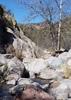
The first 3-4 miles we followed the white posts, which serve as good cairns to mark where you need to go. I could see the confluence at Keet Seel and Dowozhebetio Canyons and knew we had to turn left. Soon after, we spotted Battleship Rock and then Kachina Mother (Pointed Rock). After that, we passed the 3 water falls and were at the ruins.

The biggest issue along this hike that seemed to get worse as we got closer was the quicksand. This might have been because of the recent rains, but I think this is a normal condition here. We were soon able to tell which ground looked ok and which didn't but the rule of thumb seemed to be stay away from the big boulders and step on the clusters of small rocks. for some reason, the boulders seems to gather eddies downstream that collect pools of silt that create the quicksand. there were many times you would have to take your chances and walk on what looked stable. Usually the sand in the middle of the stream was stable but sometimes on the bends it wasnt. There were a few times when you would venture beyond the safety of rocks to find yourself in the middle of some chocolate pudding that looking like the surface tension might give way at any second and engulf you. Alan an Eric were usually about 100-200 yards ahead of us. At one point, we came around one bend to find Alan yelling, "Go to the other side, this side is bad. Eric almost died! Go to the other side! No stable ground here!" I saw a steep shore and alot of rocks on the side I wanted to go. On the other side it looked really dicey. We barely made it through there with much cursing of Alan's advice. On the way back, we took the "bad" side and made it peacefully.

that last half mile to the ruins was kind of soupy. Gordie had said it was getting nerve wracking and I had to agree. The level hike itself was nice, but the quicksand and 8.5 miles one way was wearing on us psychologically more than anything else.

Finally we got there. Alan and Eric were there first and met Patrick, our NPS guide. He was Indian, but I can't remember if he was Navajo or Hopi, I think he may have been Hopi (Alan, comment and correct please). I do remember that he said he was of the Sun Clan.

After we had some lunch and rested, we knocked on the cabin door to roust Patrick and he took us on our way. Around the first bend you get the first view of the site in it is absolutely outstanding. It was one of those "Oh my God" moments. After an extended Q&A period where I could hardly sit still, we made our way to the ruins.

I had been stessing over the climb up the 70' ladder but I think its only more like 40' and its not nearly vertical. The climb up the AZ Hot Springs laddder was more scary than this.

At the top, the pictures were snapped non-stop as I and everyone else went into Japanese tourist mode. I had to catch up with Alan and Eric talking to Patrick and had to sometimes ask him repeat answers to questions. Just before we left he said "I have to show you one more thing". This was some beads and cords that the Anasazi made he or other guides had found. He had them hidden under some rocks. He also metioned how below the ruins was a burial ground that was the top of a huge arroyo that has grown over the last 100+ yrs. There's a ladder by the benches that give a view of the site descend in the wash. Patrick said that this ladder is to provide access to archaologicialists a way to survey the wash for remains from the wash and from trash, as this was also a trash site. Its amazing to see the pics they provide to show how much the arroyo below has grown in the last 100 yrs.

On our way out at the bottom, Patrick showed us the several pottery shards at the bottom that we passed on our way in. On your way in, you're totally absorbed by the view of the ruins and you miss the shards. Then on your way out, the guide shows the shards and you feel like the total tourist you are, 17 mile hike or no 17 mile hike.

On the way out, we had some better views of the canyon, which we expected. The climb up the "staircase" was easy for me. I turned on the jets and left only Gordie and Alan behind. Eric gave a head start only because he was changing socks and was soon on my tail like Jason Vorhees until I got to the top. For all my "Speed", Alan and Gordie only got to the TH 10 min after I did.

That night we got to Tuba City for our hotel rooms, showers, dinner, and sleep. After dinner, I invited Eric and Alan to our hotel room for celebratory Serbian brandy. Gordie, the youngest man of the group, had blisters on his feet and was too tired to get drunk. As Alan, Eric, and I imbibed, Gordie faded out. I was happy to finally get a good 9 hour night of sleep afterwards after a summer of pushing the envelope.

Overall, very great weekend doing the hiking of a lifetime. Very glad that this is one of several hikes of a lifetime that I've had an opportunity to do.
 Flora
 Flora [ checklist ]
[ checklist ]  Bee Spiderflower
 Culture
 Culture [ checklist ]
[ checklist ]  Tsegi Orange
 Named place
 Named place [ checklist ]
[ checklist ]  Keet Seel Canyon
_____________________
 
Aug 04 2012
avatar

 Guides 11
 Routes 88
 Photos 2,649
 Triplogs 243

93 male
 Joined May 16 2005
 Scottsdale, AZ
Keet SeelNortheast, AZ
Northeast, AZ
Hiking avatar Aug 04 2012
Al_HikesAZTriplogs 243
Hiking18.00 Miles 2,000 AEG
Hiking18.00 Miles   9 Hrs      2.57 mph
2,000 ft AEG   2 Hrs    Break
 no routes
1st trip
Linked   none no linked trail guides
Partners none no partners
PROLOGUE

See Stillernator's triplog first.
Chris posted an invite on HAZ and we thought it looked interesting. Then it became iffy because of the monsoons closing down the Keet Seel Canyon. Thursday Aug 02 1330 Chris called to say that he had received word that the Park Service had opened the trail but could close it again if they got more rain. But Betatakin (Talastima) would be open as a Plan B. So we were on. I knew it was Chris's birthday so I bought cupcakes, birthday candles and a big Tervis insulated Pittsburgh Steelers tumbler.

The Navajo Reservation observes Daylight Savings Time so they are 1 hour ahead of AZ at this time of year.

You must take the official orientation before the hike. We went up on Fri Aug 03 to take the 1515(Navajo) orientation so that we could get an early start on Sat Aug 04 to hike this as an 18 mile dayhike. Otherwise we would have had to take the Sat Aug 04 0815(Navajo) orientation and not been able to start the hike until around 0930

DAY ONE:
Eric & I connected with Chris and Gordie at the Lowe's at I-17 and Happy Valley. About 0615(AZ) we began our caravan to Keet Seel with the Stillermobile in the lead.

Arrived at the Navajo National Monument Visitor Center at 1130AZ (1230Navajo). Sunset View campground was empty. We chose campsite #9 (the jersey number for Daniel Sepulveda - a punter for the Steelers). We set up camp. Chris doesn't just camp - he lives large and tailgates. He set up the official Steelers tailgate chairs, hauled in 3 big coolers filled with food and beverages, fired up the gas grill and starting grilling brats with his official Steelers grill utensils. He set up a 4 man Coleman bug screen and cots.

Headed to the Visitor Center for orientation. Got to the orientation 5 minutes early so we could get the good seats at the back of the class, but we were the only ones at the orientation. The Ranger spoke so softly that calling his volume a whisper would be exaggerating. Since Chris was the Permit Holder and would be the one getting into trouble if we screwed up, we just cracked jokes and dozed in and out.

After the orientation, we hiked the Rim trails. Great views of Betatakin (Talastima). Hiked down to the Aspen relict forest overlook then back up and over to the historic Contact Center and historic Ranger Hogan. Then headed back to camp for Chris's Birthday Party. Chris unwrapped the Steelers drinking glasses. Since we were on Federal land but inside the Reservation, we weren't sure if liquor would be allowed, so we stuck to juices (that's my story and I'm sticking to it). Chris gave us some different Serbian fruit punches. But after a couple of glasses, I kept getting them confused. One was apricot and another one was plum. I shared some blue agave nectar. And Chris kept grilling. He grilled brats and chicken and veggies and steak. We need to buy him a Steelers chef apron.

Chris and Gordie started talking about heavy metal bands. Since the only heavy metal I listen to is Neil Diamond and Toby Keith, I turned in anticipating an early wake up.

And the rain started pattering on my tent.

DAY TWO
I heard some heavy metal ringtone and then some grumbling. I had expected to hear a ringtone of Steelers Coach Tomlin announcing morning practice, but Chris must not have that one downloaded. It was 0315 and time to break camp and hit the trail.

The forecast was mid-80's on the Rim and mid-90's in the canyon. Partly cloudy with about a 20% chance of rain. The cloud cover and some light breezes kept it acceptably comfortable. I had 3liters in my hydration bladder, 2L in an MSR cache bag, 1L of Elete electrolytes in a Nalgene in my pack and 2-750ml bottles of Elete electrolytes in the pockets outside my pack. So 7.5L total . I ended up with about 1.5L in my hydration bladder at the end of the hike. Eric carried 6L. He carries Accelerade powder and mixes his electrolytes as he needs them. I think Chris had about 13L of water and Gordie about 9L.

Drove to the Keet Seel parking lot and started hiking about 0600. I got a good pic of dawn breaking from Tsegi Point. Going down the steps, Gordie had lagged a little behind Chris. As we approached the caching point by the junipers just before the drop into Laguna Creek Canyon we heard Gordie shout "Where's the trail?" He had blown through a turn and dropped below the trail into some juniper scrub. We could see the trail above him. Eric gave him verbal directions and I started hiking back up the trail if needed. The kid is a very good athlete, but a newbie to this kind of hiking. His big dSLR camera bag must have weighed 8-10lbs and Chris had set them up very conservatively and carrying plenty of water. Eric loaned his hiking poles to Gordie to mitigate Gordie's discomfort.

Because of the monsoons, there was an incredible amount of water and mud and quicksand in the canyon. I had a comfortable old pair of Five Ten Campfour approach shoes that I was willing to ruin. They worked perfectly. Time will tell if they are ruined. Eric wore Salomon lowcut dayhiker boots with mesh. The mesh drains really well and kept out pebbles but let in all sorts of silt and sand that built up under his toes. In hindsight he would have probably been happier with some Gore-tex trail runner and gaiter. We tried to keep our feet dry for the first half dozen crossings, then just gave up and realized we were going to get our feet wet sooner or later. We found 3 different types of quicksand. The mud pudding - the sort of quivers under foot. The muck - where you sink in a few inches. And the deep - where you sink in above your knees. The worst quicksand is around the bigger rocks. It appears that the flood must create an eddy around the rock that then fills in with the silt sand. We became pretty good at recognizing the different quicksands and negotiating them. The actual stream itself seemed to have less quicksand than outside the streambed. Eric sank past his knees in one area. I scrambled around and held out my hiking poles. All he could do was balance with the poles, slowly raise his leg and foot and move it forward then repeat with the other foot. As he got closer to solid ground I was able to help with pulling on the poles. I told Chris and Gordie to go on the other side. I did not say ". . . Eric almost died". If I had been thinking quicker I should have thrown Eric's hat on the quicksand and yelled that I needed help getting him out. Eric & I were in cruise mode and would get a little ahead of Chris & Gordie - who were both busy taking photos - but we would occasionally wait so that we maintained intermittent visual contact. Heard a raptor, spotted its nest, then watched it glide down and over us. Light underbelly - maybe a Cooper's hawk.

We got to the ruins and connected with Patrick Joshevama, the Park Service guide on duty. I greeted him in Dineh not realizing that he is Hopituh Shi-nu-mu (Hopi) and Sun Clan. If I had known he is Hopi the proper greeting would have been "Haw" or "Um waynuma?" I had been to the Hopi Festival in July so we talked about some of the festival and some of the Hopi that I know. He is a carver and was carving an atlatl and making atlatl darts. Keet Seel and Anasazi are the words used by the Tavasu (Hopi name for Navajo). The Hopi words are Kawestima and Hisatsinom so I used these words in talking with him about this place. He brought us some binders of photos of what Kawestima looked like years ago. We moved to the second set of picnic tables closer to the ruins, ate lunch, rested and put our packs in a metal storage container. Patrick arrived and told us to wear headlamps if we had them. Chris had been a little anxious about the ladder, but when he actually saw it and started climbing it he realized it wasn't that bad. I think he got a little out of his comfort zone getting on and climbing down one of the ladders in the ruins, but he quickly got comfortable with these ladders. Patrick was very knowledgeable and very patient. We kept making wisecracks and joking and we had him laughing at us. He showed us the tool stone and we joked "Oh, this was their True Value hardware store!!!" "this is a big storage room, did it have always low prices, was it the Hisatsinom WalMart?" He explained that the Kivas were the men's social clubs so we joked about them having an app for football scores. I asked about two holes in the Kiva and he explained that the loom fit in them. I asked "Women were allowed in the Kiva to weave?" Patrick explained that Hisatsinom men were weavers. Just before we left Patrick said "Ok now I have to show you the museum". He had hidden some unique items under some stones. He pulled the stones off and had some yucca cord, some "yucca and turkey feather cordage", a weapon head and some incredible small and intricate beads on a thread. Patrick explained that the Hisatsinom raised turkeys in pens near the spring below Kawestima. They used the feathers to make a cord that they wove with yucca fibers into yarn for blankets and rope. I shared the only joke I know in the Hopi language and Patrick laughed. As we were leaving, Patrick went back to working on an atlatl dart and shared the secret for making straight shafts for arrows and atlatl darts. I thanked Patrick. Kwakway is the male form for Thank You in the Hopi language. I asked about kawayo and he told me maybe. I bid him "Nu' pay nimani".

I agree with Chris that on the way in we were enthralled by the approach to Kawestima. On the way out we saw that the ground was covered in pottery sherds. I disagree a little with Chris, I did not feel like a tourist (but I didn't take as many photos). I felt like I was visiting the family home of a friend.

Eric and I led on the way out but would wait and occasionally make visual contact and verify that they showed no unusual signs of distress. Approaching Laguna Creek we did see kawayo - a mare and a foal. We tried to get close but the mare watched us warily and when we got within about 100m she and the foal would trot a 100m away.

We regrouped at the cache point. Chris hit the jets and was gone. Gordie was hurting a little and I later learned that he was developing horrible blisters. I wish I had known because I would have stopped right there and shown him how to treat them. So Gordie and I hung together and he was amazed that an old fart could hike so well. I mentored him on hiking and training techniques. Eric had spent some extra time at the cache point taking care of his feet and changing socks so he started a little after us. I made visual contact but soon he passed us. We got to the parking lot about 10 minutes behind Chris and Eric. Eric and I went to the Visitor Center so he could buy some gifts for his daughter.

We drove to Tuba City to the Quality Inn. We checked in and had some complimentary Navajo Fry Bread. Shared some with Gordie. We asked the Concierge at the Quality Inn about fine dining in Tuba City. She told us the best was at the Hogan Restaurant at the Quality Inn. I did not tip her for this advice. We went to the Hogan Restaurant. We started with the fresh salad bar. I had grilled salmon and steamed vegetables. Eric had the Taco Plate but was not brave enough to have Fry Bread tacos. Chris and Gordie came in for dinner. A British couple came in for dinner and asked the waitress what kind of beer the restaurant had. A little sheepishly she explained that they were on the Rez.

Went back to Chris's room for Serbian fruit punch. The trail had beaten Gordie up pretty bad so he nodded off. Chris wanted to hike Mormon Mountain by Flagstaff but with Gordie being tired, we called that off and retired for the night.

DAY THREE
Eric & I woke early. Had the complimentary breakfast at the Hogan Restaurant and came home. Great trip with great buddies.
 Fauna
 Fauna [ checklist ]
[ checklist ]  Wild horse
 Culture
 Culture [ checklist ]
[ checklist ]  Kayenta Anasazi Kiva
 Named place
 Named place [ checklist ]
[ checklist ]  Keet Seel Canyon  Tsegi Point
wildflower observationwildflower observationwildflower observationwildflower observationwildflower observation
Wildflowers Observation Light
_____________________
Anybody can make a hike harder. The real skill comes in making the hike easier.
life is like a roll of toilet paper. The closer it gets to the end, the faster it goes. Andy Rooney
 
Jun 20 2012
avatar

 Guides 4
 Routes 27
 Photos 4,621
 Triplogs 975

56 male
 Joined Aug 23 2005
 Pike National Fo
Keet Seel etc, AZ 
Keet Seel etc, AZ
 
Hiking avatar Jun 20 2012
sneakySASQUATCHTriplogs 975
Hiking30.39 Miles 3,440 AEG
Hiking30.39 Miles
3,440 ft AEG
 no routes
1st trip
Partners none no partners
WHAT A RIDE!

As usual lately I got a small window of time to hike with a large # of goals. Found out that the alcove was open at Keet Seel and this has been on my list since I went in 2000 or 2001 and came back to realize when I developed my ex's film that only one picture had been taken of the dwelling from the campsite. :o
I knew I needed to either go to the orientation the day before or the morning of the hike. Forecast was for 96 degrees and I wanted nothing of getting a 9:00 am start for that day to do this as a day hike. :tt: I also wanted to use that day efficiently since I was already up there.

HATCHED A PLAN! :D Talked Keet Seel rangers into letting me do the orientation at 8:00am the day before and then drive up to Grand Gulch/Cedar Mesa to check out a couple of other places on my list.

1:30AM Up on my way out the door for Navajo National Monument. 3 hrs. of sleep less than Ideal, but excited for the next couple of days.
7:30 Arrive at Navajo NM early hike out to Betatakin overlook (sandal trail?)for a view while waiting for office to open. Permit in hand and out the door by 8:45 for Grand Gulch Cedar Mesa.

MOONHOUSE! AMAZING! Had wanted to visit these since the Grand Gulch trip last year and Alex told me about this dwelling as we were driving past the access road on the way home from the backpacking trip. It wasn't until this year that I came across Rob and Randall's photosets which I somehow missed when they went. They did not disappoint.
Got my day permit at the Kiosk after running rob del desierto off the road. :sl: (Ok he was nice enough to pull over as I passed him on the way to the TH. I didn't know it was him at the time, but thought as I drove by, the truck looked an awful lot like his HAZ ride.) :sl: It was probably 11:30 by this time and hot.
I explored up and down from the main complex of dwellings and found quite a bit of evidence of habitation. First time using the new camera and could not tell if I was getting the dwellings with them shaded by the overhang, but they turned out better than I thought. Also, found a pictograph of a red figure up canyon, but it came out blurry due to user error. :cry: Of course the less interesting ones came out clear. I really found this place amazing and spent way more time here and had to adjust my schedule accordingly. I didn't have time to hit one of my destinations and explored the canyon farther up snowflat rd. I will be back to do a section of this canyon in the future.
SOUTH FORK OF MULE CANYON/MULE CANYON RUINS: The latter was a roadside stop. The former was the only place I saw people as I dropped in there was a large group of kids with a couple of adults camping. It was 7:00 pm by the time I started this and I was hoping to get the last sun on the ruins before it went below the canyon. Not as good as I hoped, but worth the visit. When I first got to the ruins the light wasn't that good so I hiked further up the canyon and climbed to a high point to search for habitation and get a view of the last rays of the sun disappearing and to eat! Was so impressed with Moon house I lost track of time and realized I had only had a couple pieces of beef jerky and a cliff bar all day. Went back to the dwellings took some more pictures and tested the camera on some low light flower pictures. Got to the truck 9:30 pm.
DRIVE BACK TO NAVAJO NM: Most adrenaline pumping action of the trip! Before Mexican Hat in a dark desolate section of the highway I saw something beyond my headlights and immediately slammed on the breaks stopping just short of two very unconcerned horses blocking both lanes. :o Later, between Kayenta and my destination once again I saw something beyond my headlights identified a cow and swerved as there was no other traffic at 12:50am. I got to my campsite which I scoped out after orientation because of the two trees at 1:00AM and was tucked into my hammock by 1:15. Woke up at 6:00am packed up cooked breakfast and on my way to Keet Seel by 7:00-7:15. I went light and brought the go lite umbrella to do my best Mary Poppins impersonation once the sun got out for the forecasted scorcher. I had good shade in the canyon until about 30 min. before getting to the dwelling. I found that this hike is not nearly as difficult when you aren't carrying your water and the person you bribed to come alongs water as well. Even with Tibber picture taking the hike in took about 2.5 hours. Unlike Joe, I was in heaven upon arrival and Cassandra Parrish took me on the tour. I spent 2 hours there and she learned me more than a few things and pointed out some other things that weren't pointed out to me during the previous tour I took. Awesome! It took about 3 hrs to hike out probably because I took less pictures. It was hot on the way out 96 in the canyon and surprisingly on the climb out my watch said 109 :o I thought it was a mistake and took it off during a break in the shade and it still said 109. I hate steep uphills in sand and was thankful for the switchbacks. :D The sand was so hot I could feel it through my shoes and socks and found myself doing the lizard dance when I stopped on a couple breaks standing on one foot at a time. My feet are pretty heat insensitive after wearing the vff's for so long so I know the sand was hot. I had the entire canyon to myself. :y: I guess the two other scheduled day hikers and three campers decided not to go.
I made it home back to Mesa before 7pm. Great trip and I don't even like hiking when it's hot.
8)
Waterfall at Keet Seel was flowing nicely. http://youtu.be/dQN61PLb2Zw
 Flora
 Flora [ checklist ]
[ checklist ]  Bee Spiderflower
_____________________
:o
 
May 31 2012
avatar

 Guides 264
 Routes 2,797
 Photos 14,494
 Triplogs 5,894

55 male
 Joined Nov 20 1996
 
Keet SeelNortheast, AZ
Northeast, AZ
Hiking avatar May 31 2012
joebartelsTriplogs 5,894
Hiking17.90 Miles 2,058 AEG
Hiking17.90 Miles   7 Hrs   35 Mns   2.80 mph
2,058 ft AEG   1 Hour   11 Mns Break14 LBS Pack
 
1st trip
Linked   none no linked trail guides
Partners partners
JuanJaimeiii
I've turned down this hike a couple times now as ruins don't excite me much. Figured I best jump on the opportunity as it may never present itself again.

Paul Johnson gave us our orientation. Little did I know it would have such a lasting impact. On to the hike I loaded the gps route. Eight and a half miles, really? Under twenty for the day put a little zip into my mentality. The only question left was how long was the admiring session at the ruins going to take?

At the gate I was careful not to pinch my fingers as described at orientation. The views from the get-go are spectacular. The hike through the canyon was quite scenic and enjoyable. The sand wasn't too bad considering all. Heck the creek crossings were rather refreshing too.

At the main waterfall we got off track. The side canyon was the most difficult part of the day for myself. I got stuck in mud quicksand. Not deep but it took some serious energy to break free. Back on track we opted for the high trail. It has a big wash out that drops ten to fifteen feet and right back up and the rest travels easy.

At the rangers check-in we were greeted with the most sincere and warm welcome I ever recall. Diane and Steve Hayden insisted we stop in. I'm not into the whole smashing up herbs and running scalding hot water over for consumption deal but jj3 took them up on it. Steve asked if we understood that the alcove was closed. I thought he was joking. Nope, there was a big washout last year. Since they don't do excavations or something (yeah I was listening well) the tribe needs to examine these washouts when they naturally occur. Sounded good to me! Since I'm not into ruins much I'm thinking this is shaping up to be a decent hike...lol

Steve is the perfect guy for those interested. I sincerely felt bad as he poured out information. Joel, Kyle, Rob and countless others would likely find this stuff fascinating and more importantly be able to respond intelligently. After nine hours or maybe it was thirty minutes we were off to view the ruins from a distant. Of which I overheard could take around two hours. In the back of my head I'm thinking this will take longer than a movie. Oh please just shoot me now. Later jj3 explained that was if we toured the ruins. ahhh

So we sat at the benches looking over to the ruins. Steve was giving a prize presentation on god only knows what. I'm scanning for buzz words that I can relate to like integer, taco, gps. Wait a minute... hey! why is everyone else here curled over asleep and I'm the one paying attention!

Steve is beyond cool. We simply share different interests. He did enlighten me on the importance of a few things. We said our goodbyes. Steve invited us back, Diane gave us a warm sendoff. Heading back I was in awe that we had already gained 1k and would be hiking down hill until the big climb out. It never got hot the entire day. I enjoyed it all thoroughly. At a moderate pace this only took six and half hours.

For jj3 this completed his "100 Hikes in Arizona" book. I asked "so what are you going to do next", he said "I'm throwing the book away"

Thanks jj3 for a cool little trip to an area of Arizona I've never seen! :y:

https://www.youtube.com/watch?v=Lx2HH_drvVY
 Fauna
 Fauna [ checklist ]
[ checklist ]  Wild horse
wildflower observationwildflower observationwildflower observationwildflower observationwildflower observation
Wildflowers Observation Isolated
_____________________
- joe
 
May 31 2012
avatar

 Routes 596
 Photos 9,604
 Triplogs 2,400

58 male
 Joined Jan 30 2011
 Chandler, AZ
Keet SeelNortheast, AZ
Northeast, AZ
Hiking avatar May 31 2012
JuanJaimeiiiTriplogs 2,400
Hiking18.00 Miles 2,000 AEG
Hiking18.00 Miles
2,000 ft AEG
 no routes
1st trip
Linked   none no linked trail guides
Partners partners
joebartels
I've been waiting for Keet Seel to open up for the season and today was the first day I would be able to do it after they opened up for 2012. This hike is in Scott Warrens book "100 Classic Hikes in Arizona". It was the only remaining hike that I had not completed from both the 1994 version and the most recent edition. The two books have a combined 110 hikes and all were enjoyable.

As for today's hike we started off at the visitor center at 8:00 for a brief orientation. The Ranger was funny in his delivery style. (you kind of had to be there) After that Joe and I hit the trail and in no time we were making our way down the river bed. The Ranger said we would cross the river 20-25 times. He was light in his number but the water felt good. As you get closer to Keet Seel you can either take the high route or stay in the river bed. We chose to take the high route.

Upon reaching the ranger Hogan at Keet Seel we were promptly greeted by Ranger Steve and Diane (I think that was her name). They invited us in and were very cordial. Shortly later another couple showed up and we went down to look at the ruins. One thing the Ranger failed to tell us at the orientation is that currently the alcove with the dwellings is closed due to a washout from recent rains. The trail leading the way in is in need of re-construction. It was fine and Steve had books with photos and lots of detail to review with us. Out of the four of us I think Joe was the most interested in learning about the ruins. ;)

Anyway once it was over we headed back and this time took the riverbed. On the return we crossed paths with some wild horses which was really cool. The weather was great all the way until we had the final climb out, that part was a little on the warm side.

It was a great hike and I had lots of laughs with Senior Jose!

Glad to have completed the book as well. I saw more of Arizona in the last year than I have seen in the previous 23 years combined. It was an Awesome Journey!
 Fauna
 Fauna [ checklist ]
[ checklist ]  Wild horse
 Named place
 Named place [ checklist ]
[ checklist ]  Keet Seel Canyon
_____________________
 
Jun 18 2011
avatar

 Routes 93
 Photos 7,758
 Triplogs 1,691

64 male
 Joined Mar 11 2003
 AZ
Keet SeelNortheast, AZ
Northeast, AZ
Hiking avatar Jun 18 2011
wallyfrackTriplogs 1,691
Hiking20.50 Miles 1,285 AEG
Hiking20.50 Miles   8 Hrs   59 Mns   2.28 mph
1,285 ft AEG
 no routes
1st trip
Linked   linked  
Partners partners
uphill_junkie
I took a trip up north with Amy, Brett & Aaron. We started the drive up after 4pm, ate in Flagstaff and got to the Navajo National Monument shortly after 10pm (11pm Navajo time). We set up camp and got some sleep. At 8:15p we got the permit and starting hiking from the visitors center. What's a few extra miles. :sweat: The weather was nice will a breeze blowing and down hill hiking. The trail in is fairly easy to follow but there are a few areas where you need to pay attention but there are markers. The hike was nice but I was in it for the ruins. We didn't know what to expect on the water crossings but the water was shallow and my hiking boots stayed pretty dry. With about 2 miles to go Aaron and I took the upper trail while Amy & Brett stayed on the creek trail. The creek trail is easier but the view from above was a nice change. When we got to the ruins we stopped and ate a snack while Max (the Ranger) got ready to lead us up. The tour went well since there were only 4 of us in the group and Max answered questions in detail. Tibber must of had a voodoo doll of me working because I took over 100 pictures on this hike and I don't remember taking that many ever. :o The hike out was warmer but we were on cruise control and got out in about 3 hours. :sweat: Thanks for setting this one up Amy.
 Culture
 Culture [ checklist ]
[ checklist ]  Inscriptions
_____________________
  2 archives
Jun 18 2011
avatar

 Guides 2
 Routes 9
 Photos 1,486
 Triplogs 944

female
 Joined Apr 28 2010
 Tucson, AZ
Keet SeelNortheast, AZ
Northeast, AZ
Hiking avatar Jun 18 2011
uphill_junkieTriplogs 944
Hiking20.50 Miles 1,285 AEG
Hiking20.50 Miles
1,285 ft AEG
 no routes
1st trip
Linked   none no linked trail guides
Partners partners
wallyfrack
This was an amazing trip, I enjoyed every aspect of it! The canyon we had to hike through was very pretty for 'desert standards' in my eyes. I'm not huge on desert scenery, but this was a combination of some green mixed in, so it made it for very interesting. Plus, hiking through water is always a nice change. It was a very easy hike, but it's kind of nice to do a 'relaxed' hike every once in a while. :D The weather couldn't have been more perfect, and neither could have the company! :) We had the entire canyon to ourselves, which made the whole thing worthwhile! It wasn't a crowded, touristy type of place. That's the benefit of only allowing 20 people in per day. We did pass one group of backpackers, but it was very brief, and the rest of the time, we had complete solitude. The ranger gave us our own personal hour & 1/2 tour of the ruins, and it was very impressive.

With the exception of it being super cold at night and my air mattress donning a whole & deflating on night 2, the trip was a fantastic getaway!

My gps read WAY different elevation gain than Wally's, but I'll go with his.
_____________________
No pants!
 
Jun 11 2011
avatar

 Guides 3
 Routes 569
 Photos 11,976
 Triplogs 1,634

50 female
 Joined Sep 18 2009
 Tucson, AZ
Keet SeelNortheast, AZ
Northeast, AZ
Hiking avatar Jun 11 2011
GrottoGirlTriplogs 1,634
Hiking17.00 Miles 1,300 AEG
Hiking17.00 Miles
1,300 ft AEG40 LBS Pack
 no routes
1st trip
Linked   none no linked trail guides
Partners partners
TUB - Group
squatpuke
This is definitely on the list of places to go if you are interested in Native American history and cliff dwellings. If you read the description of the hike on hikearizona.com and get discouraged - please don't. I believe it was written by someone who doesn't regularly backpack. It really isn't that hard if you start early to beat the heat and don't take anything that is unnecessary (unless you are an experienced backpacker). Yes, 2 gallons of water is heavy, but really it's only part of the day that you are carrying it. You'll have plenty of time to unwind in camp.

The hike in is very spectacular. Blue sky with red canyon walls marked with green vegetation - beautiful! It's a shame that the canyon is used for running cattle by the Navajo. If it wasn't it would be one of the best backpacking canyons because of the plentiful water and great views. The cows, however, make the thought of drinking the water very unpleasant. It also can make you scrub your feet before crawling into your sleeping bag. I recommend a extra few wet-wipes to do the job.

The hike in took us approximately 4 hours. Which included a lot of picture stops and a nice long snack break in the shade.

The tour was awesome in part because you get the experience of climbing up into the alcove. The buildings are well preserved which gives you a great idea of what it looked like when the Ancient Ones inhabited the area. Towards the end of the tour I ran out of battery power in my new camera. It hadn't occurred to me to bring the extra battery. I am so used to using the Ultra Lithium AA in my old Canon which would give me about 2 weeks of non-stop photos. I asked the ranger if I could run back to camp and come back for a few more pictures. She said I could. When I returned, there wasn't anyone waiting for a tour yet and some of my party was still asking questions. I worked on finishing up my photos and asked a few questions. One of my friends also was chatting to the ranger and to another lady who was in training. They were very pleasant and seem to enjoy our conversations and questions. I had shown them a map that I had of the area which marked several additional ruins. We were told that there were probably many more. We asked about hiking off trail and was told that it was not allowed. My friend joked a bit about wishing he could sleep in the ruins - the rangers echoed his wish. We were very pleased by the tour. My friend even shared a snack with them outside of fenced area.

We had a great time in camp. There were two other parties. A couple from Colorado and another Arizona backpacking group. We shared lots of good conversation which made for a pleasant night.

In the morning, we got up early and started hiking at 7 AM Navajo Time. This was to our benefit because it meant that we were hiking in shade most of the morning. We managed to get back to the cars in about 4 hours (including breaks).

I went into the visitor center restroom to wash up before our drive home. When I came out my friend reported that a Law Enforcement Ranger had been called in from another park. I guess they thought we were going to do all kinds of illegal activity. Little did we know that showing the map with the cliff dwells marked on it, asking about hiking off trail, keeping the rangers longer than usual, and a humorous remark regarding rank amongst volunteers and rangers in training had set at least one of the rangers off and we were reported to the Visitor Center. We would have never known if we hadn't stopped to use the facilities therefore we decided to leave. On our way out we saw the Law Enforcement Ranger (LER) coming into the park and we decided to return to settle matters, especially because my friend volunteers for the Parks. My friend ended up talking to the LER and resolving what was most likely just miscommunication. So, the moral of the story is beware of rangers, especially friendly ones.

Anyway, the end kind of spoiled the high feeling I had obtained from my trip. I'm still glad I went because it was an awesome learning experience. It fits well with the other backpacks I've done to Ruins (which include Crack-in-Rock and Kane to Bullet in Grand Gulch). Besides, you can't beat some of the views in the canyons of Skeleton Mesa.
 Flora
 Flora [ checklist ]
[ checklist ]  Soaptree Yucca
 Fauna
 Fauna [ checklist ]
[ checklist ]  Cow  Wild horse
 Meteorology
 Meteorology [ checklist ]
[ checklist ]  Moon
wildflower observationwildflower observationwildflower observationwildflower observationwildflower observation
Wildflowers Observation Light
_____________________
 
Jun 11 2011
avatar

 Guides 6
 Routes 6
 Photos 1,634
 Triplogs 186

58 male
 Joined Apr 04 2002
 Flagstaff, AZ
Keet SeelNortheast, AZ
Northeast, AZ
Backpack avatar Jun 11 2011
squatpukeTriplogs 186
Backpack17.00 Miles 1,200 AEG
Backpack17.00 Miles2 Days         
1,200 ft AEG
 no routes
1st trip
Linked   none no linked trail guides
Partners partners
GrottoGirl
Special thanks for Belinda for posting her trip on HAZ and letting me join. This hike has been on my list for some time and outta-the-blue...I see a post in the forums for KEET SEEL...I love this website; even got to met some new friends (nonHAZers) from Tucson.

We had done the hard part of the trail the day before when we did Betatakin...so we knew what we were up against on this OAB hike. The night before, we completed the mandatory ranger lecture back at the VC (basically a power-point with various pictures of the trail) and were excited to get on the trail the next morning.

Overall, the trail is fairly easy...the hardest part is mentally preparing to walk in urine and feces for several hours. :o I wore my Keen water shoes w/trail socks which were great for the hike, but when I got home, it took forever to hand wash those extra nasty socks while showering.

The weather was predicted to be very nice, so I opted to NOT take my 4+lb tent and only took my new Eno hammock (1lb). This was my trial run sleeping in the hammock and my experience was "so-so" (I have a tough time sleeping anywhere it seems); plenty of oak tress to hang from in the campground though. I carried extra water since I left the tent...caching 3 liters at the bottom of the hill, prior to the first stream crossing. (very good idea for future hikers btw)

We arrived at the campground first...around 2ish...and then we all bolted off for the tour with our muddy, stinky, wet feet. Our tour guide was a young woman ranger, but she seemed to know her stuff. We took TONS of pictures and gained a lot of information about the Anasazi. The site itself is amazing with preserved artifacts including midden piles with human hair, corn cobs, shards, etc. The ranger uncovered her personal stash which included some arrowheads and beads. Belinda got a double tour of the ruin as her battery expired midway during the first...she asked the ranger if she go back to camp (1/2 mile) and get a fresh one and she agreeably said "yes".

When I got back to our campsite, I found several Phoenicians from another website...a few were also hanging in hammocks, so I was able to get a few tips from some seasoned "hangers"...there was also a very nice couple for Colorado who spent quite a bit of time getting to know us. In total we had 14 and the campsite seemed a bit cramped...

This campsite has THEE NICEST compost toilets I've had the pleasure of placing my cheeks upon..."If it's pee let it be, if it's poop add a scoop" is the motto there...the scoop being a small cup of wood-chips which you can pour onto your steaming pile when finished. It seemed to work as the facilities were simply fantastic!!!

The hike out the next day seemed to go really quick. The hardest part of course was the sandy climbs at the beginning of the steep hill climb. Hiking sticks ARE VERY helpful for this section...

Once out, Mitch/Belinda had some issues back at the Visitor Center. I blame a bellagonna school teacher (who was at the site w/the rangers as a special guest) who I'm sure over-reacted to a few comments made by Mitch and caused a huge fuss with her ranger friends. Had it not been for that issue, I would give Navajo National Monument a 5-star rating. Well heck...okay I'll give it 5 stars anyway...all the bathrooms were great, campsites clean and garbage cans empy; the staff (for the most part very kind and helpful, and everything was straight forward, all we had to do was follow the rules. This park is really a gem and if you haven't been, I highly recommend.

Bob, IChun, Belinda, Mitch and Lois...thanks again for a memorable weekend!!
 Culture
 Culture [ checklist ]
[ checklist ]  Kayenta Black-on-White
_____________________
squatpuke@gmail.com
 
average hiking speed 2.31 mph
1, 2  Next

WARNING! Hiking and outdoor related sports can be dangerous. Be responsible and prepare for the trip. Study the area you are entering and plan accordingly. Dress for the current and unexpected weather changes. Take plenty of water. Never go alone. Make an itinerary with your plan(s), route(s), destination(s) and expected return time. Give your itinerary to trusted family and/or friends.

helpcommentissue

end of page marker