|
| | | |
| |
|
| Canyoneering | 4.45 Miles |
1,438 AEG |
| | Canyoneering | 4.45 Miles | | | |
| 1,438 ft AEG | | | | |
|
|
| | |
| Linked |
|
none
[ show ]
| no linked trail guides |
| Partners |
|
[ show ]
| partners | | I woke up Sunday morning to the sound of rain on the window. There was fear in my heart that my phone would soon be buzzing with news of my friends bailing on me because it was raining. I needed this trip, things had been rough for me lately. I grabbed the phone. Relief! No messages! I got on my normal weather sources and saw that the Superstitions forecast was still holding with a 30% chance of rain. I jumped up and finished getting ready and headed out the door.
Half of the group had never been to the Superstitions. They were in for a treat! We took the scenic Pinal Parkway as a warmup for the day's adventure.
Along the drive I was still learning all the options I had on my brand new Subaru Forester. With a nice toasty bum, I learned that Kevin's Toyota ahead of me could take over as my speed control as long as I kept a lock on him. It was a very relaxing drive since I only had to steer!
As we drove North the weather improved and soon it was apparent that our plan was going to be executed! We had carefully chosen a canyon that had extremely low risk of flash floods in an area with more favorable conditions than we had at home.
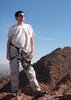
We pulled up to the trailhead to find that a group of yahoos had taken over the parking as their own personal camp. We backed down to a rough side road. I followed Kevin and soon saw that I was going to be testing not only my new car but also be expanding my off road driving abilities. With Kevin carefully directing me, I was soon three wheeling down the road. Soon, I was safely parked and was trying to give little thought of how I was ever going to drive out!!! I knew in the back of my mind we could figure something out.
As we packed, I gave Carole a ball cap I had modified to go under a helmet. The hat was perfectly horrible! Bright pink saying 'Warning! Doesn't fish well with others!' She loved it and all it's horribleness!
Since we were not parked at the traditional starting point for this adventure, we headed off in the general direction and bushwhacked until we were to a spot were we could scramble up 500 ft to the route above us. Along the way we were treated to some neat geologic features and happily our geologist friend, Garrison, gave us explanations about what we were seeing.
We headed down to the top of the first drop and took a lunch break. The anchor was a big boulder and a rosewood bush. Some of the webbing had small cuts so Josh replaced it. Kevin started down first. He uttered an explicit phrase as he started off. The wall had instantly dropped away and he was free hanging! The rappel was about 100 ft.
From there we downclimbed, Carole and I often helping each other. We also slid a lot and my pants were trashed a but luckily everyone is used to my clothing malfunctions. We finally were at the top of the grande finale rappel. The rappel had been bolted and was backed up with a rock chock. Things looked good so Josh finished rigging. He then threw the rope bag and we could hear resounding thuds as it tumbled near the bottom. I went down first. I was extremely glad I hung my pack; having to fight to stay upright on a rappel this long would have been excruciatingly painful. Instead, I was able to let out whoops and hollers as I went down the 240 ft drop!
I got to the rope bag and made a quick evaluation that I was on a ledge and that I did not really want to downclimb down from it. The rope bag was however about 20 feet away from me so I had to get off rappel, collect it, and throw it down the remaining distance. That part was easy. I got on rappel and had to fight the twisting of the rope that was making piglet tails that were halting my downward progress. Finally, I was on the ground and I was able to disconnect the rope from its bag and shake out all the twists so that the next person wouldn't have to fight.
As the group finished up rappelling, we headed down to start getting ready for the next segment of our adventure! Packrafting! At the same time, the rain started. I quickly donned my wetsuit and rain jacket to keep warm. As we blew up our boats, a real water craft came by and they offered us a ride. I held my breathe hoping again that no one would bail! Everyone was steadfast. I heard mention that the boaters probably had beer and chips! We all laughed and launched our rafts on Canyon Lake.
It was Kim's inaugural packraft! The smile on her face indicated that even rain wasn't going to stop it from being fun. Kevin and Kim had shiny new Alpacas and they showed off how they could easily glide through the water. Even though, Josh, Carole, I were still happy with our Klymit dinghies which had shown to be hardy water crafts in a mine and on the Gila, Colorado, and Flathead rivers. Garrison looked quite pleased in his borrowed Explorer 200!
As quickly as the rain started, it stopped. We were able to thoroughly enjoy our journey. Not far from where we entered the water, I spotted a herd of Bighorn Sheep! Then, we saw a Bald Eagle harassing some ducks. The Eagle soared high up to the cliffs. Without my super zoom I wasn't able to get a picture of either amazing sites. I felt lucky to have seen them.
All to soon, it was time to get out. We procrastinated a bit by heading under the bridge to check out Barranca Creek. It was a pretty creek with steep cliffs on both sides. Soon, however, I remembered that I still had to finish my off roading adventure. There was only an hour before sunset and we had a two mile hike ahead of us.
We packed up quickly and hiked up the nearly perfect dirt road. Kevin, Kim, and I were lazy and didn't take off our wetsuits. I figured I was cold enough that it might feel good to get hot. Only as we approached the cars did I start to feel uncomfortable. And that feeling was quickly forgotten.
Kevin drove out first. I jumped into the car and with everyone watching started up the bad section of the road with Kevin giving me hand signal directions while the sun quickly left us. I took several running attempt to make it up the hill. Each time I got a bit further. However when I ended up again on three wheels and no gravity to help me we had to go to Plan B. Win minutes, Kevin had the towing strap connected. Kim was driving and Kevin was directing. Soon the two girls in their wetsuits were on the main road and everyone was cheering.
We changed and headed out. Luckily, Tortilla Flats was still open so we were able to get refueled on burgers and chimis for our drive back to Tucson. |
| _____________________
| | |
|
|
|
 Route Editor