username
X
password
register
for free!
help
ArticlesGuidesRoutes
 
Photosets
 
 Comments
triplogs   photosets   labels comments more
Sugarloaf Mountain - Maricopa - 6 members in 7 triplogs have rated this an average 4 ( 1 to 5 best )
7 triplogs
login for filter options
Mar 19 2024
avatar

 Guides 110
 Routes 2,246
 Photos 8,982
 Triplogs 2,600

45 female
 Joined Dec 24 2007
 Ahwatukee, AZ
Sugarloaf Mountain - MaricopaSouthwest, AZ
Southwest, AZ
Hiking avatar Mar 19 2024
LindaAnnTriplogs 2,600
Hiking8.17 Miles 1,172 AEG
Hiking8.17 Miles   4 Hrs   1 Min   2.29 mph
1,172 ft AEG      27 Mns Break
 
1st trip
Linked   none no linked trail guides
Partners partners
The_Eagle
Route Scout Route Recorded  on Route Scout | Pop | Map | Popup | MapDEX
First hike of the day, and it was a winner. We parked near Dead Horse Tank and started walking the road. In retrospect, we could have driven to the wilderness boundary, but it would have pinstriped the hell out of the jeep. Easy enough walking. Once past the gate, the road continued and was rockier, also vague in places.

Went over a small saddle, then followed a drainage. The peak is clearly visible at this point, so we aimed for the slope on the northwest side that led to a spire we could see sticking up. Easy offtrail travel. The higher we got up the slope, the better the geology got. Once we reached the area of the spire, there was one scramble requiring the use of hands. Grippy rock helped, a cactus in the way did not help. That cactus ended the day a little smaller than it started.

Once above that spot, it was an easy scramble thru the rocks. Lots of alcoves that obviously shelter bighorn sheep and other animals. The more you look, the more alcoves you can see. We deviated from the official route at one point and went left around some rocks instead of right, and it was a very good route. From there, we followed a rocky ridge up to the summit.

Great views up top. Clear air, and a few clouds adding shadows to the landscape. Had a quick snack, then retraced our steps back down. Once at the lower part, we followed an old road for the heck of it. Encountered an area, maybe an acre in size, with dozens of numbered metal stakes in the ground, placed in seemingly no rhyme or reason. We walked around them for a few minutes, but couldn’t make much sense of it.

Definitely a worthy cooler weather hike in a remote area. Wear grippy shoes. The road wasn’t too bad. We drove the jeep, but Bruce’s Subaru could make it.
wildflower observationwildflower observationwildflower observationwildflower observationwildflower observation
Wildflowers Observation Moderate
Plenty of flowers, very green out there at the moment.

water 1 out of 5water 2 out of 5water 3 out of 5water less than max Dead Horse Tank 51-75% full 51-75% full
Looked to be well over half full, maybe closer to completely full.
_____________________
Stop crying and just go do the hike.
 
Mar 19 2024
avatar

 Guides 41
 Routes 1,626
 Photos 14,983
 Triplogs 2,760

69 male
 Joined Jan 20 2009
 Far NE Phoenix,
Sugarloaf Mountain - MaricopaSouthwest, AZ
Southwest, AZ
Hiking avatar Mar 19 2024
The_EagleTriplogs 2,760
Hiking8.59 Miles 1,140 AEG
Hiking8.59 Miles   4 Hrs   4 Mns   2.41 mph
1,140 ft AEG      30 Mns Break8 LBS Pack
 
1st trip
Linked   none no linked trail guides
Partners partners
LindaAnn
Route Scout Route Recorded  on Route Scout | Pop | Map | Popup | MapDEX
This one's been on my list for quite a while. The bang for the buck (i.e., 2hr 15min drive for an 8-mile hike) always pushed it to the back burner. Also, I was not sure if it was Subaruable.

I had mentioned this to Linda on a previous hike and gave her some tag-along hikes in the general vicinity to make it worthwhile. With the warm season approaching, it was now or never for the year. We met up at the Goodyear PnR and started our drive to the TH. You lose the pavement at the intersection of Aguila Rd and Vulture Mine Rd. At this point, Aguila is wide and smooth. At 13.1, you veer right off the wide smooth Rd to an easily navigated rd for just under 3 miles until it dead-ends into Microwave Tower Rd. 0.8 miles later, you hang left/east for the 1.2-mile 2-track to the TH. When dry, this is all doable with an HC vehicle with decent tires.

From the corral, the hike starts at Dead Horse Tank. You follow the drivable (with plenty of pinstriping) 2-track for a mile to the Hummingbird Springs Wilderness border that was established in 1990. You have mostly easy walking on a decommissioned 2-track turning to single track to the base of the mountain.

It is a short, fun climb/scramble to this peak. There was only one slightly tricky spot, made that way by a poorly placed cactus. That cactus was not a problem on our return. There is numerous sign of Bighorn Sheep and many alcoves that it is obvious that they congregate in.

We hung out at the top and took in the vast views. We were lucky to have a perfectly clear viewing day.
YouTube link

Once down, we took a slightly different route, following a 2-track that bypassed the ridgeline. We ran into an area that was marked with metal stakes, each with a small numbered disk. The #1 disk was dated in 1982 (8 years prior to becoming a wilderness). There were more than 50 of these in no rhyme or reason.

We thoroughly enjoyed this hike in a rugged area of our state, especially the climb to the peak.
 Culture
 Culture [ checklist ]
[ checklist ]  Old Rusty Stuff
 Named place
 Named place [ checklist ]
[ checklist ]  Dead Horse Tank  Sugarloaf Mountain

water 1 out of 5water 2 out of 5water less than maxwater less than max Dead Horse Tank 26-50% full 26-50% full
_____________________
There is a very fine line between "hobby" and "mental illness."
Dave Barry 🦅
 
Mar 08 2023
avatar

 Guides 99
 Routes 1,484
 Photos 16,072
 Triplogs 1,374

male
 Joined Jan 07 2017
 Fountain Hills,
Sugarloaf Mountain - MaricopaSouthwest, AZ
Southwest, AZ
Hiking avatar Mar 08 2023
DixieFlyerTriplogs 1,374
Hiking9.78 Miles 1,677 AEG
Hiking9.78 Miles
1,677 ft AEG
 
1st trip
Linked   linked  
Partners partners
SecretMtnLover
Route Scout Route Recorded  on Route Scout | Pop | Map | Popup | MapDEX
Today I decided to go hike to Sugarloaf Mountain. This was probably the 4th or 5th peak named "Sugarloaf" that I have hiked in Arizona. This particular Sugarloaf (elevation of 3,418 feet and prominence of 1,188 feet) is in the Belmont Mountains in western Maricopa County. It is also the highpoint of the Hummingbird Springs Wilderness.

I parked at Dead Horse Tank and followed the excellent driving directions posted by @grangerguy. In fact, his triplog is a de facto guide for the hike!

The first half of the drive on Microwave Station Road had some rough places, but the second half of the Microwave Station portion of the drive was much better. The spur road going to Dead Horse Tank was in decent shape also. I was happy to have been driving a high clearance 4WD vehicle, but if the road was dry I would think that an AWD SUV with decent clearance, decent tires, and a competent driver could drive to Dead Horse Tank.

The hike was straightforward: follow a road for a couple of miles or so, then follow some cattle paths, go along a wash, make your way to a ridgeline, then head up to the summit. There was one short class 3 move not too far below the summit, but other than that the hike was all class 1. There were nice unobstructed 360 degree views at the summit.

On the drive in we saw 3 deer, and then we saw a wild burro along the hike in the morning.

This was an enjoyable hike, and was perhaps the easiest of the desert peaks that I have hiked this winter.

After the hike we stopped and hiked up to Eagle Eye Arch. Tracie the Intrepid had never been to this arch, but it was my second time in 3 days to do it. The climb up to the arch from the road is short and steep, gaining 400 feet in 1/4 mile. There is loose dirt and lava rock on the use trail, so it is a bit slippery. We did not go up to the peak this time.

Distance and elevation gain for the 2 hikes is below. Stats above are the sum of the two.
Sugarloaf: 8.24 miles with 1,177 feet of AEG
Eagle Eye Arch: 1.54 miles with 500 feet of AEG
 Flora
 Flora [ checklist ]
[ checklist ]  Wallrocket
 Fauna
 Fauna [ checklist ]
[ checklist ]  Wild Burro
 Culture
 Culture [ checklist ]
[ checklist ]  Summit Register Log
wildflower observationwildflower observationwildflower observationwildflower observationwildflower observation
Wildflowers Observation Moderate
Wildflowers were on the light side of moderate. There were sections with prolific poppies, and in one section there were lots of yellow flowers, which I believe were wallrockets.

water 1 out of 5water 2 out of 5water 3 out of 5water 4 out of 5 Dead Horse Tank 76-100% full 76-100% full
There was lots of water in the tank. You'd need a boat to get across it.
_____________________
Civilization is a nice place to visit but I wouldn't want to live there
  3 archives
Nov 21 2020
avatar

 Guides 34
 Routes 138
 Photos 931
 Triplogs 111

68 male
 Joined Dec 26 2018
 Phoenix, AZ
Sugarloaf Mountain - MaricopaSouthwest, AZ
Southwest, AZ
Hiking avatar Nov 21 2020
GrangerGuyTriplogs 111
Hiking8.00 Miles 1,217 AEG
Hiking8.00 Miles   4 Hrs   45 Mns   2.34 mph
1,217 ft AEG   1 Hour   20 Mns Break10 LBS Pack
 
1st trip
Linked   none no linked trail guides
Partners none no partners
The Road

Arrived at the intersection of Microwave Station Road and Eagle Eye Road and set the odometer to zero. If you navigate to Ambrosia Mill from home, it will take you to this intersection. The mill was a processing plant for ores from nearby mines in the 1950s and 1960s.

At 0.2 miles, there are two intersections close together. Take the second right, which keeps you on Microwave Station Road. Going straight at the second intersection would take you to the mill. Microwave Station Rd. is also known as BLM Route 9110. I thought this road was supposed to be paved but it is dirt. It is clearly a high clearance road, a 5-15 MPH sort of route.

At about 3.6 miles, Route 9110A continues straight, while the main 9110 goes left. Follow 9110. At 8.7-8.8 miles from Eagle Eye Road, turn left on the unmarked road going to Dead Horse Tank. This road is high clearance, 4WD recommended. At 9.8 miles from Eagle Eye Road, you arrive at Dead Horse Tank. You can continue straight through the gate, down into and across the tank, if you have 4WD and the tank is dry.

Once through the tank, you can continue on the 4WD road toward the trailhead. The brush does close in on the 4WD road, so I found it a better plan to walk from the tank. If you carried a set of loppers, or didn't mind Arizona Pinstripes, you could drive all the way to the wilderness boundary, where there is plenty of parking.

The Trail
About 9:00, I headed out on the 4WD road on foot, toward the wilderness boundary. Vegetation continues to be creosote bush. As I headed out, it was still not quite clear which mountain is Sugarloaf. I was not sure I had actually seen it yet. At the wash, the road follows the wash for maybe 5 yards, then turns up out of it. At 0.9 miles from the tank, you arrive at the wilderness boundary. There is a fence, and a permanent gate that allows passage for people, and maybe some animals.

On the other side of the gate, the road is very obscure at first. Pay attention to your map or GPS so you don't head off in the wrong direction. Fairly quickly, the path returns to being fairly obvious 2-track. It is curious that that the BLM tried to obscure the road entirely inside the fence, then backed off to trying to make it single track, then gave up altogether and left it as two-track. The walk is so flat and so smooth, that I walked with my trekking poles folded up, which I rarely do.

Once inside the wilderness, the creosote bush starts to give way to Palo Verde. From Eagle Eye Road to the wilderness boundary, the road is almost completely flat, and the vegetation almost completely Creosote Bush and grass.

There are many burro paths. At 2.2 miles from the tank, I followed one that cut off a little triangle of road, but usually the road was the best plan. At 2.3 miles from the tank, the road follows the bottom of the wash for some distance. This wilderness, as wildernesses go, is a little dull.

After crossing the first saddle, you cross the main wash, and the remains of the road turns left. From here, it is now straightforward to see which peak is Sugarloaf. It is not the easy one I was looking at up to this point, but a much more rugged, rocky peak. I had mapped out a route up the shoulder to the right and down to the left, but that now appears to be a pretty risky plan. The shoulder that one sees on the left turns out to be a sheer cliff, and does not seem do-able at all. Clearly one should stay to the right of the drainage when climbing up. Staying to the left of the drainage would be insane, in fact. I checked this with Google Earth later. In spite of careful reviews of aerial photos, it is easy to be misled about the difficulty of a route. There is no substitute for on the ground recon.

A good waypoint to leave the wash, and head up to the saddle is marked on the recorded route. A second good place would be the Saguaro that has its arms up as if signalling for a touchdown. After arriving at the saddle, the views start to open up for the first time today. Bear left along the top of ridge from the saddle. There are a number of places one could think about penetrating the wall in front of you but staying to the right end of it turned out to be a good plan. There was just one class 3 scramble of about 8 feet, and the rest of the climb can be done standing up.

There is no need to expose yourself to any hazardous ledges. After the initial penetration of the rock wall, contour around the rocks, staying to the right of them and continuing to work your way up hill. It is a good idea to take pictures looking backward, or at least looking back and taking some mental notes, so you can follow your route back. The GPS track will also be helpful.

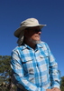
Arrived at the summit in about 2 hours 20 minutes, 4 miles from the car. It is a beautiful view, but stark. Not much color today. It doesn't generate awe in me. Signed the register. I was the first person to sign since March of this year.

From the summit, looking back toward the city, you can see Quartz Peak, the White Tank Mountains, and the Four Peaks. The Supersitions, and all of Phoenix, are hidden by the intervening mountains, but you can see smog spilling out from the city. Looking northwest, the Harquahala Mountains and wilderness are prominent, and looking southwest you see Big Horn Peak.

After about 15 minutes at the top, I picked up a little litter at the summit, and headed on back down.

Once off the summit and through the little scramble of the rocky shoulder, returning down the side of the saddle, there are many routes down, as it is quite grassy and open. At some time along the return route, the burro paths become easier than the wash. Try them out, and see what works for you. From where you pick up the two track, it becomes an easy walk back.

On the return you climb up out of the wash, over a minor saddle, and down fairly smartly, then the road levels for the remainder of the trip. Pay a little bit of attention to the route on the way back. It is possible to be misled by the burro trails.

There is burro scat and burro tracks all around, but did not see any animals. When I stopped walking it became utterly silent. No bugs, no machines, no wind.
 
May 18 2019
avatar

 Routes 12
 Photos 11
 Triplogs 46

male
 Joined Jul 10 2011
 Peoria, Az
Sugarloaf Mountain - MaricopaSouthwest, AZ
Southwest, AZ
Hiking avatar May 18 2019
alexofazTriplogs 46
Hiking
Hiking   8 Hrs   30 Mns   0.00 mph
30 LBS Pack
 no routes
1st trip
Linked   none no linked trail guides
Partners none no partners
:y:
I climbed Sugarloaf to activate the summit as part of the SOTA program, a ham radio game. It was another unseasonably beautiful May day, 2019 seams to be having a lot of those, and the views were amazing. It appeared no one had come that way in many years, with only a long forgotten road at the start of the trail and no footprints besides my own.
A friend and I drove out in 2 vehicles for safety and parked as close to my planned route as possible, where I left him and started walking. I'd planned my route to maximize terrain contours in the climb using the HikeAz Route Editor app. it proved its worth as my chosen route was also where the local game thought the best route was, I was on solid game trails all the was to the base of Sugarloaf. Beginning my climb I was harrassed by cholla balls hidden in the long grass and I valued the additional security provide by my hiking staffs as the footing often gave way and became more of a scramble as I worked my way thru the escarpment, picking my way thru the cliffs.
I reached the top northwest of the actual summit and had to cross a ridgeline with rock outcroppings like stone walls I had to climb up one side and down the other. Finally after crossing a final valley I approached true summit. The views from Phoenix to California were breathtaking. While only 3,400' high, its position in a vast desert gave it a commanding view with a welcome, cool breeze. Glancing over the southwest edge I stared down thru the tops of saguaro at hairraising sheer drop to a stream bed at the base hundreds of feet below. Previous climbers chipped their initials into boulders on the summit in 84 and 72. I guess "leave no trace" wasn't a thing then.
I set up a mast, raising the center 66' antenna high above me. This makes use of ultralight dyneema line looped around boulders, I wasn't leaving any evidence of my visit. I connected a radio and started making the required contacts with other hams to "activate" the summit. It required 4 completed signal reports, within an hour I had 11 and broke the rig down. I was the first person to log contacts from this summit so I got the honor of first "activator".
My descent reminded me I'm a backpacker, not a mountain climber. The first mile of the descent took over an hour in this sheer terrain. Once off the mountain I explored a different route back to the trucks.
_____________________
 
Mar 03 2014
avatar

 Routes 29
 Photos 1,548
 Triplogs 1,802

49 male
 Joined Jan 25 2009
 Phoenix, AZ
Sugarloaf Mountain - MaricopaSouthwest, AZ
Southwest, AZ
Hiking avatar Mar 03 2014
Dave1Triplogs 1,802
Hiking8.73 Miles 1,469 AEG
Hiking8.73 Miles
1,469 ft AEG
 
Linked   none no linked trail guides
Partners none no partners
I thought I'd go back and try this one again before it became another white whale. Came in from the north-west this time. From Eagle Eye Road (paved), I took Microwave Station Road (high clearance, 2wd ok) for about 8 miles until the turn off towards Dead Horse Tank. I planned to drive right up to the wilderness border but when I got to Dead Horse Tank it was full. Since the road goes right through the tank and my truck doesn't have SCUBA gear, that's where I parked. Its just another mile to the border.

I drew a route on Route Manager that followed an old road to the major wash that drains off of Sugarloaf. The route was easy to follow and seams to be used by cattle infrequently. The ground was still damp from the weekend's rain, with some standing pools in the wash. Along the way I heard a couple jets fly past low and fast but couldn't see them. That was about 11:30, same as last Monday. Except for the drainage in the middle (which looks like it has impassible pour-overs from below), this side of the peak is more sloped than the east side and so I was able to just walk right up to the top. I was kind of disappointed by how easy it was. I hung out on top for about an hour or so in case the jets returned. No luck. Good views though. I could see all the way across the valley to Four Peaks, exactly 99 miles away. According to the peak register there's been about 20 visitors since 2000. The usual suspects: Packard, Green, Conklin, etc... Just me so far this year, one group last year, and no one in '12 or '11. 2010 was a busy year.

I needed some excitement so I took a slightly different route down, following the drainage which required some down climbing and one leap of faith. On the way back to the truck I heard, maybe, a wild burrow but didn't see it.
wildflower observationwildflower observationwildflower observationwildflower observationwildflower observation
Wildflowers Observation Moderate
_____________________
 
Feb 24 2014
avatar

 Routes 29
 Photos 1,548
 Triplogs 1,802

49 male
 Joined Jan 25 2009
 Phoenix, AZ
Sugarloaf Mountain - MaricopaSouthwest, AZ
Southwest, AZ
Hiking avatar Feb 24 2014
Dave1Triplogs 1,802
Hiking11.31 Miles 2,386 AEG
Hiking11.31 Miles   5 Hrs   20 Mns   2.12 mph
2,386 ft AEG
 
Linked   none no linked trail guides
Partners none no partners
To give you an idea of what and where, here's Uncle Chum's shot of Sugarloaf as seen from BigHorn Peak: http://hikearizona.com/photo=392071

On Sunday I took a ride on my ATV near the Belmont Mountains, which are west of everyone's favorite White Tanks Regional Park. The roads were too rocky for my taste so I didn't ride for long but it did get me interested in the area. I spotted a high point on the map, Sugarloaf Mountain at 3418' and thought I'd check it out today. I didn't know it until after the hike but SL is located within the Hummingbird Springs Wilderness Area, although I saw no signs indicating that. Most of the washes I followed today had signs of ATV or jeep travel so maybe not many people know this is a wilderness. Or maybe they don't care.

Its difficult to get close to this peak legally by vehicle and there are no trails. From 411th ave and I-10, I drove in on marked roads as far as my old Taco could go (luckily not crossing the wilderness boundary which I would have done unknowingly) and then set out on foot across the desert, using washes when possible. As I got close to SL I noticed it was surrounded by vertical cliff bands and knew before long that I would not be summiting today. I did see a possible route so I gave it a shot anyway. From my highest point I think a good, fearless climber probably could have reached the top. I am neither so I called it a day.

No wildlife spotted all day, save for a few lizards. I did see some BHS scat but nothing like on Bighorn Peak. Took a nice tumble as I was heading back down from (near)the peak. Luckily some sharp rocks broke my fall. Saw two jets do some low passes but I was in the wash both times and couldn't reach my camera quickly enough. Maybe F-35s from Luke? I imagined how awesome it would be to be standing on top of SL and have the jets buzz by. Someday. A little warm today but breezy in spots. I think next time I might try attacking it from the north or north-west.
 Culture
 Culture [ checklist ]
[ checklist ]  Route - finding Labels
wildflower observationwildflower observationwildflower observationwildflower observationwildflower observation
Wildflowers Observation Moderate
The Brittlebush are cranking right now.
_____________________
 
average hiking speed 2.29 mph

WARNING! Hiking and outdoor related sports can be dangerous. Be responsible and prepare for the trip. Study the area you are entering and plan accordingly. Dress for the current and unexpected weather changes. Take plenty of water. Never go alone. Make an itinerary with your plan(s), route(s), destination(s) and expected return time. Give your itinerary to trusted family and/or friends.

helpcommentissue

end of page marker