username
X
password
register
for free!
help
ArticlesGuidesRoutes
 
Photosets
 
 Comments
triplogs   photosets   labels comments more
Council Rocks - 5 members in 16 triplogs have rated this an average 4.6 ( 1 to 5 best )
16 triplogs
login for filter options
Mar 09 2024
avatar

 Guides 187
 Routes 991
 Photos 12,084
 Triplogs 866

72 male
 Joined Jun 27 2015
 Tucson, Arizona
Council Rock Meander, AZ 
Council Rock Meander, AZ
 
Hiking avatar Mar 09 2024
markthurman53Triplogs 866
Hiking2.20 Miles 281 AEG
Hiking2.20 Miles   1 Hour   23 Mns   1.63 mph
281 ft AEG      2 Mns Break
 
1st trip
Linked   linked  
Partners partners
mamakatt22
After the Cochise trail we stopped off at Council Rock. Don't know if I would call this a hike, it's more of a meander. Interesting area would be a great place for kids to be set free in. Lots of interesting rock formations and nooks and crannies to explore. Spent an hour or so here then headed back to Tucson and a stop at Rudy's for dinner. Lots of campers along the road to Stronghold Canyon. Before we head back we make a quick stop in Tombstone, Forgot it was Saturday so it was packed, cruised the town then stopped off at boot Hill. I have not been here since 1958.
_____________________
 
Aug 23 2020
avatar

 Guides 1
 Routes 136
 Photos 22,415
 Triplogs 1,041

77 male
 Joined Feb 28 2003
 Tucson, AZ
Council RocksTucson, AZ
Tucson, AZ
Hiking avatar Aug 23 2020
rwstormTriplogs 1,041
Hiking1.20 Miles 150 AEG
Hiking1.20 Miles
150 ft AEG
 no routes
1st trip
Linked   none no linked trail guides
Partners none no partners
On my way to the end of the road in West Stronghold Canyon in the Dragoon Mountains, I stopped at Council Rocks for a brief look around. This historical spot is always a fine place to visit and ponder the past. Beautiful boulders and interesting vegetation are to be found here. Don't miss it if you are in the neighborhood.
 Flora
 Flora [ checklist ]
[ checklist ]  Coral Bean
 Culture
 Culture [ checklist ]
[ checklist ]  Historical Marker
 Named place
 Named place [ checklist ]
[ checklist ]  Knob Hill
_____________________
  1 archive
Dec 02 2019
avatar

 Guides 187
 Routes 991
 Photos 12,084
 Triplogs 866

72 male
 Joined Jun 27 2015
 Tucson, Arizona
Slavin Gulch Council Rocks, AZ 
Slavin Gulch Council Rocks, AZ
 
Hiking avatar Dec 02 2019
markthurman53Triplogs 866
Hiking14.94 Miles 2,306 AEG
Hiking14.94 Miles   7 Hrs   30 Mns   2.59 mph
2,306 ft AEG   1 Hour   44 Mns Break15 LBS Pack
 
1st trip
Linked   linked  
Partners none no partners
Sticking close to home again I headed back to the Dragoon Mountains. This hike was a mix of established trails and some use trails located on Google Earth. Perfect weather for a Dragoon mountain hike, clear skies high wispy clouds to add depth to the photos and plenty of water. Water everywhere even in the small streams. Was thinking about the water report and decided for Slavin Gulch measuring in gallons per minute wouldn't do so I figures I would measure it in barrels per minute. I just couldn't figure out how many barrels but it is a few. There was still a scattering of snow on the north slopes at just below 6000 feet.

Started out on the Slavin Gulch Trail #322 just after sunrise. Took me a while to figure out how to get here, the most direct road on google earth turned out to be across private property so I had to use Middlemarch Road. By the way that is the only access point if you don't know someone that owns property on the west side of the Dragoons. It is deer season so there were some hunters. If I had known that I guess I would of wore a red hat or something instead of my desert MARPATS. I don't really look like a deer though. Slavin Gulch trail follows an old road that went up to the Abril mine (1900 to 1953) but all that is left is a well defined trail. Only had issues a couple times where it crossed the creek but was able to pick up on it again without much issue. At 2.7 miles you come to the Abril Mine. I didn't climb the last 100 feet up the hill to see the actual mine because the trek up the steep hill was a bit more than I thought I should be doing alone. With the wet ground and a bit of snow it seemed as I was climbing up the ground it was sliding down faster. About half way up I decided I really didn't need to see the hole in the mountain. You seen one hole you seen em all, besides there is a two track road that leads up to the mine from the other side, maybe on another trip. Great views to the west of the Huachuca, Whetstones, Mule Shoe, Santa Ritas and Rincon Mountains. The recent storms made the visibility perfect.

I headed back down the Slavin Trail and took a route I saw visibly on Google Earth that it called the Sky Island Traverse. Easy trail to follow, it heads up a small ravine, over a low pass and then heads across grass land to the Council Rocks area. Very impressive oak trees along this section. Saw a set Mountain Lion tracks that was also using this trail but no lion. I couldn't help but look up every so often in the magnificent oak trees to see if there was a cat watching me. I'm probably too old, tough and skinny to be of much use for it though.

Once at the Council Rocks area I just meandered around on all the user trails. Very interesting and fun area. This can also be reached via the Middlemarch road that also continues on into West Cochise Canyon. I took a side trip to visit the ruins of what was called the White House. Didn't actually find it on this trip because I didn't have it marked on my GPS. Trying to locate it from memory of 20 years ago when I last was here didn't work very well. When I got home I looked at my route on Google Earth and I walked within a couple hundred yards of it.

From Council Rocks I headed back along another use trail (mainly by cows) to the Slavin Gulch Trail Head. Lots of flat grass land walking and a couple of crawls under barb wired fences. Nice walk as the sun was low in the sky. Clouds from the next storm could be seen far to the west. Made for a nice sunset on the drive home.
 Named place
 Named place [ checklist ]
[ checklist ]  Knob Hill
_____________________
 
Feb 21 2018
avatar

 Guides 100
 Routes 63
 Photos 2,548
 Triplogs 184

76 male
 Joined Nov 21 2015
 Grand Junction,
Council RocksTucson, AZ
Tucson, AZ
Hiking avatar Feb 21 2018
Steph_and_BlakeTriplogs 184
Hiking1.20 Miles 150 AEG
Hiking1.20 Miles   1 Hour      1.20 mph
150 ft AEG
 no routes
1st trip
Linked   none no linked trail guides
Partners none no partners
From the parking area, you can walk either to the left or right to reach Council Rocks. There are several social trails among the boulders that lead to the pictographs and grinding mortars but you can’t really get lost and it’s fun to try to figure out which way to go. The backdrop to the area was, we felt, just as fascinating and interesting as the pictographs and the numerous mortars. We meandered among the balancing rocks and enormous boulders to find a spot for lunch. Blake saw a healthy deer, but I was too late in getting there to see it. We enjoyed lunch in a sheltered spot and slowly took our time returning to our vehicle. We saw only one other couple along the way. A regular clearance vehicle could make the drive if it weren’t for the 10-feet wide mud hole on the way in.
_____________________
Stephanie and Blake Barnard
 
Jan 24 2018
avatar

 Guides 2
 Routes 512
 Photos 5,579
 Triplogs 4,280

69 male
 Joined Mar 01 2009
 Aztec, NM
Council RocksTucson, AZ
Tucson, AZ
Hiking avatar Jan 24 2018
PivoTriplogs 4,280
Hiking51.00 Miles 102 AEG
Hiking51.00 Miles      43 Mns   109.29 mph
102 ft AEG      15 Mns Break
 no routes
Linked   none no linked trail guides
Partners partners
Baja Arizona Hiking
MyRudy
Part of our Dragoon Tombstone day.
_____________________
  1 archive
Jan 16 2016
avatar

 Photos 100
 Triplogs 6

64 female
 Joined Jan 15 2016
 Tucson, Arizona
Council RocksTucson, AZ
Tucson, AZ
Hiking avatar Jan 16 2016
YsabetTriplogs 6
Hiking1.20 Miles 150 AEG
Hiking1.20 Miles
150 ft AEG
 no routes
1st trip
Linked   none no linked trail guides
Partners none no partners
Fantastic place on a truly beautiful day; I went there for photos and to check out the drive and had little trouble with either-- directions via Middlemarsh Road got me there with no issues. The small spring below the rock shelters was running; saw quite a few other hikers out there today, mostly couples or families with kids (a few campers in tents, too.) The 16.7-mile drive in has a LOT of turnoffs into good camping areas as private as you could possibly wish-- I plan on going back in Spring to camp for a couple of days. One warning: I spoke to a couple of locals about wildlife, and the area is getting known for its big cat population. They've seen a few and actually photographed a 'black panther' about ten years back (most likely a melanistic jaguar, as jaguar sightings are starting to pile up now.) The rocks are just right for mountain lions, and I had the uncomfortable feeling of eyes on me now and then; just be wary.
_____________________
  1 archive
Mar 28 2014
avatar

 Guides 21
 Routes 1,183
 Photos 36,909
 Triplogs 1,571

69 female
 Joined Feb 26 2004
 Phoenix, AZ
Council RocksTucson, AZ
Tucson, AZ
Hiking avatar Mar 28 2014
tibberTriplogs 1,571
Hiking1.20 Miles 150 AEG
Hiking1.20 Miles
150 ft AEG
 no routes
1st trip
Linked   none no linked trail guides
Partners partners
ABC - Group
writelots
a place I've wanted to go since Wendy mentioned it to me a couple years ago and now I've been and :y: it was everything I thot it would be and more.
This was a stop we made after establishing our camp spot at the western Cochise Indian Trailhead area and after we put up signs directing ABC folks toward our camp spot. Just had my tennies on and a little bottle of water along with my camera; a fun way to do a quick little hike for a change.

Thru the gate and up the hill and you're up among the HUGE boulders. A little further there are a couple grinding stones and then there is this big old boulder with pictographs (by Mogollon Indians 1000 years ago). Now the original locals either had some sort of scaffolding or were standing on someone to get those pictographs up that high :o .

And then Wendy took me on a winding journey through and between some of the large boulders as I think she was trying to find more pictographs or she was just trying to confuse me as I faithfully followed her while filming. Eventually we started walking east and saw the guys we had dropped off while we put up signs. Rocky took me over to this fruited cholla that presented a beautiful picture with the giant boulders and blue sky in the background.

After that I wandered around a bit on my own before joining back up for another Wendy jaunt to who knows where but she did have a mission: find that house size boulder. We wandered in the valley and then came around the corner to see this monster before us. Wendy went over to her ginormous boulder so that I could get some pics and while there I also noticed a giant 20 foot blooming ocotillo; think it's the tallest one I've ever seen... seemed apropos.

Then we wandered over to another area that had some very cool tafoni on the rock faces. From there we headed back and as we came out from around the boulders we could see a beautiful sunset shaping up so we made a pretty fast dash to an area where you could frame a smaller boulder and some desert flora in the scene. What a way to end my first time to Council Rocks :DANCE: .

Whoops, almost forgot, 2 videos are pending stabilization 4-1-14... no fooling ;)

Part 1: http://youtu.be/FZH5ZCGuB_Y including the graphs
Part 2: http://youtu.be/KeCxRWHFQWY including Wendy's horse rock and ginormous boulder

PS. Wanted to add that one of our older female hikers had just returned from a hike of Hadrian's Wall... who knew?! Anyway, here is her story: http://www.meetup.com/Arizona-Backpacking/messages/boards/thread/43061772/post/118458952/?hash=118458952#118458952
 Named place
 Named place [ checklist ]
[ checklist ]  Council Rocks
 Meteorology
 Meteorology [ checklist ]
[ checklist ]  Sunset
_____________________
For me, sometimes it's just as much about the journey as the destination.
Oh, and once in awhile, don't forget to look back at the trail you've traveled.
 
Mar 28 2014
avatar

 Guides 19
 Routes 40
 Photos 5,624
 Triplogs 341

52 female
 Joined Nov 22 2005
 Tucson, AZ
Council RocksTucson, AZ
Tucson, AZ
Hiking avatar Mar 28 2014
writelotsTriplogs 341
Hiking2.40 Miles 300 AEG
Hiking2.40 Miles
300 ft AEG
 no routes
1st trip
Linked   none no linked trail guides
Partners none no partners
Made 2 separate trips out to Council Rocks for sunset: Friday and Saturday nights. Our camp in West Stronghold canyon was the perfect spot to allow us to head out to the rocks for sunset photography then back to camp for dinner and beers!

It was fun to show this spot off to folks who'd never been here before. It's hard to deny the magic of this spot, even to the most jaded visitor.
 Meteorology
 Meteorology [ checklist ]
[ checklist ]  Sunrise
_____________________
-----------------------------------
Change will not come if we wait for some other person or some other time. We are the ones we've been waiting for. We are the change that we seek.- Barack Obama
 
Apr 14 2013
avatar

 Guides 2
 Routes 512
 Photos 5,579
 Triplogs 4,280

69 male
 Joined Mar 01 2009
 Aztec, NM
Council RocksTucson, AZ
Tucson, AZ
Hiking avatar Apr 14 2013
PivoTriplogs 4,280
Hiking0.36 Miles 104 AEG
Hiking0.36 Miles
104 ft AEG
 no routes
Linked   none no linked trail guides
Partners partners
Floridasunshine
MyRudy
wildflower observationwildflower observationwildflower observationwildflower observationwildflower observation
Wildflowers Observation Isolated
_____________________
 
Apr 14 2013
avatar

 Photos 3
 Triplogs 106

26 male
 Joined Apr 23 2012
 Tucson, AZ
Council RocksTucson, AZ
Tucson, AZ
Hiking avatar Apr 14 2013
MyRudyTriplogs 106
Hiking0.36 Miles 104 AEG
Hiking0.36 Miles
104 ft AEG
 no routesno photosets
1st trip
Linked   none no linked trail guides
Partners none no partners
_____________________
 
Jan 17 2013
avatar

 Guides 1
 Routes 43
 Photos 666
 Triplogs 78

60 male
 Joined Mar 15 2012
 Sonoita, AZ
Cochise Stronghold Trail #279Tucson, AZ
Tucson, AZ
Hiking avatar Jan 17 2013
MAVMTriplogs 78
Hiking1.36 Miles 529 AEG
Hiking1.36 Miles      40 Mns   2.72 mph
529 ft AEG      10 Mns Break12 LBS Pack
 
Linked   linked  
Partners none no partners
Cochise Stronghold West -

I made way to the Dragoons for a mid-afternoon outing / brief hike - finishing in the long late afternoon shadows. The West Stronghold of the Dragoons is the more remote side of this unique medium elevation range. The light was classic Arizona backed by a cloudless cobalt sky - not to mention much warmer temperatures than as of late! I stopped to relax along the way at the Council Rocks TH. I found a partially smothered / lightly smoldering campfire which could be evidenced by the light smell of smoke from a good distance away upon approach. After taking care to help the fire's extinction, I napped in warm sun for awhile as this area of the Dragoons is just so inviting...

After which I would make way to the end of FR688 and the Western Stronghold TH - there I found a group of three hikers just coming down from the divide (only the second group of people I've witnessed in the Dragoons in the past year). These guys had camped at Council Rocks TH the night before and had been freezing their butts off the previous four nights while minivan camping about the region. The campers were from Vancouver, Knoxville & Des Moines and had been looking forward to the warmth that winter in AZ brings... I turned them onto / suggested Slavin Gulch Trail for their next foray into the Goons. After a quick shadowed hike up toward the switchbacks and back down - I chatted a bit more with these chilly Arizona tourists at their campfire before moving toward Sierra Vista and home in the approaching dusk.
 Flora
 Flora [ checklist ]
[ checklist ]  Banana Yucca

water 1 out of 5water 2 out of 5water 3 out of 5water 4 out of 5 Tenneco Well 76-100% full 76-100% full
Windmill was pumping away. This is the most reliable, excellent water source on the western slope of the Dragoons. If it is not filled to flowing over and pooling about the tanks - there is an easily accessed spicket under the windmill that has never failed yet.
_____________________
The MaNtiS - Assume & be Damned!
http://www.mavm.com
 
May 25 2012
avatar

 Guides 1
 Routes 43
 Photos 666
 Triplogs 78

60 male
 Joined Mar 15 2012
 Sonoita, AZ
Slavin Gulch Trail #332Tucson, AZ
Tucson, AZ
Hiking avatar May 25 2012
MAVMTriplogs 78
Hiking2.00 Miles 200 AEG
Hiking2.00 Miles      50 Mns   3.00 mph
200 ft AEG      10 Mns Break18 LBS Pack
 
Linked   linked  
Partners none no partners
Took another trip out to the Dragoons for a sunset hike about and drive with Tresa. Headed-up from the FR to where the path T's with Council Rocks Trail and explored around the confluence of these two routes a bit. No GPS, etc...
 Flora
 Flora [ checklist ]
[ checklist ]  Sacred Datura
 Culture
 Culture [ checklist ]
[ checklist ]  Windmill
 Named place
 Named place [ checklist ]
[ checklist ]  Dragoon Mountains  Tenneco Well

water 1 out of 5water 2 out of 5water 3 out of 5water 4 out of 5 Tenneco Well 76-100% full 76-100% full
We found 'Tenneco Well' to be an ideal oasis without compare for its location! Water was abundant as the main 2000+ gallon tank ran over to amply engorge nearby oaks. One could have easily showered with the topside overspill being piped away at 7'< above ground!
_____________________
The MaNtiS - Assume & be Damned!
http://www.mavm.com
 
Oct 30 2010
avatar

 Guides 19
 Routes 40
 Photos 5,624
 Triplogs 341

52 female
 Joined Nov 22 2005
 Tucson, AZ
West Dragoons Wander, AZ 
West Dragoons Wander, AZ
 
Hiking avatar Oct 30 2010
writelotsTriplogs 341
Hiking5.50 Miles 600 AEG
Hiking5.50 Miles
600 ft AEG
 no routes
1st trip
Linked   linked  
Partners partners
Sarae
Estimating on mileage and AEG - I think we covered about that much territory. Lots of stuff off of trails or along old roads, not much with any real planning involved. It was nice to just wander in the open grasslands for a while after my trip deep in the canyon.

We drove in Friday night and made camp in a large, flat, oak filled glen which we couldn't believe wasn't already the camp of the deer hunters which had taken every other good spot. We realized our error just a couple of hours into our campfire, when the Phoenix Climbing Meetup started to arrive. They were polite, quiet and all - but there were a lot of them, and my dogs just wouldn't leave them alone. After an evening of barking and pawing at the tent walls, we decided to move on to another camp in the morning.

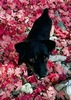
We drove about on the forest roads, finding spot after spot already housing groups of eager campers. It was busy weekend! We stopped off at Council Rocks and spent a little over an hour exploring the massive boulders, rock grottoes and dry washes of that area. Tons of fun. At one particularly large balanced boulder, Lilo and Monty ran up first, then ran down again to the unmistakable tune of a rattlesnake. At least I can trust them to keep as far from those things as they can! Our buddy Dennis, who is a herp nut, squeezed himself into the space between the rocks to get a good photo of the snake. He's a nut - but he really knows what he's doing. Sarae, the dogs and I stayed safely on the ground below.

We drove back into West Stronghold Canyon, and after a bit of searching found a delightful little campsite which had been hidden by the spent weeds of summer. Just a little clearing and we were set. Although it was crowded in the canyon, our spot was completely visually isolated - and we only heard the other campers when their pack of dogs started barking. Perfect!

Dennis headed off to find more reptiles, and Sarae and I wandered up and down a couple of the canyons just beyond the trailhead. We'd been told that there was water up in one of them, and though we found it, we wished we'd been told from the start that it was stank, nasty stuff we were looking for :?

We headed back to camp, but I felt like my hiker was just getting warmed up, so I continued along a couple of forest roads, along the western face of the hill, with superb views down into the valley and across to the Whetstone Mountains. It was a spectacular sunset. I arrived back in camp just in time for campfire, dutch-oven stew and great cocktails. Top it off with a point-perfect smore and a couple of very tired puppies and you've got a day well spent.

I love camping. Anyone who wants more than that outta life is just plain evil.
_____________________
-----------------------------------
Change will not come if we wait for some other person or some other time. We are the ones we've been waiting for. We are the change that we seek.- Barack Obama
 
Oct 29 2010
avatar

 Guides 1
 Routes 11
 Photos 691
 Triplogs 94

45 female
 Joined May 14 2008
 Tucson, AZ
Western Dragoon Wanderings, AZ 
Western Dragoon Wanderings, AZ
 
Hiking avatar Oct 29 2010
SaraeTriplogs 94
Hiking2.00 Miles
Hiking2.00 Miles
 no routes
1st trip
Linked   linked  
Partners partners
writelots
Spent Halloween weekend exploring some of the areas where Cochise wandered with Wendy and our friend Dennis. Took a look at some pictographs and other evidence of previous inhabitants. We did a bit of boulder hopping up some creek beds near the TH for the western access of the Cochise Stronghold Trail.

The whole area was hopping with hunters and tourists and climbers, ect. We had one camp on Friday night right at the mouth of Slavin Gulch, but we decided to move when a group of about 15 ppl showed up late to crash our peaceful campsite. Boo! :? Saturday morning, we drove around the 4X4 roads and made a stop at Council Rocks. We climbed up the boulder strewn trail and found many pictographs, boulders, arachnids, spiky grass seeds, and a few reptiles. Dennis got some good pics of a black tailed rattlesnake that had holed up under a ledge with rattlesnake pictographs for company... perfect! :)

Our second night's camp was along the road approaching the TH for the western access of the Cochise Stronghold Trail. It was just off the road, and there were others camped nearby (including a group with about a million dogs), but it was still a nice spot with oaks, sycamores, and juniper to shade us. We cooked up a stew feast in the dutch oven and enjoyed the beautiful starry sky with it's occasional falling star.

Sunday morning we cooked up some biscuits and gravy and then packed up for the short drive back to Tucson. A really fantastic introduction to the Dragoons for me! :D
_____________________
In every walk with nature one receives far more than he seeks. ~John Muir
 
Jan 01 2009
avatar

 Guides 16
 Routes 11
 Photos 1,006
 Triplogs 410

39 male
 Joined Mar 22 2006
 Phoenix, AZ
Council RocksTucson, AZ
Tucson, AZ
Hiking avatar Jan 01 2009
JoelHazeltonTriplogs 410
Hiking1.20 Miles 150 AEG
Hiking1.20 Miles
150 ft AEG
 no routes
1st trip
Linked   none no linked trail guides
Partners none no partners
Short little exploratory hike with my girlfriend, my sister, and her husband. Our second annual Southern Arizona New Year's camping trip.
 Geology
 Geology [ checklist ]
[ checklist ]  Granite
_____________________
"Arizona is the land of contrast... You can go from Minnesota to California in a matter of minutes, then have Mexican food that night." -Jack Dykinga

http://www.joelhazelton.com
 
Feb 04 2003
avatar

 Guides 1
 Routes 136
 Photos 22,415
 Triplogs 1,041

77 male
 Joined Feb 28 2003
 Tucson, AZ
Slavin Gulch Trail #332Tucson, AZ
Tucson, AZ
Hiking avatar Feb 04 2003
rwstormTriplogs 1,041
Hiking7.40 Miles 1,854 AEG
Hiking7.40 Miles
1,854 ft AEG
 no routes
1st trip
Linked   linked  
Partners none no partners
SAHC - Group
Club hike. Love the west side of the Dragoons and have been camping/hiking there occasionally since the late 1980's. :) We started out by heading up to the old mine then drove over to Council Rocks to look around.
 Named place
 Named place [ checklist ]
[ checklist ]  Abril Mine
_____________________
 
average hiking speed 2.23 mph

WARNING! Hiking and outdoor related sports can be dangerous. Be responsible and prepare for the trip. Study the area you are entering and plan accordingly. Dress for the current and unexpected weather changes. Take plenty of water. Never go alone. Make an itinerary with your plan(s), route(s), destination(s) and expected return time. Give your itinerary to trusted family and/or friends.

helpcommentissue

end of page marker