|
| | | |
| |
|
| Hiking | 11.87 Miles |
2,270 AEG |
| | Hiking | 11.87 Miles | 7 Hrs 27 Mns | | 1.85 mph |
| 2,270 ft AEG | 1 Hour 1 Min Break | | | |
|
|
| |
| Linked |
|
none
[ show ]
| no linked trail guides |
| Partners |
|
none
[ show ]
| no partners | | This hike was to the summit of Arrastra Mountain (elevation of 4,807 feet and prominence of 1,487 feet), and is a hike that I have been wanting to do for a while. Arrastra Mountain is the high point of both the Poachie Range and the Arrastra Mountain Wilderness Area.
Arrastra Mountain is in Mojave County, and is between Wickenburg and Wickieup.
The name arrastra is a spanish term for a drag mill that was used to grind ore. A huge, flat granite rock was dragged over ore in a pit by an animal going in a circle around the pit. The existence of such mills led to the naming of several places in Arizona that were near one of the mills, including this mountain.
This hike had two parts: a road walk, and then an off-trail excursion from the road to the summit.
It is about a 5.5 mile drive from Highway 93 to the trailhead near Dunlap Mine. With a suitable vehicle one could drive all the way to the trailhead and eliminate any road walking.
I had read that the road got much rougher past a gate that is about 2 miles from the highway, so I had planned to drive to the gate, park, and hike on the road the rest of the way to the trailhead.
I actually drove about 1.5 miles and decided to park and hike the rest of the way. The road wasn't that bad, although there was a rutted out place going up a hill that required paying attention to your tire placement. I don't enjoy those kind of drives and it was a nice day so I decided to do some extra hiking. The road wasn't any worse from where I parked to the gate, and for about half a mile past the gate it wasn't any worse either. However, beyond that point there were some rougher sections, a couple of dips that will challenge your vehicles approach/departure angles, and a place or two that will require some good clearance. Additionally, your vehicle's paint job will suffer unless you make some stops along the way to do some gardening.
On the last mile of the road walk I followed some tire tracks in a wash instead of hiking on the road. If I was driving I would definitely go in this wash. The was was wide and had coarse sand in it, and there were no ruts or any other obstacles.
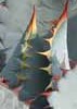
The off-trail hike was short -- about 4 miles RT. I headed west to the mountain. It was relatively flat at first, and while there was some vegetation there were lanes through it that minimized any bushwhacking. Then I followed a ridgeline up to a false summit. The last part to the false summit was steep and there was a bit of rock scrambling as I got closer to the false summit.
Once at the false summit, the true summit was in view. I went through a boulder strewn gully to get to the peak, and there was some class 3 boulder scrambling going up the gully. Once above the gully I was slightly north of the summit, and it was an easy stroll from there to the high point.
I located the benchmark and one reference mark(RM1), but did not see the other reference mark. I also did not attempt to locate the ever popular azimuth mark, which was 1/2 mile away to the NNW.
The summit area was bouldery, and it was a nice place to take a lunch break and enjoy the unobstructed 360 degree views.
I returned the way that I came. |
| _____________________
| Civilization is a nice place to visit but I wouldn't want to live there |
| | |
|
|
|
 Route Editor