|
| | | |
| |
|
| Hiking | 10.53 Miles |
2,646 AEG |
| | Hiking | 10.53 Miles | 5 Hrs 17 Mns | | 2.03 mph |
| 2,646 ft AEG | 5 Mns Break | | | |
|
|
| |
| Partners |
|
none
[ show ]
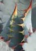
| no partners | | I did this last time almost 4 years ago, but it seems like less than that. After 5057, it seemed easier than last time, but not by much. The steepness is pretty intense, but the overall gain and length of the hike isn't that much.
Headed straight up to the peak at first. I kept a decent pace through the steep parts, only stopping once or twice for a pic to catch my breath. It didn't feel so much like a lung buster this time, but I did feel a fatigue creep in that told me to slow the pace a bit, which helped. At the top I noticed the radiation warning signs, which I don't remember from the last time I was there  . I didn't linger long worrying that a wormhole to the future would open up. . I didn't linger long worrying that a wormhole to the future would open up.
On the way down I tried to get to 3702 but bailed as I was approaching the lower peak. At that point the faint trail had disappeared and going any higher involved getting more vertical and bouldering on loose rock. I wasn't comfortable trying that on my own. As I got back down and looked back, it seemed like if I had gone to the right there was a more accessible route, but it's hard to tell when you're right on top of it. When I got home and looked at the route and the topo, I realized I was trying to summit the wrong peak, which was the lower one to the NW. I was happy enough for this day to get as far as I did.
Saw a gila monster on the road on my way back, nothing else of note happened. Feeling not sore at all the next day, in great contrast to the 5057 death march the week earlier. |
| _____________________
| | |
|
|
|
 Route Editor


 pain in check. Solid outing.