|
| | | Holdout Black Rock Creek Loop, AZ | | | |
|
|
Holdout Black Rock Creek Loop, AZ
| | |
| |
|
| Hiking | 16.18 Miles |
2,367 AEG |
| | Hiking | 16.18 Miles | 10 Hrs 25 Mns | | 1.79 mph |
| 2,367 ft AEG | 1 Hour 23 Mns Break | | | |
|
|
| |
| Partners |
|
[ show ]
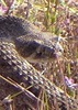
| partners | | S and I hiked a portion of Holdout Creek back at the end of January, but being a 4-hour drive, we did not have a ton of time, so I packed up the 4Runner, and we headed out Tuesday afternoon to camp at the TH near Reef Tank to hike this loop. 941 is rocky and has some minor erosion, but nothing a 4WD HC vehicle can't handle. 68 has a couple of minor eroded steep sections, but the biggest thing about 68 is the width, as it's pretty tight, expect a ton of AZ pinstrips. After stopping at the Taylor Freeze in Pima (I've driven by this place for years, and finally stopped), we arrived at the TH around 5:30 to discover two FJ's (one with bull horns) parked, which was a complete surprise considering the drive and seclusion of the area. Discussed moving to a different location due to the other vehicles already there, but we never saw the people driving them, and they were still there when we left Thursday evening. The TH was cold, wet, and shrouded in cloud cover due to the rain earlier in the day. We got up before sunrise and started the loop CW right at sunrise.
Easy road walk on 68 to the turn off road to Black Rock Canyon. This road is insanely steep and eroded in some places, with nowhere to turn a vehicle around if needed. I would not drive my 4Runner down it; however, tire tracks were going down it.
Black Rock Creek
We initially missed the gate by Poncho Tank but soon realized the mistake and retreated. The only carin we saw on Black Rock all day was in the creek bed after dropping down off the road; after that, it's a ton of route finding or walking in the creek. After a rock-pounding hike up/down Campaign Creek last week, part II was in store so a couple of times, we jumped on a path we thought was part of the tread, only to find it to be a cow path that ended or went up some insanely steep ridge; it definitely needs some carins built, but unfortunately, we did not have the time to do so. Most of the hike (except the last mile or so) is unburnt with tons of Pinyon Pines, the last mile is Defcon 4 for catclaw, I gave the usual sacrifices  . Spent a few minutes at the corral near the confluence, took a break in the shade, and continued. . Spent a few minutes at the corral near the confluence, took a break in the shade, and continued.
Holdout Creek
We initially attempted to check out the grottos in Holdout, but after hiking up the creek for a few, there was a section with boulders too big to climb. S had Chumley's bypass route around; however, it was already near 1, and we didn't want to delay our climb up Holdout, so we put it on the back burner for next time. As we backtracked and started up the Holdout trail, we heard a dog barking, so we assumed our FJ friends at the TH were up there camping. However, after we made the initial small climb, we spotted the dog, walking around, barking with no one in sight. We called him over to look for a tag, but there was not one. He would not let us get within a couple of feet of him and would run away when we got close. He followed us for about a mile, then we never saw him again. We hoped he was with our FJ party, but were not certain. As it was in January, the trail is messy with sacrificial plants along the way to assist you. There are some carins, but route finding is necessary. The temps were only supposed to be in the high 60's with a nice breeze; however, S's gauge was reading 80 degrees with zero wind. With minimal shade, the heat started to get to me, and it was a slower hike out, stopping a couple of extra times to cool off and filter water in the creek. We got back to the TH a little before 5:30, cleaned up, and made the long drive home.
While most of this area was affected by the Pinnacle fire, it is still beautiful in a different way, and the secluded nature of it adds to that. Thanks, S, for joining me on this adventure. |
|
Wildflowers Observation Substantial
|
|
 |
Holdout Creek |
Heavy flow |
Heavy flow |
| | | Good clear running water to filter. | | _____________________
Hiking is just walking where it’s okay to pee.  |
| | |
|
|
|
 Route Editor


 I was glad to visit the area again and do a little bit of exploring...we'll need to come back again sometime to see if we can't make our way into Lower Holdout to play among the boulders.


 )!
)!
 . The nasty catclaw, honey locust, whatever it was, took its pound of flesh.