username
X
password
register
for free!
help
ArticlesGuidesRoutes
 
Photosets
 
 Comments
triplogs   photosets   labels comments more
Cave Creek / Skunk Tank Loop - 70 members in 169 triplogs have rated this an average 3.6 ( 1 to 5 best )
1, 2, 3, 4, 5 ... 9  Next
169 triplogs
login for filter options
Mar 10 2025
avatar

 Routes 5
 Photos 58
 Triplogs 46

49 male
 Joined Apr 18 2002
 Phoenix, AZ
Cave Creek / Skunk Tank LoopPhoenix, AZ
Phoenix, AZ
Hiking avatar Mar 10 2025
rehlersTriplogs 46
Hiking10.30 Miles 1,905 AEG
Hiking10.30 Miles   4 Hrs   55 Mns   2.09 mph
1,905 ft AEG
 no routesno photosets
1st trip
Linked   none no linked trail guides
Partners none no partners
Excellent trail conditions overall. Mostly easy to follow and no overgrowth. A few sections on side of steep mountain were a little narrow, but still plenty of flat ground to walk on. Going clockwise, the first mile was on a well-maintained trail with good cairns marking cave creek crossing. The next about 4 miles was on a single lane dirt road. This is nice in that you don't have to worry about snakes since trail visibility is great. The transition from road back to trail was not well marked. The next about 1.5 miles down to cave creek was the least well-defined section of trail, but still overall not bad and also not overgrown. Coming back along cave creek trail was a pleasant, easy-going end to the hike.
_____________________
 
Feb 01 2025
avatar

 Guides 4
 Routes 491
 Photos 10,890
 Triplogs 1,257

55 male
 Joined Nov 20 2012
 Phoenix, AZ
Cave Creek / Skunk Tank LoopPhoenix, AZ
Phoenix, AZ
Hiking avatar Feb 01 2025
BiFrostTriplogs 1,257
Hiking9.78 Miles 1,878 AEG
Hiking9.78 Miles   4 Hrs   27 Mns   2.47 mph
1,878 ft AEG      29 Mns Break
 
1st trip
Linked   none no linked trail guides
Partners partners
John9L
Tough_Boots
Been a few years since last time on this loop. Joined 9L and Kyle for the loop starting near Seven Springs road and crossing Cave Creek to climb the hill towards Skunk Tank. It's old road so nice tread but uphill over to Skunk Tank. The tank was well...just a cow tank.

From there we headed down to Cave Creek and took a break. What we didn't know going into the hike was that there was an ultra trail running event traversing our route mostly along Cave Creek. Fortunately most of the trail runners had already passed and we saw just the tail end.

After the break we continued on Cave Creek back towards the trailhead. Considering how dry it's been there were some really nice deep pools along the creek. Definitely legit swimmers to enjoy on a warmer day. Eventually made it back to the vehicle...nice quick Saturday hike!
_____________________
  1 archive
Jan 05 2025
avatar

 Routes 46
 Photos 253
 Triplogs 47

19 male
 Joined Aug 13 2023
 Phoenix, AZ
Seven Springs Wander, AZ 
Seven Springs Wander, AZ
 
Hiking avatar Jan 05 2025
diabloTriplogs 47
Hiking5.91 Miles 579 AEG
Hiking5.91 Miles   2 Hrs   29 Mns   2.51 mph
579 ft AEG      8 Mns Break
1st trip
Linked   linked  
Partners none no partners
I was in this area last Thanksgiving to just see the colors and was intrigued at a flowing creek so close to home. Today, it fit the bill just right. Drove up to Humboldt before to catch the last bit of the sunrise before heading down to seven springs. Started at 34 degrees but later didn’t need a jacket. Easy going the whole way and stopped at the swim hole, but no swimming today. A great day with some great friends!
 Named place
 Named place [ checklist ]
[ checklist ]  Horseshoe Reservoir
foliage observationfoliage observationfoliage observationfoliage observationfoliage observation
Autumn Foliage Observation Isolated
 
Nov 01 2023
avatar

 Triplogs 71

male
 Joined Jan 23 2025
 Seattle, WA
Cave Creek / Skunk Tank LoopPhoenix, AZ
Phoenix, AZ
Hiking avatar Nov 01 2023
dhelderTriplogs 71
Hiking9.90 Miles 1,905 AEG
Hiking9.90 Miles
1,905 ft AEG
 no routesno photosets
1st trip
Linked   none no linked trail guides
Partners none no partners
 
Feb 25 2023
avatar

 Guides 3
 Routes 633
 Photos 8,249
 Triplogs 605

54 male
 Joined Apr 13 2011
 Gilbert, AZ
Cave Creek / Skunk Tank LoopPhoenix, AZ
Phoenix, AZ
Hiking avatar Feb 25 2023
ddgrunningTriplogs 605
Hiking11.46 Miles 1,995 AEG
Hiking11.46 Miles   4 Hrs   42 Mns   2.59 mph
1,995 ft AEG      17 Mns Break
 
1st trip
Linked   linked  
Partners none no partners
Route Scout Route Recorded  on Route Scout | Pop | Map | Popup | MapDEX
Hadn't ever ventured up to this area. My assessement:

--Cave Creek trail: would be great in the spring/summer when there are leaves on the trees, and in the fall, when colors are popping. 2-3 nice swimming holes along the way, for warmer weather.

--Skunk Creek trail: the initial climb is a good workout with decent views, but from Skunk tank on, it's basically a somewhat drab road walk.

I off-trailed up to the Quien Sabe mine. Entrance imploded; not a lot to see.

The highlight of the hike for me was the impressive crested saguaro off the side of the trail on Cave Creek.
_____________________
 
Jan 23 2023
avatar

 Guides 47
 Routes 96
 Photos 850
 Triplogs 385

81 male
 Joined Dec 24 2005
 Phoenix, AZ
Cave Creek / Skunk Tank LoopPhoenix, AZ
Phoenix, AZ
Hiking avatar Jan 23 2023
MEWhitemanTriplogs 385
Hiking9.67 Miles 2,041 AEG
Hiking9.67 Miles   5 Hrs      1.93 mph
2,041 ft AEG
 no routesno photosets
1st trip
Linked   none no linked trail guides
Partners partners
hiazny10
Tom and I hiked this loop clockwise from FR 24b. It was overcast and was lightly snowing on the Skunk Tank half of the hike. This my first time for this one and I enjoyed it especially the single track on the Skunk Tank descending to Cave Creek. Good hike.
_____________________
 
Mar 13 2022
avatar

 Routes 228
 Triplogs 215

36 male
 Joined Sep 05 2014
 Phoenix, AZ
Cave Creek / Skunk Tank LoopPhoenix, AZ
Phoenix, AZ
Hiking avatar Mar 13 2022
FrostshocknoobTriplogs 215
Hiking10.85 Miles 1,984 AEG
Hiking10.85 Miles   5 Hrs   4 Mns   2.39 mph
1,984 ft AEG      32 Mns Break
 
no photosets
Partners none no partners
_____________________
 
Feb 13 2022
avatar

 Guides 13
 Photos 15,630
 Triplogs 323

male
 Joined Oct 23 2010
 mesa
Cave Creek / Skunk Tank LoopPhoenix, AZ
Phoenix, AZ
Hiking avatar Feb 13 2022
gummoTriplogs 323
Hiking10.60 Miles 1,905 AEG
Hiking10.60 Miles   5 Hrs   33 Mns   1.91 mph
1,905 ft AEG6 LBS Pack
 no routes
1st trip
Linked   none no linked trail guides
Partners none no partners
The route was difficult to follow at times due to people and livestock creating new trails that led to nowhere. The trail changed in a few areas from when I did this six years ago.
_____________________
 
Dec 30 2021
avatar

 Guides 1
 Routes 136
 Photos 1,367
 Triplogs 364

47 male
 Joined Jun 10 2011
 Phoenix, AZ
Cave Creek / Skunk Tank LoopPhoenix, AZ
Phoenix, AZ
Backpack avatar Dec 30 2021
The_DudeTriplogs 364
Backpack10.77 Miles 1,950 AEG
Backpack10.77 Miles   24 Hrs   58 Mns   2.19 mph
1,950 ft AEG40 LBS Pack
 
no photosets
1st trip
Linked   none no linked trail guides
Partners partners
Falke
Route Scout Route Recorded  on Route Scout | Pop | Map | Popup | MapDEX
Road out is in great shape. Took a quick backpack with my buddy Michael to a spot I hadn't been to in a while. Did the loop clockwise from the CC trailhead. Skunk Tank is solid two track for most of the way with some solid and rolling uphill, especially with 40 pounds on my back. We picked up so much mud and grass on the first two miles that I could have crafted a basket or something. Took a lunch break just beyond the pass for some great view north of skull Mesa and quien sabe. Lots of green of the hillsides, but the riparian trees are all bare of course. Continued onto the #4 a few miles wanting to camp closer to the truck for and easy next day. Set up our hammocks right along the creek and had a low key evening. Leisurely morning in camp and them back to the truck and lunch at Big Earls. Temps were not as bad as expected, probably about 42 overnight. Expected rain and wanted to give my hammock rain gear a try, but we had none and I won't complain. Water was flowing anywhere and everywhere though, quite scenic.
_____________________
 
Dec 10 2021
avatar

 Guides 1
 Routes 8
 Photos 202
 Triplogs 9

65 male
 Joined Sep 02 2003
 Phoenix, AZ
Cave Creek / Skunk Tank LoopPhoenix, AZ
Phoenix, AZ
Backpack avatar Dec 10 2021
johnmc22Triplogs 9
Backpack13.00 Miles 2,334 AEG
Backpack13.00 Miles1 Day   3 Hrs   31 Mns   
2,334 ft AEG
 
1st trip
Partners none no partners
We headed out to the Cave Creek trailhead in Seven Springs early on Friday morning for a 1-night backpack. Four of us backpacked the Cave Creek / Skunk Tank Loop in the clockwise direction, with an added 1 mile spur (2 mi. RT) to find a good campsite along Cave Creek.

The road to Seven Springs was fine even though we had 1/2 inch of rain the night before. Just a few sections of light muddiness. We hiked in from the Cave Creek trailhead, skirted the Seven Springs Campground, and soon got to the signed junction with the Cottonwood Trail. The signed junction is a few hundred yards after you cross the cattle fence on one of those ladder thingys. There is another false trail before the signed junction, so be sure not to take that.

Heading up Cottonwood Trail, you cross the creek and, if you're not careful, you can quickly lose the trail. Note that, after crossing the creek, the trail (counterintuitively) turns to the left and proceeds upstream for a bit before turning uphill. There are some cairns there for you to follow if you look for them. Once you start heading uphill, it turns into an old 2-track jeep road, so it's fairly easy to follow the trail all the way to Skunk Tank. After a short distance, you encounter another trail junction where Cottonwood Trail cuts off to the left and Skunk Tank Trail continues straight (which is the way you should go).

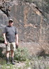
Skunk Tank Trail does some climbing over the next 3 miles or so with 3 distinct trail peaks and 1 mini-peak. You'll definitely feel it, especially if you're carrying a 30 lb pack but, on this cool winter day it didn't seem so bad. The trail's definitely rocky but the footing was decent throughout the whole loop. While the climb is steep at times, you are rewarded with some fantastic views of the surrounding mountains along the ridges (along with some of the healthiest looking saguaros I've seen anywhere). Once you've topped out at the 3rd peak (4100'), you'll see the signed junction for the Quien Sabe trail. Stay on Skunk Tank Trail and start your decent down to the Skunk Tank itself.

Upon arriving at Skunk Tank, the 2-track road comes to an end and you have to pick up a single track trail. This is tricky, so if you have GPS, use it. In a nutshell, right before you get to the tank, there is a faint trail to the right and a cattle fence with a sign that says "close gate after you." Cut through the cattle fence at that gate and follow the faint trail. The first 100 yards are the trickiest. A previous triplog said "stay to the left of the cut" which made no sense to me at the time, but when you see "the cut" (or gorge, or mini-canyon) you will know it. After that point, there's some mild uphill to get to a point where you can cross "Blue Rock Canyon" (at least that's what we called it). The trail is pretty easy to follow from that point all the way down to Cave Creek. At one point, we encountered a huge bull and 3 calves which alarmed us a bit, but they weren't happy to see us either so they started heading down the mountain in front of us. Turns out they were pretty surefooted so they went all the way down to Cave Creek (about 800' vertical down) in front of us. This was just a taste of things to come.

As you head down the last mile to Cave Creek, the views of "Blue Rock Canyon" and the surrounding terrain are absolutely gorgeous. And there's a spectacular array of saguaros that, as I said above, are the healthiest I've seen anywhere. I can't believe more people don't hike this trail. The scenery is fantastic. And we didn't see a single other person all day.

Now, here's what's not so fantastic. Once you get to the Cave Creek Trail, we headed left to find a campsite along the water. The cattle have overtaken this gorgeous, riparian area. We stopped about every 200 yards at potential campsites along the creek and there was so much cow poop there literally wasn't a spot to pitch a tent. Plus, the cattle have trampled everything in sight along the creek. It's a real shame. We backpacked this route in Feb 2020 (a shuttle hike from Seven Springs to Spur Cross) and I don't remember a single visible sign of cattle grazing. Now, it's a mess and, c'mon man, something needs to be done to save this wilderness.

Back to the hike... After heading ~1 mile south of the Skunk Tank trail junction, we found a suitable campsite along the creek that had a fire ring and less cow poop (not zero, mind you... just less). With some creative poop relocation, we were able to create a pretty nice campsite. That night, the low was 29 degrees, so it was a bit cool in the morning.

Our hike out on Cave Creek Trail #4 the next day was lovely but uneventful. Following the trail along the creek gave us completely different scenery vs. the day before. It took us about 3 hours to cover the 5 miles (with full packs and with occasional breaks).

Overall, this was an absolutely beautiful loop hike and I highly recommended it. There's very few people on the trail and we didn't see any other people camping on a Friday night. Even though I vented about the cattle grazing, don't let that stop you from going. We really need some more people to hike this loop to keep the trails from fading away.

Overall: 4.5 stars with the only deduction being due to the cattle situation.

water 1 out of 5water 2 out of 5water 3 out of 5water less than max Big Maggie May Medium flow Medium flow
The creek is flowing nicely

dry Quien Sabe Spring Dry Dry
No flow near the trail. I did not explore up to the spring itself

dry Skunk Tank Dry Dry
No water in the tank.

water 1 out of 5water less than maxwater less than maxwater less than max Skunk Tank Canyon Pools to trickle Pools to trickle
I could see pools down in the canyon but Cave Creek is so close (and flowing), so it's much easier to access.
_____________________
 
Sep 11 2021
avatar

 Guides 34
 Routes 138
 Photos 931
 Triplogs 111

68 male
 Joined Dec 26 2018
 Phoenix, AZ
Cave Creek / Skunk Tank LoopPhoenix, AZ
Phoenix, AZ
Hiking avatar Sep 11 2021
GrangerGuyTriplogs 111
Hiking10.86 Miles 1,824 AEG
Hiking10.86 Miles   6 Hrs   46 Mns   1.81 mph
1,824 ft AEG      46 Mns Break15 LBS Pack
 
1st trip
Partners none no partners
This is a beautiful hike. Need more people out here to keep the trails from fading away.

Got an 4:30 AM start on this so I could finish before it got really hot. The road in looks like it was recently bladed and is in good shape. Where Trail 247 leaves Trail 4 and crosses the creek, the preferred route is a little uncertain. Once across the creek, however, route finding is not difficult. If you look closely at my GPS track near Skunk Tank, you will see that I got off the trail for a while. Once I found it, I came back to the deep cut so I had a good track. Recommend staying to the left of the deep cut when leaving skunk tank, then cross it to stay on the best trail. Quite a bit of catclaw on the route. Long pants recommended at this time. Good water flowing in Cave Creek all along.

water 1 out of 5water less than maxwater less than maxwater less than max Skunk Tank 1-25% full 1-25% full
There was muddy water in the tank.

water 1 out of 5water less than maxwater less than maxwater less than max Skunk Tank Canyon Pools to trickle Pools to trickle
There were pools in the canyon just below Skunk Tank.
 
Feb 06 2021
avatar

 Photos 94
 Triplogs 5

female
 Joined Nov 11 2019
 Phoenix, AZ
Cave Creek / Skunk Tank LoopPhoenix, AZ
Phoenix, AZ
Hiking avatar Feb 06 2021
AdventureFridaysTriplogs 5
Hiking9.90 Miles 1,905 AEG
Hiking9.90 Miles
1,905 ft AEG
 no routes
1st trip
Linked   none no linked trail guides
Partners none no partners
We started on the skunk tank section and came back on the 4. There was a group of trail runners doing a 50 mile run today. Wow! Not many hikers or wildlife other than birds and some cows. The weather was about as perfect as it can get. We don't often hike 10 miles. We were tired. I don't know how some of you do such long hikes. My little dog did great. He has a bad leg and I have to carry him occasionally. It's nice he is small enough to stand on my fanny pack. Today was his longest hike ever. I like a loop, but I think next time I'll just hike further on the 4. It's more interesting with the water and the awesome cactus.
 
Jan 31 2021
avatar

 Guides 1
 Routes 209
 Photos 1,231
 Triplogs 196

male
 Joined Mar 14 2015
 Phoenix, AZ
Cave Creek / Skunk Tank LoopPhoenix, AZ
Phoenix, AZ
Hiking avatar Jan 31 2021
astrobrewerTriplogs 196
Hiking11.11 Miles 2,017 AEG
Hiking11.11 Miles   5 Hrs   52 Mns   2.05 mph
2,017 ft AEG      27 Mns Break
 
1st trip
Linked   none no linked trail guides
Partners none no partners
Route Scout Route Recorded  on Route Scout | Pop | Map | Popup | MapDEX
First time hiking in this area. The air was cool and there were patches of snow on the ground, but the sun was out and it was pleasant for hiking. The hike follows the creek through a first of mostly juniper trees. The creek had water flowing and it was really pretty. After a couple miles the trail crossed the river and it goes from first to canyon. Many saguaros on the north facing slopes above the canyon including a crested saguaro.

After crossing the creek again we reached the junction with the Skunk Tank trail. It starts out as a single track trail and it just goes up up up. Finally there is a gate at a sign for Skunk Tank and the trail turns into a muddy and wide dirt road going up at a more moderate slope. But that doesn't last and it gets steep and keeps going up. After climbing forever it finally starts going back down. Good views along the way of snowy mountains. Lots of squishy mud and cow pies along the trail mean you have to watch your step.

A great hike. I see why this one is written up in the books.
_____________________
  1 archive
Jan 26 2021
avatar

 Guides 94
 Routes 842
 Photos 22,068
 Triplogs 1,994

52 male
 Joined Sep 18 2002
 Tempe, AZ
Cave Creek Trail #4Phoenix, AZ
Phoenix, AZ
Hiking avatar Jan 26 2021
chumleyTriplogs 1,994
Hiking5.58 Miles 735 AEG
Hiking5.58 Miles   2 Hrs   43 Mns   2.12 mph
735 ft AEG      5 Mns Break
 
1st trip
Partners none no partners
The forecast was looking positively Norwegian and I'm not one to sit at home and watch TV when nature puts on a rare magic show. I'm also not one to fight dangerous highway conditions, traffic, collisions, and the other things that Arizona provides when the sky isn't blue. With the snow level set to drop below 2kft by Tuesday morning, I decide my best option was to wake up where I wanted to be, in a place that wouldn't also leave me stranded. The Beeline and I-17 were absolutely off-limits--just a bad idea for anybody who really thought about it. I'd never been past the Bartlett Lake turn in a desert snow before, and the last time was probably 20 years ago. The desert up there isn't the prettiest ... not a lot of saguaros and cliffs that make for dramatic photos. But it's amazing how much fun you can have when photos aren't the goal :? :sweat: So off I went....

I headed up toward Seven Springs and a severe line of storms came in during the afternoon and dropped an inch or two of snow across north Scottsdale, Carefree and Cave Creek. It made my drive more dicey than I anticipated. Nonetheless, I set up camp for the night and went out to gather some additional firewood. The Sheriff stopped as I was cutting a dead tree near the road to ask if I was aware of the forecast and to inform me that he had closed the road at Blue Wash. He was satisfied with my preparedness, and I was thrilled to know that nobody else would be driving out that way overnight :y: .

I managed to keep the fire going for a few good hours. It wasn't cold, maybe 30, but the snow was relentless. I slept well but had to get up every hour or so to knock the snow off the tent. Morning's light brought a winter wonderland as the snow continued to fall at a steady clip. Exactly what I had hoped for! :)

After some breakfast I set out for a snowy hike. Would I make the first ever snowshoe ascent of Quien Sabe Peak? :lol: :sweat: Nah. There was only about 8" of snow, so no reason for flotation. As I made my way across Cave Creek, up Cottonwood, and started the ascent on Skunk Tank, the snow and wind was borderline unpleasant. I only made it up about 400 feet before deciding to bail on any more climbing. Back down at the creek, I headed down #4 for a mile or so before heading back to camp.

I saw a truck at the Bronco trailhead on the drive out and the driver told me the road had been opened just about half an hour earlier. I was leaving just in time! :y:
 Culture
 Culture [ checklist ]
[ checklist ]  Ladder Stile
 Named place
 Named place [ checklist ]
[ checklist ]  Saint Clair Peak
 Meteorology
 Meteorology [ checklist ]
[ checklist ]  Forecast
_____________________
I'm not sure what my spirit animal is, but I'm confident it has rabies.
 
Dec 18 2020
avatar

 Routes 34
 Photos 313
 Triplogs 42

86 male
 Joined Dec 11 2005
 Phoenix, AZ
Cave Creek / Skunk Tank LoopPhoenix, AZ
Phoenix, AZ
Hiking avatar Dec 18 2020
muskybankrTriplogs 42
Hiking9.90 Miles 1,120 AEG
Hiking9.90 Miles   4 Hrs   45 Mns   2.34 mph
1,120 ft AEG      31 Mns Break10 LBS Pack
 
1st trip
Linked   none no linked trail guides
Partners none no partners
37 degrees in Scottsdale, heading to Seven Springs at 8:00 am, where the frog ponds alongside the road were frozen over and it was 34 degrees to start. We like the clockwise direction as it spaces out the 1950 feet of AEG. Likewise we like the parking spots at FR24b(don’t block the road) as those cut off a round trip of about .75 miles. There are apparently several different ways to get to the Skunk Tank trail but we like walking down 24b to the stile across the fence, and then several hundred more feet where you can see a well-cairned trail head off across Cave Creek, and proceed up hill on the other side. This is the Skunk Tank. As we got to the Cottonwood junction with Skunk Tank(0.75 miles) we could feel our frozen fingers again and were surprised to see a new fire trail up to 12 feet wide we could stroll on, we thought, all the way to Trail #4, less than five miles away. We were, of course, wrong. These trails, in the Spur Cross/New River Mesa area offer many big sky views and this one also has the old Quien Sabe mine, that was once rumored to contain some copper. We saw no evidence of that, but then, we’re not mining engineers. One has to be somewhat in awe of these old sourdoughs that walked miles up hill with heavy tools to dig holes in hard ground, literally in the middle of nowhere. After 4.5 miles, the road slid by a gate which ushered us into a cliff-hanging single track providing some awesome views assuming you dared look up from your shoes, since the views started out straight down for 500 feet or more, but the trail did keep going downhill which was good and, at the 6.2 mile mark, we came to the Trail #4 junction, alongside Cave Creek which we followed back uphill 3.8 miles to our parking lot on FR24B. We saw a few cattle and plenty of evidence of horses but no other hikers, bikers or animals. Since this area is said to contain mountain lions, most of us made up some horror stories to encourage our slowest hikers(me) not to lag back too far. The GPS readings come from my trip computer which samples every 5 seconds vs. the triplog which samples about every 12 seconds and totaled 9.6 miles for this trip vs. the trip computer at 10.0 miles. The difference in distance comes mostly from the single track. The photos were all taken by Phil who has an actual camera vs. my toy camera. I didn't realize I even had that setting and why I have it remains a mystery or what buttons I pushed to activate it likewise.
foliage observationfoliage observationfoliage observationfoliage observationfoliage observation
Autumn Foliage Observation None
Pretty nice a week ago coming back down seven springs road, today not quite so brilliant.
wildflower observationwildflower observationwildflower observationwildflower observationwildflower observation
Wildflowers Observation None
none
_____________________
 
Nov 02 2019
avatar

 Guides 12
 Routes 192
 Photos 863
 Triplogs 356

42 male
 Joined Nov 30 2015
 Phoenix, AZ
Quien Sabe PeakPhoenix, AZ
Phoenix, AZ
Run/Jog avatar Nov 02 2019
ShatteredArmTriplogs 356
Run/Jog14.46 Miles 2,697 AEG
Run/Jog14.46 Miles   5 Hrs   23 Mns   2.89 mph
2,697 ft AEG      23 Mns Break
 
1st trip
I've jogged and hiked around the Cave Creek trail system quite a bit (my favorite in the general Phx vicinity), and when one of my friends suggested we summit Quien Sabe Peak, I did not oppose. One member of our group had the GPX route that has you going all the way up the ridge as soon as Quien Sabe trail crosses (the route on the guide). I suggested we take Quien Sabe all the way to the saddle before where it drops down to Mattys Fork.

Started at the gate on the road leading out to the old ranger station, and headed for Skunk Tank trail. I've done the Skunk Tank loop before, so knew what to expect... It was in the mid 40s at the start, but quickly heated up on the exposed trail. Headed south on Quien Sabe all the way to the saddle. It looked like the best way up would be up the draw, in a grassy area, instead of on the ridge. Turned out to be a pretty easy bushwhack to the summit. I think this route is probably far superior to the one that follows the ridge the whole way up; you can make much better time on the old Jeep road.

On the way down, we decided to take a detour and complete the Skunk Tank loop, with Cave Creek flowing. Stopped at the swimming hole for a bit (turns out the water is really cold, even in the desert), and then proceeded back to the car. Trail 4 is one of my favorites, and the leaves were popping a mile or so from the TH.
foliage observationfoliage observationfoliage observationfoliage observationfoliage observation
Autumn Foliage Observation Moderate
Still green a couple miles from the ranch, and a lot of fallen leaves in the Seven Springs area. Some good yellow foliage in between.
_____________________
  2 archives
Oct 19 2019
avatar

 Guides 27
 Routes 670
 Photos 12,111
 Triplogs 857

56 male
 Joined Jul 05 2006
 Mesa, AZ
Cave Creek / Skunk Tank LoopPhoenix, AZ
Phoenix, AZ
Hiking avatar Oct 19 2019
DarthStillerTriplogs 857
Hiking11.10 Miles 1,944 AEG
Hiking11.10 Miles   5 Hrs   43 Mns   1.94 mph
1,944 ft AEG
 
1st trip
Partners none no partners
The first time I did this hike, it was June 2002. It was the first time I hiked in this area, so I didn't realize how long the drive was to get out there. I saw the hike in the 100 Classic Hikes in AZ book and it said 8 miles. It's more like 11. I mistakenly thought it would be a casual Sunday afternoon hike. I remember driving home in the dark and having to get up early for work the next day.

This time I got a much earlier start, and decided to hike it in October, when the weather is cooler and the 7 Springs area has a lot of fall color. It was pretty cool in the morning, but it warmed up quickly once the sun hit, as usual. The Cave Creek Trail is nice in the level spot, and then as it climbs and descends, the rockiness starts to wear a bit. Nice pools of water to be seen below.

Quien Sabe gives the best vista views on this hike. Got a glimpse of the Skull Mesa ruins just at the bottom of the trail. It's a big climb, but it doesn't seem too bad since it's not really steep at all.

Skunk Tank Trail is a pain. Loose potato sized rocks everywhere. For a trail that loses all that elevation from the high point of this hike (going counter clockwise), there sure are a lot of uphill sections. At Quien Sabe spring I got sidetracked off the main trail, which added about a total 0.4 miles to the hike.

On my 8th mile, Route Scout glitched out on me and didn't record for nearly a mile. It suddenly started again on its own and gave a much longer reading of 44 minutes for that mile, which was really 1.5 miles. After that it was fine. the route is posted so I could measure my sidetracked portion to get my total mileage.

Packed a lunch but ate at the car when I was done, then had to manage my way through detours on the way home since the 101 south was closed until about 2 pm.
_____________________
 
May 19 2019
avatar

 Routes 26
 Triplogs 282

39 male
 Joined Apr 14 2019
 Phoenix, AZ
Cave Creek / Skunk Tank LoopPhoenix, AZ
Phoenix, AZ
Hiking avatar May 19 2019
richvoskoTriplogs 282
Hiking10.40 Miles 1,661 AEG
Hiking10.40 Miles   5 Hrs   42 Mns   1.85 mph
1,661 ft AEG      5 Mns Break
 
no photosets
1st trip
Linked   none no linked trail guides
Partners none no partners
 
Mar 23 2019
avatar

 Routes 386
 Photos 49
 Triplogs 792

43 female
 Joined Jun 23 2015
 Phoenix, AZ
Cave Creek / Skunk Tank LoopPhoenix, AZ
Phoenix, AZ
Hiking avatar Mar 23 2019
emilystardustTriplogs 792
Hiking9.90 Miles 1,120 AEG
Hiking9.90 Miles
1,120 ft AEG
 no routesno photosets
1st trip
Linked   none no linked trail guides
Partners none no partners
_____________________
 
Jan 21 2019
avatar

 Routes 36
 Photos 2,658
 Triplogs 1,348

67 male
 Joined Jul 28 2004
 Scottsdale, AZ
Cave Creek / Skunk Tank LoopPhoenix, AZ
Phoenix, AZ
Hiking avatar Jan 21 2019
mazatzalTriplogs 1,348
Hiking9.90 Miles 1,120 AEG
Hiking9.90 Miles
1,120 ft AEG
 no routes
A little chilly when the breeze kicked up. Only saw a couple of people on our way back along trail 4
Good flow in Cave Creek.
foliage observationfoliage observationfoliage observationfoliage observationfoliage observation
Autumn Foliage Observation Isolated
wildflower observationwildflower observationwildflower observationwildflower observationwildflower observation
Wildflowers Observation Isolated
_____________________
  2 archives
average hiking speed 2.21 mph
1, 2, 3, 4, 5 ... 9  Next

WARNING! Hiking and outdoor related sports can be dangerous. Be responsible and prepare for the trip. Study the area you are entering and plan accordingly. Dress for the current and unexpected weather changes. Take plenty of water. Never go alone. Make an itinerary with your plan(s), route(s), destination(s) and expected return time. Give your itinerary to trusted family and/or friends.

helpcommentissue

end of page marker