|
| | | |
| |
|
| Hiking | 14.10 Miles |
3,200 AEG |
| | Hiking | 14.10 Miles | 9 Hrs 13 Mns | | 2.00 mph |
| 3,200 ft AEG | 2 Hrs 9 Mns Break | 10 LBS Pack | | |
|
|
| |
| Linked |
|
none
[ show ]
| no linked trail guides |
| Partners |
|
none
[ show ]
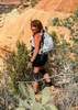
| no partners | | Roussi, Erica and I have tried to get this one off the ground several times. Earlier in the winter, we worried about not enough daylight. Then, there was too much snow. This time we pulled it off, and had a spectacular day hike from near Route 60 to the canyon.
Finding the trailhead parking is not so easy. I found that navigating to N34 16.8025 W111 8.2303 puts your right at the turnoff to the parking on NF-405A. You can put this into Google Maps and get there.
We departed the trailhead and headed out around 6:30 am. The trail follows the two-track for a long ways. I had been watching the snow depth on the NOAA website, and it only melted off here earlier in the week, leaving the trail a little wet, with minor mud in places.
We speculated on some tracks we came across, a 4-legged creature running along the trail for sure. At the time we speculated feline, but as I have looked at Roussi's pictures later, I am pretty sure it was coyote.
Eventually you start seeing signs for the trail leaving the two-track, usually to go around a hill that the road goes over. Either road or trail is fine, but the trail will be more hiker friendly, with a little less elevation gain.
When we got to the wilderness boundary, we hunted up the Geocache that is there, just outside the wilderness, and signed the log and left a small gift for the next person.
Once inside the wilderness, at times, the trail is not very distinct, or rather, there are too many trails. There are cowpaths galore. At El Grande Tank, you can follow the paths either way around the tank. The path along the dam, through the trees turns out to be less desirable, as there are bees there. We heard them, but never saw them. Past the tank, the trail becomes even more vague, but I was able to imagine it and stay on track.
As we continued down, we ran into a couple of men returning from am overnight backpack down near the creek, the only people we saw this day. To those guys, if you ever read this, we knocked the cowpie off that you put up on the wilderness boundary sign. That was a disgusting act! Not at all funny.
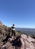
The last bit of trail down to the creek is treacherous, but do-able with poles. It is mentally much easier to go up that section than to go down. We had lunch at the creek, took a few pictures, and headed back up.
It is a long climb backup. It seems like it is uphill the whole way until about a mile from the parking lot. The wind came up, bringing a threat of minor showers, but they never materialized. Fortunately, the wind was at our back, so it gave us a small push up the hill.
We got back to the cars about 3:30. |
|
Wildflowers Observation Isolated
Really not very much yet. |
|
 |
El Grande Tank |
76-100% full |
76-100% full |
| | | Plenty of water in this tank, but a little muddy. The creek is a much better option unless you are desperate. |
 |
Haigler Creek |
Medium flow |
Medium flow |
| | | Plenty of water in Tonto Creek here. We did not cross over to check any of the other creeks flowing in at this location. | | | |
|
|
|
 Route Editor


 . We just didn't really enjoy. Lots of rugged terrain and scree and the only pretty views are aft 6 miles you see "some" canyon. And we saw probably 40 cows and 2 bulls. Super friendly lil fellas...