|
| | | |
| |
|
| Hiking | 6.60 Miles |
1,807 AEG |
| | Hiking | 6.60 Miles | 2 Hrs 50 Mns | | 2.33 mph |
| 1,807 ft AEG | | | | |
|
|
| |
| Linked |
|
none
[ show ]
| no linked trail guides |
| Partners |
|
none
[ show ]
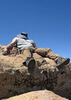
| no partners | | Headed up to Camp Verde to help family with some yardwork and then rewarded myself with Blodgett ](https://hikearizona.com/dex2/images/smilies/eusa_wall.gif "Brick wall") . .  Actually, it wasn't that bad, though it was definitely an uphill slog on very rocky trails. Luckily, the weather was close to perfect for this hike. Cloudy and breezy for most of the hike. Even got spit on at various times. Had about half hour of sunshine, but still managed to get a sunburn....wasn't expecting that! Got on the trail around noon to a slight drizzle and thunder in the distance Actually, it wasn't that bad, though it was definitely an uphill slog on very rocky trails. Luckily, the weather was close to perfect for this hike. Cloudy and breezy for most of the hike. Even got spit on at various times. Had about half hour of sunshine, but still managed to get a sunburn....wasn't expecting that! Got on the trail around noon to a slight drizzle and thunder in the distance  . (I bet most people who visit Bull Pen don't even know that this trail exists as all eyes are towards the river and West Clear Creek Trail). The TH for Blodgett is about 100 yards west of where West Clear Creek Trail starts and has little sign in front of a very unappealing trail (compared to west creek). Foot traffic on this trail appeared to very minimal. There are remnants of a podium where a register once existed, but it looks like it has been years since that had been utilized. The trail, even though it doesn't get a lot of use, was still fairly easy to follow. The first .5 miles does a little climbing and then parallels West Clear Creek. The trail then crosses a wash and heads to the north. This was "roughest" trail finding for the entire hike. Recent rains and the resulting growth had obscured the trail and one of the things that helped me identify the turn was a wooden stake sticking up forlornly above the low growth. About .2 miles from the wash I passed through a wooden divide. At this location and an earlier spot I came across stakes and spools of barbwire. It looks like someone plans on doing some fencing in the near future. It is from the wooden did idea that the climb really begins. For the next mile it was just varying degrees of inclines. There was one switchback that was beautifully level. Enjoy it. Everything else was up and rocky! As I climbed, I kept expecting to rise above the valley only to find myself entering a bigger valley with mountain slopes rising up on both sides. There was a brief exception to this around 1.5 miles in (maybe a little more) where it opened up to the east and I got some nice views of West Clear Creek and some red rock formations. But after that I was back in the valley. After the mile long climb, I came to a section that I can best describe as "uphill flatness". Still getting some elevation, but very gradually. Also, still in a valley for a good portion of this. It does open up where I got some good canyon views to the east. It was in this section that I came to a grassy, dry tank that looks like it seem some animal activity when there's water. Just after the tank there is a steep, short climb about .2 miles in length. Upon reaching the top the trail joins an old road for the last .5 miles to the trails end. The TH at this end is well signed and has enough parking for 3-6 vehicles depending how big (the vehicles) and thoughtful other users are. The hike down was a nice reversal, but challenging on the knees and toes. The weather really added a special element to this hike. Very memorable! Had the trail to myself. No other users or wildlife. . (I bet most people who visit Bull Pen don't even know that this trail exists as all eyes are towards the river and West Clear Creek Trail). The TH for Blodgett is about 100 yards west of where West Clear Creek Trail starts and has little sign in front of a very unappealing trail (compared to west creek). Foot traffic on this trail appeared to very minimal. There are remnants of a podium where a register once existed, but it looks like it has been years since that had been utilized. The trail, even though it doesn't get a lot of use, was still fairly easy to follow. The first .5 miles does a little climbing and then parallels West Clear Creek. The trail then crosses a wash and heads to the north. This was "roughest" trail finding for the entire hike. Recent rains and the resulting growth had obscured the trail and one of the things that helped me identify the turn was a wooden stake sticking up forlornly above the low growth. About .2 miles from the wash I passed through a wooden divide. At this location and an earlier spot I came across stakes and spools of barbwire. It looks like someone plans on doing some fencing in the near future. It is from the wooden did idea that the climb really begins. For the next mile it was just varying degrees of inclines. There was one switchback that was beautifully level. Enjoy it. Everything else was up and rocky! As I climbed, I kept expecting to rise above the valley only to find myself entering a bigger valley with mountain slopes rising up on both sides. There was a brief exception to this around 1.5 miles in (maybe a little more) where it opened up to the east and I got some nice views of West Clear Creek and some red rock formations. But after that I was back in the valley. After the mile long climb, I came to a section that I can best describe as "uphill flatness". Still getting some elevation, but very gradually. Also, still in a valley for a good portion of this. It does open up where I got some good canyon views to the east. It was in this section that I came to a grassy, dry tank that looks like it seem some animal activity when there's water. Just after the tank there is a steep, short climb about .2 miles in length. Upon reaching the top the trail joins an old road for the last .5 miles to the trails end. The TH at this end is well signed and has enough parking for 3-6 vehicles depending how big (the vehicles) and thoughtful other users are. The hike down was a nice reversal, but challenging on the knees and toes. The weather really added a special element to this hike. Very memorable! Had the trail to myself. No other users or wildlife. |
| _____________________
| | |
|
|
|
 Route Editor