|
| | | |
| |
|
| Canyoneering | 4.50 Miles |
950 AEG |
| | Canyoneering | 4.50 Miles | | | |
| 950 ft AEG | | | | |
|
|
| | |
| Linked |
|
none
[ show ]
| no linked trail guides |
| Partners |
|
[ show ]
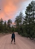
| partners | | Another trip down the canyon from the bridge to see the pretty leaves. The crazy hot weather we've had the past few years have the trees confused. Just like earlier visits this season to the Inner Basin up north and Ash Creek in the south, there was a mix of colors with the trees. Some were done and leaf-less, while others were peak, and many still green. Regardless of the level of autumnal transformation, this place is magical.
Jason has never had the pleasure of "hiking" down this one, so he was all in. We started down about 9am from the bridge. There were a couple of cars already parked, but it was looky-loos’ visiting the cave. We started at the cave and worked our way down from there.
The usual conditions greeted us right away. Lack of a clear path, lots of leaves, but unlike all of my previous December visits, not much water. I missed seeing the large pools and little falls that have dotted this hike in the past. We made our way down to the first set of house and car-sized boulders. Jason really enjoyed this area for sure. He kept telling me how much fun he was having trying to climb up/over/around the gigantor obstacles
The clearest path usually sends you along a similar track doing this one, but I don't think I have ever hiked this one in and out along the same path. The lack of water and large pools that I have experienced in the past made creek hiking possible, but the boulders still forced you decide which way to go - certain death along a cliff or a brutal bushwhack along the other edges. Just one of the appealing parts of this hike. With the steep canyon walls, my gps cut out a few times so my Route Scout trail had alot of straight lines.
We ran into another group of hikers with familiar faces when we stopped for a break. We decided to push on to see how the rest of the canyon was looking. The further we went down, the more water there was. The narrow section past the big boulder field had some decent water. Running from pool to pool only, but still much more water than the area right below the bridge.
After making it down about 2.5 miles, we decided to turn around. Jason was very excited to get back to the boulder area (ha). We made pretty good time going back.
When we got back to the truck, the circus at the bridge was a reminder of how nice this place was when the road was closed. I made that hike down 2-3x and never saw another soul. We came across a few groups near the cave, but they didn't seem prepared for what awaited them just a little further down. I'd guess 10 cars were parked along the road and the traffic was steady, both ways, including a local "Jesus is King" biker gang that was rolling their Harley's up the hill in front of us. |
| _____________________
"Jobs fill your pockets, adventures fill your soul."
instagram: @andydilling |
| | |
|
|
|
 Route Editor


 Anyways, We had a blast making our way up the canyon. Several large boulder fields turned into some fun obstacles and route finding. For the most part it was a light to moderate boulder hop through. There were some tough shrubs here and there but otherwise, not to much in regards to plants/bushes that we needed to get through. The upper part of the canyon turned into a nice wash. We had to remember to keep looking up the whole time because those canyon walls hold so many interesting caves and rock formations. We stopped for lunch at Lost Dutch Canyon before making our way out of the canyon.
  Definitely type 3 fun - but it was worth it.


