|
| | | |
| |
|
| Hiking | 3.30 Miles |
389 AEG |
| | Hiking | 3.30 Miles | 1 Hour 39 Mns | | 2.00 mph |
| 389 ft AEG | | | | |
|
|
| |
| Linked |
|
none
[ show ]
| no linked trail guides |
| Partners |
|
none
[ show ]
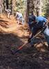
| no partners | | | I was misled on the first 1/4 mile of this trail because of some large fallen trees. That made the faint road appear to turn to the right when I did not. After reaching what appeared to be a dead end, I needed to bushwhack UP. Eventually, I hit the same road again but I didn't know it was the same road until going back down again. Once on the road it was easy to follow, however, there were so many fallen trees crossing the road. That slowed me down a bit. This trail needs some serious maintenance. Near the end of the road, I was able to bushwhack UP and toward the peak. There were a lot of aspen trees at the top which were fairly easy to squeeze through. Eventually, I reached a clearing which was the peak. I didn't see a registry here but instead an open grassy field. On the way down, I tried to go around the aspen trees from the other side of the peak. Once I got on the old road, I decided to stay on it all the way to the bottom. Then, I found the confusing junction about 1/4 mile or less from the trailhead. |
| _____________________
Michael Williams
IT Professional
Rocky Point Vacation Rentals
Ocean Front Condo in Rocky Point, Sonora, Mexico
www.beachfrontmexico.us
 |
| | |
|
|
|
 Route Editor