 Route Editor

| Guide | ♦ | 28 Triplogs | 0 Topics |
details | drive | permit | forecast | 🔥 route |
stats |
photos | triplogs | topics | location |
| 125 | 28 | 0 |
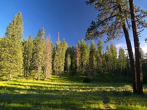
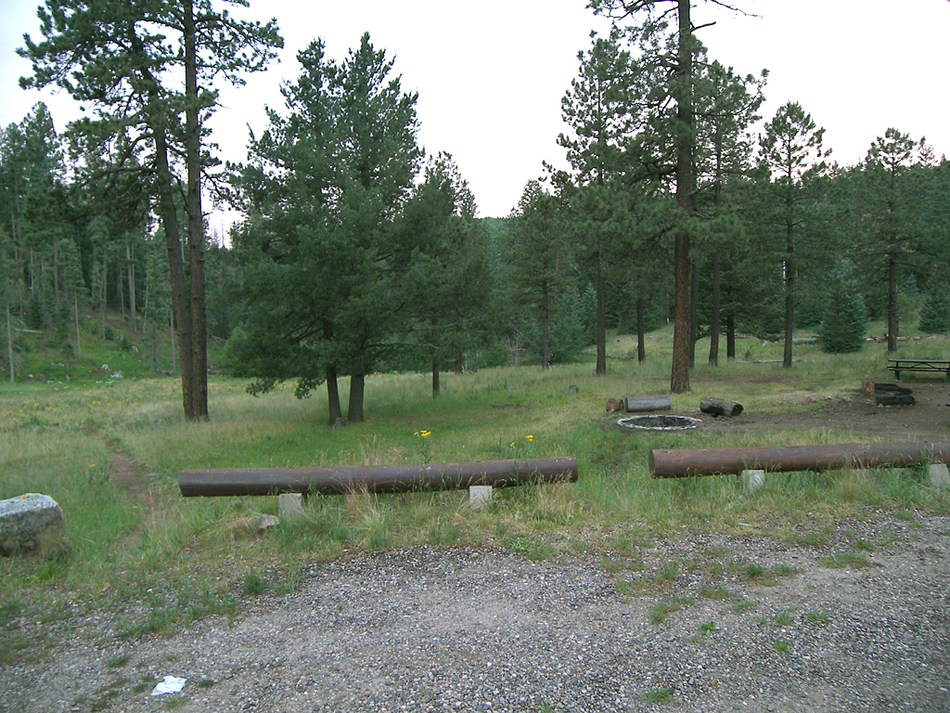
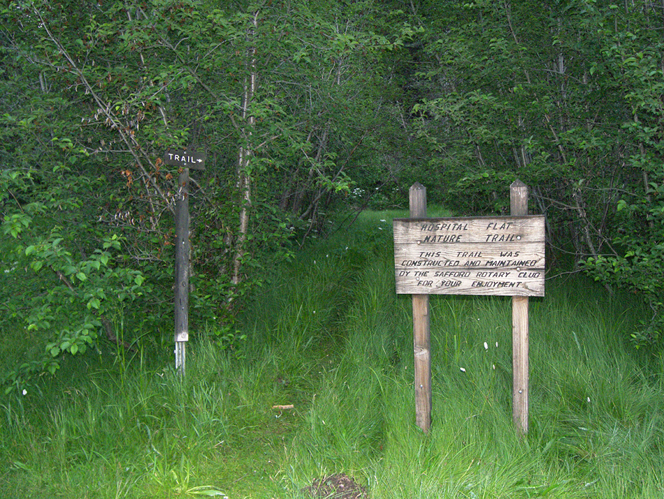
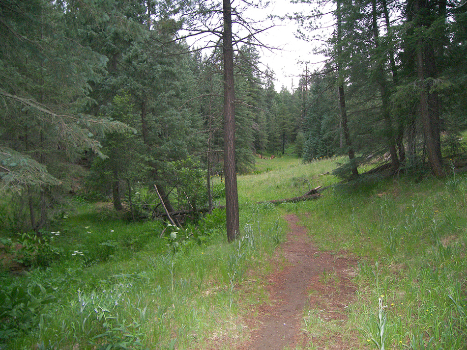
alpine therapy by PrestonSands  Continuing on in my series of hikes that are not really destinations but rather "something to do if you are in the area", is the Hospital Flat Nature Trail. Built by the Safford Rotary Club, this easy loop hike circles around the little hill that separates Hospital Flat from Treasure Park. Hospital Flat gets its name from the military hospital located there in the 1870s and '80s. Rather than be made to suffer in the desert heat at nearby Fort Grant, sick or wounded soldiers were brought up to Hospital Flat to recuperate in the cool alpine environment. Today, the expansive meadow that forms Hospital Flat is the location of a forest service campground and this scenic little trail. The trail is easy to follow for the most part, except where it ends at the turnoff for Treasure Park, where the myriad of other paths gets a little confusing. Starting this hike from Hospital Flat solves that problem. State Highway 366, which provides access to this hike, is closed yearly due to snow from November 15 to April 15, at a point one mile before the trailhead. Continuing on in my series of hikes that are not really destinations but rather "something to do if you are in the area", is the Hospital Flat Nature Trail. Built by the Safford Rotary Club, this easy loop hike circles around the little hill that separates Hospital Flat from Treasure Park. Hospital Flat gets its name from the military hospital located there in the 1870s and '80s. Rather than be made to suffer in the desert heat at nearby Fort Grant, sick or wounded soldiers were brought up to Hospital Flat to recuperate in the cool alpine environment. Today, the expansive meadow that forms Hospital Flat is the location of a forest service campground and this scenic little trail. The trail is easy to follow for the most part, except where it ends at the turnoff for Treasure Park, where the myriad of other paths gets a little confusing. Starting this hike from Hospital Flat solves that problem. State Highway 366, which provides access to this hike, is closed yearly due to snow from November 15 to April 15, at a point one mile before the trailhead.At the end of the Hospital Flat Campground road, about fifty feet to the left of campsites 10 and 11, is a well-trodden trail leading into the meadow. Follow this trail downhill to the far side of the meadow, where it meets a little creek, near campsite 9. There will be a large wooden sign there, marking the start of the Hospital Flat Nature Trail 32.66533 N, 109.87560 W. The first of many wooden posts with the word "trail" and an arrow appears here as well. These markers are scattered along the rest of the trail. Just past the signs, the trail plows through an alder thicket and crosses a little wooden bridge over Big Creek. A metal donation/trail guide box that appears to be abandoned sits beside the trail at the edge of the campground. Now you'll begin following Big Creek downstream through a peaceful riparian area full of large-leaved cow parsnip and skunk cabbage plants. Young alder trees crowd small crystal clear pools along this gently trickling alpine stream. A narrow grassy meadow soon follows, amid dense stands of fir and spruce.
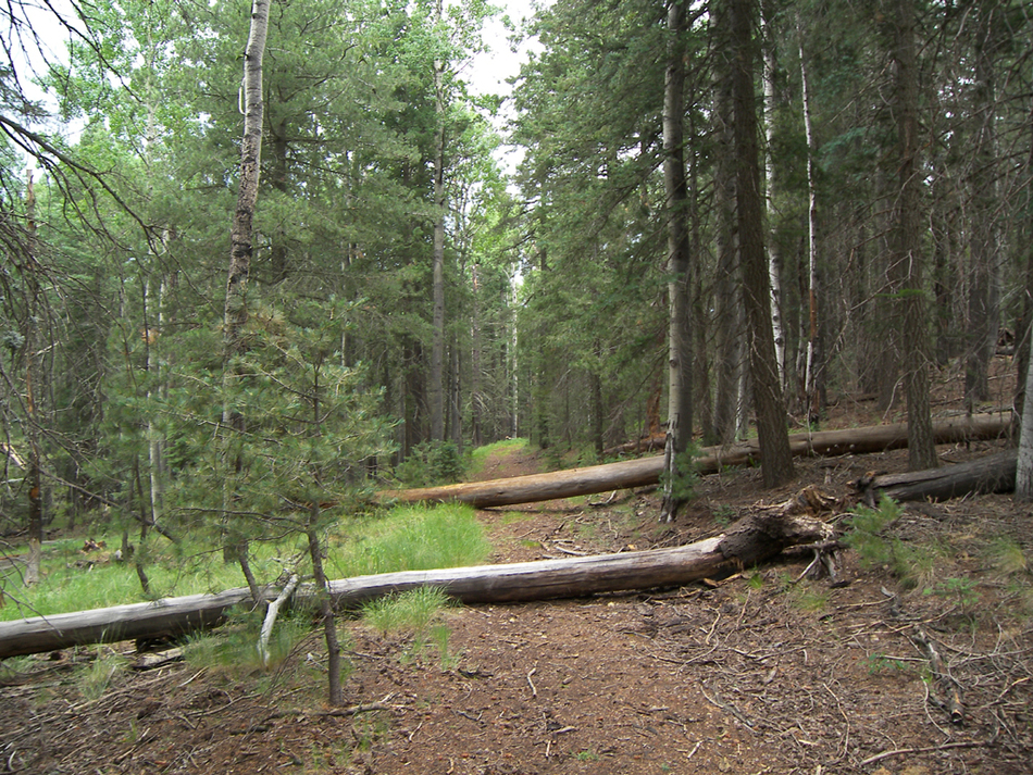
The trail leaves the old logging road just before reaching a parking area along Highway 366, at the start of the Treasure Park road. A few more "trail" signs attempt to direct you back to Hospital Flat from the highway, but I couldn't make any sense of them among the intertwining paths and fallen logs. It's easier to just hang a left on the Swift Trail (highway 366) and follow it for 0.4 miles back to Hospital Flat Campground.
Check out the Official Route and Triplogs. Leave No Trace and +Add a Triplog after your hike to support this local community. | |||||||||||||||||||||||||||||||||||||||||||||||||||||||||||||||||||||||||||||||||||||||||||||||||||||||||||||||||||||||||||||||||||||||||||||||||||||||||||||||||||||||||||||||||||||||||||||||||||||||||


