username
X
password
register
for free!
help
ArticlesGuidesRoutes
 
Photosets
 
 Comments
triplogs   photosets   labels comments more
Iron King Trail - 6 members in 15 triplogs have rated this an average 3.2 ( 1 to 5 best )
15 triplogs
login for filter options
Aug 13 2022
avatar

 Guides 116
 Routes 337
 Photos 11,399
 Triplogs 894

63 male
 Joined Dec 20 2010
 Sunnyslope, PHX
Peavine National Recreation TrailPrescott, AZ
Prescott, AZ
Mtn Biking avatar Aug 13 2022
kingsnakeTriplogs 894
Mtn Biking13.16 Miles 315 AEG
Mtn Biking13.16 Miles   2 Hrs   11 Mns   6.03 mph
315 ft AEG
 
Partners none no partners
Prescotstyle proposed biking Peavine Trail to Iron King Trail. Since it is only three easy miles to the Entro siding, I got to Sundog Ranch Trailhead early to get in some extra miles. 🚴🏻‍♂️

First I rode up the west side of Watson Lake to the boat ramp. Then I doubled back, heading down Sundog Trail to the industrial park. Not feeling like going all the way back to Sundog Ranch Trailhead just to come back to where I was, but a few feet over, I heaved my bike over a gate, then rode down into the Watson Woods Riparian Preserve.

After an hour on my own, I finally met up with Paul at the south end of Watson Lake.

There were TONS of people walking & biking on Peavine Trail and Iron King Trail. A couple of the more serious bikers got a kick out of Paul riding a unicycle. But there were way too many fat, lazy, cheating 🎃s on “e-bikes”. 👋

Flowers in the Watson Lake, Peavine Trail and Iron King Trail area were going bonkers with all the rain Prescott has been receiving. (The next 10 days are predicted to rain as well.)

Our humid ride complete, Paul and I retreated to his place for lunch & liquid replenishment. Is there a more refreshing post-hike beer than an ice-cold Pabst?
 Named place
 Named place [ checklist ]
[ checklist ]  Watson Lake
wildflower observationwildflower observationwildflower observationwildflower observationwildflower observation
Wildflowers Observation Substantial
Big patches of sacred datura and silverleaf nightshade. Plus bindweed / morning glory (?), cliffrose, peavine, scarlet penstemon, dalmatian toadflax, fleabane, globemallow & many more!
_____________________
http://prestonm.com : Everyone's enjoyment of the outdoors is different and should be equally honored.
  1 archive
Jul 01 2021
avatar

 Guides 116
 Routes 337
 Photos 11,399
 Triplogs 894

63 male
 Joined Dec 20 2010
 Sunnyslope, PHX
Iron King TrailPrescott, AZ
Prescott, AZ
Hiking avatar Jul 01 2021
kingsnakeTriplogs 894
Hiking8.09 Miles 214 AEG
Hiking8.09 Miles   2 Hrs   31 Mns   3.21 mph
214 ft AEG
 
1st trip
Linked   none no linked trail guides
Partners none no partners
The punishment for violating a forest closure is a Class B misdemeanor which carries a $5,000 fine and up to six months in Federal Pound Me in the 🎃 Prison. In my younger days, I was a guard. I like going home at night and eating baloney that is not rainbow-colored. 🤢

Because Prescott Valley is a metastasizing suburb of metastasizing Prescott, it is gradually encroaching even upon Iron King Trail: The first mile is now a sidewalk, and only three trailish miles remain. I started hiking at 7:15 a.m. from the traffic circle at Santa Fe Loop Rd. and Jasper Pkwy., which is actually “no parking”. (I jumped out, and my wife drove off.) 🚧

A popular trailhead is catty corner from the Granville Dog Park, on the northeast corner of Granville Fairway and Santa Fe Loop Rd. I saw a bunch of non-construction vehicles there, but it does not strike me as the sort of place that will remain legal once the community is built out. If you don’t mind cement walking, park back at Santa Fe Station Park on the southwest corner of Santa Fe Loop Rd. and Glassford Hill Rd.

It was only 65℉ when I started hiking, but quite humid due to Prescott Valley getting a ½” of rain the day before. It was a toasty 87℉ when I finished only three hours later. 🥵

The first half mile of actual rail trail (as opposed to sidewalk), is adjacent to hundreds of houses in various stages of construction. The next half mile, to the first rail car, is site preparation for even more construction. That first mile west of the Jasper Pkwy. traffic circle is where all the flowers are located.

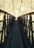
I'd heard that the rail cars marked every mile of Iron King Trail, but that is no longer quite the case: Yes, there are rail cars at milepost 2 and 3, but none at milepost 1 by the traffic circle, and there is a third one at milepost 3.4 (perhaps moved from milepst 1?). It looks like the rail cars were used to move maybe a half dozen people, or pull light loads between stations. The one I looked at closely had a 12 volt battery and what appeared to be a truck engine. 🚂

The first 2¾ miles from Santa Fe Station Park, or 1¾ from the Jasper Pkwy. traffic circle, are totally exposed. No shade. It is only when the Iron King Trail begins entering the Granite Dells its final 1¼ miles that there is occasional spot shade. Conversely, the last hour of your hike will be in the blazing sun.

The Iron King Trail ends at the old Entro siding on the Peavine Trail. (Of which nothing remains.) There’s a portapotty, a picnic table and several historical signs — which I took time to read as I was for once far ahead of schedule.

“No trespassing” signed barbwire fences parallel both sides of the Iron King Trail from the Jasper Pkwy. traffic circle all the way to Entro, then again north along Peavine Trail. I’d been hoping to do some exploring northeast of Entro, around Hill 5630, and checkout the Boblett Cemetery, so that was a bummer. Hopefully the land eventually transfers to park land, not destroyed by developers. 👋

I barely stopped on my way back along the Iron King Trail, making the four miles to Santa Fe Station Park in only 75 minutes.My average moving speed for the day was 3.2 mph. On the way back down I-17 towards Phoenix, the Tiger Fire ( https://inciweb.nwcg.gov/incident/7595 ) west of I-17 had grown considerably, but thankfully not enough to close the freeway. I love being home before noon!

Hike Video: https://vimeo.com/570677294
 Meteorology
 Meteorology [ checklist ]
[ checklist ]  Moon
wildflower observationwildflower observationwildflower observationwildflower observationwildflower observation
Wildflowers Observation Light
Light in first mile west of the traffic circle. Nothing the next two miles to Peavine Trail. Plenty of silverleaf nightshade. Fair number of southwestern prickly poppy. Some obviously planted species. Scattering of other wildflowers, including globemallow.
_____________________
http://prestonm.com : Everyone's enjoyment of the outdoors is different and should be equally honored.
 
Oct 01 2019
avatar

 Guides 4
 Routes 93
 Photos 302
 Triplogs 697

51 male
 Joined Jul 05 2008
 Gilbert, AZ
Peavine National Recreation TrailPrescott, AZ
Prescott, AZ
Hiking avatar Oct 01 2019
adeniumTriplogs 697
Hiking8.16 Miles 79 AEG
Hiking8.16 Miles   1 Hour   18 Mns   6.28 mph
79 ft AEG
 no routesno photosets
Linked   linked  
Partners none no partners
Trail run
_____________________
 
May 19 2018
avatar

 Guides 69
 Routes 37
 Photos 3,010
 Triplogs 2,387

55 male
 Joined Oct 24 2010
 Phoenix,Az
Iron King TrailPrescott, AZ
Prescott, AZ
Run/Jog avatar May 19 2018
mt98dewTriplogs 2,387
Run/Jog8.30 Miles 500 AEG
Run/Jog8.30 Miles   1 Hour   25 Mns   5.86 mph
500 ft AEG
 no routesno photosets
1st trip
Linked   none no linked trail guides
Partners none no partners
I usually plan out my hikes a couple days in advance and ironically, neither of my planned trails for today's "daily double" came to fruition. Fire restrictions shot down my first intended trail, so I randomly and rather haphazardly chose another trail in the vicinity. Ergo, the Iron King Trail. I ended up doing this trail first, by default. I had driven over to the Ranch TH (#62) and discovered that they don't open their gates until 6am, so I ended up driving back to Iron King Trail and got on the trail at.....6am :lol:

Things have certainly changed, (at least in part) since this trail description was done. The author, Abe, saw it coming and it is probably worst than he envisioned. As a side note, there a now 7 stop lights before you reach the TH. The TH is located on the NE corner of Glassford Hill Rd and Santa Fe Loop Rd. There is plenty of parking for trail users, but I don't imagine that the TH sees much use. The trail starts off by taking a boxed culvert under Glassford Hill Rd and then is immediately diverted to a sidewalk. So the first mile of this run was on a strip of dirt sandwiched between Santa Fe Rd and a sidewalk. (I try to avoid cement as much as possible, it's hard on my knees). To my left I had a well established neighborhood and to my right - where the trail use to be, remnants were still visible - is a subdivision in the making. :? The second mile involved a dirt strip that may or may not be there years from now. Currently, it is skirting the development that is in progress. There are young trees planted, so this may turn into a nice, urban trail. It wasn't until I was over 2 miles that I felt I was on the trail that Abe was describing. And it was as described: fairly flat, straight and wide. Even though trail was uninteresting, the Granite Dells were a nice feature to focus on. And about 2.5 miles in, I was far enough into the Dells that the surrounding views were engaging enough to make at least this part of the run enjoyable. There were suppose to be 4 rail cars and I think with the rerouting they are down to 3. I didn't examine them too closely, but they do add some character to the trail.

Once I hit Peavine Trail, I turned around and retraced my steps. I can see this being a well used local trail, especially with the homes burgeoning in the area, but definitely not a destination trail. Still on the plus side: it is a good trail for running, there is no target shooting going on in the background, and, at least for today, there were no fire restrictions. :)
_____________________
 
Oct 15 2017
avatar

 Triplogs 72

41 female
 Joined Feb 14 2017
 Prescott Valley,
Iron King TrailPrescott, AZ
Prescott, AZ
Hiking avatar Oct 15 2017
sleepybear929Triplogs 72
Hiking4.00 Miles 500 AEG
Hiking4.00 Miles
500 ft AEG
 no routesno photosets
1st trip
Linked   none no linked trail guides
Partners none no partners
Short hike out and back. Only hiked 2 miles out but it was easy, flat ground. Dogs loved it.
_____________________
 
May 05 2014
avatar

 Routes 38
 Photos 2
 Triplogs 4

70 male
 Joined May 11 2015
 Dewey, Az
Iron King TrailPrescott, AZ
Prescott, AZ
Hiking avatar May 05 2014
peach107Triplogs 4
Hiking5.32 Miles
Hiking5.32 Miles
 no routesno photosets
1st trip
Linked   none no linked trail guides
Partners none no partners
Nice quiet easy hike on an old railroad bed. Pronghorn running around out in the fields.
_____________________
 
Apr 12 2012
avatar

 Routes 18
 Photos 580
 Triplogs 1,081

42 male
 Joined Nov 16 2010
 Kingman, AZ
Iron King TrailPrescott, AZ
Prescott, AZ
Hiking avatar Apr 12 2012
nikorock28Triplogs 1,081
Hiking6.00 Miles 300 AEG
Hiking6.00 Miles
300 ft AEG
 no routesno photosets
Linked   none no linked trail guides
Partners none no partners
Easy stroll with a friend.
_____________________
  1 archive
Dec 28 2011
avatar

 Photos 68
 Triplogs 70

female
 Joined Oct 27 2011
 Prescott, AZ
Iron King TrailPrescott, AZ
Prescott, AZ
Hiking avatar Dec 28 2011
BOHOHikerTriplogs 70
Hiking10.00 Miles 500 AEG
Hiking10.00 Miles   3 Hrs      3.33 mph
500 ft AEG
 no routesno photosets
1st trip
Linked   none no linked trail guides
Partners none no partners
Started off today at about 12:30PM. This was the first time that I ever decided to try this trail. I began at the Prescott Valley trail head off of Glassford Hills road. The weather today was fantastic considering it is the end of December. for the first couple of miles, the scenery was not really, "all that." If a person likes wide open spaces, then you will really like this area... But, it was not until I reached the red rocks that I really began to enjoy myself. I found it very beautiful... When I hit the connector trail onto the "Peavine," I decided to keep going for another mile or so....
The terrain is easy, and it is a rather "mellow" walk... Did some jogging on the way back and ended up doing about 10 miles round trip. My dog "lucy" and myself got ourselves a rather good work out... After finishing up, on the way home, rewarded myself by getting a "Papa Johns" pizza...
:guilty:
_____________________
 
Jul 04 2011
avatar

 Routes 18
 Photos 580
 Triplogs 1,081

42 male
 Joined Nov 16 2010
 Kingman, AZ
Iron King TrailPrescott, AZ
Prescott, AZ
Hiking avatar Jul 04 2011
nikorock28Triplogs 1,081
Hiking6.00 Miles 400 AEG
Hiking6.00 Miles   1 Hour   33 Mns   3.87 mph
400 ft AEG
 no routesno photosets
Linked   none no linked trail guides
Partners none no partners
Hike/jog with a friend. AEG is a guess. We went to the 3 mile car and returned. Quite warm from 12-130 with no shade on the trail. The few minutes of cloud cover were appreciated.
_____________________
  1 archive
Oct 03 2008
avatar

 Guides 2
 Photos 689
 Triplogs 105

64 female
 Joined Apr 05 2005
 Mesa, AZ
Iron King TrailPrescott, AZ
Prescott, AZ
Mtn Biking avatar Oct 03 2008
NanTriplogs 105
Mtn Biking7.80 Miles 500 AEG
Mtn Biking7.80 Miles
500 ft AEG
 no routesno photosets
1st trip
Linked   linked  
Partners none no partners
I started this trail from the Peavine and followed it to its end at Hwy 69 just to see where it went. There's not much to see once you get out of the pass, just a lot of grassland/ranchland that probably looks a lot better when it's green, and a gentle downhill grade. Grade wasn't so gentle on the way back up, and I was fighting a headwind that suddenly picked up promptly at 3:00! Well, at least I made up for missing the gym this weekend.
_____________________
 
Oct 03 2008
avatar

 Guides 2
 Photos 689
 Triplogs 105

64 female
 Joined Apr 05 2005
 Mesa, AZ
Peavine National Recreation TrailPrescott, AZ
Prescott, AZ
Mtn Biking avatar Oct 03 2008
NanTriplogs 105
Mtn Biking6.50 Miles 70 AEG
Mtn Biking6.50 Miles
70 ft AEG
 no routes
1st trip
Linked   linked  
Partners none no partners
Not exactly mountain biking, other than a rough downhill bit getting to the Lower Granite Basin access road from the Lake Watson parking lot. I rented a bicycle from Encore Performance & Fabrication just north of the roundabout, and made my way around Watson Lake to join up with the Peavine about 1/2 mile west of the TH. Beautiful area, with fading sunflowers lining the trail and birds in the marshes. I had to restrain myself from making choo-choo noises. After a short bit the trail enters a rocky pass reminiscent of Texas canyon, between Tucson and Willcox. At the junction I took the Iron King trail to see where it went.
 Culture
 Culture [ checklist ]
[ checklist ]  Railroad Freight Car
_____________________
  2 archives
Mar 17 2007
avatar

 Triplogs 3

male
 Joined Mar 10 2007
 Prescott, AZ
Iron King TrailPrescott, AZ
Prescott, AZ
Hiking avatar Mar 17 2007
dogmanTriplogs 3
Hiking4.00 Miles 500 AEG
Hiking4.00 Miles
500 ft AEG
 no routesno photosets
1st trip
Linked   none no linked trail guides
Partners none no partners
_____________________
 
Aug 21 2005
avatar

 Guides 17
 Photos 296
 Triplogs 59

66 male
 Joined Jun 09 2002
 Prescott, AZ
Iron King TrailPrescott, AZ
Prescott, AZ
Hiking avatar Aug 21 2005
AbeTriplogs 59
Hiking7.80 Miles 500 AEG
Hiking7.80 Miles   4 Hrs      1.95 mph
500 ft AEG
 no routes
Linked   none no linked trail guides
Partners none no partners
Short little early morning walk with my eldest daughter. Antelopes, one big jack rabbit, and two baby cottontails entertained us through the hike.
_____________________
"Solitude is as needful to the imagination as society is wholesome for the character." James Russell Lowell
 
Jul 24 2005
avatar

 Guides 17
 Photos 296
 Triplogs 59

66 male
 Joined Jun 09 2002
 Prescott, AZ
Iron King TrailPrescott, AZ
Prescott, AZ
Hiking avatar Jul 24 2005
AbeTriplogs 59
Hiking7.80 Miles 500 AEG
Hiking7.80 Miles   4 Hrs   30 Mns   1.73 mph
500 ft AEG
 no routes
Linked   none no linked trail guides
Partners none no partners
Could not ask for an awesome day for a small hike with my two younger kid's, Chris and Dori. After a cleansing of the air from a monsoon storm yesterday afternoon late and a gray day today to cool the temps, my kids and I arrived at the trailhead around 8:30 this morning. With two kids chomping at the bit, it did not not take long to hit the trail.
I let my son ride his bike, and my youngest and I did the hiking. I wanted to see if she was ready for longer hikes soon to come with her. And don't you know she did real well! I was quite proud of her as we plugged along and she talking up a storm at me.
Snack was funny, we all gobbled up our peanut butter and jelly sandwiches like they were nothing. And afterwards I let them explore around on the rocks.
All in all a great day.
_____________________
"Solitude is as needful to the imagination as society is wholesome for the character." James Russell Lowell
 
Aug 07 2004
avatar

 Guides 17
 Photos 296
 Triplogs 59

66 male
 Joined Jun 09 2002
 Prescott, AZ
Iron King TrailPrescott, AZ
Prescott, AZ
Hiking avatar Aug 07 2004
AbeTriplogs 59
Hiking7.80 Miles 500 AEG
Hiking7.80 Miles   4 Hrs      1.95 mph
500 ft AEG
 no routes
Linked   none no linked trail guides
Partners none no partners
An urban trail created with the help of the "Rails to Trail" program, the Town of Prescott Valley, and other organizations through out.
_____________________
"Solitude is as needful to the imagination as society is wholesome for the character." James Russell Lowell
 
average hiking speed 1.88 mph

WARNING! Hiking and outdoor related sports can be dangerous. Be responsible and prepare for the trip. Study the area you are entering and plan accordingly. Dress for the current and unexpected weather changes. Take plenty of water. Never go alone. Make an itinerary with your plan(s), route(s), destination(s) and expected return time. Give your itinerary to trusted family and/or friends.

helpcommentissue

end of page marker